Image
Tool
Risk Mapping, Assessment, and Planning (Risk MAP) Program
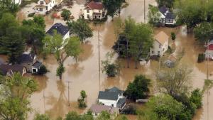
This program helps communities identify, assess, communicate, and mitigate their flood risk through more precise flood mapping products, risk assessment tools, and support for planning and outreach. Risk MAP Vision
Through collaboration with state, tribal, and local entities, Risk MAP delivers data that increases public awareness and leads to action that reduces risk to life and property. Risk MAP focuses on products and services beyond the traditional Flood Insurance Rate Map (FIRM) and works with officials to help put flood risk data and assessment tools to use.