Image
Tool
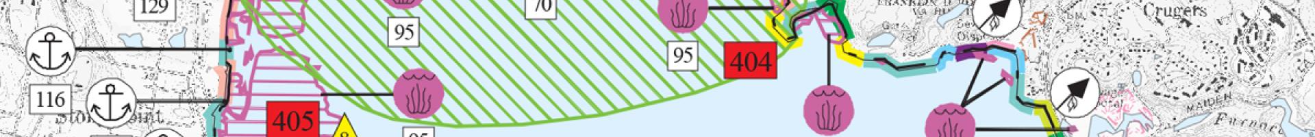
Environmental Sensitivity Index
Maps on this site provide a concise summary of coastal resources that are at risk if an oil or chemical spill occurs nearby. Examples of at-risk resources include biological resources (such as birds and shellfish beds), sensitive shorelines (such as marshes and tidal flats), and human-use resources (such as public beaches and parks).
When an oil spill occurs, ESI maps can help responders meet one of the main response objectives: reducing the environmental consequences of the spill and the cleanup efforts. Additionally, ESI maps can be used by planners—before a spill happens—to identify vulnerable locations, establish protection priorities, and identify cleanup strategies.
Details
Hazards