Stressors and impacts
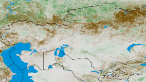
In the face of rapidly expanding population, economic instability, and civil unrest, Ethiopia sometimes struggles to ensure that its citizens have access to adequate food resources. In this already-dry region, food production shocks that result from droughts, floods, and heat waves can further compound the problem of inadequate food. When these events occur, they can devastate crops and livestock, further reducing the quantity of food resources and decreasing farmers’ llivelihoods.
In 2006, a steady 10-year decline in Ethiopian rainfall—accompanied by a steady increase in the number of people who needed food aid—resulted in a situation with more than eight million residents relying on government food assistance. A severe drought the previous year endangered subsistence crops, cash crops, and livestock and, in turn, the health and livelihoods of the people who depended upon them. The United Nation’s Food and Agriculture Organization estimated that more than one million people in the Somali region of Ethiopia were facing severe food shortages. Ethiopian decision makers and international aid organizations needed unbiased estimates of domestic food production to coordinate food assistance programs.
The Famine Early Warning System Network
Leaders turned to the Famine Early Warning System Network (FEWS NET). This organization uses remotely-sensed data from U.S. science agencies and other data from national ministries of trade and agriculture, international organizations, and non-governmental organizations, along with localized data such as staple food prices and rainfall, to provide decision makers in food-insecure nations with a bird’s-eye view of current and upcoming food security challenges. Remotely-sensed information from satellites on crop cover, precipitation, evapotranspiration, and the normalized difference vegetation index (NDVI)—a measure of crop greenness—warns decision makers of poor crop health or drought conditions. Leaders can use this information to determine appropriate policies to address an anticipated food crisis.
Confirming available resources
In 2006, decision makers needed reliable information to develop appropriate action plans to mitigate the anticipated food shortage. The Ethiopian Central Statistics Agency (CSA) and Bureau of Agriculture and Rural Development (BoARD) differed in their estimates of crop production by 40 percent. FEWS NET leveraged its remotely-sensed data to estimate crop area, and ultimately confirmed the BoARD estimate. This confirmation had major planning implications for the Ethiopian government and international aid agencies. The satellite data provided a firm factual basis to help leaders manage the crisis.