Tasks for Element 1:
- Maintain up-to-date data on climate hazards and community climate and health vulnerabilities, and use hazard vulnerability analyses to inform health services and infrastructure planning today and for the future (out to 20–50 years).
- Develop a comprehensive understanding of the role of the hospital, long-term care, and ambulatory settings within the community during and after identified extreme weather events, and use this knowledge to inform resilience strategies.
Recognize your climate risks
Identifying climate risks and community vulnerabilities is an important step in defining health care delivery system resilience. Health care organizations are encouraged to conduct a climate risk assessment so that they may better understand and catalog present and future extreme weather risks. Hospital and health systems that operate multiple campuses (in many instances across varying climate zones) should complete climate risk assessments for each of their sites. Hospital systems should carefully consider how each campus interacts with its community, as well as how resources and capacity might shift if extreme weather affects some or all of a system’s regional assets. These considerations may be particularly relevant in comparing the needs of urban and rural facilities—for example, during or following a disaster a rural community may rely on its hospital for essential community services, such as food, water or basic shelter, while an urban setting may provide a wider array of essential emergency services, reducing pressure on the hospital to provide broader community services.
Work with others
Similarly, it may be important to meet with local and regional governing authorities or planning departments to understand preferred local and regional risk assessment methodologies and tools. Climate risks are highly variable across the United States; some are gradual (like sea level rise) while others are becoming more extreme today. The Climate Resilience Toolkit offers a set of tools that hospitals can use to gather information on climate hazards. Climate risks have inherent uncertainty, a necessary by-product of climate models that use many inputs to characterize probable outcomes for particular times and locations. In light of these complexities, additional technical expertise may be available through local universities, municipal planning departments, or consultants.
Consider climate in the context of other hazards
The need to embrace a multi-hazard approach is essential, especially for facilities located in areas that may be exposed to a variety of extreme weather hazards. While this checklist and resources focuses on climate-related hazards, hospitals must consider a broad range of additional risks, from bio-terrorism to pandemics. Multi-hazard assessments can reveal potentially conflicting effects of mitigation measures. Thus, the results of a climate risk assessment should be included in an organization’s larger Hazard Vulnerability Analysis (HVA).
Checklist
The Element 1 Checklist assists health care organizations in assessing climate and health vulnerabilities, as well as assisting in clarifying the role of the facility or campus in the health care system and surrounding community. The Element 1 Checklist helps organizations define the climate and community contexts for developing enhanced resilience strategies.
Download the Element 1 Checklist:
Key resources for climate projections
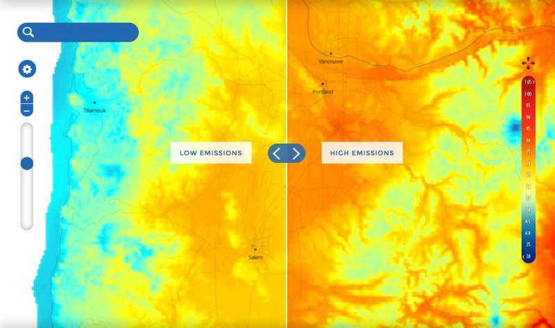
Climate Inspector: Provides users with a way to review four different climate projections for any given location. Explore projected changes in temperature or precipitation, and download maps, trend data, or projected annual cycle data. Requires some understanding on the variation between climate models.
NOAA Climate Change Portal: This portal lets users display or download climate projection output from the Coupled Model Intercomparison Project (CMIP5) that informed the IPCC Fifth Assessment Report. Contains user-friendly drop down menus of models, atmospheric fields, and time.
Key resources for mapping graphics
CanVis: This software gives users an opportunity to modify maps and photos of a campus or facility to visualize impacts of projected sea level rise. This downloadable photo-editing program gives users the power to generate “after” pictures illustrating possible futures.
Climate Outlooks: This site provides access to maps showing experts' judgments regarding chances for above-, below-, or near-average temperature and precipitation, as well as potential hazards and drought conditions, with timescales ranging from weeks to years.
Coastal Flood Exposure Mapper: This visualization site gives users a way to overlay risk maps and produce unified images. Provides local maps to stimulate discussions about the people, places, and natural resources exposed to coastal flooding. Users create a collection of maps showing risk from various hazards.
FEMA Flood Map Service Center: This center helps users find, view, analyze, and print flood hazard maps to identify threats and risks for specific locations and facilities.
Hazus: This downloadable software provides access to FEMA models for estimating potential losses from earthquakes, floods, and hurricanes and evaluating costs and benefits of mitigation options.
U.S. Drought Portal: This site provides a range of information and services related to drought including early warnings, climate data, and decision support services.
Download a document (PDF) with these and additional Element 1 resource links.


