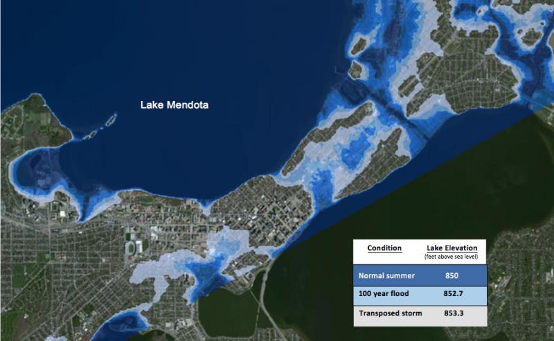
This map shows Lake Mendota water levels for (a) a normal summer, (b) a 100-year flood, and (c) the projected level if a June 2008 storm system that occurred over the Baraboo River watershed had instead occurred over the Yahara River watershed.
Image credit: Daniel Fletcher
Page/s that contain this image:
Last modified:
22 June 2015 - 6:07pm

