Access a range of climate-related reports issued by government agencies and scientific organizations. Browse the reports listed below, or filter by scope, content, or focus in the boxes above. To expand your results, click the Clear Filters link.
The Working Group II contribution to the IPCC Sixth Assessment Report assesses the impacts of climate change, looking at ecosystems, biodiversity, and human communities at global and regional levels. It also reviews vulnerabilities and the capacities and limits of the natural world and human societies to adapt to climate change.
To plan for future sea level rise, Miami-Dade County relies on the 2019 Unified Sea Level Rise Projection for Southeast Florida developed by the Southeast Florida Regional Climate Change Compact. These projections are revised every five years to ensure they reflect the best available science. Based on these consensus projections, they expect sea levels to be approximately two feet higher 40 years from 2019 levels and continue rising beyond that.
This report's subtitle is Managing the Uncertainty of Future Sea Level Change and Extreme Water Levels for Department of Defence Coastal Sites Worldwide.
From the Executive Summary: Global change, including climate change, poses unique challenges to the Department of Defense (DoD). In particular, coastal military sites, and their associated natural and built infrastructure, operations, and readiness capabilities, are vulnerable to the impacts of rising global sea level and local extreme water level (EWL) events. This report and its accompanying scenario database provide regionalized sea level and EWL scenarios for three future time horizons (2035, 2065, and 2100) for 1,774 DoD sites worldwide. The global nature of DoD’s presence required a broad and comprehensive approach that to this point has been lacking in similar efforts.
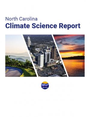
This report is a scientific assessment of historical climate trends and potential future climate change in North Carolina under increased greenhouse gas concentrations. The report includes an overview of the physical science of climate change, detailed information on observed and projected changes in temperature and precipitation averages and extremes, hurricanes and other storms, sea level, and other relevant climate metrics. Findings are presented for both the state as a whole and for each of three regions in the state: the Coastal Plain, the Piedmont, and the Western Mountains. The report also includes chapters on sea level rise, trends involving interactions of multiple aspects of the climate system (including inland flooding, wildfire, forest ecosystem changes, urban heat island effects, and air pollution), and findings relevant to engineering design standards.
A case study approach to calculating the economic impact of the U.S. Climate Resilience Toolkit.
The frequency and severity of disasters over the last few decades have presented unprecedented challenges for communities across the United States. This report summarizes the existing portfolio of relevant or related resilience measurement efforts and notes gaps and challenges associated with them. It describes how some communities build and measure resilience, and offers four key actions that communities could take to build and measure their resilience to address gaps identified in current community resilience measurement efforts. The report also provides recommendations to the Gulf Research Program to build and measure resilience in the Gulf of Mexico region.
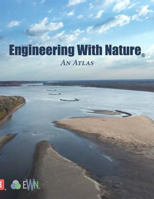
The EWN Atlas is a collection of 56 projects illustrating a diverse portfolio of contexts, motivations, and successful outcomes, presented and considered from an Engineering With Nature® perspective to reveal the usefulness of nature-based approaches and the range of benefits that can be achieved. Engineering With Nature is an initiative of the U.S. Army Corps of Engineers enabling more sustainable delivery of economic, social, and environmental benefits associated with water resources infrastructure. EWN intentionally aligns natural and engineering processes to efficiently and sustainably deliver economic, environmental, and social benefits through collaborative processes.
The Global Change Research Act of 1990 mandates that the U.S. Global Change Research Program deliver a report to Congress and the President no less than every four years that “1) integrates, evaluates, and interprets the findings of the Program…; 2) analyzes the effects of global change on the natural environment, agriculture, energy production and use, land and water resources, transportation, human health and welfare, human social systems, and biological diversity; and 3) analyzes current trends in global change, both human-induced and natural, and projects major trends for the subsequent 25 to 100 years.” The Fourth National Climate Assessment (NCA4) fulfills that mandate in two volumes. This report, Volume II, draws on the foundational science described in Volume I, the Climate Science Special Report. Volume II focuses on the human welfare, societal, and environmental elements of climate change and variability for 10 regions and 18 national topics, with particular attention paid to observed and projected risks, impacts, consideration of risk reduction, and implications under different mitigation pathways. Where possible, NCA4 Volume II provides examples of actions underway in communities across the United States to reduce the risks associated with climate change, increase resilience, and improve livelihoods. This assessment was written to help inform decision makers, utility and natural resource managers, public health officials, emergency planners, and other stakeholders by providing a thorough examination of the effects of climate change on the United States.
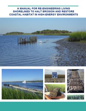
Shorelines with high boat wake and wave energy face especially rapid erosion and habitat loss. A new living shoreline design from researchers at the University of Florida and the Guana Tolomato Matanzas Reserve that uses gabion-breaks has proven successful in high-energy environments. The gabion-break design uses two lines of defense to reduce erosion along the marsh edge—porous wooden breakwalls placed in front of structures that will foster oyster growth. This manual for restoration practitioners describes a collaborative research project that tested gabion-breaks along the Atlantic Intracoastal Waterway in northeast Florida. It discusses the project’s results and details the steps to use gabion-breaks, including planning, design, maintenance, monitoring, and costs.
The Nags Head Comprehensive Plan is an official policy document adopted by the Town of Nags Head to strategically plan for and enhance the quality of life and physical character of the community. The plan, while not regulatory in nature, builds upon adopted plans and policies to provide a foundation for decision making, future regulations, and project development. Further, the plan was created utilizing community input to illustrate a vision for the future of Nags Head and define steps to secure that future.
This Technical Report presents results from a large set of sectoral impact models that quantify and monetize climate change impacts in the U.S., with a primary focus on the contiguous U.S., under moderate and severe future climates. The report summarizes and communicates the results of the second phase of quantitative sectoral impacts analysis under the Climate Change Impacts and Risk Analysis (CIRA) project. The effort is intended to inform the fourth National Climate Assessment (NCA4) of the U.S. Global Change Research Program (USGCRP). The goal of this work is to estimate climate change impacts and economic damages to multiple U.S. sectors (e.g., human health, infrastructure, and water resources) under different scenarios. Though this report does not make policy recommendations, it is designed to inform strategies to enhance resiliency and protect human health, investments, and livelihoods.
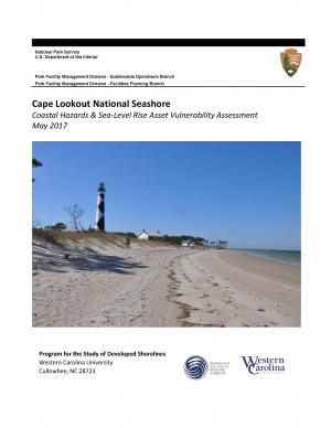
The protocol developed and used in this report is unique in that it is an asset-level assessment of the vulnerability of infrastructure to multiple coastal hazards and climate change factors (e.g., erosion, flooding, storm surge, sea-level rise, and historical flooding) over a 35-year planning horizon (2050). The protocol was applied to all buildings and roads in Cape Lookout National Seashore; the results are summarized in the report.
Green infrastructure can help to maximize the environmental, economic, and social benefits of parks. This guide from EPA encourages partnerships between park agencies and stormwater agencies to promote the use of green infrastructure on park lands to improve park lands and access to parks, better manage stormwater, increase community resiliency to shifting weather patterns, and provide funding to implement and maintain park enhancements that benefit the community. Using a stepwise approach for building relationships with potential partners, the guide includes information on how to identify and engage partners, build relationships, involve the community, leverage funding opportunities, and identify green infrastructure opportunities. It includes recommendations on the types of projects that are most likely to attract positive attention and funding and that provide a wide range of benefits. Included case studies from across the country illustrate approaches presented in the guide.
The Tampa Bay region is known as one of the most vulnerable in the world to wind damage, coastal flooding from storm surge, and rising sea levels. The City of St. Petersburg—with over 60 miles of coastal frontage—has already felt the impacts of storms. The adverse effects from these types of environmental events often impact low-income communities the hardest, as they have the most difficulty bouncing back from stresses and shocks. The City of St. Petersburg is committed to ensuring that investments in making the city resilient are equitable and create a range of opportunities that everyone can benefit from. The Urban Land Institute of Tampa Bay convened top experts in climate resilience from New Orleans, Miami, Boston, and the Tampa Bay region to provide technical assistance to the city on creating an equitable culture of resilience. A grant from the ULI Foundation and Kresge Foundation funded this effort.
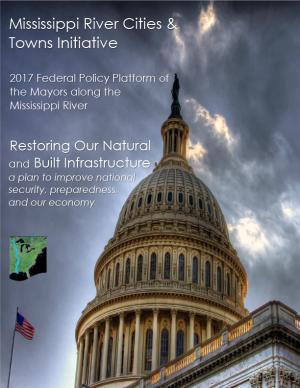
This plan sets forth the 2017 federal policy platform of the Mississippi River Cities and Towns Initiative, an association of 75 U.S. mayors along the Mississippi River. The document sets forth the mayors’ recommendation of federal programs to support and strengthen the built and natural infrastructure of the Mississippi River corridor, proposing specific funding levels and support of several federal programs. Suggestions for finance mechanisms to restore Mississippi River infrastructure are also included.
This report—the first phase of the Department of the Interior (DOI) assessment effort for Hurricane Sandy projects—was developed for DOI by a metrics expert group of physical and ecological scientists and socioeconomic experts who recommended performance metrics for measuring changes in resilience resulting from the DOI-sponsored projects. It identifies natural and artificial coastal features most affected by Hurricane Sandy along the Northeast coast—such as marshes, beaches, and estuaries—and recommended metrics that would indicate resilience change in those features.
Find out how hometowns across the United States are building their resilience to climate change. Two women who studied climate change science and policy in graduate school took a three-month road trip to find out what climate change adaptation looks like in the United States. They visited more than 30 communities preparing for climate change and documented what they learned in blogs and through media reports. This report describes six big lessons from the ongoing adaptation work they saw across the country.
This report outlines 100 recommendations to help improve federal programs and their ability to prepare for climate change, drawing from a series of workshops with leading federal, state, and local officials and building upon lessons learned post-disaster in New Orleans (following Hurricane Katrina), New York (following Hurricane Sandy), and Vermont (after Hurricane Irene). The report identifies more than 30 federal programs, initiatives, and laws that can be used to prepare for extreme events such as storms, floods, and heat waves as well as rising seas. This report informed the White House's State, Local, and Tribal Leaders Task Force on Climate Preparedness and Resilience.
The City of Norfolk is using an integrative process of planning, preparing, mitigating, and communicating to reduce the impacts of flooding. Working with international and regional experts and residents, Norfolk is creating planning models to predict future shoreline conditions. The models will predict how local rates of sea level rise affect the construction of public buildings, shipyards, naval facilities, homes, and other private development.
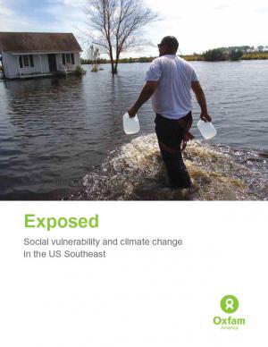
Oxfam America, in their work to shed light on the vulnerability of the geography and people of the U.S. Southeast, commissioned two reports from the Hazards and Vulnerability Research Institute at the University of South Carolina. The first one covers the entire 13-state region, while the second one contains much more detail about Louisiana and Mississippi. This document provides a brief overview of the findings, the concepts, and the methodology. The aim of these materials is to be useful tools to people in coastal communities, and to decision makers shaping policies in the region.
The Florida Transportation Plan (FTP) is the statewide long-range transportation plan for all of Florida. It is complemented by this Strategic Intermodal System Policy Plan, which identifies policies for planning and implementing the statewide high-priority network of transportation facilities critical to Florida’s economic competitiveness.
Historically, studies about climate hazards and social vulnerability have been conducted in separate silos. The Social Vulnerability Index (SoVI) is the first study of its kind to examine both the potential impact of natural hazards and which populations are most likely to be negatively affected. This research, commissioned by Oxfam America, includes a series of layered maps that depict social and climate change-related hazard vulnerability. The maps assist in identifying hotspots in the U.S. Southeast, which are at significant risk in the face of four particular climate change-related hazards: drought, flooding, hurricane force winds, and sea level rise. The specific region of focus is the 13-state region of the US Southeast: Alabama, Arkansas, Florida, Georgia, Kentucky, Louisiana, Maryland, Mississippi, North Carolina, South Carolina, Tennessee, Texas, and Virginia. Roughly 80 percent of all U.S. counties that experience persistent poverty (defined as a county in which at least 20 percent of the population experiences poverty for three decades or more) lie in this region.
As global temperatures increase, sea levels rise, and weather patterns change, the stewards of our nation's infrastructure are challenged to consider how these changes may affect the country's roads, airports, rail, transit systems, and ports. This study focuses on potential impacts of climate change on human infrastructure in the U.S. Gulf Coast region.


