The State Climate Summaries provided here were initially produced to meet the demand for state-level climate information in the wake of the Third U.S. National Climate Assessment. This 2022 version provides new information and extends the historical climate record to 2020 for each state. The summaries cover assessment topics directly related to NOAA’s mission, specifically historical climate variations and trends, future climate model projections of climate conditions during the 21st century, and past and future conditions of sea level and coastal flooding. Additional background information and links are given below.
Access a range of climate-related reports issued by government agencies and scientific organizations. Browse the reports listed below, or filter by scope, content, or focus in the boxes above. To expand your results, click the Clear Filters link.
Safe and secure water supplies are a continuing fundamental pursuit for life in the West. This 2021 Report provides an assessment of climate change impacts to water uses in the West and adds a new set of West-wide information based in paleohydrology. This report describes our collaborative actions taken to increase the reliability of water and power deliveries since 2016, including: science and research, planning, infrastructure sustainability, efficient hydropower production, and on-the-ground actions to meet needs for irrigation, municipalities, power, Tribes, and the environment.
Flooding is the natural hazard with the greatest economic and social impact in the United States, and these impacts are becoming more severe over time. This report contributes to existing knowledge on urban flooding by examining real-world examples in specific metropolitan areas: Baltimore, Houston, Chicago, and Phoenix. The report identifies commonalities and variances among the case study metropolitan areas in terms of causes, adverse impacts, unexpected problems in recovery, or effective mitigation strategies, as well as key themes of urban flooding. It also relates, as appropriate, causes and actions of urban flooding to existing federal resources or policies.
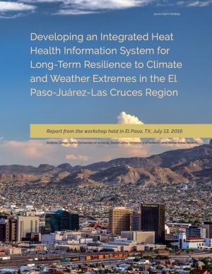
This report summarizes findings from a workshop held in El Paso, Texas, on July 13, 2016. The El Paso-Juárez-Las Cruces region is home to approximately 2.4 million people, most of whom are living in or near the urban centers of Ciudad Juárez (Chihuahua), El Paso, and Las Cruces (New Mexico). These cities share characteristics, such as a high proportion of residents of Hispanic origin, median income below the U.S. national average, and a range of climate-related environmental issues that include drought, flooding, air pollution, dust storms, and frequent occurrences of extremely high temperatures during the late spring and early summer. With hotter temperatures and more frequent and persistent heat waves projected for the El Paso-Juárez-Las Cruces region, it is critical to develop more robust systems of institutions, social learning, and partnerships to understand risks and strengthen public health resilience.
Climate change impacts ecosystems in many ways, from effects on species to phenology to wildfire dynamics. Assessing the potential vulnerability of ecosystems to future changes in climate is an important first step in prioritizing and planning for conservation. Although assessments of climate change vulnerability commonly are done for species, fewer have been done for ecosystems. To aid regional conservation planning efforts, this report assesses climate change vulnerability for ecosystems in the Southeastern United States and Caribbean.
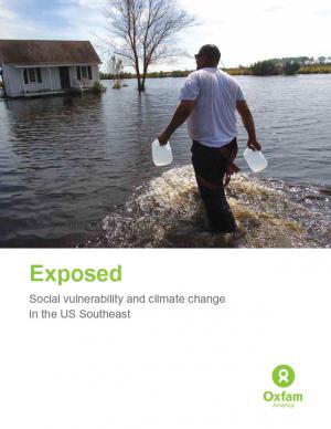
Historically, studies about climate hazards and social vulnerability have been conducted in separate silos. The Social Vulnerability Index (SoVI) is the first study of its kind to examine both the potential impact of natural hazards and which populations are most likely to be negatively affected. This research, commissioned by Oxfam America, includes a series of layered maps that depict social and climate change-related hazard vulnerability. The maps assist in identifying hotspots in the U.S. Southeast, which are at significant risk in the face of four particular climate change-related hazards: drought, flooding, hurricane force winds, and sea level rise. The specific region of focus is the 13-state region of the US Southeast: Alabama, Arkansas, Florida, Georgia, Kentucky, Louisiana, Maryland, Mississippi, North Carolina, South Carolina, Tennessee, Texas, and Virginia. Roughly 80 percent of all U.S. counties that experience persistent poverty (defined as a county in which at least 20 percent of the population experiences poverty for three decades or more) lie in this region.
A collection of case studies and information about how coastal communities can plan for and adapt to climate change. These resources represent a national guide for how coastal communities can plan and adapt. Case study issues range from coastal managers addressing sea level rise in Rhode Island to coral bleaching caused by rising sea temperatures in Florida.


