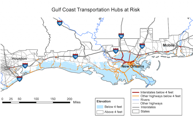
In the Gulf Coast region, 2,400 miles of major roadway are projected to be inundated by sea level rise within this century. The map shows roadways at risk in the event of a sea level rise of about four feet, which is within the range of projections for this region during this time frame.
Source:
Image credit: Kafalenos et al. 2008.
Last modified:
14 June 2015 - 9:42am

