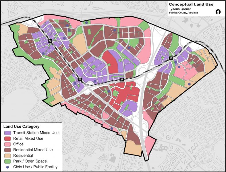
Conceptual land use map for Tysons Corner, Virginia, displayed by zoning type. The map shows plans that are part of Fairfax County's Transforming Tysons project. Click map for a larger view.
Image Credit: Fairfax County, Virginia. CC BY-ND 2.0, https://creativecommons.org/licenses/by-nd/2.0/, via Flickr.
Page/s that contain this image:
Last modified:
3 November 2016 - 12:09pm

