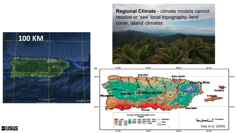
An aerial view of the island of Puerto Rico with 100km gridline context is compared to an annual precipitation map of Puerto Rico. Regional climate models cannot resolve or ‘see’ local topography, land cover, or island climates.
Source:
Full image provided by Adam Terando (USGS). Additional image credit: Daly, C., Helmer, E.H., Quinones, M., 2003. Mapping the climate of Puerto Rico, Vieques and Culebra. Int. J. Climatol. 23, 1359–1381. https://doi.org/10.1002/joc.937
Last modified:
18 July 2022 - 12:27pm

