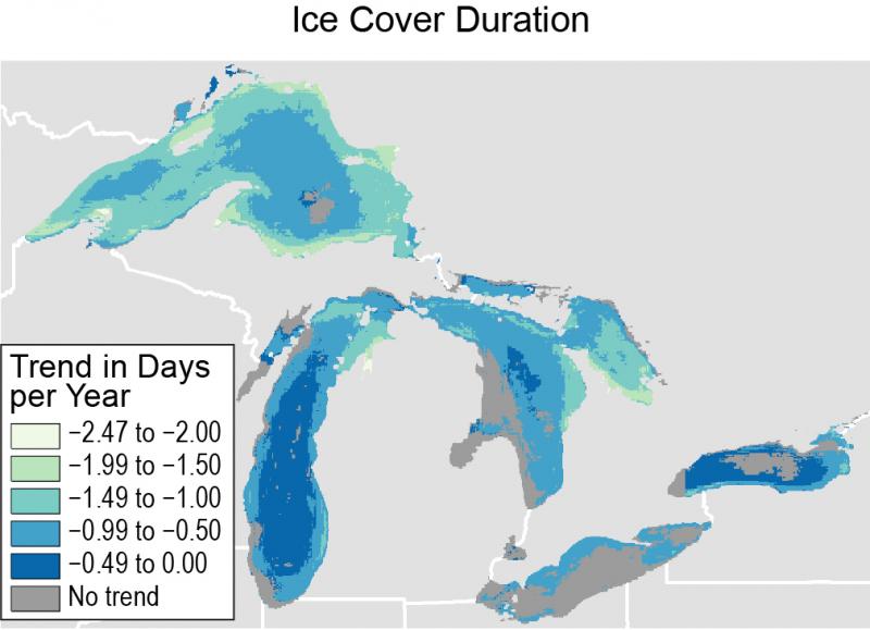
The duration of seasonal ice cover decreased in most areas of the Great Lakes between 1973 and 2013. The map shows the rate of change in ice cover duration. The greatest rate of decrease in seasonal ice cover duration is seen near shorelines, with smaller rates occurring in the deeper central parts of Lakes Michigan and Ontario, which rarely have ice cover.
Source:
Source: Adapted from Mason, L.A., C.M. Riseng, A.D. Gronewold, E.S. Rutherford, J. Wang, A. Clites, S.D.P. Smith, and P.B. McIntyre, 2016. "Fine-scale spatial variation in ice cover and surface temperature trends across the surface of the Laurentian Great Lakes." Climatic Change 138(1), 71-83. http://dx/doi/org/10.1007/s10584-016-1721-2. Used with permission from Springer.
Page/s that contain this image:
Last modified:
6 December 2018 - 9:27am

