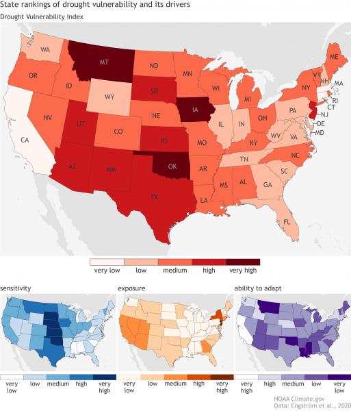
Vulnerability to drought is driven by more than just a lack of rain: it’s a combination of how susceptible a state is to drought and whether it’s prepared for impacts. Learn how a state's sensitivity, exposure, and ability to adapt indicate its vulnerability to drought in this Climate.gov article »
Public domain image produced by NOAA Climate.gov, using data from Engström and others, 2020.
Page/s that contain this image:
Last modified:
20 October 2020 - 11:13am

