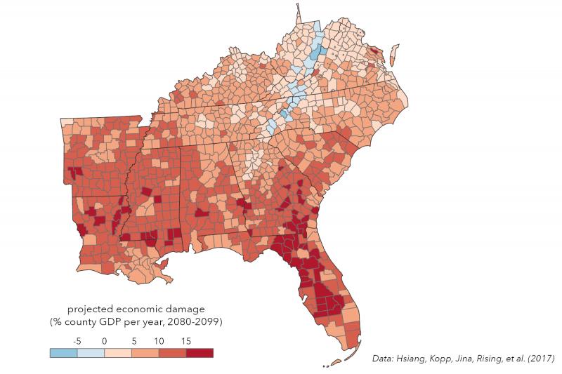
By the late 21st century, if emissions of heat-trapping gases continue increasing, most Southeast counties are projected to experience economic damages from climate change. Colors show annual economic damages projected for 2080–2099 under RCP8.5, expressed as a percentage of gross domestic product for each county in the Southeast. Data from Hsiang, Kopp, Jina, Rising, et al. (2017). Click on the image for a larger view and credit information.
Visualization by Jory Fleming, Carolinas Integrated Sciences & Assessments (CISA).
Page/s that contain this image:
Last modified:
23 June 2021 - 10:20am

