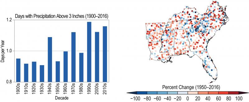
Across the Southeast, the number of days per year with heavy precipitation (shown by decade on the left) has generally increased since the 1900s. On the right, dots show individual station trends toward more (red) or less (blue) heavy precipitation from 1950 to 2016. Fourth National Climate Assessment, Figure 19.3.
Data sources for the figure: NOAA NCEI and CICS-NC.
Page/s that contain this image:
Last modified:
4 June 2021 - 10:37am

