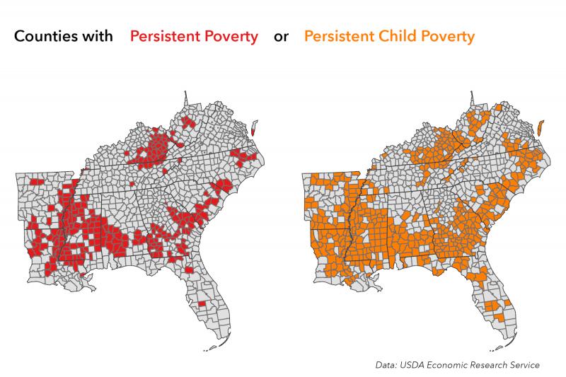
As of 2015, counties highlighted on these maps were facing persistent poverty. In other words, for the past 30 years (or more), at least 20 percent of the adults (left) or children under 18 (right) living in these counties had household incomes below the poverty line. Data from the USDA Economic Research Service. Click on the image for a larger view and credit information.
Visualization by Jory Fleming, Carolinas Integrated Science and Assessments (CISA). Public domain.
Page/s that contain this image:
Last modified:
23 June 2021 - 10:24am

