Access a range of climate-related reports issued by government agencies and scientific organizations. Browse the reports listed below, or filter by scope, content, or focus in the boxes above. To expand your results, click the Clear Filters link.
This Guide is written for practitioners already using or wanting to use future climate information in their work, but who are not familiar with the underlying assumptions and choices surrounding climate data. Here, we introduce the climate model scenarios that are used to “drive” climate models forward in time. These scenarios are a combination of socioeconomic and climate forcing pathways. We summarize differences between these scenarios for the Great Lakes region to show users how their choice of model scenario affects future temperature and precipitation projections.
Created especially for decision makers and adaptation planners in the Great Lakes region, this report offers planners guidance in developing adaptation plans while navigating local politics and specialized data. Content is accessible for users of all skill levels, with a focus on beginner. The report is divided into six main sections: Climate Change in the Great Lakes Region, Decision Making Under Uncertainty, Climate Information in the Local Planning Process, Data Analysis Guide for Assessing Climate Vulnerability, Building Climate Knowledge and Capacity, and Making the Case.
The EWN Atlas is a collection of 56 projects illustrating a diverse portfolio of contexts, motivations, and successful outcomes, presented and considered from an Engineering With Nature® perspective to reveal the usefulness of nature-based approaches and the range of benefits that can be achieved. Engineering With Nature is an initiative of the U.S. Army Corps of Engineers enabling more sustainable delivery of economic, social, and environmental benefits associated with water resources infrastructure. EWN intentionally aligns natural and engineering processes to efficiently and sustainably deliver economic, environmental, and social benefits through collaborative processes.
During late 2016, the National Integrated Drought Information System, the National Drought Mitigation Center, the Midwestern Regional Climate Center, and other regional partners convened four stakeholder meetings in the Midwest Drought Early Warning System. Each of these meetings included a historical drought overview and climate outlook for the region, discussion of critical drought-related needs and challenges, exploration of available tools, local drought planning and management approaches, and strategy development to improve drought early warning and resiliency in the Midwest.
This report was designed to Identify how beachgoers perceive the risk of dangerous currents and waves in the Great Lakes; evaluate existing messages and delivery mechanisms (such as National Weather Service Surf Zone Forecasts); translate complex beach conditions into understandable, actionable messages for specific beachgoer audiences; and identify effective delivery mechanisms for specific audiences.
This plan identifies Ohio's mitigation strategy, which helps guide local mitigation planning and project efforts. The State of Ohio Standard Hazard Mitigation Plan was first approved by FEMA in 2005. This 2011 plan revision details Ohio’s highest priority hazards: river/stream flooding, tornadoes, winter storms, landslides, dam/levee failure, wildfire, coastal flooding, earthquakes, coastal erosion, drought, severe summer storms, invasive species, and land subsidence hazards. The plan also integrates and introduces the State Hazard Analysis, Resource and Planning Portal (SHARPP), a web-based system that captures and disseminates state and local hazard mitigation planning and project information.
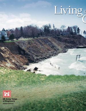
This booklet describes how natural processes affect the coast, including changes in lake levels, storms and storm surges, waves and wave climate, transport of sediment, ice on the shore, shoreline erosion, lakebed erosion, and movement of water on the land. It also describes how to protect coastal investments by adapting to natural processes, restoring a natural shoreline, moderating coastal erosion, armoring the shore, stabilizing bluffs and banks, controlling surface water and groundwater, building environmentally friendly shore protection structures, and working with engineers and contractors. The final section covers risk management and the economics of protecting a coastal investment, including shoreline property features and value, government regulations to protect a coastal investment, costs of shore protection, and accounting for climate change. There is also a list of resources for more information and a glossary of coastal engineering terms.

