Access a range of climate-related reports issued by government agencies and scientific organizations. Browse the reports listed below, or filter by scope, content, or focus in the boxes above. To expand your results, click the Clear Filters link.
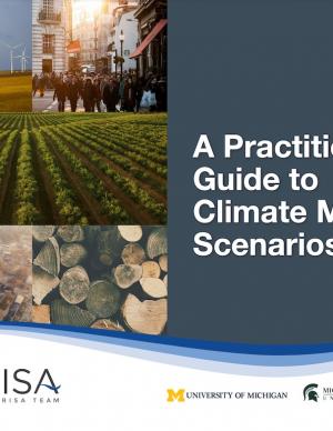
This Guide is written for practitioners already using or wanting to use future climate information in their work, but who are not familiar with the underlying assumptions and choices surrounding climate data. Here, we introduce the climate model scenarios that are used to “drive” climate models forward in time. These scenarios are a combination of socioeconomic and climate forcing pathways. We summarize differences between these scenarios for the Great Lakes region to show users how their choice of model scenario affects future temperature and precipitation projections.
To plan for future sea level rise, Miami-Dade County relies on the 2019 Unified Sea Level Rise Projection for Southeast Florida developed by the Southeast Florida Regional Climate Change Compact. These projections are revised every five years to ensure they reflect the best available science. Based on these consensus projections, they expect sea levels to be approximately two feet higher 40 years from 2019 levels and continue rising beyond that.
This report's subtitle is Managing the Uncertainty of Future Sea Level Change and Extreme Water Levels for Department of Defence Coastal Sites Worldwide.
From the Executive Summary: Global change, including climate change, poses unique challenges to the Department of Defense (DoD). In particular, coastal military sites, and their associated natural and built infrastructure, operations, and readiness capabilities, are vulnerable to the impacts of rising global sea level and local extreme water level (EWL) events. This report and its accompanying scenario database provide regionalized sea level and EWL scenarios for three future time horizons (2035, 2065, and 2100) for 1,774 DoD sites worldwide. The global nature of DoD’s presence required a broad and comprehensive approach that to this point has been lacking in similar efforts.
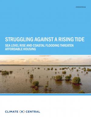
This report highlights the equity implications of sea level rise in the first nationwide assessment of risk to the country’s affordable housing supply. As climate change causes sea levels to rise, the number of affordable housing units at risk of coastal flooding is projected to more than triple to nearly 25,000 nationwide over the next 30 years.
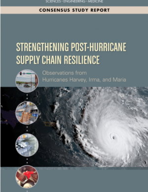
In the third quarter of 2017, Hurricanes Harvey, Irma and Maria revealed some significant vulnerabilities in the national and regional supply chains of Texas, Florida, the U.S. Virgin Islands, and Puerto Rico. Drawing on lessons learned during the 2017 hurricanes, this report explores future strategies to improve supply chain management in disaster situations. It makes recommendations to strengthen the roles of continuity planning, partnerships between civic leaders with small businesses, and infrastructure investment to ensure that essential supply chains will remain operational in the next major disaster. Focusing on the supply chains food, fuel, water, pharmaceutical, and medical supplies, the recommendations of this report will assist FEMA as well as state and local officials, private sector decision makers, civic leaders, and others who can help ensure that supply chains remain robust and resilient in the face of natural disasters.
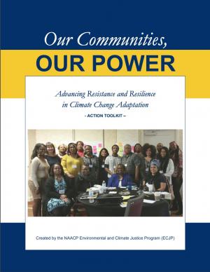
The Beloved Community is a vision for our future where all people share equally in the wealth and bounty of the earth, where we protect its abundance, diversity, and beauty for future generations. In this vision of liberation, racism, exploitation, and domination are replaced by democracy, cooperation, interdependence, and love. To get there, we pursue transformative, systems-change solutions. What do we mean by this? The root causes of the problems our communities face—like climate change, racism, and economic inequality—are all deeply connected. Since the problems are connected, so are the solutions. The purpose of this toolkit is to put us on the path toward achieving this vision. Through the context of building equity and resilience into climate adaptation planning, we introduce strategies to transform our communities and, by extension, society. Our ultimate goal is to create lasting and systemic change. At the same time, we recognize the urgency of the issues our communities face and the need to take action now. That is why we pursue change at every scale—from policy changes to community-based projects—to institute the transformative change we need to uphold our vision of the beloved community.
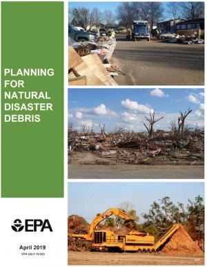
The guidance provided by this report is designed to help all communities create disaster debris management plans. It assists communities in planning for natural disaster debris before disasters—such as hurricanes, earthquakes, tornadoes, volcanoes, floods, wildfires, and winter storms—occur by providing useful, relevant information intended to increase community preparedness and resiliency. The report includes recommended components of a debris management plan, suggested management options for various natural disaster debris streams, a collection of case studies that highlights how several communities prepared for and managed debris generated by recent natural disasters, resources to consult in planning for natural disasters, and the EPA’s recommended pre-incident planning process to help prepare communities for effective disaster debris management.
The frequency and severity of disasters over the last few decades have presented unprecedented challenges for communities across the United States. This report summarizes the existing portfolio of relevant or related resilience measurement efforts and notes gaps and challenges associated with them. It describes how some communities build and measure resilience, and offers four key actions that communities could take to build and measure their resilience to address gaps identified in current community resilience measurement efforts. The report also provides recommendations to the Gulf Research Program to build and measure resilience in the Gulf of Mexico region.
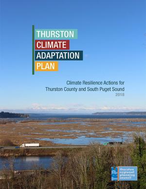
The goal of this concerted effort is to help Thurston County (Washington) and the broader South Puget Sound region prepare for and adjust to climate change. The Thurston Regional Planning Council crafted this document with a $250,000 National Estuary Program grant from the U.S. Environmental Protection Agency and significant in-kind support from the community. Partners included representatives from tribes, municipalities, universities, nonprofits, businesses, and other entities within the project area: three geographically diverse watersheds (Nisqually, Deschutes, and Kennedy-Goldsborough) within Thurston County that drain into Puget Sound. The watersheds encompass beaches, rivers, lakes, wetlands, highlands, forests, farms, ranches, cities, towns, and tribal reservations. It is the Council's hope that other communities throughout the Puget Sound region, state, and nation will replicate this project’s science-based assessments, innovative public-engagement efforts (including development of a resilience game), collaborative planning processes, economic analyses, and comprehensive actions.
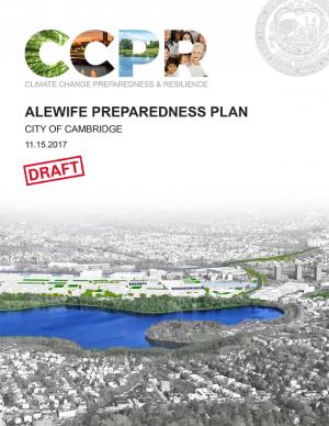
The city of Cambridge, Massachusetts, is developing a Climate Change Preparedness and Resilience Plan as a practical guide to implement specific strategies in response to climate change threats (heat, flooding from precipitation, flooding from sea level rise and storm surge). The Alewife Preparedness Plan—the first neighborhood plan to be developed—will test how the proposed strategies might create a new framework for resiliency in Alewife. It comprises two parts: a Report and a Handbook. The Report provides the context, framework, and strategies to create a prepared and resilient Alewife neighborhood; the Handbook, a companion document, is a practical compendium of specific preparedness and resiliency strategies and best practices.
The Nags Head Comprehensive Plan is an official policy document adopted by the Town of Nags Head to strategically plan for and enhance the quality of life and physical character of the community. The plan, while not regulatory in nature, builds upon adopted plans and policies to provide a foundation for decision making, future regulations, and project development. Further, the plan was created utilizing community input to illustrate a vision for the future of Nags Head and define steps to secure that future.
The Tampa Bay region is known as one of the most vulnerable in the world to wind damage, coastal flooding from storm surge, and rising sea levels. The City of St. Petersburg—with over 60 miles of coastal frontage—has already felt the impacts of storms. The adverse effects from these types of environmental events often impact low-income communities the hardest, as they have the most difficulty bouncing back from stresses and shocks. The City of St. Petersburg is committed to ensuring that investments in making the city resilient are equitable and create a range of opportunities that everyone can benefit from. The Urban Land Institute of Tampa Bay convened top experts in climate resilience from New Orleans, Miami, Boston, and the Tampa Bay region to provide technical assistance to the city on creating an equitable culture of resilience. A grant from the ULI Foundation and Kresge Foundation funded this effort.
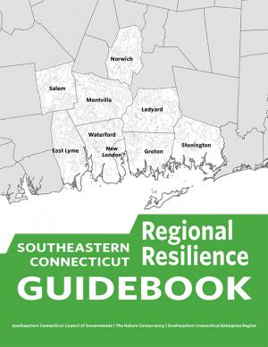
This guidebook results from the culmination of a year of dialogue among diverse stakeholders in southeastern Connecticut who defined challenges and solutions from extreme weather, climate change, and shifting social and economic conditions. Participants included representatives from nine municipalities, public and private utilities, public health departments, chambers of commerce, major employers, conservation organizations, academic institutions, community non-profits, and state agencies, among others. The dialogue captured six themed planning sectors (water, food, ecosystem services, transportation, energy, and regional economy) in a process that used surface and integrated solutions to address singular and multiple challenges across planning sectors. The guidebook provides a quick reference resource to help shape and inform actions that will advance a regional resilience framework for southeastern Connecticut; an accompanying Summary of Findings captures the project's final outcomes and conclusions, as well as providing a comprehensive account of the objectives, process, and details.
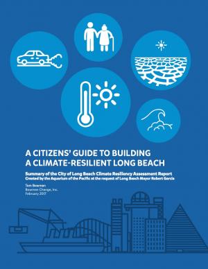
This user-friendly summary is based on the 2015 report “City of Long Beach Climate Resiliency Assessment Report" and “Appendices” prepared by the Aquarium of the Pacific at the request of Mayor Robert Garcia. The report includes clear infographics that describe current and projected conditions in the city. It also describe what the city is currently doing and what else the city and its residents can do.
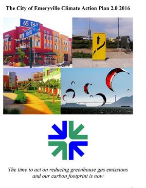
Emeryville is the first city in California's Bay Area to update its Climate Action Plan and align its greenhouse gas (GHG) emissions targets with the State of California’s climate targets. This Climate Action Plan 2.0 includes updates to Emeryville’s 2008 Climate Action Plan, looking towards state targets for reducing 40 percent below baseline levels of GHG emissions by 2030 and 80 percent below baseline levels by 2050. The CAP 2.0 meets the compliance for the Global Covenant of Mayors, a platform for standardizing climate change action planning for local city governments and demonstrating local commitment to climate change mitigation and adaptation. The plan contains GHG targets, updated GHG community and municipal inventories, business-as-usual GHG forecast, deep decarbonization vision for 2050, adaptation and mitigation action plans, and a monitoring plan. With 17 mitigation goals, five adaptation goals, over 100 combined initiatives for 2030, and five long-term strategies for 2050, this CAP 2.0 represents a strong step in reducing emissions and building climate resilience.
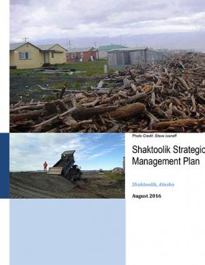
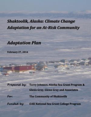
Shaktoolik, a community on the eastern edge of Norton Sound in Alaska, faces considerable threats from erosion and flooding. The community decided to take a “defend in place” approach to erosion, allowing residents to remain at the current village site for the immediate future, although residents have indicated that they are interested in eventually relocating. This Strategic Management Plan provides the “blueprint” or framework for how the community and agencies will proceed to make Shaktoolik a more resilient community and to support their “defend in place” efforts.
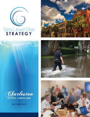
Flooding and sea level rise are challenges the City of Charleston has taken seriously for centuries. However, this City that we love is experiencing the effects more frequently than ever. In the 1970s Charleston experienced an average of 2 days of tidal flooding per year and it is projected that the City could experience 180 days of tidal flooding in 2045. Identifying initiatives that will improve our ability to withstand these effects is timely. This
Sea Level Rise Strategy Plan is that comprehensive inventory of initiatives.
In January 2015, Long Beach Mayor Robert Garcia asked the Aquarium of the Pacific to take a lead in assessing the primary threats that climate change poses to Long Beach, to identify the most vulnerable neighborhoods and segments of the population, and to identify and provide a preliminary assessment of options to reduce those vulnerabilities. Over the course of 2015, the Aquarium hosted and participated in meetings and workshops with academic and government scientists, business and government leaders, local stakeholders, and Long Beach residents to discuss key issues facing our community as the result of climate change. This report, completed in December 2015, represents the culmination of these efforts. The report offers detailed assessments of the five main threats of climate change to Long Beach: drought, extreme heat, sea level rise and coastal flooding, deteriorating air quality, and public health and social vulnerability. It also provides an overview of what is currently being done to mitigate and adapt to these threats, and other options to consider. Finally, this report presents a series of steps and actions that city leaders and community stakeholders can use as a template for making Long Beach a model of a climate resilient city.
This plan evaluates the risks that different hazards pose to Berkeley and engages the community in dialogue to identify the most important steps that the city and its partners should pursue to reduce these risks. The plan updates the city's plan initially adopted in 2004. To develop the 2004 Disaster Mitigation Plan, the city conducted detailed research on four major natural and two major “man-made” hazards present in Berkeley: earthquake, wildland-urban interface fire, landslide, flood, hazardous materials release, and terrorism. Since that time, new maps and data depicting the extent and possible impacts from tsunami and climate change have become available. In 2011, the city added these hazards to the list and they are incorporated into this plan..
This report documents the effort to develop an understanding of possible impacts of climate change and potential future responses by the Towns of Acushnet and Fairhaven and the City of New Bedford, Massachusetts. It focuses specific attention on sea level rise, precipitation, and frequency or intensity of storms that may affect public infrastructure related to water quality and habitat protection.
This report describes a community-driven project built on efforts by Shaktoolik and other at-risk, mainly Alaska Native villages on the Bering Sea coast to adapt to potentially devastating effects of climate change. The project involved a multi-party approach to assist the community of Shaktoolik to make a decision whether to relocate or stay at the current location. The result is a well-defined process that may be replicated by other at-risk communities in the region. The final report documents lessons learned, adaptation methods for Shaktoolik, potential funding sources, and a step-by-step action plan to implement the community's decision.
In 2013, the Baltimore City Department of Planning and Office of Sustainability created the Disaster Preparedness and Planning Project (DP3) as an effort to address existing hazards while simultaneously preparing for predicted hazards due to climate change. This project develops an integrated All Hazards Mitigation Plan, floodplain mapping, and Climate Adaptation Plan program that links research, outreach, and actions to assure implementation of a comprehensive and new risk-preparedness system for addressing existing and future impacts. Integrating hazard mitigation planning, which focuses on past events, with climate adaptation planning, which focuses on what will likely happen in the future, offers a positive, win-win solution for Baltimore City.
The City of Marquette is the largest city in Michigan's Upper Peninsula and one of the most economically diverse in the state. The city is especially vulnerable to environmental, economic, and social impacts of climate change, largely because it borders Lake Superior. A team of Michigan State University Extension specialists and educators received funding from the Great Lakes Integrated Sciences and Assessments Center (GLISA) to collaborate with GLISA researchers, relevant decision makers, and stakeholders in Marquette to increase community resilience through incorporating climate variability and change adaption strategies into local land use master plans and policies. Key stakeholders in the agriculture, forestry, natural resources, health, planning, and tourism fields participated in the development of climate change concerns and strategies. Overwhelmingly, residents and local leaders wanted to protect the natural environment that makes Marquette such a desirable place to live. This report details the process and results of this community-driven process, and also contains specific, detailed GIS maps of the region that reflect the climate vulnerabilities and concerns of the residents and leaders in the Marquette region.
NOTE: This report inspired the creation of another report: "Climate and Health Adaptation Planning Guide for Michigan Communities"
PlaNYC is a long-term sustainability plan based on the latest climate science. This report includes ideas on how to rebuild the communities in New York City affected by Hurricane Sandy in 2012 and how to increase resilience and infrastructure of buildings city-wide in order to protect against future extreme events.
This Climate Action Plan represents Baltimore's commitment to being a leader in sustainability and improving their city environment. The plan contains feasible measures to help the city reduce greenhouse gas emissions and curb the effects of climate change. The plan calls for a goal of a 15 percent reduction in greenhouse gas emissions by 2020. In order to reach this goal, the plan promotes renewable energy generation and energy retrofits, waste diversion, and water efficiency. CAP measures will help citizens save energy and money, as well as encourage the use of sustainable modes of transit, high-density urban land use, and increased tree plantings. From the mayor's message: "While we as a City alone cannot change the course of world climate patterns, we must do our part. The City of Baltimore’s Climate Action plan is our promise to take action, reduce our greenhouse gas emissions, increase our quality of life, and grow Baltimore. "
Preparation of the Strategic Climate Action Plan is an opportunity to take stock of progress related to climate change, to look forward, and to plan for the future.
A report on climate change impacts and climate change action plans for marine ecosystems on California's north-central coast. It presents scientific observations and expectations to identify potential issues related to changing climate—with an emphasis on the most likely ecological impacts and the impacts that would be most severe if they occur.
In determining appropriate adaptation strategies, project staff worked with participants to survey a wide range of potential strategy options and develop a process for evaluation and prioritization of targeted strategies.
King County in Washington State has established a comprehensive program to prepare for climate change, and many of the tools and strategies that King County has employed can be applied in other communities. This memorandum from the King County Office of Strategic Planning and Performance Management, published by the American Planning Association, describes strategies developed in King County to direct local government efforts to address climate change.

