Access a range of climate-related reports issued by government agencies and scientific organizations. Browse the reports listed below, or filter by scope, content, or focus in the boxes above. To expand your results, click the Clear Filters link.
The Vermont Climate Action Plan aims to dramatically reduce greenhouse gas emissions, help protect Vermont communities and landscapes from the greatest risks of climate change, and create new clean energy industry and jobs. The Climate Action Plan includes strategies to:
- Reduce greenhouse gas emissions from the transportation, building, regulated utility, industrial, commercial, and agricultural sectors;
- Encourage smart growth and related strategies;
- Achieve long-term sequestration and storage of carbon and promote best management practices to achieve climate mitigation, adaption, and resilience on natural working lands;
- Achieve net zero emissions by 2050 across all sectors;
- Reduce energy burdens for rural and marginalized communities;
- Limit the use of chemicals, substances, or products that contribute to climate change; and
- Build and encourage climate adaptation and resilience of Vermont communities and natural systems.
The Climate Action Plan serves as a guide for the Vermont Legislature in setting policy that supports climate change solutions for Vermonters and Vermont's landscape.
A range of resources documenting report preparation are available in the Climate Action Plan Appendices.
In 2020, New York City's Mayor’s Office of Resiliency initiated an engagement process, called the Climate Knowledge Exchange, to align research with climate resiliency and adaptation needs. This report is the first in an annual series that will maintain a public agenda for climate research in NYC. The report communicates NYC’s research needs to external partners, including academic scientists, federal researchers, philanthropic foundations, and community organizations. This in turn will catalyze new and creative partnerships to develop credible and actionable research products that address NYC’s most pressing climate challenges. The report includes the engagement methodology and survey text used with various agencies.
Natural hazards such as flooding, high wind, drought, and landslides pose major threats to communities across the United States, and reducing the threats they pose to lives, properties, and the economy is a top priority for many communities. The key goal of this guide is to help communities identify and engage the staff and resources that can play a role in building resilience with nature-based solutions.
Planning for climate change resiliency is an increasingly pressing requirement for communities throughout the world and the Delaware Valley Regional Planning Commission (DVRPC) region. In order to help local officials, non-profits, and communities with this process, numerous planning tools have been developed by a wide range of public and private agencies. Accordingly, the purpose of this paper is to explain, organize, and prioritize the tools that currently exist in order to select ones that are broadly accessible to a wide range of organizations, applicable across a range of sectors, and not overly redundant. During this selection process, a list of over 60 tools was winnowed down to a final toolkit of 18 that are particularly useful at any stage in the resiliency planning process and can be used for communities throughout the DVRPC region.
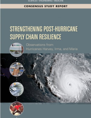
In the third quarter of 2017, Hurricanes Harvey, Irma and Maria revealed some significant vulnerabilities in the national and regional supply chains of Texas, Florida, the U.S. Virgin Islands, and Puerto Rico. Drawing on lessons learned during the 2017 hurricanes, this report explores future strategies to improve supply chain management in disaster situations. It makes recommendations to strengthen the roles of continuity planning, partnerships between civic leaders with small businesses, and infrastructure investment to ensure that essential supply chains will remain operational in the next major disaster. Focusing on the supply chains food, fuel, water, pharmaceutical, and medical supplies, the recommendations of this report will assist FEMA as well as state and local officials, private sector decision makers, civic leaders, and others who can help ensure that supply chains remain robust and resilient in the face of natural disasters.
This report and the accompanying community spotlights provide an overview of climate change science, reasons why action is needed, how science supports decision making and planning, ways to adapt to climate change and limit the severity of its effects, and how such efforts can help build resiliency. The report illustrates the ways in which science can help individuals, communities, businesses, and government agencies make informed decisions. By working together to identify solutions and bring about positive change, we can reduce the risks faced by current and future generations.
The Central Council of the Tlingit and Haida Indian Tribes of Alaska (Tlingit & Haida) is a federally recognized Indian Tribe that serves 20 villages and communities stretching over 43,000 square miles within the Alaska Panhandle. The Tlingit and Haida membership is among the largest, most isolated, and most geographically dispersed of Native or Tribal populations nationwide. The region encompasses a 525-mile strip of coastline and interior waterways, bordered by Canada on the north, south, and east, with the Gulf of Alaska on the west.
The Central Council recognizes that wild salmon, berries, clams, herring, halibut, yellow cedar and other species important for subsistence, cash and culture are at risk. In response, they have released a 53-page climate change adaptation plan. The document is a roadmap for prioritizing, monitoring, and responding to threats stemming from warming air and ocean temperatures, caused by increasing levels of greenhouse gases trapped in the atmosphere.
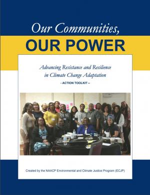
The Beloved Community is a vision for our future where all people share equally in the wealth and bounty of the earth, where we protect its abundance, diversity, and beauty for future generations. In this vision of liberation, racism, exploitation, and domination are replaced by democracy, cooperation, interdependence, and love. To get there, we pursue transformative, systems-change solutions. What do we mean by this? The root causes of the problems our communities face—like climate change, racism, and economic inequality—are all deeply connected. Since the problems are connected, so are the solutions. The purpose of this toolkit is to put us on the path toward achieving this vision. Through the context of building equity and resilience into climate adaptation planning, we introduce strategies to transform our communities and, by extension, society. Our ultimate goal is to create lasting and systemic change. At the same time, we recognize the urgency of the issues our communities face and the need to take action now. That is why we pursue change at every scale—from policy changes to community-based projects—to institute the transformative change we need to uphold our vision of the beloved community.
The frequency and severity of disasters over the last few decades have presented unprecedented challenges for communities across the United States. This report summarizes the existing portfolio of relevant or related resilience measurement efforts and notes gaps and challenges associated with them. It describes how some communities build and measure resilience, and offers four key actions that communities could take to build and measure their resilience to address gaps identified in current community resilience measurement efforts. The report also provides recommendations to the Gulf Research Program to build and measure resilience in the Gulf of Mexico region.
Flooding is the natural hazard with the greatest economic and social impact in the United States, and these impacts are becoming more severe over time. This report contributes to existing knowledge on urban flooding by examining real-world examples in specific metropolitan areas: Baltimore, Houston, Chicago, and Phoenix. The report identifies commonalities and variances among the case study metropolitan areas in terms of causes, adverse impacts, unexpected problems in recovery, or effective mitigation strategies, as well as key themes of urban flooding. It also relates, as appropriate, causes and actions of urban flooding to existing federal resources or policies.
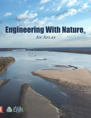
The EWN Atlas is a collection of 56 projects illustrating a diverse portfolio of contexts, motivations, and successful outcomes, presented and considered from an Engineering With Nature® perspective to reveal the usefulness of nature-based approaches and the range of benefits that can be achieved. Engineering With Nature is an initiative of the U.S. Army Corps of Engineers enabling more sustainable delivery of economic, social, and environmental benefits associated with water resources infrastructure. EWN intentionally aligns natural and engineering processes to efficiently and sustainably deliver economic, environmental, and social benefits through collaborative processes.
The goal of this concerted effort is to help Thurston County (Washington) and the broader South Puget Sound region prepare for and adjust to climate change. The Thurston Regional Planning Council crafted this document with a $250,000 National Estuary Program grant from the U.S. Environmental Protection Agency and significant in-kind support from the community. Partners included representatives from tribes, municipalities, universities, nonprofits, businesses, and other entities within the project area: three geographically diverse watersheds (Nisqually, Deschutes, and Kennedy-Goldsborough) within Thurston County that drain into Puget Sound. The watersheds encompass beaches, rivers, lakes, wetlands, highlands, forests, farms, ranches, cities, towns, and tribal reservations. It is the Council's hope that other communities throughout the Puget Sound region, state, and nation will replicate this project’s science-based assessments, innovative public-engagement efforts (including development of a resilience game), collaborative planning processes, economic analyses, and comprehensive actions.
The protocol developed and used in this report is unique in that it is an asset-level assessment of the vulnerability of infrastructure to multiple coastal hazards and climate change factors (e.g., erosion, flooding, storm surge, sea-level rise, and historical flooding) over a 35-year planning horizon (2050). The protocol was applied to all buildings and roads in Cape Lookout National Seashore; the results are summarized in the report.
This guidebook results from the culmination of a year of dialogue among diverse stakeholders in southeastern Connecticut who defined challenges and solutions from extreme weather, climate change, and shifting social and economic conditions. Participants included representatives from nine municipalities, public and private utilities, public health departments, chambers of commerce, major employers, conservation organizations, academic institutions, community non-profits, and state agencies, among others. The dialogue captured six themed planning sectors (water, food, ecosystem services, transportation, energy, and regional economy) in a process that used surface and integrated solutions to address singular and multiple challenges across planning sectors. The guidebook provides a quick reference resource to help shape and inform actions that will advance a regional resilience framework for southeastern Connecticut; an accompanying Summary of Findings captures the project's final outcomes and conclusions, as well as providing a comprehensive account of the objectives, process, and details.
With insight from 26 campus and stakeholder advisors, the support of the USDA Agricultural Marketing Service’s Transportation Division, and input from regional food supply chain businesses throughout the region, this 68-page report details the process used to assess the Chicago region food system and findings through the three-year participatory research effort. It includes eleven sections with 17 figures to illustrate key concepts, along with extensive supporting materials. The report presents three innovations with proofs of concept that could be applied widely in the region and beyond to improve food distribution, both in rural and urban regions.
Blacksburg's Climate Action Plan represents both a short- and long-term set of strategies to pursue to reach the community’s energy and climate action goals. The long-range goal, established by Town Council in 2007, is to reduce community-wide greenhouse gas emissions by 80 percent below 1990 levels by 2050. Blacksburg’s Climate Action Plan is divided into six chapters covering the major sectors of the community responsible for Blacksburg’s greenhouse gas emissions. Citizens' priority strategies are reflected in each of the sector chapters in three ways: a set of “Individual Actions” that citizens can choose to adopt in their own lives, shorter time-horizon “Let’s Get Started” strategies, and longer-term “Looking Ahead” strategies.
The State of Maine is experiencing shifts in atmospheric and oceanographic conditions that put it at the precipice of abrupt climate change. This report—part of the Department of Homeland Security's Regional Resiliency Assessment Program (RRAP)—focuses on the local and regional consequences of climate disruptions and their impacts on critical infrastructure in the Casco Bay region, the most developed and populous region in Maine. The report identifies vulnerabilities that may potentially affect the region’s ability to maintain its critical infrastructure systems and recover from the impacts of climate change.
King County, Washington's Strategic Climate Action Plan sets forth strategies for reducing greenhouse gas emissions and preparing for climate change impacts.
This guide provides a framework for the selection of appropriate storm damage risk reduction treatments for low-volume roads. There are important tasks and processes that are necessary to make informed treatment selections that this guide does not cover in detail, but should be included in comprehensive road management programs. These tasks include road condition inventories, hazard assessments, and strategic plans for treating high-hazard sites. Specific “stormproofing” measures discussed in this guide include timely road maintenance, many key road drainage measures, culvert diversion prevention, pulling back marginal fill slopes, use of biotechnical and vegetative slope stabilization and erosion control, gully prevention, bridge maintenance, and many other measures.
The New River Valley Livability Energy Report uses nine principles to describe a sustainable, affordable, and reliable regional energy plan for the New River Valley in Virginia. Each principle is accompanied by practical strategies communities can use to promote sustainability. The report could serve as a model for other regional energy plans.
The two main objectives of this pilot project were to (1) assess the vulnerability of Boston's Central Artery/Tunnel System to sea level rise and extreme storm events, and (2) investigate and present adaptation options to reduce identified vulnerabilities.
In support of the Eugene-Springfield Multi-Jurisdictional Natural Hazards Mitigation Plan, staff from the cities of Eugene and Springfield, Oregon, with support from the Oregon Partnership for Disaster Resilience, convened meetings in 2014 with representatives from the following sectors: drinking water, health care and public education, electricity, transportation, food, housing, communication, stormwater, wastewater, natural systems, and public safety. The team met for six hours with each sector and, working from a standard list of questions, collected information about the adaptive capacity and sensitivity to specific hazards. This report includes sector summaries resulting from these interviews that reflect the conversations and thinking of the participants.
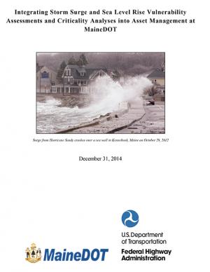
The Maine Department of Transportation study identified transportation assets that are vulnerable to flooding from sea level rise and storm surge in six coastal towns. The team developed depth-damage functions and adaptation design options at three of the sites, and evaluated the costs and benefits of the alternative design structures.
This report, the first of its kind for the City of Grand Rapids, outlines the condition of the city's climate resiliency and offers recommendations for how it can both impact and adapt to climate change. The report's goal is to both spur a larger community conversation around processes that will enable Grand Rapids to become a more climate-resilient city and to spur many specific short- and near-term projects, policies, programs, and plans to mitigate the effects of climate change. The report documents projected local climate changes, their potential negative impact to low-income families, and outlines small near-term solutions that the city can make to curb or adapt to climate change. Recommendations include investing in green space and improving the city's tree canopy, improving the city's energy autonomy, and implementing green street infrastructure materials and maintenance techniques.
In 2013, the Baltimore City Department of Planning and Office of Sustainability created the Disaster Preparedness and Planning Project (DP3) as an effort to address existing hazards while simultaneously preparing for predicted hazards due to climate change. This project develops an integrated All Hazards Mitigation Plan, floodplain mapping, and Climate Adaptation Plan program that links research, outreach, and actions to assure implementation of a comprehensive and new risk-preparedness system for addressing existing and future impacts. Integrating hazard mitigation planning, which focuses on past events, with climate adaptation planning, which focuses on what will likely happen in the future, offers a positive, win-win solution for Baltimore City.
The City of Marquette is the largest city in Michigan's Upper Peninsula and one of the most economically diverse in the state. The city is especially vulnerable to environmental, economic, and social impacts of climate change, largely because it borders Lake Superior. A team of Michigan State University Extension specialists and educators received funding from the Great Lakes Integrated Sciences and Assessments Center (GLISA) to collaborate with GLISA researchers, relevant decision makers, and stakeholders in Marquette to increase community resilience through incorporating climate variability and change adaption strategies into local land use master plans and policies. Key stakeholders in the agriculture, forestry, natural resources, health, planning, and tourism fields participated in the development of climate change concerns and strategies. Overwhelmingly, residents and local leaders wanted to protect the natural environment that makes Marquette such a desirable place to live. This report details the process and results of this community-driven process, and also contains specific, detailed GIS maps of the region that reflect the climate vulnerabilities and concerns of the residents and leaders in the Marquette region.
NOTE: This report inspired the creation of another report: "Climate and Health Adaptation Planning Guide for Michigan Communities"
PlaNYC is a long-term sustainability plan based on the latest climate science. This report includes ideas on how to rebuild the communities in New York City affected by Hurricane Sandy in 2012 and how to increase resilience and infrastructure of buildings city-wide in order to protect against future extreme events.
The Plan's goals include reducing community-wide greenhouse gas emissions 10 percent below 1990 levels by 2020, reducing community-wide fossil fuel use 50 percent by 2030, and identifying strategies that will help the community adapt to climate change and rising fuel prices
This Executive Order requires that King County, Washington, municipal departments employ coordinated strategies of land use to mitigate and adapt to global warming.

