Access a range of climate-related reports issued by government agencies and scientific organizations. Browse the reports listed below, or filter by scope, content, or focus in the boxes above. To expand your results, click the Clear Filters link.
A growing number of local governments are taking steps toward climate adaptation, mostly through the development of climate adaptation plans. However, the rate and pace of adaptation action has significantly lagged behind planning, especially in mid- and small-sized municipalities where resources are often limited and local politics may further delay action. This report describes how to use economics to build support for climate adaptation. Using case studies from cities large and small, it highlights how to effectively use economic data and methods, provides eight types of economic analyses for climate adaptation, and explains how to clearly communicate economic data to different audiences.
The world continues to emit greenhouse gases while the planet's climate is changing faster than ever. This report intends to take up the latest and most essential scientific findings published in an extraordinary year—the climate science year in review.
The Disaster Resilience Framework serves as a guide for analysis of federal actions to facilitate and promote resilience to natural disasters. This report identifies the rising number of natural disasters and increasing reliance on federal assistance as a significant source of federal fiscal exposure. Disaster resilience helps to reduce the impact of climate-related events on people and property. Recognizing the gravity of the effect of these disasters on the American people and the fiscal exposure it creates, the framework was made to help those who have responsibility for oversight and management of federal efforts to consider what they might do that will result in federal and non-federal decision makers taking action to increase disaster resilience throughout the nation.
The Design Guidelines serve as a reference for residents, business owners, and developers to translate flood resiliency strategies into best practices. They include a resilience toolkit to address building form, building envelope, and site access; description and supporting information on technical and cost considerations, insurance factors, and sustainable design co-benefits; guidance on urban design, accessibility, and public realm matters related to changes in elevation between a site and surrounding infrastructure; measures to manage additional climate hazards; and case studies that apply resilience strategies from the toolkit to representative building types in the future flood zone. The Guidelines will also be used to administer a future Coastal Flood Resilience Zoning Overlay District.
This report focuses on making the case for climate adaptation, providing specific insights and recommendations in key sectors: food security, the natural environment, water, cities and urban areas, infrastructure, disaster risk management, and finance. It is designed to inspire action among decision makers, including heads of state and government officials, mayors, business executives, investors, and community leaders.
This report and the accompanying community spotlights provide an overview of climate change science, reasons why action is needed, how science supports decision making and planning, ways to adapt to climate change and limit the severity of its effects, and how such efforts can help build resiliency. The report illustrates the ways in which science can help individuals, communities, businesses, and government agencies make informed decisions. By working together to identify solutions and bring about positive change, we can reduce the risks faced by current and future generations.
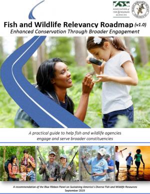
The Fish and Wildlife Relevancy Roadmap is a practical guide that state and provincial fish and wildlife conservation agencies can use to overcome barriers to broader relevance, public engagement, and support. The roadmap is not prescriptive and provides multiple pathways to respond to the diverse social, economic, demographic, political, and environmental changes that states and provinces face. The Roadmap was developed by a team of over 60 leaders from state, federal, provincial, and private conservation organizations and others with an interest in conservation.
Alaska has recently experienced profound environmental change related to extreme weather events and deviations from the historical climate. Sustained warmth, sea ice loss, coastal flooding, river flooding, and major ecosystem changes have impacted the daily lives of Alaskans around the state. The International Arctic Research Center and the University of Alaska Fairbanks have documented these changes, and are providing individuals, Alaska businesses, communities, government, and others with the resources they need to better assess impacts and develop adaptation strategies.
Communities in Hawai'i are highly vulnerable to natural disasters such as hurricanes, tsunamis, floods, seasonal high waves, earthquakes, volcanic eruptions, lava flows, and sea level rise. Since a changing climate is expected to worsen the effects of these natural hazards, planners and communities must work together to prepare for long term disastor recovery. The study developed statewide guidance documents and tools to improve community resilience to coastal hazards and sea level rise, thereby encouraging communities to focus on recovery practices before a disaster hits.
The Central Council of the Tlingit and Haida Indian Tribes of Alaska (Tlingit & Haida) is a federally recognized Indian Tribe that serves 20 villages and communities stretching over 43,000 square miles within the Alaska Panhandle. The Tlingit and Haida membership is among the largest, most isolated, and most geographically dispersed of Native or Tribal populations nationwide. The region encompasses a 525-mile strip of coastline and interior waterways, bordered by Canada on the north, south, and east, with the Gulf of Alaska on the west.
The Central Council recognizes that wild salmon, berries, clams, herring, halibut, yellow cedar and other species important for subsistence, cash and culture are at risk. In response, they have released a 53-page climate change adaptation plan. The document is a roadmap for prioritizing, monitoring, and responding to threats stemming from warming air and ocean temperatures, caused by increasing levels of greenhouse gases trapped in the atmosphere.
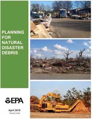
The guidance provided by this report is designed to help all communities create disaster debris management plans. It assists communities in planning for natural disaster debris before disasters—such as hurricanes, earthquakes, tornadoes, volcanoes, floods, wildfires, and winter storms—occur by providing useful, relevant information intended to increase community preparedness and resiliency. The report includes recommended components of a debris management plan, suggested management options for various natural disaster debris streams, a collection of case studies that highlights how several communities prepared for and managed debris generated by recent natural disasters, resources to consult in planning for natural disasters, and the EPA’s recommended pre-incident planning process to help prepare communities for effective disaster debris management.
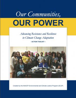
The Beloved Community is a vision for our future where all people share equally in the wealth and bounty of the earth, where we protect its abundance, diversity, and beauty for future generations. In this vision of liberation, racism, exploitation, and domination are replaced by democracy, cooperation, interdependence, and love. To get there, we pursue transformative, systems-change solutions. What do we mean by this? The root causes of the problems our communities face—like climate change, racism, and economic inequality—are all deeply connected. Since the problems are connected, so are the solutions. The purpose of this toolkit is to put us on the path toward achieving this vision. Through the context of building equity and resilience into climate adaptation planning, we introduce strategies to transform our communities and, by extension, society. Our ultimate goal is to create lasting and systemic change. At the same time, we recognize the urgency of the issues our communities face and the need to take action now. That is why we pursue change at every scale—from policy changes to community-based projects—to institute the transformative change we need to uphold our vision of the beloved community.
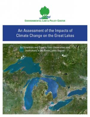
Climate change is causing significant and far-reaching impacts on the Great Lakes and the Great Lakes region. This report, from 18 leading scientists and experts from Midwest and Canadian universities and research institutions, draws on the array of existing research to assess how the shifting global climate impacts the unique Great Lakes region.
Flooding is the natural hazard with the greatest economic and social impact in the United States, and these impacts are becoming more severe over time. This report contributes to existing knowledge on urban flooding by examining real-world examples in specific metropolitan areas: Baltimore, Houston, Chicago, and Phoenix. The report identifies commonalities and variances among the case study metropolitan areas in terms of causes, adverse impacts, unexpected problems in recovery, or effective mitigation strategies, as well as key themes of urban flooding. It also relates, as appropriate, causes and actions of urban flooding to existing federal resources or policies.
The frequency and severity of disasters over the last few decades have presented unprecedented challenges for communities across the United States. This report summarizes the existing portfolio of relevant or related resilience measurement efforts and notes gaps and challenges associated with them. It describes how some communities build and measure resilience, and offers four key actions that communities could take to build and measure their resilience to address gaps identified in current community resilience measurement efforts. The report also provides recommendations to the Gulf Research Program to build and measure resilience in the Gulf of Mexico region.
This plan represents the efforts of the State of Minnesota in fulfilling the responsibility for hazard mitigation planning. The purpose of this plan is to identify the state’s major hazards, assess the vulnerability to those hazards, and take steps to reduce vulnerability using the technical and program resources of Minnesota agencies. The process has included consideration of current and expected future impacts from Minnesota’s already changing climate, as relevant to hazard mitigation planning. The plan identifies goals and recommends actions and initiatives for the state government to adapt to, reduce, and/or prevent injury and damage from hazardous events.
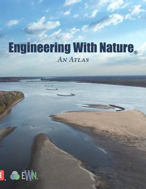
The EWN Atlas is a collection of 56 projects illustrating a diverse portfolio of contexts, motivations, and successful outcomes, presented and considered from an Engineering With Nature® perspective to reveal the usefulness of nature-based approaches and the range of benefits that can be achieved. Engineering With Nature is an initiative of the U.S. Army Corps of Engineers enabling more sustainable delivery of economic, social, and environmental benefits associated with water resources infrastructure. EWN intentionally aligns natural and engineering processes to efficiently and sustainably deliver economic, environmental, and social benefits through collaborative processes.
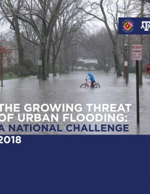
This report offers the first national assessment of the scope and consequences of urban flooding in the United States. Researchers analyzed available data concerning urban flooding, surveyed municipal flood and stormwater managers, and met with professionals whose disciplines intersect with urban flooding at the local, state, and national level. The research team's findings affirm that urban flooding is a national and significant source of economic loss, social disruption, and housing inequality. This report presents the full results of the study, addresses governance issues that affect urban flood risk reduction, examines critical challenges, and offers recommendations for actions.
The Global Change Research Act of 1990 mandates that the U.S. Global Change Research Program deliver a report to Congress and the President no less than every four years that “1) integrates, evaluates, and interprets the findings of the Program…; 2) analyzes the effects of global change on the natural environment, agriculture, energy production and use, land and water resources, transportation, human health and welfare, human social systems, and biological diversity; and 3) analyzes current trends in global change, both human-induced and natural, and projects major trends for the subsequent 25 to 100 years.” The Fourth National Climate Assessment (NCA4) fulfills that mandate in two volumes. This report, Volume II, draws on the foundational science described in Volume I, the Climate Science Special Report. Volume II focuses on the human welfare, societal, and environmental elements of climate change and variability for 10 regions and 18 national topics, with particular attention paid to observed and projected risks, impacts, consideration of risk reduction, and implications under different mitigation pathways. Where possible, NCA4 Volume II provides examples of actions underway in communities across the United States to reduce the risks associated with climate change, increase resilience, and improve livelihoods. This assessment was written to help inform decision makers, utility and natural resource managers, public health officials, emergency planners, and other stakeholders by providing a thorough examination of the effects of climate change on the United States.
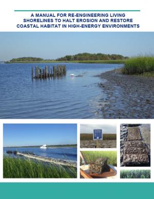
Shorelines with high boat wake and wave energy face especially rapid erosion and habitat loss. A new living shoreline design from researchers at the University of Florida and the Guana Tolomato Matanzas Reserve that uses gabion-breaks has proven successful in high-energy environments. The gabion-break design uses two lines of defense to reduce erosion along the marsh edge—porous wooden breakwalls placed in front of structures that will foster oyster growth. This manual for restoration practitioners describes a collaborative research project that tested gabion-breaks along the Atlantic Intracoastal Waterway in northeast Florida. It discusses the project’s results and details the steps to use gabion-breaks, including planning, design, maintenance, monitoring, and costs.
This special report from the Intergovernmental Panel on Climate change describes the impacts of global warming of 1.5 °C above pre-industrial levels. The report also describes potential global greenhouse gas emission pathways, in the context of strengthening the global response to the threat of climate change, sustainable development, and efforts to eradicate poverty.
This report considers the economic, environmental, and social factors that contribute to resilience, and how the concept of resilience translates to the private sector, municipal decision makers, and communities. It summarizes key themes posed by the Urban Land Institute's resilience work in the years since Hurricane Sandy, with a particular focus on ULI’s resilience-focused Advisory Services work. Ten Principles was developed through a ULI member workshop in summer 2017, which included 15 ULI member leaders who had served on resilience-focused Advisory Services Panels and other Urban Resilience program activities over the past four years. The members attending the workshop formulated the ten principles, which are illustrated in the report with on-the-ground examples from Advisory Services panels.
This guidebook outlines five core components of multimodal network connectivity, as listed below, with a focus on pedestrians and bicyclists. While these components are all related, the distinctions between them provide a framework for selecting connectivity measures that address specific questions. Multimodel networks are accessible, interconnected pedestrian and/or bicycle transportation facilities that allow all users to safely and conveniently get where they want to go.
The guidebook describes analysis methods and supporting measures associated with each of these components:
- Network completeness - How much of the transportation network is available to bicyclists and pedestrians?
- Network density - How dense are the available links and nodes of the bicycle and pedestrian network?
- Route directness - How far out of their way do users have to travel to find a facility they can or want to use?
- Access to destinations - What destinations can be reached using the transportation network?
- Network quality - How does the network support users of varying levels of experience, ages, abilities, and comfort with bicycling or walking?
The goal of this concerted effort is to help Thurston County (Washington) and the broader South Puget Sound region prepare for and adjust to climate change. The Thurston Regional Planning Council crafted this document with a $250,000 National Estuary Program grant from the U.S. Environmental Protection Agency and significant in-kind support from the community. Partners included representatives from tribes, municipalities, universities, nonprofits, businesses, and other entities within the project area: three geographically diverse watersheds (Nisqually, Deschutes, and Kennedy-Goldsborough) within Thurston County that drain into Puget Sound. The watersheds encompass beaches, rivers, lakes, wetlands, highlands, forests, farms, ranches, cities, towns, and tribal reservations. It is the Council's hope that other communities throughout the Puget Sound region, state, and nation will replicate this project’s science-based assessments, innovative public-engagement efforts (including development of a resilience game), collaborative planning processes, economic analyses, and comprehensive actions.
In 1950, fewer than one-third of the world's people lived in cities. Today more than half do. By 2050, urban areas will be home to some two-thirds of Earth's human population. This scale and pace of urbanization has never been seen in human history.
The report provides a foundation for new scientific collaborations on how cities function, how they grow, and how they can be managed sustainably for decades to come.
This report acknowledges that climate adaptation has begun to emerge as a field of practice, but states that the work is not evolving quickly or deliberately enough for communities to adequately prepare for the dangerous shocks and stresses that increasingly will be introduced by climate change. The report assesses the current state of the climate adaptation field, provides a vision of what a mature, effective field would look like, and recommends steps that should be taken to realize that vision.
This BAMS special report presents assessments of how human-caused climate change may have affected the strength and likelihood of individual extreme events. This sixth edition of explaining extreme events of the previous year (2016) from a climate perspective is the first of these reports to find that some extreme events were not possible in a pre-industrial climate.
The Arctic shows no sign of returning to reliably frozen region of recent past decades. Despite relatively cool summer temperatures, observations in 2017 continue to indicate that the Arctic environmental system has reached a "new normal," characterized by long-term losses in the extent and thickness of the sea ice cover, the extent and duration of the winter snow cover and the mass of ice in the Greenland Ice Sheet and Arctic glaciers, and warming sea surface and permafrost temperatures. Issued annually since 2006, the Arctic Report Card is a timely and peer-reviewed source for clear, reliable, and concise environmental information on the current state of different components of the Arctic environmental system relative to historical records. The report is intended for a wide audience, including scientists, teachers, students, decision makers, and the general public interested in the Arctic environment and science.
This report provides the first state-wide assessment for Hawai'i documenting vulnerability to sea level rise. The report includes recommendations to reduce exposure and sensitivity to sea level rise and to increase capacity to adapt. It also provides recommendations based on emerging practices framed through extensive stakeholder consultations. It is considered a "living" report, and will be updated as further information is gathered. The framework of the report is intended to be used when facing other climate change threats affecting Hawai'i.
As a key part of the Fourth National Climate Assessment (NCA4), the U.S. Global Change Research Program (USGCRP) oversaw the production of this stand-alone report of the state of science relating to climate change and its physical impacts. The Climate Science Special Report (CSSR) is designed to be an authoritative assessment of the science of climate change, with a focus on the United States, to serve as the foundation for efforts to assess climate-related risks and inform decision making about responses.
As Volume 1 of NCA4, CSSR serves several purposes, including providing (1) an updated and detailed analysis of the findings of how climate change is affecting weather and climate across the United States; (2) an executive summary and 15 chapters that provide the basis for the discussion of climate science found in the second volume of NCA4; and (3) foundational information and projections for climate change, including extremes, to improve “end-to-end” consistency in sectoral, regional, and resilience analyses within the second volume. CSSR integrates and evaluates the findings on climate science and discusses the uncertainties associated with these findings. It analyzes current trends in climate change, both human-induced and natural, and projects major trends to the end of this century. As an assessment and analysis of the science, CSSR provides important input to the development of other parts of NCA4, and their primary focus on the human welfare, societal, economic and environmental elements of climate change. Much of the underlying report is written at a level more appropriate for a scientific audience, though the Executive Summary is intended to be accessible to a broader audience.
The city of Cambridge, Massachusetts, is developing a Climate Change Preparedness and Resilience Plan as a practical guide to implement specific strategies in response to climate change threats (heat, flooding from precipitation, flooding from sea level rise and storm surge). The Alewife Preparedness Plan—the first neighborhood plan to be developed—will test how the proposed strategies might create a new framework for resiliency in Alewife. It comprises two parts: a Report and a Handbook. The Report provides the context, framework, and strategies to create a prepared and resilient Alewife neighborhood; the Handbook, a companion document, is a practical compendium of specific preparedness and resiliency strategies and best practices.
A coalition of 26 businesses, environmental organizations, community groups, and universities in the Detroit area has produced the “Detroit Climate Action Plan.” The proposition intends to address public health and environmental justice issues through a plan that individuals and businesses can practice. The 77-page report contains 20 major goals for the coming years, including calls for the reduction of greenhouse gas emissions by Detroit businesses by 10 percent in the next 5 years, and 80 percent by 2050. Additionally, the plan recommends improvements to the energy efficiency and durability of homes, better stormwater runoff management, expanded use of renewable energy, and broadened recycling and organic waste collection by 2022.
On March 13, 2017, the Roundtable on Environmental Health Sciences, Research, and Medicine and the Roundtable on Population Health Improvement jointly convened a 1-day public workshop in Washington, DC, to explore potential strategies for public health, environmental health, health care, and related stakeholders to help communities and regions to address and mitigate the health effects of climate change. Participants discussed the perspectives of civic, government, business, and health-sector leaders, and existing research, best practices, and examples that inform stakeholders and practitioners on approaches to support mitigation of and adaptation to climate change and its effects on population health. This publication summarizes the presentations and discussions from the workshop.
This report focuses on identifying, developing, and implementing strategies to increase the power system’s resilience in the face of events that can cause large-area, long-duration outages: blackouts that extend over multiple service areas and last several days or longer. Resilience is not just about lessening the likelihood that these outages will occur; it is also about limiting the scope and impact of outages when they do occur, restoring power rapidly afterwards, and learning from these experiences to better deal with events in the future.
The Nags Head Comprehensive Plan is an official policy document adopted by the Town of Nags Head to strategically plan for and enhance the quality of life and physical character of the community. The plan, while not regulatory in nature, builds upon adopted plans and policies to provide a foundation for decision making, future regulations, and project development. Further, the plan was created utilizing community input to illustrate a vision for the future of Nags Head and define steps to secure that future.
In the aftermath of Tropical Storms Irene and Sandy, the population centers of Greater New Haven and Bridgeport recognized significant exposure and vulnerability to their infrastructure, environment, and socioeconomic assets from extreme weather events and a changing climate. To counteract immediate and longer-term risks and broaden dialogue on community resilience building, the Southern Connecticut Regional Framework for Coastal Resilience project was launched. The overarching goal of this project was prioritizing actions and strengthening partnerships by providing proactive risk assessment, community engagement, conceptual design of on-the-ground projects, and this Final Report. The principal purpose of the project was to advance a Regional Resilience Framework—built on projects and partnerships—needed to help improve resilience for over 591,000 residents that represent over 30 percent of Connecticut’s coast. A core goal of this project was to strengthen the resilience of existing and future ecosystems, including a diverse suite of services and co-benefits, alongside existing and future development activities within a population center critical to the state of Connecticut’s future.

