Access a range of climate-related reports issued by government agencies and scientific organizations. Browse the reports listed below, or filter by scope, content, or focus in the boxes above. To expand your results, click the Clear Filters link.
Climate change is causing significant and far-reaching impacts on the Great Lakes and the Great Lakes region. This report, from 18 leading scientists and experts from Midwest and Canadian universities and research institutions, draws on the array of existing research to assess how the shifting global climate impacts the unique Great Lakes region.
The frequency and severity of disasters over the last few decades have presented unprecedented challenges for communities across the United States. This report summarizes the existing portfolio of relevant or related resilience measurement efforts and notes gaps and challenges associated with them. It describes how some communities build and measure resilience, and offers four key actions that communities could take to build and measure their resilience to address gaps identified in current community resilience measurement efforts. The report also provides recommendations to the Gulf Research Program to build and measure resilience in the Gulf of Mexico region.
This drought assessment report spans a Northern Great Plains region that includes North Dakota, South Dakota, and eastern Montana. It begins with an examination of the observed hydroclimatic conditions that led to the 2017 spring and summertime drought and places those conditions into historical context of 1895–present. The role of anthropogenic climate change is assessed through its possible impact on 2017 precipitation, temperature, and soil moisture. Finally, the report examines whether the record-low summertime precipitation that led to the 2017 drought was predicted by modern initialized forecast systems used by drought forecasters.
Georgetown Climate Center (GCC) prepared this report to help the Eastern Shore Climate Adaptation Partnership (ESCAP) identify strategies for adapting to increasing sea level rise and flood risk in the Eastern Shore region of Maryland. ESCAP worked with the Eastern Shore Regional GIS cooperative to assess sea level rise vulnerabilities in the six counties and two municipalities that participate in ESCAP. GCC and the University of Maryland Environmental Finance Center helped to identify potential legal and policy options for enhancing flood resilience in Eastern Shore communities. This report summarizes how more rural jurisdictions, like those on the Eastern Shore, can enhance flood resilience by updating local land use ordinances and floodplain regulations and by pursuing other non-regulatory options, including acquiring flood-prone properties, preserving open space in the floodplain, and coordinating regionally on public outreach and education programs.
The Global Change Research Act of 1990 mandates that the U.S. Global Change Research Program deliver a report to Congress and the President no less than every four years that “1) integrates, evaluates, and interprets the findings of the Program…; 2) analyzes the effects of global change on the natural environment, agriculture, energy production and use, land and water resources, transportation, human health and welfare, human social systems, and biological diversity; and 3) analyzes current trends in global change, both human-induced and natural, and projects major trends for the subsequent 25 to 100 years.” The Fourth National Climate Assessment (NCA4) fulfills that mandate in two volumes. This report, Volume II, draws on the foundational science described in Volume I, the Climate Science Special Report. Volume II focuses on the human welfare, societal, and environmental elements of climate change and variability for 10 regions and 18 national topics, with particular attention paid to observed and projected risks, impacts, consideration of risk reduction, and implications under different mitigation pathways. Where possible, NCA4 Volume II provides examples of actions underway in communities across the United States to reduce the risks associated with climate change, increase resilience, and improve livelihoods. This assessment was written to help inform decision makers, utility and natural resource managers, public health officials, emergency planners, and other stakeholders by providing a thorough examination of the effects of climate change on the United States.
This guidebook was designed to support tribes’ efforts to proactively adapt to climate change and thrive for generations to come, building on the ongoing climate-related work in tribal communities. It provides a framework for climate change adaptation planning in the context of existing tribal priorities, and directly considers the unique issues facing indigenous communities. Specifically, the Guidebook directs readers to the foundation of existing resources and tribal adaptation efforts and identifies opportunities for braiding together traditional knowledges and western science in developing adaptation plans. The framework outlined in the guidebook will be useful for tribes in different phases of climate adaptation planning efforts, and supports learning from the experiences, approaches, and lessons of tribes working to become more resilient to climate change.
This report offers the first national assessment of the scope and consequences of urban flooding in the United States. Researchers analyzed available data concerning urban flooding, surveyed municipal flood and stormwater managers, and met with professionals whose disciplines intersect with urban flooding at the local, state, and national level. The research team's findings affirm that urban flooding is a national and significant source of economic loss, social disruption, and housing inequality. This report presents the full results of the study, addresses governance issues that affect urban flood risk reduction, examines critical challenges, and offers recommendations for actions.
The continuing acidification of the Arctic Ocean is projected to have significant ecological and socioeconomic impacts over coming decades, with consequences both for local communities and globally. This is the overarching finding of the 2018 Arctic Ocean Acidification Assessment, presented at the 2018 Arctic Biodiversity Congress. The assessment, conducted by the Arctic Monitoring and Assessment Programme (AMAP) of the Arctic Council, updates a 2013 assessment and presents the chemical, biological, and socioeconomic impacts of ocean acidification, which is driven primarily by global greenhouse gas emissions.
Coordinated by a partnership between climate services organizations in the U.S. and Canada, this product provides a synthesis report summarizing the previous years’ climate trends, events, new research, assessments, and related activities in the Great Lakes region. The 2017 report provides an overview of the climate trends and impacts in the basin for the year, including information on the past year’s climate trends, a summary of some of the major climatic events, and a summary of relevant new climate research and activities. It was developed as a longer term trend analysis and compilation of the existing Great Lakes Region Quarterly Climate Impacts and Outlook and is intended for use by managers and practitioners at federal, state, provincial, regional, and local scales, as well as for stakeholders and the general public. The report is also available for download from binational.net.
This analysis examines what's at risk for U.S. coastal real estate from sea level rise. Millions of Americans living in coastal communities will face more frequent and disruptive high-tide flooding; as this flooding increases, it will reach a threshold where normal routines become impossible and coastal residents, communities, and businesses are forced to make difficult, often costly choices. For this analysis, that threshold is defined as flooding that occurs 26 times per year (on average, once every other week) or more, a level of disruption referred to as chronic inundation. The results identify the number of residential and commercial properties at risk of chronic inundation—and the total current property value, estimated population, and property tax base affected—for the entire coastline of the lower 48 states.
The Northern Rockies Adaptation Partnership identified climate change issues relevant to resource management in the Northern Rockies region and developed solutions intended to minimize negative effects of climate change and facilitate transition of diverse ecosystems to a warmer climate. Their vulnerability assessment emphasizes water, fisheries, wildlife, forest and rangeland vegetation and disturbance, recreation, cultural heritage, and ecosystem services, which are regarded as key resource areas for local ecosystems and communities. Resource managers used the assessment to develop a detailed list of ways to address climate change vulnerabilities through management actions. The large number of adaptation strategies and tactics, many of which are a component of current management practice, provide a pathway for slowing the rate of deleterious change in resource conditions.
The Northern Rockies Adaptation Partnership identified climate change issues relevant to resource management in the Northern Rockies region and developed solutions intended to minimize negative effects of climate change and facilitate transition of diverse ecosystems to a warmer climate. Their vulnerability assessment emphasizes water, fisheries, wildlife, forest and rangeland vegetation and disturbance, recreation, cultural heritage, and ecosystem services, which are regarded as key resource areas for local ecosystems and communities. Resource managers used the assessment to develop a detailed list of ways to address climate change vulnerabilities through management actions. The large number of adaptation strategies and tactics, many of which are a component of current management practice, provide a pathway for slowing the rate of deleterious change in resource conditions.
During late 2016, the National Integrated Drought Information System, the National Drought Mitigation Center, the Midwestern Regional Climate Center, and other regional partners convened four stakeholder meetings in the Midwest Drought Early Warning System. Each of these meetings included a historical drought overview and climate outlook for the region, discussion of critical drought-related needs and challenges, exploration of available tools, local drought planning and management approaches, and strategy development to improve drought early warning and resiliency in the Midwest.
Coastal flooding in the United States is already occurring and the risk of flooding is expected to grow in most coastal regions, in part due to climate change. The Centers for Disease Control and Prevention developed this booklet, aimed at the general public, that identifies steps people can take to prepare for the health risks associated with coastal flooding. The booklet answers some of the key questions about coastal flooding in a changing climate: why these events are on the rise; how it might affect health; and what people can do before, during, and after a coastal flooding event to stay safe. Scientific information used in the document is derived from peer-reviewed synthesis and assessment products, including those published by the U.S. Global Change Research Program and the Intergovernmental Panel on Climate Change, as well as other peer-reviewed sources and federal agency resources.
The SWIPA 2017 assessment is the fourth assessment from the Arctic Monitoring and Assessment Programme addressing Arctic climate issues and is a direct follow-up to the first Snow, Water, Ice and Permafrost in the Arctic (SWIPA): Climate Change and the Cryosphere assessment report published in 2011. The SWIPA 2017 assessment was conducted between 2010 and 2016 by an international group of over 90 scientists, experts, and knowledgeable members of the Arctic indigenous communities. Access to reliable and up-to-date information is essential for the development of science-based decision making regarding ongoing changes in the Arctic and their global implications.
In the aftermath of Tropical Storms Irene and Sandy, the population centers of Greater New Haven and Bridgeport recognized significant exposure and vulnerability to their infrastructure, environment, and socioeconomic assets from extreme weather events and a changing climate. To counteract immediate and longer-term risks and broaden dialogue on community resilience building, the Southern Connecticut Regional Framework for Coastal Resilience project was launched. The overarching goal of this project was prioritizing actions and strengthening partnerships by providing proactive risk assessment, community engagement, conceptual design of on-the-ground projects, and this Final Report. The principal purpose of the project was to advance a Regional Resilience Framework—built on projects and partnerships—needed to help improve resilience for over 591,000 residents that represent over 30 percent of Connecticut’s coast. A core goal of this project was to strengthen the resilience of existing and future ecosystems, including a diverse suite of services and co-benefits, alongside existing and future development activities within a population center critical to the state of Connecticut’s future.
With support from the Minnesota Pollution Control Agency, the Region Nine Development Commission created this plan to assess South Central Minnesota’s vulnerability to climate change and create strategies for the region to adapt to climate change. Region Nine, working in tandem with a Climate Change Adaptation Task Force, identified eight top priority sectors to prioritize the planning process: agriculture, water, human health, energy, transportation, forests, ecosystems, business, and economy. The result of the planning process was real, actionable strategies that can be used as a guide to initiate discussions and begin a planning process in Region Nine communities.
This plan sets forth the 2017 federal policy platform of the Mississippi River Cities and Towns Initiative, an association of 75 U.S. mayors along the Mississippi River. The document sets forth the mayors’ recommendation of federal programs to support and strengthen the built and natural infrastructure of the Mississippi River corridor, proposing specific funding levels and support of several federal programs. Suggestions for finance mechanisms to restore Mississippi River infrastructure are also included.
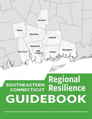
This guidebook results from the culmination of a year of dialogue among diverse stakeholders in southeastern Connecticut who defined challenges and solutions from extreme weather, climate change, and shifting social and economic conditions. Participants included representatives from nine municipalities, public and private utilities, public health departments, chambers of commerce, major employers, conservation organizations, academic institutions, community non-profits, and state agencies, among others. The dialogue captured six themed planning sectors (water, food, ecosystem services, transportation, energy, and regional economy) in a process that used surface and integrated solutions to address singular and multiple challenges across planning sectors. The guidebook provides a quick reference resource to help shape and inform actions that will advance a regional resilience framework for southeastern Connecticut; an accompanying Summary of Findings captures the project's final outcomes and conclusions, as well as providing a comprehensive account of the objectives, process, and details.
This draft Regional Action Plan in support of NOAA Fisheries Climate Science Strategy helps communicate a regional vision for climate-related science in the South Atlantic, providing a framework for scientists and managers to prioritize and accomplish research on climate-related impacts to marine and coastal ecosystems. It promotes scientists working with partners and the management community to construct management approaches that ensure the development of science-based strategies to sustain marine resources and resource-dependent coastal communities in a changing climate. Highlights include establishing a NOAA Fisheries South Atlantic Climate Science Team, expanding scientific expertise and partnerships, conducting vulnerability assessments for South Atlantic species, and drafting a South Atlantic Ecosystem Status Report. The draft was available for public comment through March 24, 2017; the Plan will be finalized in summer 2017.
This report details the 2016 collaborative assessment project of the Upper Snake River Tribes Foundation and its member tribes—the Burns Paiute Tribe, the Fort McDermitt Paiute-Shoshone Tribe, the Shoshone-Bannock Tribes, and the Shoshone-Paiute Tribes—and partners Adaptation International, the University of Washington, and Oregon State University. The project assessed climate change vulnerability for the Upper Snake River watershed in Idaho, Nevada, and Oregon, and combined the best available localized climate projections with traditional knowledge, tribal priorities, and local observations to develop quantitative vulnerability rankings for 16 species of shared concern and a qualitative assessment for an additional 12 shared concerns. The set of 28 shared concerns assessed for climate change vulnerability provided a balanced cross-section of the species, habitats, and resource issues important to the tribes. Along with this report, the project also produced eight summary sheets detailing specific species and habitat vulnerability.
This report is part of a series of six case studies that explore lessons that are being learned by climate collaboratives from around the United States that are bringing together local governments and other stakeholders at the regional level to both reduce carbon pollution (mitigation) and prepare for the impacts of climate change (adaptation). Each case study explores the history and development structure and decision-making methods, funding sources, roles, and initiatives of each of these climate collaboratives. A synthesis report also explores lessons that can be learned by comparing the efforts of each collaborative on climate policy in their regions. These case studies were supported by a grant from the Kresge Foundation. In developing these case studies, the Georgetown Climate Center collaborated with the Alliance of Regional Collaboratives for Climate Adaptation (ARCCA).
The Northeast Regional Action Plan was developed to increase the production, delivery, and use of climate-related information to fulfill the NOAA Fisheries mission in the region, and identifies priority needs and specific actions to implement the NOAA Fisheries Climate Science Strategy in the Northeast over the next three to five years. The U.S. Northeast Shelf Large Marine Ecosystem supports a number of economically important fisheries and a wide variety of other important marine and coastal species, from river herring to marine mammals and sea turtles. The region has experienced rising ocean temperatures over the past several decades, along with shifts in the distribution of many fish stocks poleward or deeper. Other expected climate-related changes include sea level rise, decreasing pH (acidification), and changing circulation patterns that could impact marine resources, their habitats, and the people, businesses, and communities that depend on them.
The Gulf of Mexico Regional Action Plan was developed to increase the production, delivery, and use of climate-related information to fulfill the NOAA Fisheries mission in the region, and identifies priority needs and specific actions to implement the NOAA Fisheries Climate Science Strategy in the Gulf of Mexico over the next three to five years. The Gulf contains a diverse range of habitats, including unique coral systems atop salt domes, high relief carbonate banks, and shallow coastal ecosystems that support a variety of commercially and recreationally important marine fish and shellfish. Understanding how the major climate drivers affect the distribution and abundance of marine species, their habitats, and their prey is important to effective management. Climate-related factors expected to impact the Gulf of Mexico include warming ocean temperatures, sea level rise, and ocean acidification.
The Pacific Islands Regional Action Plan was developed to increase the production, delivery, and use of climate-related information to fulfill the NOAA Fisheries mission in the region, and identifies priority needs and specific actions to implement the NOAA Fisheries Climate Science Strategy in the Pacific Islands over the next three to five years. The Pacific Islands Region spans a large geographic area including the North and South Pacific subtropical gyres and the archipelagic waters of Hawaii, American Samoa, Guam, the Commonwealth of the Northern Marianas Islands, and the U.S. Pacific remote island areas. The Pacific Islands region supports a wide variety of ecologically and economically important species and habitats, from coral reefs to pelagic fish stocks. Climate-related changes in the region include a rise in ocean temperatures, reduced nutrients in the euphotic zone, an increase in ocean acidity, a rise in sea level, and changes in ocean currents. Many of these changes have already been observed and are projected to increase further. These changes will directly and indirectly impact insular and pelagic ecosystems and the communities that depend upon them.
This report documents the efforts of seven partnerships to build resilience of natural resources in the United States. These partnerships demonstrate the benefits of using existing collaborative, landscape-scale conservation approaches to address climate change and other resource management challenges. Their goal is to build and maintain an ecologically connected network of terrestrial, coastal, and marine conservation areas that are likely to be resilient to climate change, demonstrating some ability to support a broad range of fish, wildlife, and plants under changing conditions.
This guide describes how Climate Central's Surging Seas web tool can be used to support activities that receive points within the Federal Emergency Management Agency's (FEMA) Community Rating System (CRS) program. It is informed by conversations with local CRS coordinators and implementers, and with FEMA CRS representatives. The guide provides step-by-step instructions on how to access and obtain information and downloads from the Surging Seas tool that could be utilized within specific CRS activities in FEMA’s Coordinator’s Manual (FIA-15/2013).
The Western Regional Action Plan was developed to increase the production, delivery, and use of climate-related information to fulfill the NOAA Fisheries mission in the region, and identifies priority needs and specific actions to implement the NOAA Fisheries Climate Science Strategy in the West over the next three to five years. The California Current Large Marine Ecosystem (CCLME) spans the entire west coast of the continental U.S. and has significant seasonal, inter-annual, and inter-decadal fluctuations in climate that impact the marine food-web and fisheries. The CCLME is highly important economically and ecologically. Commercial and recreational fisheries in the CCLME contribute significantly to the U.S. economy, and a host of fish, bird, and mammal species depend on the productive waters and lipid-rich food web of the CCLME for their annual feeding migrations. Migrant species include several million metric tons of hake and sardine from the waters off southern California, several hundred million juvenile salmon from U.S. West Coast rivers, millions of seabirds from as far as New Zealand (sooty shearwaters) and Hawaii (Laysan and black-footed albatrosses), and tens of thousands of grey whales from Baja California and humpback whales from the Eastern North Pacific. These feeding migrations allow species to load up on energy reserves as an aid to survival during their winter months in southern extremes of their distribution. Climate-related physical processes that disrupt the CCLME ecosystem may result in negative impacts to U.S. fisheries, migrant species, and the people and communities that depend on these living marine resources.
This report provides educators and advisors information, perspective, and resources to help farmers in the Midwest and Northeast prepare for, cope with, and recover from the adverse impacts of a changing climate. Developed collaboratively by scientists, conservationists, and educators, the report translates the best available climate science into usable resources for making climate-informed decisions. Flexible and adaptive management are key to reduce risk, increase resilience to potential disruptions, and even take advantage of opportunities presented by climate change. The Adaptation Workbook provides a structured process to consider potential climate change impacts, management challenges and opportunities, and climate adaptation responses.
With insight from 26 campus and stakeholder advisors, the support of the USDA Agricultural Marketing Service’s Transportation Division, and input from regional food supply chain businesses throughout the region, this 68-page report details the process used to assess the Chicago region food system and findings through the three-year participatory research effort. It includes eleven sections with 17 figures to illustrate key concepts, along with extensive supporting materials. The report presents three innovations with proofs of concept that could be applied widely in the region and beyond to improve food distribution, both in rural and urban regions.
As climate changes and ocean temperatures rise, the abundance, distribution, and life cycles of fish in federally managed ocean fisheries may change too. Federal agencies managing ocean fisheries have limited information to determine exactly how climate change might harm specific fish populations, and may not always understand the potential effects. To better manage climate-related risks, the report recommends (1) the development of guidance on how to incorporate climate information into the fisheries management process, and (2) finalizing Regional Action Plans for implementing the NOAA Fisheries Climate Science Strategy that incorporate performance measures for tracking achievement of the Strategy’s Objectives.
The Alaska Regional Action Plan (ARAP) for the Southeastern Bering Sea was developed to increase the production, delivery, and use of climate-related information to fulfill the NOAA Fisheries mission in the region, and identifies priority needs and specific actions to implement the NOAA Fisheries Climate Science Strategy in the region over the next three to five years. NOAA’s Alaska Fisheries Science Center is responsible for marine resources in five large marine ecosystems—the southeastern Bering Sea, the Gulf of Alaska, the Aleutian Islands, the northern Bering and Chukchi seas, and the Beaufort Sea. The first ARAP focuses on the southeastern Bering Sea because it supports large marine mammal and bird populations and some of the most profitable and sustainable commercial fisheries in the United States. Climate-related changes in ocean and coastal ecosystems are already impacting the fish, seabirds, and marine mammals as well as the people, businesses, and communities that depend on these living marine resources.
This guide provides a step-by-step approach for incorporating climate change information into new or existing conservation plans in coastal environments. The guide’s six steps draw from existing strategic conservation planning frameworks, but focus on climate considerations and key resources specifically relevant to the coastal environment, including coastal watersheds.
Climate change impacts ecosystems in many ways, from effects on species to phenology to wildfire dynamics. Assessing the potential vulnerability of ecosystems to future changes in climate is an important first step in prioritizing and planning for conservation. Although assessments of climate change vulnerability commonly are done for species, fewer have been done for ecosystems. To aid regional conservation planning efforts, this report assesses climate change vulnerability for ecosystems in the Southeastern United States and Caribbean.
This Health Impact Assessment was done in conjunction with the development of an adaptation plan, with the goal of ensuring that the strategies developed would be health-focused before implementation. By conducting the HIA during the Climate Change Adaptation Plan’s development, greater efficiencies were created in terms of addressing strategy-specific, health-related issues that could be avoided at the start, rather than discovering them after the strategies had already been implemented. This report is the culmination of the HIA process and summarizes each step of the assessment, including the HIA Project Team and Advisory Committee’s recommendations for improving the Climate Change Adaptation Plan. The adoption of these recommendations will increase the value relevance of the adaptation plan and benefit the health of the region.
An analysis of 45 years of U.S. Forest Service records from the western U.S. show that the number of large fires on Forest Service land is increasing dramatically. The area burned by these fires is also growing at an alarming rate.

