Access a range of climate-related reports issued by government agencies and scientific organizations. Browse the reports listed below, or filter by scope, content, or focus in the boxes above. To expand your results, click the Clear Filters link.
This plan represents the efforts of the State of Minnesota in fulfilling the responsibility for hazard mitigation planning. The purpose of this plan is to identify the state’s major hazards, assess the vulnerability to those hazards, and take steps to reduce vulnerability using the technical and program resources of Minnesota agencies. The process has included consideration of current and expected future impacts from Minnesota’s already changing climate, as relevant to hazard mitigation planning. The plan identifies goals and recommends actions and initiatives for the state government to adapt to, reduce, and/or prevent injury and damage from hazardous events.
The EWN Atlas is a collection of 56 projects illustrating a diverse portfolio of contexts, motivations, and successful outcomes, presented and considered from an Engineering With Nature® perspective to reveal the usefulness of nature-based approaches and the range of benefits that can be achieved. Engineering With Nature is an initiative of the U.S. Army Corps of Engineers enabling more sustainable delivery of economic, social, and environmental benefits associated with water resources infrastructure. EWN intentionally aligns natural and engineering processes to efficiently and sustainably deliver economic, environmental, and social benefits through collaborative processes.
The Second State of the Carbon Cycle Report (SOCCR2) was led and developed by the Carbon Cycle Interagency Working Group under the auspices of the U.S. Global Change Research Program. Contributing to the Fourth National Climate Assessment, SOCCR2 is designed as a special interagency assessment focused on the advances in the science and the understanding of the carbon cycle across North America since the first SOCCR (2007). Specifically, SOCCR2 focuses on U.S. and North American carbon cycle processes, stocks, fluxes, and interactions with global-scale carbon budgets and climate change impacts in managed and unmanaged systems. The report includes an assessment of the carbon stocks and fluxes in soils, water (including near-coastal oceans), vegetation, aquatic-terrestrial interfaces (e.g., coasts, estuaries, wetlands), human settlements, agriculture, and forestry. It considers relevant carbon management science perspectives and science-based tools for supporting and informing decisions. The status of and emerging opportunities for improving measurements, observations, and projections of stocks and fluxes in the carbon cycle, including uncertainty identification, are part of the report.
The Global Change Research Act of 1990 mandates that the U.S. Global Change Research Program deliver a report to Congress and the President no less than every four years that “1) integrates, evaluates, and interprets the findings of the Program…; 2) analyzes the effects of global change on the natural environment, agriculture, energy production and use, land and water resources, transportation, human health and welfare, human social systems, and biological diversity; and 3) analyzes current trends in global change, both human-induced and natural, and projects major trends for the subsequent 25 to 100 years.” The Fourth National Climate Assessment (NCA4) fulfills that mandate in two volumes. This report, Volume II, draws on the foundational science described in Volume I, the Climate Science Special Report. Volume II focuses on the human welfare, societal, and environmental elements of climate change and variability for 10 regions and 18 national topics, with particular attention paid to observed and projected risks, impacts, consideration of risk reduction, and implications under different mitigation pathways. Where possible, NCA4 Volume II provides examples of actions underway in communities across the United States to reduce the risks associated with climate change, increase resilience, and improve livelihoods. This assessment was written to help inform decision makers, utility and natural resource managers, public health officials, emergency planners, and other stakeholders by providing a thorough examination of the effects of climate change on the United States.
This special report from the Intergovernmental Panel on Climate change describes the impacts of global warming of 1.5 °C above pre-industrial levels. The report also describes potential global greenhouse gas emission pathways, in the context of strengthening the global response to the threat of climate change, sustainable development, and efforts to eradicate poverty.
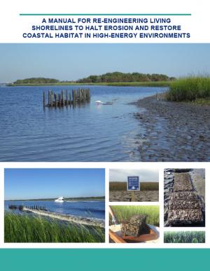
Shorelines with high boat wake and wave energy face especially rapid erosion and habitat loss. A new living shoreline design from researchers at the University of Florida and the Guana Tolomato Matanzas Reserve that uses gabion-breaks has proven successful in high-energy environments. The gabion-break design uses two lines of defense to reduce erosion along the marsh edge—porous wooden breakwalls placed in front of structures that will foster oyster growth. This manual for restoration practitioners describes a collaborative research project that tested gabion-breaks along the Atlantic Intracoastal Waterway in northeast Florida. It discusses the project’s results and details the steps to use gabion-breaks, including planning, design, maintenance, monitoring, and costs.
The Northern Rockies Adaptation Partnership identified climate change issues relevant to resource management in the Northern Rockies region and developed solutions intended to minimize negative effects of climate change and facilitate transition of diverse ecosystems to a warmer climate. Their vulnerability assessment emphasizes water, fisheries, wildlife, forest and rangeland vegetation and disturbance, recreation, cultural heritage, and ecosystem services, which are regarded as key resource areas for local ecosystems and communities. Resource managers used the assessment to develop a detailed list of ways to address climate change vulnerabilities through management actions. The large number of adaptation strategies and tactics, many of which are a component of current management practice, provide a pathway for slowing the rate of deleterious change in resource conditions.
The Northern Rockies Adaptation Partnership identified climate change issues relevant to resource management in the Northern Rockies region and developed solutions intended to minimize negative effects of climate change and facilitate transition of diverse ecosystems to a warmer climate. Their vulnerability assessment emphasizes water, fisheries, wildlife, forest and rangeland vegetation and disturbance, recreation, cultural heritage, and ecosystem services, which are regarded as key resource areas for local ecosystems and communities. Resource managers used the assessment to develop a detailed list of ways to address climate change vulnerabilities through management actions. The large number of adaptation strategies and tactics, many of which are a component of current management practice, provide a pathway for slowing the rate of deleterious change in resource conditions.
The goal of this concerted effort is to help Thurston County (Washington) and the broader South Puget Sound region prepare for and adjust to climate change. The Thurston Regional Planning Council crafted this document with a $250,000 National Estuary Program grant from the U.S. Environmental Protection Agency and significant in-kind support from the community. Partners included representatives from tribes, municipalities, universities, nonprofits, businesses, and other entities within the project area: three geographically diverse watersheds (Nisqually, Deschutes, and Kennedy-Goldsborough) within Thurston County that drain into Puget Sound. The watersheds encompass beaches, rivers, lakes, wetlands, highlands, forests, farms, ranches, cities, towns, and tribal reservations. It is the Council's hope that other communities throughout the Puget Sound region, state, and nation will replicate this project’s science-based assessments, innovative public-engagement efforts (including development of a resilience game), collaborative planning processes, economic analyses, and comprehensive actions.
This BAMS special report presents assessments of how human-caused climate change may have affected the strength and likelihood of individual extreme events. This sixth edition of explaining extreme events of the previous year (2016) from a climate perspective is the first of these reports to find that some extreme events were not possible in a pre-industrial climate.
The SWIPA 2017 assessment is the fourth assessment from the Arctic Monitoring and Assessment Programme addressing Arctic climate issues and is a direct follow-up to the first Snow, Water, Ice and Permafrost in the Arctic (SWIPA): Climate Change and the Cryosphere assessment report published in 2011. The SWIPA 2017 assessment was conducted between 2010 and 2016 by an international group of over 90 scientists, experts, and knowledgeable members of the Arctic indigenous communities. Access to reliable and up-to-date information is essential for the development of science-based decision making regarding ongoing changes in the Arctic and their global implications.
As a key part of the Fourth National Climate Assessment (NCA4), the U.S. Global Change Research Program (USGCRP) oversaw the production of this stand-alone report of the state of science relating to climate change and its physical impacts. The Climate Science Special Report (CSSR) is designed to be an authoritative assessment of the science of climate change, with a focus on the United States, to serve as the foundation for efforts to assess climate-related risks and inform decision making about responses.
As Volume 1 of NCA4, CSSR serves several purposes, including providing (1) an updated and detailed analysis of the findings of how climate change is affecting weather and climate across the United States; (2) an executive summary and 15 chapters that provide the basis for the discussion of climate science found in the second volume of NCA4; and (3) foundational information and projections for climate change, including extremes, to improve “end-to-end” consistency in sectoral, regional, and resilience analyses within the second volume. CSSR integrates and evaluates the findings on climate science and discusses the uncertainties associated with these findings. It analyzes current trends in climate change, both human-induced and natural, and projects major trends to the end of this century. As an assessment and analysis of the science, CSSR provides important input to the development of other parts of NCA4, and their primary focus on the human welfare, societal, economic and environmental elements of climate change. Much of the underlying report is written at a level more appropriate for a scientific audience, though the Executive Summary is intended to be accessible to a broader audience.
The Montana Climate Assessment (MCA) synthesizes, evaluates, and shares credible and relevant scientific information about climate change in Montana with the citizens of the state. The motivation for the MCA arose from citizens and organizations in Montana who have expressed interest in receiving timely and pertinent information about climate change, including information about historical variability, past trends, and projections of future impacts as they relate to topics of economic concern. This first assessment reports on climate trends and their consequences for three of Montana’s vital sectors: water, forests, and agriculture.
This assessment was a multidisciplinary research project that investigated future changes to southern Santa Barbara County climate, beaches, watersheds, wetland habitats, and beach ecosystems. The target audience is local land use planners and decision makers, and the main objective is to provide information that assists the cities of Santa Barbara, Carpinteria, and Goleta, the County of Santa Barbara, and UC Santa Barbara in climate adaptation planning with a clear focus on coastal ecosystems.
In the aftermath of Tropical Storms Irene and Sandy, the population centers of Greater New Haven and Bridgeport recognized significant exposure and vulnerability to their infrastructure, environment, and socioeconomic assets from extreme weather events and a changing climate. To counteract immediate and longer-term risks and broaden dialogue on community resilience building, the Southern Connecticut Regional Framework for Coastal Resilience project was launched. The overarching goal of this project was prioritizing actions and strengthening partnerships by providing proactive risk assessment, community engagement, conceptual design of on-the-ground projects, and this Final Report. The principal purpose of the project was to advance a Regional Resilience Framework—built on projects and partnerships—needed to help improve resilience for over 591,000 residents that represent over 30 percent of Connecticut’s coast. A core goal of this project was to strengthen the resilience of existing and future ecosystems, including a diverse suite of services and co-benefits, alongside existing and future development activities within a population center critical to the state of Connecticut’s future.
Forest and grassland ecosystems provide a wide range of services, including wood products, recreation, wildlife habitat, and protection of water quality. These ecosystems are also extremely valuable for their ability to store carbon, with U.S. forests absorbing more than 600 million metric tons of carbon each year. This report describes the role of forests and grasslands in the carbon cycle and outlines considerations for managing for carbon as one of many environmental benefits provided by natural ecosystems. Land management activities can influence the ability of ecosystems to absorb and sequester carbon, as well as provide other ecosystem services, and this report explores considerations for land managers interested in increasing carbon benefits on the lands that they manage.
With support from the Minnesota Pollution Control Agency, the Region Nine Development Commission created this plan to assess South Central Minnesota’s vulnerability to climate change and create strategies for the region to adapt to climate change. Region Nine, working in tandem with a Climate Change Adaptation Task Force, identified eight top priority sectors to prioritize the planning process: agriculture, water, human health, energy, transportation, forests, ecosystems, business, and economy. The result of the planning process was real, actionable strategies that can be used as a guide to initiate discussions and begin a planning process in Region Nine communities.
Green infrastructure can help to maximize the environmental, economic, and social benefits of parks. This guide from EPA encourages partnerships between park agencies and stormwater agencies to promote the use of green infrastructure on park lands to improve park lands and access to parks, better manage stormwater, increase community resiliency to shifting weather patterns, and provide funding to implement and maintain park enhancements that benefit the community. Using a stepwise approach for building relationships with potential partners, the guide includes information on how to identify and engage partners, build relationships, involve the community, leverage funding opportunities, and identify green infrastructure opportunities. It includes recommendations on the types of projects that are most likely to attract positive attention and funding and that provide a wide range of benefits. Included case studies from across the country illustrate approaches presented in the guide.
This Technical Report presents results from a large set of sectoral impact models that quantify and monetize climate change impacts in the U.S., with a primary focus on the contiguous U.S., under moderate and severe future climates. The report summarizes and communicates the results of the second phase of quantitative sectoral impacts analysis under the Climate Change Impacts and Risk Analysis (CIRA) project. The effort is intended to inform the fourth National Climate Assessment (NCA4) of the U.S. Global Change Research Program (USGCRP). The goal of this work is to estimate climate change impacts and economic damages to multiple U.S. sectors (e.g., human health, infrastructure, and water resources) under different scenarios. Though this report does not make policy recommendations, it is designed to inform strategies to enhance resiliency and protect human health, investments, and livelihoods.
This plan sets forth the 2017 federal policy platform of the Mississippi River Cities and Towns Initiative, an association of 75 U.S. mayors along the Mississippi River. The document sets forth the mayors’ recommendation of federal programs to support and strengthen the built and natural infrastructure of the Mississippi River corridor, proposing specific funding levels and support of several federal programs. Suggestions for finance mechanisms to restore Mississippi River infrastructure are also included.
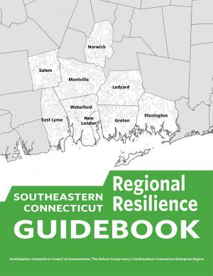
This guidebook results from the culmination of a year of dialogue among diverse stakeholders in southeastern Connecticut who defined challenges and solutions from extreme weather, climate change, and shifting social and economic conditions. Participants included representatives from nine municipalities, public and private utilities, public health departments, chambers of commerce, major employers, conservation organizations, academic institutions, community non-profits, and state agencies, among others. The dialogue captured six themed planning sectors (water, food, ecosystem services, transportation, energy, and regional economy) in a process that used surface and integrated solutions to address singular and multiple challenges across planning sectors. The guidebook provides a quick reference resource to help shape and inform actions that will advance a regional resilience framework for southeastern Connecticut; an accompanying Summary of Findings captures the project's final outcomes and conclusions, as well as providing a comprehensive account of the objectives, process, and details.
This draft Regional Action Plan in support of NOAA Fisheries Climate Science Strategy helps communicate a regional vision for climate-related science in the South Atlantic, providing a framework for scientists and managers to prioritize and accomplish research on climate-related impacts to marine and coastal ecosystems. It promotes scientists working with partners and the management community to construct management approaches that ensure the development of science-based strategies to sustain marine resources and resource-dependent coastal communities in a changing climate. Highlights include establishing a NOAA Fisheries South Atlantic Climate Science Team, expanding scientific expertise and partnerships, conducting vulnerability assessments for South Atlantic species, and drafting a South Atlantic Ecosystem Status Report. The draft was available for public comment through March 24, 2017; the Plan will be finalized in summer 2017.
The Northeast Regional Action Plan was developed to increase the production, delivery, and use of climate-related information to fulfill the NOAA Fisheries mission in the region, and identifies priority needs and specific actions to implement the NOAA Fisheries Climate Science Strategy in the Northeast over the next three to five years. The U.S. Northeast Shelf Large Marine Ecosystem supports a number of economically important fisheries and a wide variety of other important marine and coastal species, from river herring to marine mammals and sea turtles. The region has experienced rising ocean temperatures over the past several decades, along with shifts in the distribution of many fish stocks poleward or deeper. Other expected climate-related changes include sea level rise, decreasing pH (acidification), and changing circulation patterns that could impact marine resources, their habitats, and the people, businesses, and communities that depend on them.
The Gulf of Mexico Regional Action Plan was developed to increase the production, delivery, and use of climate-related information to fulfill the NOAA Fisheries mission in the region, and identifies priority needs and specific actions to implement the NOAA Fisheries Climate Science Strategy in the Gulf of Mexico over the next three to five years. The Gulf contains a diverse range of habitats, including unique coral systems atop salt domes, high relief carbonate banks, and shallow coastal ecosystems that support a variety of commercially and recreationally important marine fish and shellfish. Understanding how the major climate drivers affect the distribution and abundance of marine species, their habitats, and their prey is important to effective management. Climate-related factors expected to impact the Gulf of Mexico include warming ocean temperatures, sea level rise, and ocean acidification.
The Pacific Islands Regional Action Plan was developed to increase the production, delivery, and use of climate-related information to fulfill the NOAA Fisheries mission in the region, and identifies priority needs and specific actions to implement the NOAA Fisheries Climate Science Strategy in the Pacific Islands over the next three to five years. The Pacific Islands Region spans a large geographic area including the North and South Pacific subtropical gyres and the archipelagic waters of Hawaii, American Samoa, Guam, the Commonwealth of the Northern Marianas Islands, and the U.S. Pacific remote island areas. The Pacific Islands region supports a wide variety of ecologically and economically important species and habitats, from coral reefs to pelagic fish stocks. Climate-related changes in the region include a rise in ocean temperatures, reduced nutrients in the euphotic zone, an increase in ocean acidity, a rise in sea level, and changes in ocean currents. Many of these changes have already been observed and are projected to increase further. These changes will directly and indirectly impact insular and pelagic ecosystems and the communities that depend upon them.
This report documents that the average temperature in 2015 was over one degree higher than pre-industrial times and that the period 2011–2015 was the warmest five-year period on record, consistent with established warming trends. The report further documents that in 2015 another milestone was reached, with globally averaged CO2 levels of 400 parts per million (ppm). The year 2016 is on track to be even warmer and will be the first year in which CO2 at the Mauna Loa Observatory remains above 400 ppm all year, and for many generations to come.
The probability of extreme climate events since 2011, especially those involving extreme high temperatures, has been substantially increased by climate change, often by a factor of 10 or more. The single most significant event in humanitarian terms, with over 250,000 lives lost, was the 2011–2012 famine in the Horn of Africa, where drought was a major factor.
This report documents the efforts of seven partnerships to build resilience of natural resources in the United States. These partnerships demonstrate the benefits of using existing collaborative, landscape-scale conservation approaches to address climate change and other resource management challenges. Their goal is to build and maintain an ecologically connected network of terrestrial, coastal, and marine conservation areas that are likely to be resilient to climate change, demonstrating some ability to support a broad range of fish, wildlife, and plants under changing conditions.
The Western Regional Action Plan was developed to increase the production, delivery, and use of climate-related information to fulfill the NOAA Fisheries mission in the region, and identifies priority needs and specific actions to implement the NOAA Fisheries Climate Science Strategy in the West over the next three to five years. The California Current Large Marine Ecosystem (CCLME) spans the entire west coast of the continental U.S. and has significant seasonal, inter-annual, and inter-decadal fluctuations in climate that impact the marine food-web and fisheries. The CCLME is highly important economically and ecologically. Commercial and recreational fisheries in the CCLME contribute significantly to the U.S. economy, and a host of fish, bird, and mammal species depend on the productive waters and lipid-rich food web of the CCLME for their annual feeding migrations. Migrant species include several million metric tons of hake and sardine from the waters off southern California, several hundred million juvenile salmon from U.S. West Coast rivers, millions of seabirds from as far as New Zealand (sooty shearwaters) and Hawaii (Laysan and black-footed albatrosses), and tens of thousands of grey whales from Baja California and humpback whales from the Eastern North Pacific. These feeding migrations allow species to load up on energy reserves as an aid to survival during their winter months in southern extremes of their distribution. Climate-related physical processes that disrupt the CCLME ecosystem may result in negative impacts to U.S. fisheries, migrant species, and the people and communities that depend on these living marine resources.
This report promotes a relatively simple solution to the problem of increasing heat and air pollution in cities: plant more trees. Trees cool the air by casting shade and releasing water vapor, and their leaves can filter out fine particulate matter (PM)—one of the most dangerous forms of air pollution, generated from burning biomass and fossil fuels.
The report documents analysis that tree planting efforts could improve the health of millions of people, and that trees are as cost-effective as many other common solutions. The report also shows that most of the cooling and filtering effects created by trees are fairly localized, so densely populated cities—as well as those with higher overall pollution levels—tend to see the highest overall return on investment (ROI) from tree plantings.
This handbook summarizes the current state of National Park Service (NPS) climate adaptation and key approaches currently in practice or considered for climate change adaptation in coastal areas in order to guide adaptation planning in coastal parks. The chapters focus on policy, planning, cultural resources, natural resources, facility management, and communication/education. The handbook highlights processes, tools, and examples that are applicable to many types of NPS plans and decisions. One chapter includes a case study of Hurricane Sandy response and recovery strategies, including changes to infrastructure. Another chapter features practical coastal infrastructure information, including cost per unit length of constructed features (including seawalls, beach nourishment, and nature-based features). The level of detail varies by topic depending on the state of research and practice in that field.
The Alaska Regional Action Plan (ARAP) for the Southeastern Bering Sea was developed to increase the production, delivery, and use of climate-related information to fulfill the NOAA Fisheries mission in the region, and identifies priority needs and specific actions to implement the NOAA Fisheries Climate Science Strategy in the region over the next three to five years. NOAA’s Alaska Fisheries Science Center is responsible for marine resources in five large marine ecosystems—the southeastern Bering Sea, the Gulf of Alaska, the Aleutian Islands, the northern Bering and Chukchi seas, and the Beaufort Sea. The first ARAP focuses on the southeastern Bering Sea because it supports large marine mammal and bird populations and some of the most profitable and sustainable commercial fisheries in the United States. Climate-related changes in ocean and coastal ecosystems are already impacting the fish, seabirds, and marine mammals as well as the people, businesses, and communities that depend on these living marine resources.
This report features observed trend data on 37 climate indicators, including U.S and global temperatures, ocean acidity, sea level, river flooding, droughts, and wildfires. It documents rising temperatures, shifting patterns of snow and rainfall, and increasing numbers of extreme climate events, such as heavy rainstorms and record high temperatures. Many of these observed changes are linked to the rising levels of carbon dioxide and other greenhouse gases in our atmosphere, caused by human activities.
The cold temperatures of Alaska have led to the storage of vast quantities of soil and vegetation carbon, yet high-latitude ecosystems are potentially more vulnerable to higher temperature changes than ecosystems in the temperate zone. In particular, these increases in temperature may expose the substantial stores of carbon in the region to loss from more wildfire and permafrost thaw, which could turn the ecosystems of Alaska into a net carbon source. The assessment of Alaska ecosystem carbon stocks and fluxes, as well as methane fluxes, as reported here was conducted to better understand the baseline and projected carbon distributions and potential responses to a rapidly changing environment.
This guide provides a step-by-step approach for incorporating climate change information into new or existing conservation plans in coastal environments. The guide’s six steps draw from existing strategic conservation planning frameworks, but focus on climate considerations and key resources specifically relevant to the coastal environment, including coastal watersheds.
Climate change impacts ecosystems in many ways, from effects on species to phenology to wildfire dynamics. Assessing the potential vulnerability of ecosystems to future changes in climate is an important first step in prioritizing and planning for conservation. Although assessments of climate change vulnerability commonly are done for species, fewer have been done for ecosystems. To aid regional conservation planning efforts, this report assesses climate change vulnerability for ecosystems in the Southeastern United States and Caribbean.
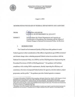
This document provides final guidance for federal agencies on how to consider the impacts of their actions on global climate change in their National Environmental Policy Act (NEPA) reviews, providing a framework for agencies to consider both the effects of a proposed action on climate change, as indicated by its estimated greenhouse gas emissions, and the effects of climate change on a proposed action. The memorandum applies to all types of proposed federal agency actions that are subject to NEPA analysis and guides agencies on how to address the greenhouse gas emissions from federal actions and the effects of climate change on their proposed actions within the existing NEPA regulatory framework.

