Access a range of climate-related reports issued by government agencies and scientific organizations. Browse the reports listed below, or filter by scope, content, or focus in the boxes above. To expand your results, click the Clear Filters link.
The Sea Level Rise Technical Report provides the most up-to-date sea level rise projections available for all U.S. states and territories; decision-makers will look to it for information.
This multi-agency effort, representing the first update since 2017, offers projections out to the year 2150 and information to help communities assess potential changes in average tide heights and height-specific threshold frequencies as they strive to adapt to sea level rise.
The Fiscal Year 2022 edition of the U.S. Global Change Research Program (USGCRP’) annual report to Congress, Our Changing Planet, presents recent Program accomplishments that illustrate how USGCRP is meeting its mandate under the GCRA and achieving the goals outlined in the Program’s 2012–2021 Strategic Plan and its 2017 update. Highlighted activities represent interagency collaborations undertaken in calendar year 2020 that rely on coordinated investments of two or more member agencies and contribute to implementing USGCRP’s strategic goals.
The central recommendation of this report, submitted to the National Climate Task Force, is that the pursuit of a decade-long national conservation effort be faithful to eight core principles. These principles—which include a commitment to collaboration, support for voluntary and locally led conservation, and honoring of Tribal sovereignty and private property rights—are essential ingredients to building and maintaining broad support, enthusiasm, and trust for this effort. These principles are also indispensable to achieving durable outcomes that meaningfully improve the lives of Americans.
This Guide is written for practitioners already using or wanting to use future climate information in their work, but who are not familiar with the underlying assumptions and choices surrounding climate data. Here, we introduce the climate model scenarios that are used to “drive” climate models forward in time. These scenarios are a combination of socioeconomic and climate forcing pathways. We summarize differences between these scenarios for the Great Lakes region to show users how their choice of model scenario affects future temperature and precipitation projections.
This report aims to build the capacity of organizations to serve as catalysts in supporting members of their communities stepping into leadership roles, as well as engaging them meaningfully in defining the scope of local climate change risks and impacts and formulating and implementing equitable solutions alongside key partners. This guide was developed using qualitative data collected through a series of interviews with experts from around the country who are designing, managing, and implementing community-based leadership development programs. Although not all of these programs directly address climate change and environmental justice, this collection of diverse programming illustrates the broad ways in which communities address leadership development and grassroots engagement in local decision making. This tool provides a comprehensive picture of training and capacity-building theory and practice, and showcases programs that are diverse in content, audience, geography, outcome, and practice.
This report provides step-by-step guidance and lessons learned on how to effectively engage with community members to understand climate impacts and to develop more equitable climate resilience strategies. Community-based organizations have repeatedly emphasized that to equitably and successfully carry out climate resilience solutions, it’s imperative to directly engage with community members to deeply understand how these threats directly impact them. Likewise, to formulate solutions that are equitable and truly work—and to get utilities and city officials to prioritize equitable investments in under-invested areas—organizations must directly engage with members of the community when identifying solutions. The toolkit provides real-world case studies, a project planning and facilitation guide, and extensive lists of references and resources.
This report's subtitle is Managing the Uncertainty of Future Sea Level Change and Extreme Water Levels for Department of Defence Coastal Sites Worldwide.
From the Executive Summary: Global change, including climate change, poses unique challenges to the Department of Defense (DoD). In particular, coastal military sites, and their associated natural and built infrastructure, operations, and readiness capabilities, are vulnerable to the impacts of rising global sea level and local extreme water level (EWL) events. This report and its accompanying scenario database provide regionalized sea level and EWL scenarios for three future time horizons (2035, 2065, and 2100) for 1,774 DoD sites worldwide. The global nature of DoD’s presence required a broad and comprehensive approach that to this point has been lacking in similar efforts.
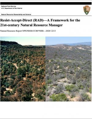
The National Park Service and other federal land management agency partners offer Resist-Accept-Direct (RAD)—A Decision Framework for the 21st-century Natural Resource Manager. The report presents and explores a simple set of distinct management options that decision makers can consider when responding to ecosystems facing the potential for rapid, irreversible ecological change. In so doing, the report provides a framework that encourages natural resource managers to consider strategic, forward-looking actions, rather than structure management goals based on past conditions.
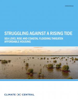
This report highlights the equity implications of sea level rise in the first nationwide assessment of risk to the country’s affordable housing supply. As climate change causes sea levels to rise, the number of affordable housing units at risk of coastal flooding is projected to more than triple to nearly 25,000 nationwide over the next 30 years.
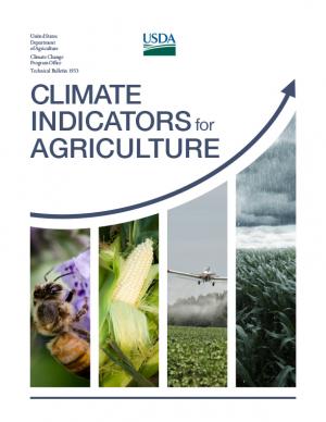
This report provides national, regional, and local information to support effective decision making by U.S. agricultural producers, resource managers, and other agricultural system stakeholders. A set of 20 indicators identifies high-priority agricultural and climate data products while providing the basis for tracking climate change as it plays out across American working lands, toward devising adaptive operational responses.
The report was written as input to the sustained National Climate Assessment process to provide a discrete set of variables that describe linkages between climate trends and variability and U.S. agriculture in recent decades. An additional objective is that the indicators themselves (along with the frameworks for constructing location- and operation-specifc indicators) provide an information resource that can help information service programs, such as USDA’s Climate Hubs, evaluate operational risks posed by climate change in specifc production systems across the country.
This report and the accompanying community spotlights provide an overview of climate change science, reasons why action is needed, how science supports decision making and planning, ways to adapt to climate change and limit the severity of its effects, and how such efforts can help build resiliency. The report illustrates the ways in which science can help individuals, communities, businesses, and government agencies make informed decisions. By working together to identify solutions and bring about positive change, we can reduce the risks faced by current and future generations.
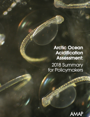
This Summary for Policymakers summarizes the findings of the AMAP Assessment 2018: Arctic Ocean Acidification report released in October 2018. It offers a review of the latest science relating to regional ocean acidification, the biological responses to it, an overview of case studies and their associated findings, and recommendations for the Arctic Council.
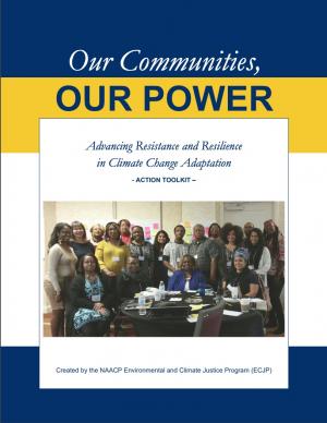
The Beloved Community is a vision for our future where all people share equally in the wealth and bounty of the earth, where we protect its abundance, diversity, and beauty for future generations. In this vision of liberation, racism, exploitation, and domination are replaced by democracy, cooperation, interdependence, and love. To get there, we pursue transformative, systems-change solutions. What do we mean by this? The root causes of the problems our communities face—like climate change, racism, and economic inequality—are all deeply connected. Since the problems are connected, so are the solutions. The purpose of this toolkit is to put us on the path toward achieving this vision. Through the context of building equity and resilience into climate adaptation planning, we introduce strategies to transform our communities and, by extension, society. Our ultimate goal is to create lasting and systemic change. At the same time, we recognize the urgency of the issues our communities face and the need to take action now. That is why we pursue change at every scale—from policy changes to community-based projects—to institute the transformative change we need to uphold our vision of the beloved community.
Regional adaptation fora (RAFs) are regional climate change adaptation conferences associated with the National Adaptation Forum. There are six RAFs: the California Adaptation Forum, the Carolinas Climate Resilience Conference, the Great Lakes Adaptation Forum, Local Solutions: Eastern Climate Preparedness Conference, the Southeast Florida Climate Change Compact Summit, and the Southwest Adaptation Forum. This report presents analysis and information drawn from the 2018 RAFs to gain insight about the state of the field, assess opportunities for the field to leverage the RAFs to accelerate dissemination and uptake of promoting promising adaptation practices across regions, and determine how the American Society of Adaptation Professionals can best support the RAFs going forward. The top finding is that RAFs are moving the needle for adaptation professionals and the field. The report serves as a testament to the need for, and value of, regional adaptation fora and encourages increased investment in these events and greater coordination between them.
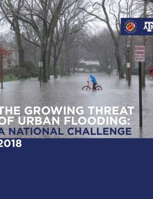
This report offers the first national assessment of the scope and consequences of urban flooding in the United States. Researchers analyzed available data concerning urban flooding, surveyed municipal flood and stormwater managers, and met with professionals whose disciplines intersect with urban flooding at the local, state, and national level. The research team's findings affirm that urban flooding is a national and significant source of economic loss, social disruption, and housing inequality. This report presents the full results of the study, addresses governance issues that affect urban flood risk reduction, examines critical challenges, and offers recommendations for actions.
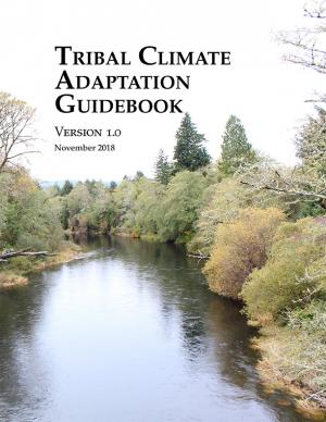
This guidebook was designed to support tribes’ efforts to proactively adapt to climate change and thrive for generations to come, building on the ongoing climate-related work in tribal communities. It provides a framework for climate change adaptation planning in the context of existing tribal priorities, and directly considers the unique issues facing indigenous communities. Specifically, the Guidebook directs readers to the foundation of existing resources and tribal adaptation efforts and identifies opportunities for braiding together traditional knowledges and western science in developing adaptation plans. The framework outlined in the guidebook will be useful for tribes in different phases of climate adaptation planning efforts, and supports learning from the experiences, approaches, and lessons of tribes working to become more resilient to climate change.
The Global Change Research Act of 1990 mandates that the U.S. Global Change Research Program deliver a report to Congress and the President no less than every four years that “1) integrates, evaluates, and interprets the findings of the Program…; 2) analyzes the effects of global change on the natural environment, agriculture, energy production and use, land and water resources, transportation, human health and welfare, human social systems, and biological diversity; and 3) analyzes current trends in global change, both human-induced and natural, and projects major trends for the subsequent 25 to 100 years.” The Fourth National Climate Assessment (NCA4) fulfills that mandate in two volumes. This report, Volume II, draws on the foundational science described in Volume I, the Climate Science Special Report. Volume II focuses on the human welfare, societal, and environmental elements of climate change and variability for 10 regions and 18 national topics, with particular attention paid to observed and projected risks, impacts, consideration of risk reduction, and implications under different mitigation pathways. Where possible, NCA4 Volume II provides examples of actions underway in communities across the United States to reduce the risks associated with climate change, increase resilience, and improve livelihoods. This assessment was written to help inform decision makers, utility and natural resource managers, public health officials, emergency planners, and other stakeholders by providing a thorough examination of the effects of climate change on the United States.
This analysis examines what's at risk for U.S. coastal real estate from sea level rise. Millions of Americans living in coastal communities will face more frequent and disruptive high-tide flooding; as this flooding increases, it will reach a threshold where normal routines become impossible and coastal residents, communities, and businesses are forced to make difficult, often costly choices. For this analysis, that threshold is defined as flooding that occurs 26 times per year (on average, once every other week) or more, a level of disruption referred to as chronic inundation. The results identify the number of residential and commercial properties at risk of chronic inundation—and the total current property value, estimated population, and property tax base affected—for the entire coastline of the lower 48 states.
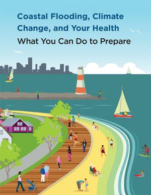
Coastal flooding in the United States is already occurring and the risk of flooding is expected to grow in most coastal regions, in part due to climate change. The Centers for Disease Control and Prevention developed this booklet, aimed at the general public, that identifies steps people can take to prepare for the health risks associated with coastal flooding. The booklet answers some of the key questions about coastal flooding in a changing climate: why these events are on the rise; how it might affect health; and what people can do before, during, and after a coastal flooding event to stay safe. Scientific information used in the document is derived from peer-reviewed synthesis and assessment products, including those published by the U.S. Global Change Research Program and the Intergovernmental Panel on Climate Change, as well as other peer-reviewed sources and federal agency resources.
This report documents the efforts of seven partnerships to build resilience of natural resources in the United States. These partnerships demonstrate the benefits of using existing collaborative, landscape-scale conservation approaches to address climate change and other resource management challenges. Their goal is to build and maintain an ecologically connected network of terrestrial, coastal, and marine conservation areas that are likely to be resilient to climate change, demonstrating some ability to support a broad range of fish, wildlife, and plants under changing conditions.
As climate changes and ocean temperatures rise, the abundance, distribution, and life cycles of fish in federally managed ocean fisheries may change too. Federal agencies managing ocean fisheries have limited information to determine exactly how climate change might harm specific fish populations, and may not always understand the potential effects. To better manage climate-related risks, the report recommends (1) the development of guidance on how to incorporate climate information into the fisheries management process, and (2) finalizing Regional Action Plans for implementing the NOAA Fisheries Climate Science Strategy that incorporate performance measures for tracking achievement of the Strategy’s Objectives.
Climate change impacts ecosystems in many ways, from effects on species to phenology to wildfire dynamics. Assessing the potential vulnerability of ecosystems to future changes in climate is an important first step in prioritizing and planning for conservation. Although assessments of climate change vulnerability commonly are done for species, fewer have been done for ecosystems. To aid regional conservation planning efforts, this report assesses climate change vulnerability for ecosystems in the Southeastern United States and Caribbean.
This guide provides a step-by-step approach for incorporating climate change information into new or existing conservation plans in coastal environments. The guide’s six steps draw from existing strategic conservation planning frameworks, but focus on climate considerations and key resources specifically relevant to the coastal environment, including coastal watersheds.
Rapidly rising seas threaten to drown tidal marshes and diminish the benefits provided to people and wildlife by these valuable coastal ecosystems. Increasingly, government agencies and non-government organizations are harnessing the power of computer-based models of marsh ecosystems to inform management and policy strategies to sustain tidal marshes. This report covers the entire modeling lifecycle, from developing a modeling approach and working with data to communicating modeling results. While some of the information pertains specifically to the northeastern United States, the report is also intended as a useful resource for modeling of marsh migration in other regions. The report is available online, with a printer-friendly version also available for download.
Drought threatens our country’s natural resources, economy, and overall health. Increasingly, NOAA is charged with providing and improving information that helps stakeholders at all levels manage water resources in a more resilient and climate-smart manner. Working with input from farmers, ranchers, natural resource managers, and other drought-impacted industries and populations, NOAA research has worked to improve drought monitoring and prediction for better planning and mitigation of impacts.
Coastal communities across the United States are facing worsening risks of flooding during routine high tides and damaging storm surges. With sea level rise accelerating along the East and Gulf Coasts, these problems are projected to intensify in the coming years, and they are likely to have a disproportionate impact on low-income and minority communities. This report is an attempt to guide improvements in policy making around disaster aid and preparedness, to ensure that communities receive the support they need before and in the aftermath of climate-related disasters. It also makes the case for better long-term planning and sufficient resources to anticipate and prioritize the needs of frontline communities who bear the brunt of the climate impacts our nation is experiencing.
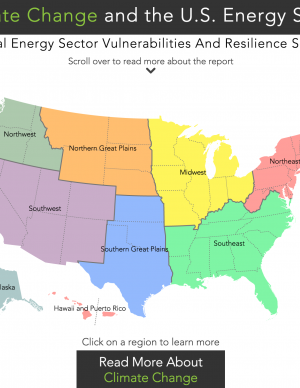
An interactive map provides access to one-page documents of climate and energy information customized for nine regions of the United States. Each document summarizes climate impacts for the region; provides a table of Quick Facts on energy supply and demand, electrical power, and critical infrastructure in the region; and enumerates examples of important energy sector vulnerabilities and climate resilience solutions.
This guide provides a framework for the selection of appropriate storm damage risk reduction treatments for low-volume roads. There are important tasks and processes that are necessary to make informed treatment selections that this guide does not cover in detail, but should be included in comprehensive road management programs. These tasks include road condition inventories, hazard assessments, and strategic plans for treating high-hazard sites. Specific “stormproofing” measures discussed in this guide include timely road maintenance, many key road drainage measures, culvert diversion prevention, pulling back marginal fill slopes, use of biotechnical and vegetative slope stabilization and erosion control, gully prevention, bridge maintenance, and many other measures.
This publication is the annual National Marine Fisheries Service yearbook of fishery statistics for the United States for 2014. The report provides data on U.S. recreational catch and commercial fisheries landings and value, as well as other aspects of U.S. commercial fishing. In addition, data are reported on the U.S. fishery processing industry, imports and exports of fishery-related products, and domestic supply and per capita consumption of fishery products.
This handbook (USGS Professional Paper 1815) was designed as a guide to the science and simulation models for understanding the dynamics and impacts of sea level rise on coastal ecosystems. Coastal land managers, engineers, and scientists can benefit from this synthesis of tools and models that have been developed for projecting causes and consequences of sea level change on the landscape and seascape.
The Resilient Strategies Guide for Water Utilities provides options for drinking water, wastewater, and stormwater utilities to assist them in developing plans that contain strategies that address their specific needs and priorities.
The Guide outlines the resilience planning process and helps you to identify potential strategies and promote a better understanding of resilience strategies. At the end of the Guide, you can download a report containing all of your selections and submitted information.
Without significant changes, existing water systems will soon no longer be able to provide the services that citizens have come to expect. After six years of research, The Johnson Foundation presents a resource intended to examine challenges associated with quality, availability, and resilience of U.S. freshwater resources due to climate change, aging infrastructure, and extreme events. The report contains a set of principles to help guide the efforts of leaders in various sectors as they act upon the recommendations offered.
This technical report looks at more than 60 years of coastal water level and local elevation data, analyzing sea level rise and nuisance flood frequency changes around the United States.
In April 2014, the National Park Service (NPS) convened a select group of leaders in the fields of planning, architecture, landscape architecture, historic preservation, archeology, science, and park and cultural resource management to participate in a planning session entitled Preserving Coastal Heritage. This summary report provides the recommendations and feedback that emerged over the course of the two-day work session, along with highlights from the presentations and remarks. Case studies include four sites in New York and New Jersey. The Preserving Coastal Heritage work session was part of an NPS effort to develop a cultural resources climate change response strategy.
In 2008, agricultural greenhouse gas sources accounted for about six percent of total U.S. greenhouse gas emissions. This report, known as the USDA GHG Inventory, was developed to provide a comprehensive assessment of the contribution of U.S. agriculture and forestry to greenhouse gas emissions and carbon sequestration, providing an in-depth look at greenhouse gas emissions and carbon sequestration at the state and regional scales.
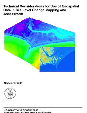
Guidance for federal and state agencies and coastal planners for conducting sea level change assessments and mapping. The report is intended to provide technical guidance to agencies, practitioners, and coastal decision-makers seeking to use and/or collect geospatial data to assist with sea level change assessments and mapping products.


