Access a range of climate-related reports issued by government agencies and scientific organizations. Browse the reports listed below, or filter by scope, content, or focus in the boxes above. To expand your results, click the Clear Filters link.
The Working Group II contribution to the IPCC Sixth Assessment Report assesses the impacts of climate change, looking at ecosystems, biodiversity, and human communities at global and regional levels. It also reviews vulnerabilities and the capacities and limits of the natural world and human societies to adapt to climate change.
A Coastal Resilience Center research team, led by Dr. Cassandra R. Davis of the University of North Carolina at Chapel Hill, has released a report that explores the disproportionate impacts of federal mitigation assistance on socially marginalized groups and under-resourced neighborhoods. The purpose of the report is to improve mitigation efforts by addressing equity in emergency management, ultimately supporting the creation of national policy for federal agencies including FEMA, the National Oceanic and Atmospheric Administration, and others.
This Guide is written for practitioners already using or wanting to use future climate information in their work, but who are not familiar with the underlying assumptions and choices surrounding climate data. Here, we introduce the climate model scenarios that are used to “drive” climate models forward in time. These scenarios are a combination of socioeconomic and climate forcing pathways. We summarize differences between these scenarios for the Great Lakes region to show users how their choice of model scenario affects future temperature and precipitation projections.
This report's subtitle is Managing the Uncertainty of Future Sea Level Change and Extreme Water Levels for Department of Defence Coastal Sites Worldwide.
From the Executive Summary: Global change, including climate change, poses unique challenges to the Department of Defense (DoD). In particular, coastal military sites, and their associated natural and built infrastructure, operations, and readiness capabilities, are vulnerable to the impacts of rising global sea level and local extreme water level (EWL) events. This report and its accompanying scenario database provide regionalized sea level and EWL scenarios for three future time horizons (2035, 2065, and 2100) for 1,774 DoD sites worldwide. The global nature of DoD’s presence required a broad and comprehensive approach that to this point has been lacking in similar efforts.
Hotter weather, stronger typhoons, coral reef death, and physical and mental health risks are among the major challenges detailed in this report on climate change in the Commonwealth of the Northern Mariana Islands (CNMI). Threatened resources include high-value coastal infrastructure and the millions of dollars that ocean ecosystems add to the CNMI economy annually. This report provides guidance for decision makers seeking to better understand the implications of climate variability and change for CNMI and its communities and identifies the additional information and research needed to support responses that enhance resilience and help CNMI to withstand the changes to come.
This report highlights the equity implications of sea level rise in the first nationwide assessment of risk to the country’s affordable housing supply. As climate change causes sea levels to rise, the number of affordable housing units at risk of coastal flooding is projected to more than triple to nearly 25,000 nationwide over the next 30 years.
This report is a scientific assessment of historical climate trends and potential future climate change in North Carolina under increased greenhouse gas concentrations. The report includes an overview of the physical science of climate change, detailed information on observed and projected changes in temperature and precipitation averages and extremes, hurricanes and other storms, sea level, and other relevant climate metrics. Findings are presented for both the state as a whole and for each of three regions in the state: the Coastal Plain, the Piedmont, and the Western Mountains. The report also includes chapters on sea level rise, trends involving interactions of multiple aspects of the climate system (including inland flooding, wildfire, forest ecosystem changes, urban heat island effects, and air pollution), and findings relevant to engineering design standards.
Planning for climate change resiliency is an increasingly pressing requirement for communities throughout the world and the Delaware Valley Regional Planning Commission (DVRPC) region. In order to help local officials, non-profits, and communities with this process, numerous planning tools have been developed by a wide range of public and private agencies. Accordingly, the purpose of this paper is to explain, organize, and prioritize the tools that currently exist in order to select ones that are broadly accessible to a wide range of organizations, applicable across a range of sectors, and not overly redundant. During this selection process, a list of over 60 tools was winnowed down to a final toolkit of 18 that are particularly useful at any stage in the resiliency planning process and can be used for communities throughout the DVRPC region.
While all people living in the United States are affected by climate change, some communities and some populations are more vulnerable to changing climate conditions than others. This final report from a NOAA-funded project in New Jersey highlights current evidence regarding impacts of changing climate-related coastal hazards on socially vulnerable populations, identify opportunities to address needs of socially vulnerable populations as part of coastal community climate resilience planning, and outlines possible options for coastal management policy that may enhance efforts to address needs of socially vulnerable populations as part of coastal community resilience efforts.
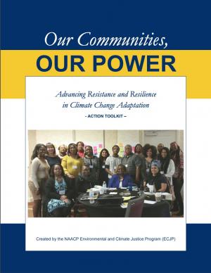
The Beloved Community is a vision for our future where all people share equally in the wealth and bounty of the earth, where we protect its abundance, diversity, and beauty for future generations. In this vision of liberation, racism, exploitation, and domination are replaced by democracy, cooperation, interdependence, and love. To get there, we pursue transformative, systems-change solutions. What do we mean by this? The root causes of the problems our communities face—like climate change, racism, and economic inequality—are all deeply connected. Since the problems are connected, so are the solutions. The purpose of this toolkit is to put us on the path toward achieving this vision. Through the context of building equity and resilience into climate adaptation planning, we introduce strategies to transform our communities and, by extension, society. Our ultimate goal is to create lasting and systemic change. At the same time, we recognize the urgency of the issues our communities face and the need to take action now. That is why we pursue change at every scale—from policy changes to community-based projects—to institute the transformative change we need to uphold our vision of the beloved community.
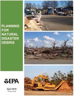
The guidance provided by this report is designed to help all communities create disaster debris management plans. It assists communities in planning for natural disaster debris before disasters—such as hurricanes, earthquakes, tornadoes, volcanoes, floods, wildfires, and winter storms—occur by providing useful, relevant information intended to increase community preparedness and resiliency. The report includes recommended components of a debris management plan, suggested management options for various natural disaster debris streams, a collection of case studies that highlights how several communities prepared for and managed debris generated by recent natural disasters, resources to consult in planning for natural disasters, and the EPA’s recommended pre-incident planning process to help prepare communities for effective disaster debris management.
The goal of this concerted effort is to help Thurston County (Washington) and the broader South Puget Sound region prepare for and adjust to climate change. The Thurston Regional Planning Council crafted this document with a $250,000 National Estuary Program grant from the U.S. Environmental Protection Agency and significant in-kind support from the community. Partners included representatives from tribes, municipalities, universities, nonprofits, businesses, and other entities within the project area: three geographically diverse watersheds (Nisqually, Deschutes, and Kennedy-Goldsborough) within Thurston County that drain into Puget Sound. The watersheds encompass beaches, rivers, lakes, wetlands, highlands, forests, farms, ranches, cities, towns, and tribal reservations. It is the Council's hope that other communities throughout the Puget Sound region, state, and nation will replicate this project’s science-based assessments, innovative public-engagement efforts (including development of a resilience game), collaborative planning processes, economic analyses, and comprehensive actions.
This report provides the first state-wide assessment for Hawai'i documenting vulnerability to sea level rise. The report includes recommendations to reduce exposure and sensitivity to sea level rise and to increase capacity to adapt. It also provides recommendations based on emerging practices framed through extensive stakeholder consultations. It is considered a "living" report, and will be updated as further information is gathered. The framework of the report is intended to be used when facing other climate change threats affecting Hawai'i.
In the aftermath of Tropical Storms Irene and Sandy, the population centers of Greater New Haven and Bridgeport recognized significant exposure and vulnerability to their infrastructure, environment, and socioeconomic assets from extreme weather events and a changing climate. To counteract immediate and longer-term risks and broaden dialogue on community resilience building, the Southern Connecticut Regional Framework for Coastal Resilience project was launched. The overarching goal of this project was prioritizing actions and strengthening partnerships by providing proactive risk assessment, community engagement, conceptual design of on-the-ground projects, and this Final Report. The principal purpose of the project was to advance a Regional Resilience Framework—built on projects and partnerships—needed to help improve resilience for over 591,000 residents that represent over 30 percent of Connecticut’s coast. A core goal of this project was to strengthen the resilience of existing and future ecosystems, including a diverse suite of services and co-benefits, alongside existing and future development activities within a population center critical to the state of Connecticut’s future.
The protocol developed and used in this report is unique in that it is an asset-level assessment of the vulnerability of infrastructure to multiple coastal hazards and climate change factors (e.g., erosion, flooding, storm surge, sea-level rise, and historical flooding) over a 35-year planning horizon (2050). The protocol was applied to all buildings and roads in Cape Lookout National Seashore; the results are summarized in the report.
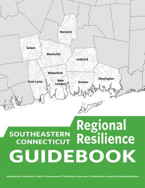
This guidebook results from the culmination of a year of dialogue among diverse stakeholders in southeastern Connecticut who defined challenges and solutions from extreme weather, climate change, and shifting social and economic conditions. Participants included representatives from nine municipalities, public and private utilities, public health departments, chambers of commerce, major employers, conservation organizations, academic institutions, community non-profits, and state agencies, among others. The dialogue captured six themed planning sectors (water, food, ecosystem services, transportation, energy, and regional economy) in a process that used surface and integrated solutions to address singular and multiple challenges across planning sectors. The guidebook provides a quick reference resource to help shape and inform actions that will advance a regional resilience framework for southeastern Connecticut; an accompanying Summary of Findings captures the project's final outcomes and conclusions, as well as providing a comprehensive account of the objectives, process, and details.
Climate Ready Boston is an ongoing initiative to help the people and city of Boston to plan for the future impacts of climate change and develop resilient solutions. Boston Mayor Martin J. Walsh describes the challenge and the city's commitment in the report's introduction: "Climate change poses a greater threat to some Bostonians. The very young and very old, people who do not speak English, and those with low incomes or medical illnesses or disabilities are all at elevated risk. By ensuring that our solutions are built together with those communities and in response to their needs, climate action will help us build a more equitable city. Furthermore, because climate change knows no borders, we will work with neighboring municipalities to address the regional impacts we face together." The Climate Ready Boston website offers proposed solutions and information specific to a range of locales. It also offers a presentation and report on Climate Change and Sea Level Rise Projections for Boston.
In January 2015, Long Beach Mayor Robert Garcia asked the Aquarium of the Pacific to take a lead in assessing the primary threats that climate change poses to Long Beach, to identify the most vulnerable neighborhoods and segments of the population, and to identify and provide a preliminary assessment of options to reduce those vulnerabilities. Over the course of 2015, the Aquarium hosted and participated in meetings and workshops with academic and government scientists, business and government leaders, local stakeholders, and Long Beach residents to discuss key issues facing our community as the result of climate change. This report, completed in December 2015, represents the culmination of these efforts. The report offers detailed assessments of the five main threats of climate change to Long Beach: drought, extreme heat, sea level rise and coastal flooding, deteriorating air quality, and public health and social vulnerability. It also provides an overview of what is currently being done to mitigate and adapt to these threats, and other options to consider. Finally, this report presents a series of steps and actions that city leaders and community stakeholders can use as a template for making Long Beach a model of a climate resilient city.
This handbook (USGS Professional Paper 1815) was designed as a guide to the science and simulation models for understanding the dynamics and impacts of sea level rise on coastal ecosystems. Coastal land managers, engineers, and scientists can benefit from this synthesis of tools and models that have been developed for projecting causes and consequences of sea level change on the landscape and seascape.
This plan—an update to the 2009 California Climate Adaptation Strategy—augments previously identified strategies in light of advances in climate science and risk management options.
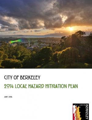
This plan evaluates the risks that different hazards pose to Berkeley and engages the community in dialogue to identify the most important steps that the city and its partners should pursue to reduce these risks. The plan updates the city's plan initially adopted in 2004. To develop the 2004 Disaster Mitigation Plan, the city conducted detailed research on four major natural and two major “man-made” hazards present in Berkeley: earthquake, wildland-urban interface fire, landslide, flood, hazardous materials release, and terrorism. Since that time, new maps and data depicting the extent and possible impacts from tsunami and climate change have become available. In 2011, the city added these hazards to the list and they are incorporated into this plan..
This report documents the effort to develop an understanding of possible impacts of climate change and potential future responses by the Towns of Acushnet and Fairhaven and the City of New Bedford, Massachusetts. It focuses specific attention on sea level rise, precipitation, and frequency or intensity of storms that may affect public infrastructure related to water quality and habitat protection.
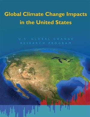
The National Climate Assessment assesses the science of climate change and its impacts across the United States, now and throughout this century. It documents climate change-related impacts and responses for various sectors and regions, with the goal of better informing public and private decision making at all levels.
The assessment draws from a large body of scientific peer-reviewed research, technical input reports, and other publicly available sources; all sources meet the standards of the Information Quality Act. The report was extensively reviewed by the public and experts, including a panel of the National Academy of Sciences, the 13 federal agencies of the U.S. Global Change Research Program, and the Federal Committee on Environment, Natural Resources, and Sustainability.
The Intergovernmental Panel on Climate Change (IPCC) Working Group II's contribution to the Fifth Assessment Report (AR5) relates to climate impacts, adaptation, and vulnerability. A Summary for Policymakers and the underlying scientific and technical assessment are also available.
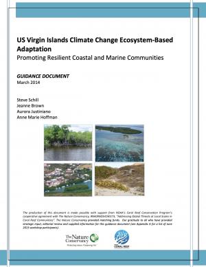
As with the rest of the world and the Caribbean region in particular, the coastal and marine communities of the US Virgin Islands (USVI) are susceptible to the effects of climate change. Hazards include increasingly hazardous coastal conditions and loss of life-sustaining marine, coastal, and island resources. Climate change is anticipated to add to the stresses of the coastal environment by altering temperature and precipitation patterns, increasing the likelihood of extreme precipitation events, and accelerating rates of sea level rise.
Responding and adapting to such changes requires an understanding of the risks; weighing options for adapting to changing conditions; and instituting a suite of strategies to implement, measure, and fund response actions having the most benefits to the ecosystems and communities that depend on those services. With support from National Oceanic and Atmospheric Administration’s (NOAA) Coral Reef Conservation Program, The Nature Conservancy’s (TNC) Caribbean Program directed a project with the objective of developing decision-support tools and conservation strategies that will advance the implementation of ecosystem-based adaptation (EBA) to climate change within the USVI.
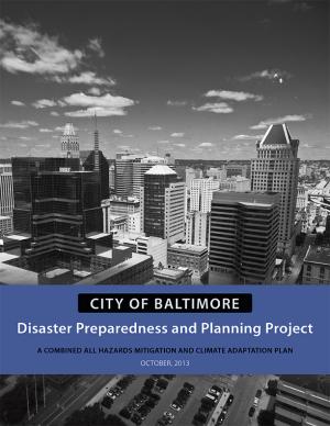
In 2013, the Baltimore City Department of Planning and Office of Sustainability created the Disaster Preparedness and Planning Project (DP3) as an effort to address existing hazards while simultaneously preparing for predicted hazards due to climate change. This project develops an integrated All Hazards Mitigation Plan, floodplain mapping, and Climate Adaptation Plan program that links research, outreach, and actions to assure implementation of a comprehensive and new risk-preparedness system for addressing existing and future impacts. Integrating hazard mitigation planning, which focuses on past events, with climate adaptation planning, which focuses on what will likely happen in the future, offers a positive, win-win solution for Baltimore City.
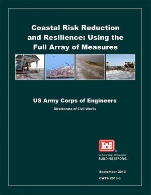
Coastal areas are especially vulnerable to hazards, now and in the future, posed by waves and surges associated with sea level change and coastal storms. Coastal risk reduction can be achieved through a variety of approaches, including natural or nature-based features (e.g., wetlands and dunes), nonstructural interventions (e.g., policies, building codes, and emergency response such as early warning and evacuation plans), and structural interventions (e.g., seawalls and breakwaters). This report discusses the U.S. Army Corps of Engineers' capabilities to help reduce risks to coastal areas and improve resilience to coastal hazards through an integrated planning approach.
The City of Marquette is the largest city in Michigan's Upper Peninsula and one of the most economically diverse in the state. The city is especially vulnerable to environmental, economic, and social impacts of climate change, largely because it borders Lake Superior. A team of Michigan State University Extension specialists and educators received funding from the Great Lakes Integrated Sciences and Assessments Center (GLISA) to collaborate with GLISA researchers, relevant decision makers, and stakeholders in Marquette to increase community resilience through incorporating climate variability and change adaption strategies into local land use master plans and policies. Key stakeholders in the agriculture, forestry, natural resources, health, planning, and tourism fields participated in the development of climate change concerns and strategies. Overwhelmingly, residents and local leaders wanted to protect the natural environment that makes Marquette such a desirable place to live. This report details the process and results of this community-driven process, and also contains specific, detailed GIS maps of the region that reflect the climate vulnerabilities and concerns of the residents and leaders in the Marquette region.
NOTE: This report inspired the creation of another report: "Climate and Health Adaptation Planning Guide for Michigan Communities"
PlaNYC is a long-term sustainability plan based on the latest climate science. This report includes ideas on how to rebuild the communities in New York City affected by Hurricane Sandy in 2012 and how to increase resilience and infrastructure of buildings city-wide in order to protect against future extreme events.
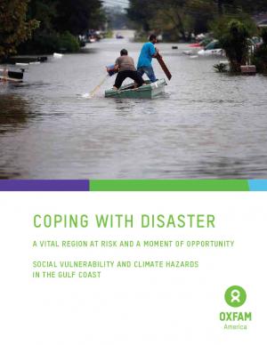
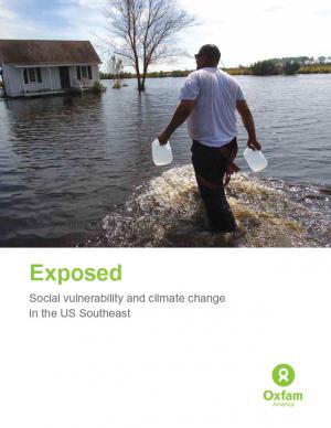
Oxfam America, in their work to shed light on the vulnerability of the geography and people of the U.S. Southeast, commissioned two reports from the Hazards and Vulnerability Research Institute at the University of South Carolina. The first one covers the entire 13-state region, while the second one contains much more detail about Louisiana and Mississippi. This document provides a brief overview of the findings, the concepts, and the methodology. The aim of these materials is to be useful tools to people in coastal communities, and to decision makers shaping policies in the region.
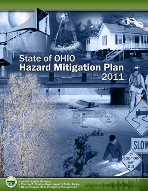
This plan identifies Ohio's mitigation strategy, which helps guide local mitigation planning and project efforts. The State of Ohio Standard Hazard Mitigation Plan was first approved by FEMA in 2005. This 2011 plan revision details Ohio’s highest priority hazards: river/stream flooding, tornadoes, winter storms, landslides, dam/levee failure, wildfire, coastal flooding, earthquakes, coastal erosion, drought, severe summer storms, invasive species, and land subsidence hazards. The plan also integrates and introduces the State Hazard Analysis, Resource and Planning Portal (SHARPP), a web-based system that captures and disseminates state and local hazard mitigation planning and project information.
This report is the Second National Climate Assessment, summarizing the science and impacts of climate change on the United States. The report discusses climate-related impacts for various societal and environmental sectors and regions across the nation. It is an authoritative scientific report written in plain language, with the goal of better informing public and private decision making at all levels.
Historically, studies about climate hazards and social vulnerability have been conducted in separate silos. The Social Vulnerability Index (SoVI) is the first study of its kind to examine both the potential impact of natural hazards and which populations are most likely to be negatively affected. This research, commissioned by Oxfam America, includes a series of layered maps that depict social and climate change-related hazard vulnerability. The maps assist in identifying hotspots in the U.S. Southeast, which are at significant risk in the face of four particular climate change-related hazards: drought, flooding, hurricane force winds, and sea level rise. The specific region of focus is the 13-state region of the US Southeast: Alabama, Arkansas, Florida, Georgia, Kentucky, Louisiana, Maryland, Mississippi, North Carolina, South Carolina, Tennessee, Texas, and Virginia. Roughly 80 percent of all U.S. counties that experience persistent poverty (defined as a county in which at least 20 percent of the population experiences poverty for three decades or more) lie in this region.


