Access a range of climate-related reports issued by government agencies and scientific organizations. Browse the reports listed below, or filter by scope, content, or focus in the boxes above. To expand your results, click the Clear Filters link.
Shorelines with high boat wake and wave energy face especially rapid erosion and habitat loss. A new living shoreline design from researchers at the University of Florida and the Guana Tolomato Matanzas Reserve that uses gabion-breaks has proven successful in high-energy environments. The gabion-break design uses two lines of defense to reduce erosion along the marsh edge—porous wooden breakwalls placed in front of structures that will foster oyster growth. This manual for restoration practitioners describes a collaborative research project that tested gabion-breaks along the Atlantic Intracoastal Waterway in northeast Florida. It discusses the project’s results and details the steps to use gabion-breaks, including planning, design, maintenance, monitoring, and costs.
This report provides an updated set of sea level rise projections that incorporate the latest science and community-scale projections. The new projections can be applied to risk management and planning processes, and are recommend for communities performing coastal impacts assessments within the state of Washington.
An interactive map based on the report shows relative sea level rise (RSLR) projections for 171 sites along Washington’s coast. The projections for each site are provided as a downloadable excel spreadsheet which contains three worksheets: (1) an overview, (2) RSLR projections for a low greenhouse gas scenario (RCP 4.5), and (3) RSLR projections for a high greenhouse gas scenario (RCP 8.5).
This analysis examines what's at risk for U.S. coastal real estate from sea level rise. Millions of Americans living in coastal communities will face more frequent and disruptive high-tide flooding; as this flooding increases, it will reach a threshold where normal routines become impossible and coastal residents, communities, and businesses are forced to make difficult, often costly choices. For this analysis, that threshold is defined as flooding that occurs 26 times per year (on average, once every other week) or more, a level of disruption referred to as chronic inundation. The results identify the number of residential and commercial properties at risk of chronic inundation—and the total current property value, estimated population, and property tax base affected—for the entire coastline of the lower 48 states.
The goal of this concerted effort is to help Thurston County (Washington) and the broader South Puget Sound region prepare for and adjust to climate change. The Thurston Regional Planning Council crafted this document with a $250,000 National Estuary Program grant from the U.S. Environmental Protection Agency and significant in-kind support from the community. Partners included representatives from tribes, municipalities, universities, nonprofits, businesses, and other entities within the project area: three geographically diverse watersheds (Nisqually, Deschutes, and Kennedy-Goldsborough) within Thurston County that drain into Puget Sound. The watersheds encompass beaches, rivers, lakes, wetlands, highlands, forests, farms, ranches, cities, towns, and tribal reservations. It is the Council's hope that other communities throughout the Puget Sound region, state, and nation will replicate this project’s science-based assessments, innovative public-engagement efforts (including development of a resilience game), collaborative planning processes, economic analyses, and comprehensive actions.
This report acknowledges that climate adaptation has begun to emerge as a field of practice, but states that the work is not evolving quickly or deliberately enough for communities to adequately prepare for the dangerous shocks and stresses that increasingly will be introduced by climate change. The report assesses the current state of the climate adaptation field, provides a vision of what a mature, effective field would look like, and recommends steps that should be taken to realize that vision.
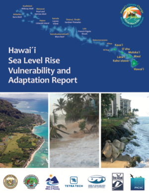
This report provides the first state-wide assessment for Hawai'i documenting vulnerability to sea level rise. The report includes recommendations to reduce exposure and sensitivity to sea level rise and to increase capacity to adapt. It also provides recommendations based on emerging practices framed through extensive stakeholder consultations. It is considered a "living" report, and will be updated as further information is gathered. The framework of the report is intended to be used when facing other climate change threats affecting Hawai'i.
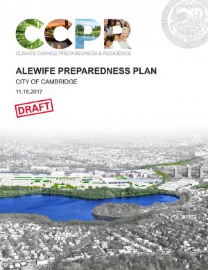
The city of Cambridge, Massachusetts, is developing a Climate Change Preparedness and Resilience Plan as a practical guide to implement specific strategies in response to climate change threats (heat, flooding from precipitation, flooding from sea level rise and storm surge). The Alewife Preparedness Plan—the first neighborhood plan to be developed—will test how the proposed strategies might create a new framework for resiliency in Alewife. It comprises two parts: a Report and a Handbook. The Report provides the context, framework, and strategies to create a prepared and resilient Alewife neighborhood; the Handbook, a companion document, is a practical compendium of specific preparedness and resiliency strategies and best practices.
Delaware is especially vulnerable to the effects of sea level rise (SLR) due to its flat topography, low mean elevation, and significant community development and infrastructure investments along the coast. Rates of relative SLR measured at tide gauges in and around Delaware are approximately twice the rate of global mean SLR. This report provides critical information on future sea level rise for Delaware's decision makers: it can help readers gain a comprehensive understanding of risk and the likelihood of worsening coastal flooding. In addition to the report, the Delaware Geological Survey worked with others to release an updated series of coastal inundation maps that depict the extent of potential inundation from current average high tide (MHHW level) to seven feet above in one-foot increments. These maps can be used as a planning tool for understanding potential future effects of sea level rise or storm surge.
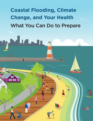
Coastal flooding in the United States is already occurring and the risk of flooding is expected to grow in most coastal regions, in part due to climate change. The Centers for Disease Control and Prevention developed this booklet, aimed at the general public, that identifies steps people can take to prepare for the health risks associated with coastal flooding. The booklet answers some of the key questions about coastal flooding in a changing climate: why these events are on the rise; how it might affect health; and what people can do before, during, and after a coastal flooding event to stay safe. Scientific information used in the document is derived from peer-reviewed synthesis and assessment products, including those published by the U.S. Global Change Research Program and the Intergovernmental Panel on Climate Change, as well as other peer-reviewed sources and federal agency resources.
Sea level rise was a major topic of the annual meeting of the National Academy of Engineering held on October 9–10, 2016, and the second day featured a forum on sea level rise adaptation. This summary of the forum, which also incorporates material from Robert J. Nicholls’ plenary presentation, outlines a rich and challenging set of problems for engineers, scientists, and those who work with them.
From Mayor Mitchell J. Landrieu's Introduction: As we marked the 10th anniversary of Hurricane Katrina in 2015, we launched the world’s first comprehensive city resilience strategy, Resilient New Orleans, combining local expertise with global best practices to confront our most urgent threats, adapt our city to our changing natural environment, invest in equity, create flexible and reliable systems, and prepare for future shocks.
It is not enough to plan for how we will adapt to climate change. We must end our contribution to it. As the world committed to action in Paris in 2015, so too did we. I signed the Global Covenant of Mayors on Climate & Energy, adding New Orleans to the team of more than 7,400 cities in 119 countries worldwide committed to taking climate action.
The Nags Head Comprehensive Plan is an official policy document adopted by the Town of Nags Head to strategically plan for and enhance the quality of life and physical character of the community. The plan, while not regulatory in nature, builds upon adopted plans and policies to provide a foundation for decision making, future regulations, and project development. Further, the plan was created utilizing community input to illustrate a vision for the future of Nags Head and define steps to secure that future.
In the aftermath of Tropical Storms Irene and Sandy, the population centers of Greater New Haven and Bridgeport recognized significant exposure and vulnerability to their infrastructure, environment, and socioeconomic assets from extreme weather events and a changing climate. To counteract immediate and longer-term risks and broaden dialogue on community resilience building, the Southern Connecticut Regional Framework for Coastal Resilience project was launched. The overarching goal of this project was prioritizing actions and strengthening partnerships by providing proactive risk assessment, community engagement, conceptual design of on-the-ground projects, and this Final Report. The principal purpose of the project was to advance a Regional Resilience Framework—built on projects and partnerships—needed to help improve resilience for over 591,000 residents that represent over 30 percent of Connecticut’s coast. A core goal of this project was to strengthen the resilience of existing and future ecosystems, including a diverse suite of services and co-benefits, alongside existing and future development activities within a population center critical to the state of Connecticut’s future.
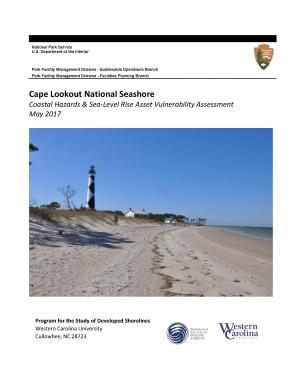
The protocol developed and used in this report is unique in that it is an asset-level assessment of the vulnerability of infrastructure to multiple coastal hazards and climate change factors (e.g., erosion, flooding, storm surge, sea-level rise, and historical flooding) over a 35-year planning horizon (2050). The protocol was applied to all buildings and roads in Cape Lookout National Seashore; the results are summarized in the report.
The Tampa Bay region is known as one of the most vulnerable in the world to wind damage, coastal flooding from storm surge, and rising sea levels. The City of St. Petersburg—with over 60 miles of coastal frontage—has already felt the impacts of storms. The adverse effects from these types of environmental events often impact low-income communities the hardest, as they have the most difficulty bouncing back from stresses and shocks. The City of St. Petersburg is committed to ensuring that investments in making the city resilient are equitable and create a range of opportunities that everyone can benefit from. The Urban Land Institute of Tampa Bay convened top experts in climate resilience from New Orleans, Miami, Boston, and the Tampa Bay region to provide technical assistance to the city on creating an equitable culture of resilience. A grant from the ULI Foundation and Kresge Foundation funded this effort.
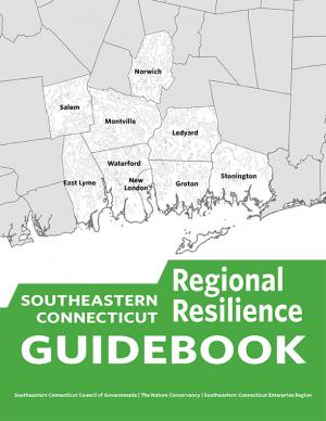
This guidebook results from the culmination of a year of dialogue among diverse stakeholders in southeastern Connecticut who defined challenges and solutions from extreme weather, climate change, and shifting social and economic conditions. Participants included representatives from nine municipalities, public and private utilities, public health departments, chambers of commerce, major employers, conservation organizations, academic institutions, community non-profits, and state agencies, among others. The dialogue captured six themed planning sectors (water, food, ecosystem services, transportation, energy, and regional economy) in a process that used surface and integrated solutions to address singular and multiple challenges across planning sectors. The guidebook provides a quick reference resource to help shape and inform actions that will advance a regional resilience framework for southeastern Connecticut; an accompanying Summary of Findings captures the project's final outcomes and conclusions, as well as providing a comprehensive account of the objectives, process, and details.
This user-friendly summary is based on the 2015 report “City of Long Beach Climate Resiliency Assessment Report" and “Appendices” prepared by the Aquarium of the Pacific at the request of Mayor Robert Garcia. The report includes clear infographics that describe current and projected conditions in the city. It also describe what the city is currently doing and what else the city and its residents can do.
Climate Ready Boston is an ongoing initiative to help the people and city of Boston to plan for the future impacts of climate change and develop resilient solutions. Boston Mayor Martin J. Walsh describes the challenge and the city's commitment in the report's introduction: "Climate change poses a greater threat to some Bostonians. The very young and very old, people who do not speak English, and those with low incomes or medical illnesses or disabilities are all at elevated risk. By ensuring that our solutions are built together with those communities and in response to their needs, climate action will help us build a more equitable city. Furthermore, because climate change knows no borders, we will work with neighboring municipalities to address the regional impacts we face together." The Climate Ready Boston website offers proposed solutions and information specific to a range of locales. It also offers a presentation and report on Climate Change and Sea Level Rise Projections for Boston.
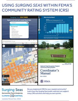
This guide describes how Climate Central's Surging Seas web tool can be used to support activities that receive points within the Federal Emergency Management Agency's (FEMA) Community Rating System (CRS) program. It is informed by conversations with local CRS coordinators and implementers, and with FEMA CRS representatives. The guide provides step-by-step instructions on how to access and obtain information and downloads from the Surging Seas tool that could be utilized within specific CRS activities in FEMA’s Coordinator’s Manual (FIA-15/2013).
Climate Ready DC is the District’s strategy to make the city more resilient to future climate change. It is based on the best available climate science and was developed through consultation with leading experts within and outside of the District government.
Emeryville is the first city in California's Bay Area to update its Climate Action Plan and align its greenhouse gas (GHG) emissions targets with the State of California’s climate targets. This Climate Action Plan 2.0 includes updates to Emeryville’s 2008 Climate Action Plan, looking towards state targets for reducing 40 percent below baseline levels of GHG emissions by 2030 and 80 percent below baseline levels by 2050. The CAP 2.0 meets the compliance for the Global Covenant of Mayors, a platform for standardizing climate change action planning for local city governments and demonstrating local commitment to climate change mitigation and adaptation. The plan contains GHG targets, updated GHG community and municipal inventories, business-as-usual GHG forecast, deep decarbonization vision for 2050, adaptation and mitigation action plans, and a monitoring plan. With 17 mitigation goals, five adaptation goals, over 100 combined initiatives for 2030, and five long-term strategies for 2050, this CAP 2.0 represents a strong step in reducing emissions and building climate resilience.
The Office of Management and Budget (OMB), in collaboration with the Council of Economic Advisers (CEA), has attempted to quantify the fiscal risks posed by climate change for the Federal Government. To date, this effort has yielded two primary conclusions: first, that our current understanding of the fiscal risks of climate change is nascent, limited in scope, and subject to significant uncertainty; and second, that the evidence available thus far indicates the fiscal risks to the Federal Government could be very significant over the course of this century without ambitious action to reduce greenhouse gas emissions (GHGs) and adapt our communities to a changing climate.
This report outlines the contours of fiscal risk through five program-specific assessments: crop insurance, health care, wildfire suppression, hurricane-related disaster relief, and Federal facility flood risk. These programs were assessed because they are directly influenced by climate change, they have strong links to the Federal Budget, and quantitative scientific and economic models regarding the likely magnitude of impacts were available. This report also considers potential impacts to Federal revenues.
This report describes key accomplishments and highlights opportunities for federal agencies and stakeholders to work together on a shared climate resilience agenda. The report builds on lessons learned and outlines three major areas where opportunities exist for innovation, economic growth, and collaboration: through application of science-based data and tools, support for community resilience initiatives, and integration of climate resilience into federal agency missions, operations, and culture.
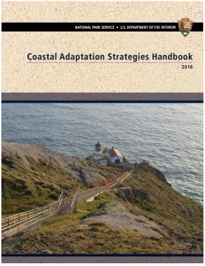
This handbook summarizes the current state of National Park Service (NPS) climate adaptation and key approaches currently in practice or considered for climate change adaptation in coastal areas in order to guide adaptation planning in coastal parks. The chapters focus on policy, planning, cultural resources, natural resources, facility management, and communication/education. The handbook highlights processes, tools, and examples that are applicable to many types of NPS plans and decisions. One chapter includes a case study of Hurricane Sandy response and recovery strategies, including changes to infrastructure. Another chapter features practical coastal infrastructure information, including cost per unit length of constructed features (including seawalls, beach nourishment, and nature-based features). The level of detail varies by topic depending on the state of research and practice in that field.
This two-part report is the result of workshops convened in 2015 and 2016. The Part 2 reports documents the second workshop, which brought federal and state coastal managers together with statutory authorities for review and permitting of marine aquaculture in federal waters off the coast of southern California with scientists and other stakeholders.
This two-part report is the result of workshops convened in 2015 and 2016. The Part 1 report documents participants' efforts to develop frames of reference and rationale for creation of an offshore finfish aquaculture industry in southern California.
This guide provides a step-by-step approach for incorporating climate change information into new or existing conservation plans in coastal environments. The guide’s six steps draw from existing strategic conservation planning frameworks, but focus on climate considerations and key resources specifically relevant to the coastal environment, including coastal watersheds.
This document provides final guidance for federal agencies on how to consider the impacts of their actions on global climate change in their National Environmental Policy Act (NEPA) reviews, providing a framework for agencies to consider both the effects of a proposed action on climate change, as indicated by its estimated greenhouse gas emissions, and the effects of climate change on a proposed action. The memorandum applies to all types of proposed federal agency actions that are subject to NEPA analysis and guides agencies on how to address the greenhouse gas emissions from federal actions and the effects of climate change on their proposed actions within the existing NEPA regulatory framework.
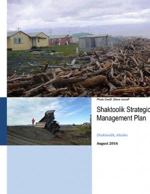
Shaktoolik, a community on the eastern edge of Norton Sound in Alaska, faces considerable threats from erosion and flooding. The community decided to take a “defend in place” approach to erosion, allowing residents to remain at the current village site for the immediate future, although residents have indicated that they are interested in eventually relocating. This Strategic Management Plan provides the “blueprint” or framework for how the community and agencies will proceed to make Shaktoolik a more resilient community and to support their “defend in place” efforts.
This report provides guidance for evaluating how sea level rise and storm surge hazards may impact the ability to provide electricity service, and for identifying and implementing solutions to enhance resilience. The document includes examples of various tools, methods, and information resources that can assist in resiliency planning. In addition, climate resilience challenges and opportunities for different types of generation, transmission, and distribution assets are identified. It also includes general methods on how to estimate the costs and benefits of resilience measures.
A multi-agency team of researchers developed this Department of Defense report to provide regionalized sea level and extreme water level scenarios for the years 2035, 2065, and 2011 for 1,774 military sites worldwide. The information included in the report is meant to assist decision makers and others in making robust choices to manage their risk of future sea level and extreme water levels.
Rapidly rising seas threaten to drown tidal marshes and diminish the benefits provided to people and wildlife by these valuable coastal ecosystems. Increasingly, government agencies and non-government organizations are harnessing the power of computer-based models of marsh ecosystems to inform management and policy strategies to sustain tidal marshes. This report covers the entire modeling lifecycle, from developing a modeling approach and working with data to communicating modeling results. While some of the information pertains specifically to the northeastern United States, the report is also intended as a useful resource for modeling of marsh migration in other regions. The report is available online, with a printer-friendly version also available for download.
In January 2015, Long Beach Mayor Robert Garcia asked the Aquarium of the Pacific to take a lead in assessing the primary threats that climate change poses to Long Beach, to identify the most vulnerable neighborhoods and segments of the population, and to identify and provide a preliminary assessment of options to reduce those vulnerabilities. Over the course of 2015, the Aquarium hosted and participated in meetings and workshops with academic and government scientists, business and government leaders, local stakeholders, and Long Beach residents to discuss key issues facing our community as the result of climate change. This report, completed in December 2015, represents the culmination of these efforts. The report offers detailed assessments of the five main threats of climate change to Long Beach: drought, extreme heat, sea level rise and coastal flooding, deteriorating air quality, and public health and social vulnerability. It also provides an overview of what is currently being done to mitigate and adapt to these threats, and other options to consider. Finally, this report presents a series of steps and actions that city leaders and community stakeholders can use as a template for making Long Beach a model of a climate resilient city.
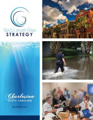
Flooding and sea level rise are challenges the City of Charleston has taken seriously for centuries. However, this City that we love is experiencing the effects more frequently than ever. In the 1970s Charleston experienced an average of 2 days of tidal flooding per year and it is projected that the City could experience 180 days of tidal flooding in 2045. Identifying initiatives that will improve our ability to withstand these effects is timely. This
Sea Level Rise Strategy Plan is that comprehensive inventory of initiatives.
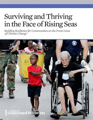
Coastal communities across the United States are facing worsening risks of flooding during routine high tides and damaging storm surges. With sea level rise accelerating along the East and Gulf Coasts, these problems are projected to intensify in the coming years, and they are likely to have a disproportionate impact on low-income and minority communities. This report is an attempt to guide improvements in policy making around disaster aid and preparedness, to ensure that communities receive the support they need before and in the aftermath of climate-related disasters. It also makes the case for better long-term planning and sufficient resources to anticipate and prioritize the needs of frontline communities who bear the brunt of the climate impacts our nation is experiencing.
This guide offers a collection of 19 practical strategies for building owners to make their properties more resilient against the effects of extreme weather events. It draws on advice from over 50 experts in the field of resilience as well as the Federal Emergency Management Agency (FEMA) and the National Flood Insurance Program (NFIP). In addition, the manual offers guidance on determining a property’s vulnerability to various hazards, finding which strategies are relevant to a particular building, and getting started with a resilience plan.

