Access a range of climate-related reports issued by government agencies and scientific organizations. Browse the reports listed below, or filter by scope, content, or focus in the boxes above. To expand your results, click the Clear Filters link.
The purpose of this report published by the Carolina Wetlands Association is to present an overview of the state of an important but shrinking resource – wetlands in North and South Carolina. The report will establish a baseline – as a basis for seeing future trends in wetlands in the Carolinas – by addressing the following questions.
- What are the functions and benefits of wetlands in the Carolinas?
- How many wetlands do we have, what are their types, and where are they?
- How have past and current land-use practices affected our wetlands?
- What other threats/stressors are there and how can we manage them?
- What is the current condition of our wetlands?
- How do we protect and manage this valuable resource through education, conservation, restoration, and other activities?
This report is current as of 2020 and will be updated as more is learned and potentially as wetlands are conserved and protected across the Carolinas in the coming years.
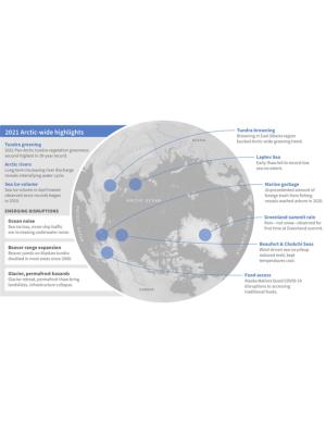
As the influences of human-caused global warming continue to intensify, with the Arctic warming significantly faster than the globe overall, the 2021 Arctic Report Card (ARC2021) brings a broad view of the state of the Arctic climate and environment. The ARC2021 provides an update on seven Arctic Vital Signs, from sea ice to snow and air temperatures to tundra greenness, and checks in on three Indicator topics for updates on river discharge, ocean acidification, and observations of substantial Arctic beaver expansion. The noteworthy emerging topics in the four ARC2021 Frostbites—marine debris, marine noise, food access during the COVID-19 pandemic, and glacier and permafrost hazards—share a common link as they look at the impacts of more people and human activity in the Arctic as well as the challenges and hazards people face with the rapidly changing cryosphere. The scientific and observational story of the Arctic is a human story—of climate change, of increased shipping and industrial activity, and of communities responding to local and regional disruptions.
This is the FY22 edition of the U.S. Gllobal Change Research Program's annual report to Congress mandated by the the Global Change Research Act. The report provides an overview of the Program’s progress in delivering on its strategic goals as well as a summary of agency expenditures under USGCRP’s budget crosscut.
The Working Group II contribution to the IPCC Sixth Assessment Report assesses the impacts of climate change, looking at ecosystems, biodiversity, and human communities at global and regional levels. It also reviews vulnerabilities and the capacities and limits of the natural world and human societies to adapt to climate change.
Climate change is expected to disrupt many aspects of life in American Sāmoa. Those who are already vulnerable—including children, the elderly, low-income families, and individuals with disabilities—are at greater risk from extreme weather and climate events. This report provides guidance for decision makers seeking to better understand the implications of climate variability and change for American Sāmoa and its communities and identifies the additional information and research needed to support responses that enhance resilience and help American Sāmoa to withstand the changes to come. This is one of a series of PIRCA reports aimed at assessing the state of knowledge about climate change indicators, impacts, and adaptive capacity of the U.S.-Affiliated Pacific Islands and the Hawaiian archipelago. Authors from the University of Hawai‘i and the East-West Center—along with 25 technical contributors from local governments, NGOs, researchers, and community groups—collaboratively developed the American Sāmoa report.
In 2020, New York City's Mayor’s Office of Resiliency initiated an engagement process, called the Climate Knowledge Exchange, to align research with climate resiliency and adaptation needs. This report is the first in an annual series that will maintain a public agenda for climate research in NYC. The report communicates NYC’s research needs to external partners, including academic scientists, federal researchers, philanthropic foundations, and community organizations. This in turn will catalyze new and creative partnerships to develop credible and actionable research products that address NYC’s most pressing climate challenges. The report includes the engagement methodology and survey text used with various agencies.
To plan for future sea level rise, Miami-Dade County relies on the 2019 Unified Sea Level Rise Projection for Southeast Florida developed by the Southeast Florida Regional Climate Change Compact. These projections are revised every five years to ensure they reflect the best available science. Based on these consensus projections, they expect sea levels to be approximately two feet higher 40 years from 2019 levels and continue rising beyond that.
This report's subtitle is Managing the Uncertainty of Future Sea Level Change and Extreme Water Levels for Department of Defence Coastal Sites Worldwide.
From the Executive Summary: Global change, including climate change, poses unique challenges to the Department of Defense (DoD). In particular, coastal military sites, and their associated natural and built infrastructure, operations, and readiness capabilities, are vulnerable to the impacts of rising global sea level and local extreme water level (EWL) events. This report and its accompanying scenario database provide regionalized sea level and EWL scenarios for three future time horizons (2035, 2065, and 2100) for 1,774 DoD sites worldwide. The global nature of DoD’s presence required a broad and comprehensive approach that to this point has been lacking in similar efforts.
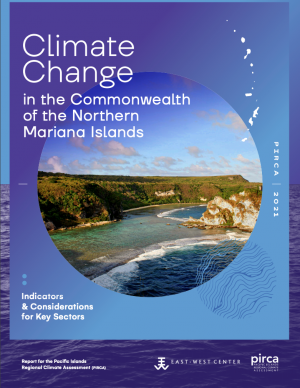
Hotter weather, stronger typhoons, coral reef death, and physical and mental health risks are among the major challenges detailed in this report on climate change in the Commonwealth of the Northern Mariana Islands (CNMI). Threatened resources include high-value coastal infrastructure and the millions of dollars that ocean ecosystems add to the CNMI economy annually. This report provides guidance for decision makers seeking to better understand the implications of climate variability and change for CNMI and its communities and identifies the additional information and research needed to support responses that enhance resilience and help CNMI to withstand the changes to come.
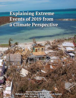
This series of BAMS special reports presents assessments of how human-caused climate change may have affected the strength and likelihood of individual extreme events. The series has been published annually since 2011.
The ninth edition of the report, Explaining Extreme Events in 2019 from a Climate Perspective, presents 15 new peer-reviewed analyses of extreme weather across four continents and one sea during 2019. It features the research of 77 scientists from 7 countries looking at both historical observations and model simulations to determine whether and by how much climate change may have influenced particular extreme events.
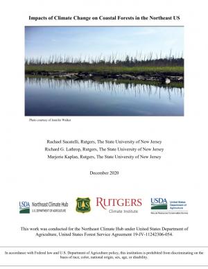
As sea levels rise along the Northeastern U.S., coastal forest ecosystems are being impacted. To better enable climate-smart decision-making, the U.S. Department of Agriculture Northeast Climate Hub engaged researchers at Rutgers University to conduct a synthesis of the current state of knowledge concerning how Northeastern U.S. coastal forests, specifically those in mid-Atlantic and southern New England states (VA, MD, DE, NJ, NY, CT, and MA), are responding to impacts from climate change. Drawing upon the scientific literature, expert interviews, and a January 2020 convening of scientists and land managers at the U.S. National Agricultural Library, Beltsville, Maryland, this synthesis identifies key knowledge gaps as well as potential management approaches.
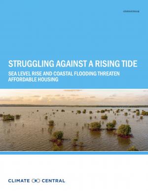
This report highlights the equity implications of sea level rise in the first nationwide assessment of risk to the country’s affordable housing supply. As climate change causes sea levels to rise, the number of affordable housing units at risk of coastal flooding is projected to more than triple to nearly 25,000 nationwide over the next 30 years.
This report is a scientific assessment of historical climate trends and potential future climate change in North Carolina under increased greenhouse gas concentrations. The report includes an overview of the physical science of climate change, detailed information on observed and projected changes in temperature and precipitation averages and extremes, hurricanes and other storms, sea level, and other relevant climate metrics. Findings are presented for both the state as a whole and for each of three regions in the state: the Coastal Plain, the Piedmont, and the Western Mountains. The report also includes chapters on sea level rise, trends involving interactions of multiple aspects of the climate system (including inland flooding, wildfire, forest ecosystem changes, urban heat island effects, and air pollution), and findings relevant to engineering design standards.
As higher seas, stronger storms, and more frequent flooding collide with COVID-19, communities of every size across the United States must address new challenges emerging from overlapping disasters. This handbook is a comprehensive resource to help local officials and emergency managers address the dual disaster scenario of flooding during the COVID-19 pandemic. This handbook, the first of its kind, draws on case studies and best practices from emergency management professionals to equip officials with six actionable recommendations for planning a proactive response as communities face multiple threats this season.
Arctic ecosystems and communities are increasingly at risk due to continued warming and declining sea ice. The Arctic marine ecosystem and the communities that depend upon it continue to experience unprecedented changes as a result of warming air temperatures, declining sea ice, and warming waters. This 2019 update to the Arctic Report Card draws particular attention to the Bering Sea region, where declining winter sea ice exemplifies the potential for sudden and extreme change. Indigenous Elders from the Bering Sea region offer their experiences of living at the forefront of climate change.
Alaska has recently experienced profound environmental change related to extreme weather events and deviations from the historical climate. Sustained warmth, sea ice loss, coastal flooding, river flooding, and major ecosystem changes have impacted the daily lives of Alaskans around the state. The International Arctic Research Center and the University of Alaska Fairbanks have documented these changes, and are providing individuals, Alaska businesses, communities, government, and others with the resources they need to better assess impacts and develop adaptation strategies.
This Summary for Policymakers summarizes the findings of the AMAP Assessment 2018: Arctic Ocean Acidification report released in October 2018. It offers a review of the latest science relating to regional ocean acidification, the biological responses to it, an overview of case studies and their associated findings, and recommendations for the Arctic Council.
This report is the first major product of the current Canadian national assessment, which launched in 2017 and intends to publish a series of authoritative reports between 2018 and 2021. This assessment focuses on answering the questions: how has Canada’s climate changed to date, why, and what changes are projected for the future? This initial report provides a climate science foundation for the other national assessment products. Its objectives are to assess current knowledge about how Canada’s climate is changing and why, and what changes are projected for the future, to help inform mitigation and adaptation decision making and to help raise public awareness and understanding of Canada’s changing climate. The CCCR is written for a broad range of professionals who are familiar with the topic of climate change but who may not have expertise in the physical sciences.
The Beloved Community is a vision for our future where all people share equally in the wealth and bounty of the earth, where we protect its abundance, diversity, and beauty for future generations. In this vision of liberation, racism, exploitation, and domination are replaced by democracy, cooperation, interdependence, and love. To get there, we pursue transformative, systems-change solutions. What do we mean by this? The root causes of the problems our communities face—like climate change, racism, and economic inequality—are all deeply connected. Since the problems are connected, so are the solutions. The purpose of this toolkit is to put us on the path toward achieving this vision. Through the context of building equity and resilience into climate adaptation planning, we introduce strategies to transform our communities and, by extension, society. Our ultimate goal is to create lasting and systemic change. At the same time, we recognize the urgency of the issues our communities face and the need to take action now. That is why we pursue change at every scale—from policy changes to community-based projects—to institute the transformative change we need to uphold our vision of the beloved community.
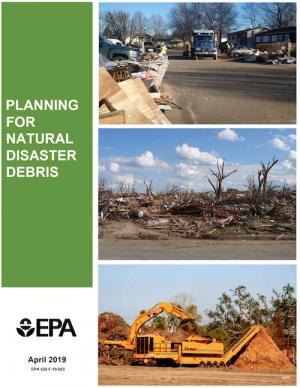
The guidance provided by this report is designed to help all communities create disaster debris management plans. It assists communities in planning for natural disaster debris before disasters—such as hurricanes, earthquakes, tornadoes, volcanoes, floods, wildfires, and winter storms—occur by providing useful, relevant information intended to increase community preparedness and resiliency. The report includes recommended components of a debris management plan, suggested management options for various natural disaster debris streams, a collection of case studies that highlights how several communities prepared for and managed debris generated by recent natural disasters, resources to consult in planning for natural disasters, and the EPA’s recommended pre-incident planning process to help prepare communities for effective disaster debris management.
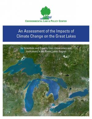
Climate change is causing significant and far-reaching impacts on the Great Lakes and the Great Lakes region. This report, from 18 leading scientists and experts from Midwest and Canadian universities and research institutions, draws on the array of existing research to assess how the shifting global climate impacts the unique Great Lakes region.
The Global Change Research Act of 1990 mandates that the U.S. Global Change Research Program deliver a report to Congress and the President no less than every four years that “1) integrates, evaluates, and interprets the findings of the Program…; 2) analyzes the effects of global change on the natural environment, agriculture, energy production and use, land and water resources, transportation, human health and welfare, human social systems, and biological diversity; and 3) analyzes current trends in global change, both human-induced and natural, and projects major trends for the subsequent 25 to 100 years.” The Fourth National Climate Assessment (NCA4) fulfills that mandate in two volumes. This report, Volume II, draws on the foundational science described in Volume I, the Climate Science Special Report. Volume II focuses on the human welfare, societal, and environmental elements of climate change and variability for 10 regions and 18 national topics, with particular attention paid to observed and projected risks, impacts, consideration of risk reduction, and implications under different mitigation pathways. Where possible, NCA4 Volume II provides examples of actions underway in communities across the United States to reduce the risks associated with climate change, increase resilience, and improve livelihoods. This assessment was written to help inform decision makers, utility and natural resource managers, public health officials, emergency planners, and other stakeholders by providing a thorough examination of the effects of climate change on the United States.
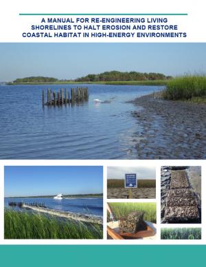
Shorelines with high boat wake and wave energy face especially rapid erosion and habitat loss. A new living shoreline design from researchers at the University of Florida and the Guana Tolomato Matanzas Reserve that uses gabion-breaks has proven successful in high-energy environments. The gabion-break design uses two lines of defense to reduce erosion along the marsh edge—porous wooden breakwalls placed in front of structures that will foster oyster growth. This manual for restoration practitioners describes a collaborative research project that tested gabion-breaks along the Atlantic Intracoastal Waterway in northeast Florida. It discusses the project’s results and details the steps to use gabion-breaks, including planning, design, maintenance, monitoring, and costs.
The continuing acidification of the Arctic Ocean is projected to have significant ecological and socioeconomic impacts over coming decades, with consequences both for local communities and globally. This is the overarching finding of the 2018 Arctic Ocean Acidification Assessment, presented at the 2018 Arctic Biodiversity Congress. The assessment, conducted by the Arctic Monitoring and Assessment Programme (AMAP) of the Arctic Council, updates a 2013 assessment and presents the chemical, biological, and socioeconomic impacts of ocean acidification, which is driven primarily by global greenhouse gas emissions.
This special report from the Intergovernmental Panel on Climate change describes the impacts of global warming of 1.5 °C above pre-industrial levels. The report also describes potential global greenhouse gas emission pathways, in the context of strengthening the global response to the threat of climate change, sustainable development, and efforts to eradicate poverty.
This report provides an updated set of sea level rise projections that incorporate the latest science and community-scale projections. The new projections can be applied to risk management and planning processes, and are recommend for communities performing coastal impacts assessments within the state of Washington.
An interactive map based on the report shows relative sea level rise (RSLR) projections for 171 sites along Washington’s coast. The projections for each site are provided as a downloadable excel spreadsheet which contains three worksheets: (1) an overview, (2) RSLR projections for a low greenhouse gas scenario (RCP 4.5), and (3) RSLR projections for a high greenhouse gas scenario (RCP 8.5).
This analysis examines what's at risk for U.S. coastal real estate from sea level rise. Millions of Americans living in coastal communities will face more frequent and disruptive high-tide flooding; as this flooding increases, it will reach a threshold where normal routines become impossible and coastal residents, communities, and businesses are forced to make difficult, often costly choices. For this analysis, that threshold is defined as flooding that occurs 26 times per year (on average, once every other week) or more, a level of disruption referred to as chronic inundation. The results identify the number of residential and commercial properties at risk of chronic inundation—and the total current property value, estimated population, and property tax base affected—for the entire coastline of the lower 48 states.
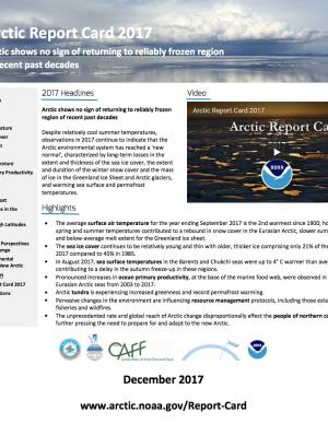
The Arctic shows no sign of returning to reliably frozen region of recent past decades. Despite relatively cool summer temperatures, observations in 2017 continue to indicate that the Arctic environmental system has reached a "new normal," characterized by long-term losses in the extent and thickness of the sea ice cover, the extent and duration of the winter snow cover and the mass of ice in the Greenland Ice Sheet and Arctic glaciers, and warming sea surface and permafrost temperatures. Issued annually since 2006, the Arctic Report Card is a timely and peer-reviewed source for clear, reliable, and concise environmental information on the current state of different components of the Arctic environmental system relative to historical records. The report is intended for a wide audience, including scientists, teachers, students, decision makers, and the general public interested in the Arctic environment and science.
This BAMS special report presents assessments of how human-caused climate change may have affected the strength and likelihood of individual extreme events. This sixth edition of explaining extreme events of the previous year (2016) from a climate perspective is the first of these reports to find that some extreme events were not possible in a pre-industrial climate.
As a key part of the Fourth National Climate Assessment (NCA4), the U.S. Global Change Research Program (USGCRP) oversaw the production of this stand-alone report of the state of science relating to climate change and its physical impacts. The Climate Science Special Report (CSSR) is designed to be an authoritative assessment of the science of climate change, with a focus on the United States, to serve as the foundation for efforts to assess climate-related risks and inform decision making about responses.
As Volume 1 of NCA4, CSSR serves several purposes, including providing (1) an updated and detailed analysis of the findings of how climate change is affecting weather and climate across the United States; (2) an executive summary and 15 chapters that provide the basis for the discussion of climate science found in the second volume of NCA4; and (3) foundational information and projections for climate change, including extremes, to improve “end-to-end” consistency in sectoral, regional, and resilience analyses within the second volume. CSSR integrates and evaluates the findings on climate science and discusses the uncertainties associated with these findings. It analyzes current trends in climate change, both human-induced and natural, and projects major trends to the end of this century. As an assessment and analysis of the science, CSSR provides important input to the development of other parts of NCA4, and their primary focus on the human welfare, societal, economic and environmental elements of climate change. Much of the underlying report is written at a level more appropriate for a scientific audience, though the Executive Summary is intended to be accessible to a broader audience.
Delaware is especially vulnerable to the effects of sea level rise (SLR) due to its flat topography, low mean elevation, and significant community development and infrastructure investments along the coast. Rates of relative SLR measured at tide gauges in and around Delaware are approximately twice the rate of global mean SLR. This report provides critical information on future sea level rise for Delaware's decision makers: it can help readers gain a comprehensive understanding of risk and the likelihood of worsening coastal flooding. In addition to the report, the Delaware Geological Survey worked with others to release an updated series of coastal inundation maps that depict the extent of potential inundation from current average high tide (MHHW level) to seven feet above in one-foot increments. These maps can be used as a planning tool for understanding potential future effects of sea level rise or storm surge.
The SWIPA 2017 assessment is the fourth assessment from the Arctic Monitoring and Assessment Programme addressing Arctic climate issues and is a direct follow-up to the first Snow, Water, Ice and Permafrost in the Arctic (SWIPA): Climate Change and the Cryosphere assessment report published in 2011. The SWIPA 2017 assessment was conducted between 2010 and 2016 by an international group of over 90 scientists, experts, and knowledgeable members of the Arctic indigenous communities. Access to reliable and up-to-date information is essential for the development of science-based decision making regarding ongoing changes in the Arctic and their global implications.
This assessment of seven priority hazards was undertaken by the Florida BRACE (Building Resilience Against Climate Effects) program. Existing climate scenarios project heat, drought, and sea level rise vulnerability to the year 2100 with a high, medium, and low range of outcomes for these three hazards. Hurricane winds, storm surge, flooding, and wildland fire are more difficult to project into the future due to a significantly smaller geographic impact; for these four hazards, probability indexes were used in conjunction with historical patterns to explain possible changes to Florida’s long-term weather. Social and medical vulnerability indices were also employed to quantify social and medical vulnerability to these priority hazards.
Sea level rise was a major topic of the annual meeting of the National Academy of Engineering held on October 9–10, 2016, and the second day featured a forum on sea level rise adaptation. This summary of the forum, which also incorporates material from Robert J. Nicholls’ plenary presentation, outlines a rich and challenging set of problems for engineers, scientists, and those who work with them.
The sea ice surrounding Antarctica has increased in extent and concentration from the late 1970s, when satellite-based measurements began, until 2015. Although this increasing trend is modest, it is surprising given the overall warming of the global climate and the region. Indeed, climate models, which incorporate our best understanding of the processes affecting the region, generally simulate a decrease in sea ice. Moreover, sea ice in the Arctic has exhibited pronounced declines over the same period, consistent with global climate model simulations. For these reasons, the behavior of Antarctic sea ice has presented a conundrum for global climate change science. The National Academies of Sciences, Engineering, and Medicine held a workshop in January 2016 to bring together scientists with different sets of expertise and perspectives to further explore potential mechanisms driving the evolution of recent Antarctic sea ice variability and to discuss ways to advance understanding of Antarctic sea ice and its relationship to the broader ocean-climate system. This publication summarizes the presentations and discussions from the workshop.
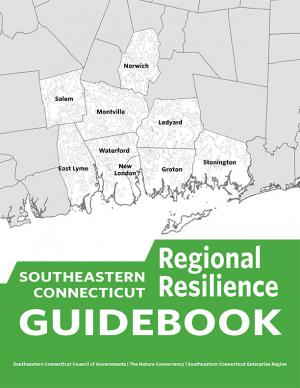
This guidebook results from the culmination of a year of dialogue among diverse stakeholders in southeastern Connecticut who defined challenges and solutions from extreme weather, climate change, and shifting social and economic conditions. Participants included representatives from nine municipalities, public and private utilities, public health departments, chambers of commerce, major employers, conservation organizations, academic institutions, community non-profits, and state agencies, among others. The dialogue captured six themed planning sectors (water, food, ecosystem services, transportation, energy, and regional economy) in a process that used surface and integrated solutions to address singular and multiple challenges across planning sectors. The guidebook provides a quick reference resource to help shape and inform actions that will advance a regional resilience framework for southeastern Connecticut; an accompanying Summary of Findings captures the project's final outcomes and conclusions, as well as providing a comprehensive account of the objectives, process, and details.

