Access a range of climate-related reports issued by government agencies and scientific organizations. Browse the reports listed below, or filter by scope, content, or focus in the boxes above. To expand your results, click the Clear Filters link.
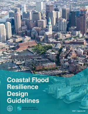
The Design Guidelines serve as a reference for residents, business owners, and developers to translate flood resiliency strategies into best practices. They include a resilience toolkit to address building form, building envelope, and site access; description and supporting information on technical and cost considerations, insurance factors, and sustainable design co-benefits; guidance on urban design, accessibility, and public realm matters related to changes in elevation between a site and surrounding infrastructure; measures to manage additional climate hazards; and case studies that apply resilience strategies from the toolkit to representative building types in the future flood zone. The Guidelines will also be used to administer a future Coastal Flood Resilience Zoning Overlay District.
Alaska has recently experienced profound environmental change related to extreme weather events and deviations from the historical climate. Sustained warmth, sea ice loss, coastal flooding, river flooding, and major ecosystem changes have impacted the daily lives of Alaskans around the state. The International Arctic Research Center and the University of Alaska Fairbanks have documented these changes, and are providing individuals, Alaska businesses, communities, government, and others with the resources they need to better assess impacts and develop adaptation strategies.
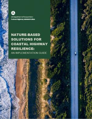
This guide is designed to help transportation practitioners understand how and where nature-based and hybrid solutions can be used to improve the resilience of coastal roads and bridges. It summarizes the potential flood-reduction benefits and co-benefits of these strategies, then follows the steps in the project delivery process, providing guidance on considering nature-based solutions in the planning process, conducting site assessments, key engineering and ecological design considerations, permitting approaches, construction considerations, and monitoring and maintenance strategies. The guide also includes appendices with site characterization tools, decision support for selecting nature-based solutions, suggested performance metrics, and links to additional tools and resources.
This report identifies eight distinct strategies cities are using to pay for large-scale climate resilience projects, mostly to address sea level rise and flooding. The analysis is based on a close look at how eight U.S. cities in seven states have been organizing the funding needed to implement their ambitious climate resilience plans. Each of these cities has had to find its own way to public and private financial resources, because there is no system in place for solving the problem of how to pay for climate resilience. Examining these cities’ pathways revealed common strategies that, while only reflecting the leading edge of urban climate resilience financing practices, quite likely foreshadow what other cities already or may do.
The Central Council of the Tlingit and Haida Indian Tribes of Alaska (Tlingit & Haida) is a federally recognized Indian Tribe that serves 20 villages and communities stretching over 43,000 square miles within the Alaska Panhandle. The Tlingit and Haida membership is among the largest, most isolated, and most geographically dispersed of Native or Tribal populations nationwide. The region encompasses a 525-mile strip of coastline and interior waterways, bordered by Canada on the north, south, and east, with the Gulf of Alaska on the west.
The Central Council recognizes that wild salmon, berries, clams, herring, halibut, yellow cedar and other species important for subsistence, cash and culture are at risk. In response, they have released a 53-page climate change adaptation plan. The document is a roadmap for prioritizing, monitoring, and responding to threats stemming from warming air and ocean temperatures, caused by increasing levels of greenhouse gases trapped in the atmosphere.
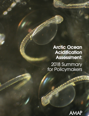
This Summary for Policymakers summarizes the findings of the AMAP Assessment 2018: Arctic Ocean Acidification report released in October 2018. It offers a review of the latest science relating to regional ocean acidification, the biological responses to it, an overview of case studies and their associated findings, and recommendations for the Arctic Council.
This report is the first major product of the current Canadian national assessment, which launched in 2017 and intends to publish a series of authoritative reports between 2018 and 2021. This assessment focuses on answering the questions: how has Canada’s climate changed to date, why, and what changes are projected for the future? This initial report provides a climate science foundation for the other national assessment products. Its objectives are to assess current knowledge about how Canada’s climate is changing and why, and what changes are projected for the future, to help inform mitigation and adaptation decision making and to help raise public awareness and understanding of Canada’s changing climate. The CCCR is written for a broad range of professionals who are familiar with the topic of climate change but who may not have expertise in the physical sciences.
The guidance provided by this report is designed to help all communities create disaster debris management plans. It assists communities in planning for natural disaster debris before disasters—such as hurricanes, earthquakes, tornadoes, volcanoes, floods, wildfires, and winter storms—occur by providing useful, relevant information intended to increase community preparedness and resiliency. The report includes recommended components of a debris management plan, suggested management options for various natural disaster debris streams, a collection of case studies that highlights how several communities prepared for and managed debris generated by recent natural disasters, resources to consult in planning for natural disasters, and the EPA’s recommended pre-incident planning process to help prepare communities for effective disaster debris management.
The Beloved Community is a vision for our future where all people share equally in the wealth and bounty of the earth, where we protect its abundance, diversity, and beauty for future generations. In this vision of liberation, racism, exploitation, and domination are replaced by democracy, cooperation, interdependence, and love. To get there, we pursue transformative, systems-change solutions. What do we mean by this? The root causes of the problems our communities face—like climate change, racism, and economic inequality—are all deeply connected. Since the problems are connected, so are the solutions. The purpose of this toolkit is to put us on the path toward achieving this vision. Through the context of building equity and resilience into climate adaptation planning, we introduce strategies to transform our communities and, by extension, society. Our ultimate goal is to create lasting and systemic change. At the same time, we recognize the urgency of the issues our communities face and the need to take action now. That is why we pursue change at every scale—from policy changes to community-based projects—to institute the transformative change we need to uphold our vision of the beloved community.
The frequency and severity of disasters over the last few decades have presented unprecedented challenges for communities across the United States. This report summarizes the existing portfolio of relevant or related resilience measurement efforts and notes gaps and challenges associated with them. It describes how some communities build and measure resilience, and offers four key actions that communities could take to build and measure their resilience to address gaps identified in current community resilience measurement efforts. The report also provides recommendations to the Gulf Research Program to build and measure resilience in the Gulf of Mexico region.
Climate change is causing significant and far-reaching impacts on the Great Lakes and the Great Lakes region. This report, from 18 leading scientists and experts from Midwest and Canadian universities and research institutions, draws on the array of existing research to assess how the shifting global climate impacts the unique Great Lakes region.
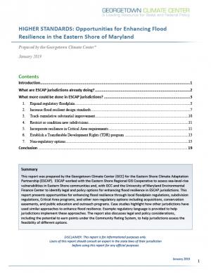
Georgetown Climate Center (GCC) prepared this report to help the Eastern Shore Climate Adaptation Partnership (ESCAP) identify strategies for adapting to increasing sea level rise and flood risk in the Eastern Shore region of Maryland. ESCAP worked with the Eastern Shore Regional GIS cooperative to assess sea level rise vulnerabilities in the six counties and two municipalities that participate in ESCAP. GCC and the University of Maryland Environmental Finance Center helped to identify potential legal and policy options for enhancing flood resilience in Eastern Shore communities. This report summarizes how more rural jurisdictions, like those on the Eastern Shore, can enhance flood resilience by updating local land use ordinances and floodplain regulations and by pursuing other non-regulatory options, including acquiring flood-prone properties, preserving open space in the floodplain, and coordinating regionally on public outreach and education programs.
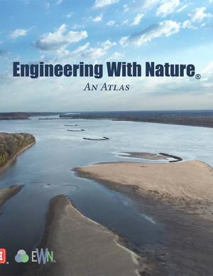
The EWN Atlas is a collection of 56 projects illustrating a diverse portfolio of contexts, motivations, and successful outcomes, presented and considered from an Engineering With Nature® perspective to reveal the usefulness of nature-based approaches and the range of benefits that can be achieved. Engineering With Nature is an initiative of the U.S. Army Corps of Engineers enabling more sustainable delivery of economic, social, and environmental benefits associated with water resources infrastructure. EWN intentionally aligns natural and engineering processes to efficiently and sustainably deliver economic, environmental, and social benefits through collaborative processes.
The Global Change Research Act of 1990 mandates that the U.S. Global Change Research Program deliver a report to Congress and the President no less than every four years that “1) integrates, evaluates, and interprets the findings of the Program…; 2) analyzes the effects of global change on the natural environment, agriculture, energy production and use, land and water resources, transportation, human health and welfare, human social systems, and biological diversity; and 3) analyzes current trends in global change, both human-induced and natural, and projects major trends for the subsequent 25 to 100 years.” The Fourth National Climate Assessment (NCA4) fulfills that mandate in two volumes. This report, Volume II, draws on the foundational science described in Volume I, the Climate Science Special Report. Volume II focuses on the human welfare, societal, and environmental elements of climate change and variability for 10 regions and 18 national topics, with particular attention paid to observed and projected risks, impacts, consideration of risk reduction, and implications under different mitigation pathways. Where possible, NCA4 Volume II provides examples of actions underway in communities across the United States to reduce the risks associated with climate change, increase resilience, and improve livelihoods. This assessment was written to help inform decision makers, utility and natural resource managers, public health officials, emergency planners, and other stakeholders by providing a thorough examination of the effects of climate change on the United States.
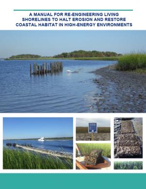
Shorelines with high boat wake and wave energy face especially rapid erosion and habitat loss. A new living shoreline design from researchers at the University of Florida and the Guana Tolomato Matanzas Reserve that uses gabion-breaks has proven successful in high-energy environments. The gabion-break design uses two lines of defense to reduce erosion along the marsh edge—porous wooden breakwalls placed in front of structures that will foster oyster growth. This manual for restoration practitioners describes a collaborative research project that tested gabion-breaks along the Atlantic Intracoastal Waterway in northeast Florida. It discusses the project’s results and details the steps to use gabion-breaks, including planning, design, maintenance, monitoring, and costs.
This special report from the Intergovernmental Panel on Climate change describes the impacts of global warming of 1.5 °C above pre-industrial levels. The report also describes potential global greenhouse gas emission pathways, in the context of strengthening the global response to the threat of climate change, sustainable development, and efforts to eradicate poverty.
The continuing acidification of the Arctic Ocean is projected to have significant ecological and socioeconomic impacts over coming decades, with consequences both for local communities and globally. This is the overarching finding of the 2018 Arctic Ocean Acidification Assessment, presented at the 2018 Arctic Biodiversity Congress. The assessment, conducted by the Arctic Monitoring and Assessment Programme (AMAP) of the Arctic Council, updates a 2013 assessment and presents the chemical, biological, and socioeconomic impacts of ocean acidification, which is driven primarily by global greenhouse gas emissions.
This report provides an updated set of sea level rise projections that incorporate the latest science and community-scale projections. The new projections can be applied to risk management and planning processes, and are recommend for communities performing coastal impacts assessments within the state of Washington.
An interactive map based on the report shows relative sea level rise (RSLR) projections for 171 sites along Washington’s coast. The projections for each site are provided as a downloadable excel spreadsheet which contains three worksheets: (1) an overview, (2) RSLR projections for a low greenhouse gas scenario (RCP 4.5), and (3) RSLR projections for a high greenhouse gas scenario (RCP 8.5).
This analysis examines what's at risk for U.S. coastal real estate from sea level rise. Millions of Americans living in coastal communities will face more frequent and disruptive high-tide flooding; as this flooding increases, it will reach a threshold where normal routines become impossible and coastal residents, communities, and businesses are forced to make difficult, often costly choices. For this analysis, that threshold is defined as flooding that occurs 26 times per year (on average, once every other week) or more, a level of disruption referred to as chronic inundation. The results identify the number of residential and commercial properties at risk of chronic inundation—and the total current property value, estimated population, and property tax base affected—for the entire coastline of the lower 48 states.
The goal of this concerted effort is to help Thurston County (Washington) and the broader South Puget Sound region prepare for and adjust to climate change. The Thurston Regional Planning Council crafted this document with a $250,000 National Estuary Program grant from the U.S. Environmental Protection Agency and significant in-kind support from the community. Partners included representatives from tribes, municipalities, universities, nonprofits, businesses, and other entities within the project area: three geographically diverse watersheds (Nisqually, Deschutes, and Kennedy-Goldsborough) within Thurston County that drain into Puget Sound. The watersheds encompass beaches, rivers, lakes, wetlands, highlands, forests, farms, ranches, cities, towns, and tribal reservations. It is the Council's hope that other communities throughout the Puget Sound region, state, and nation will replicate this project’s science-based assessments, innovative public-engagement efforts (including development of a resilience game), collaborative planning processes, economic analyses, and comprehensive actions.
This report provides the first state-wide assessment for Hawai'i documenting vulnerability to sea level rise. The report includes recommendations to reduce exposure and sensitivity to sea level rise and to increase capacity to adapt. It also provides recommendations based on emerging practices framed through extensive stakeholder consultations. It is considered a "living" report, and will be updated as further information is gathered. The framework of the report is intended to be used when facing other climate change threats affecting Hawai'i.
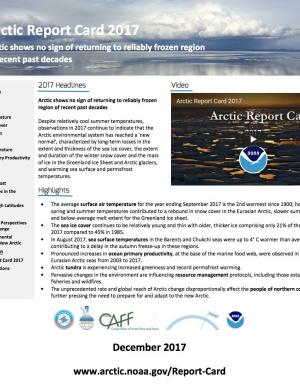
The Arctic shows no sign of returning to reliably frozen region of recent past decades. Despite relatively cool summer temperatures, observations in 2017 continue to indicate that the Arctic environmental system has reached a "new normal," characterized by long-term losses in the extent and thickness of the sea ice cover, the extent and duration of the winter snow cover and the mass of ice in the Greenland Ice Sheet and Arctic glaciers, and warming sea surface and permafrost temperatures. Issued annually since 2006, the Arctic Report Card is a timely and peer-reviewed source for clear, reliable, and concise environmental information on the current state of different components of the Arctic environmental system relative to historical records. The report is intended for a wide audience, including scientists, teachers, students, decision makers, and the general public interested in the Arctic environment and science.
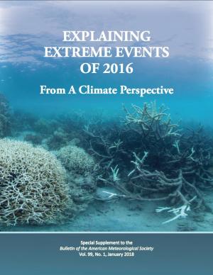
This BAMS special report presents assessments of how human-caused climate change may have affected the strength and likelihood of individual extreme events. This sixth edition of explaining extreme events of the previous year (2016) from a climate perspective is the first of these reports to find that some extreme events were not possible in a pre-industrial climate.
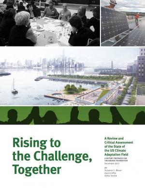
This report acknowledges that climate adaptation has begun to emerge as a field of practice, but states that the work is not evolving quickly or deliberately enough for communities to adequately prepare for the dangerous shocks and stresses that increasingly will be introduced by climate change. The report assesses the current state of the climate adaptation field, provides a vision of what a mature, effective field would look like, and recommends steps that should be taken to realize that vision.
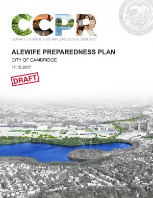
The city of Cambridge, Massachusetts, is developing a Climate Change Preparedness and Resilience Plan as a practical guide to implement specific strategies in response to climate change threats (heat, flooding from precipitation, flooding from sea level rise and storm surge). The Alewife Preparedness Plan—the first neighborhood plan to be developed—will test how the proposed strategies might create a new framework for resiliency in Alewife. It comprises two parts: a Report and a Handbook. The Report provides the context, framework, and strategies to create a prepared and resilient Alewife neighborhood; the Handbook, a companion document, is a practical compendium of specific preparedness and resiliency strategies and best practices.
As a key part of the Fourth National Climate Assessment (NCA4), the U.S. Global Change Research Program (USGCRP) oversaw the production of this stand-alone report of the state of science relating to climate change and its physical impacts. The Climate Science Special Report (CSSR) is designed to be an authoritative assessment of the science of climate change, with a focus on the United States, to serve as the foundation for efforts to assess climate-related risks and inform decision making about responses.
As Volume 1 of NCA4, CSSR serves several purposes, including providing (1) an updated and detailed analysis of the findings of how climate change is affecting weather and climate across the United States; (2) an executive summary and 15 chapters that provide the basis for the discussion of climate science found in the second volume of NCA4; and (3) foundational information and projections for climate change, including extremes, to improve “end-to-end” consistency in sectoral, regional, and resilience analyses within the second volume. CSSR integrates and evaluates the findings on climate science and discusses the uncertainties associated with these findings. It analyzes current trends in climate change, both human-induced and natural, and projects major trends to the end of this century. As an assessment and analysis of the science, CSSR provides important input to the development of other parts of NCA4, and their primary focus on the human welfare, societal, economic and environmental elements of climate change. Much of the underlying report is written at a level more appropriate for a scientific audience, though the Executive Summary is intended to be accessible to a broader audience.
Coastal flooding in the United States is already occurring and the risk of flooding is expected to grow in most coastal regions, in part due to climate change. The Centers for Disease Control and Prevention developed this booklet, aimed at the general public, that identifies steps people can take to prepare for the health risks associated with coastal flooding. The booklet answers some of the key questions about coastal flooding in a changing climate: why these events are on the rise; how it might affect health; and what people can do before, during, and after a coastal flooding event to stay safe. Scientific information used in the document is derived from peer-reviewed synthesis and assessment products, including those published by the U.S. Global Change Research Program and the Intergovernmental Panel on Climate Change, as well as other peer-reviewed sources and federal agency resources.
Delaware is especially vulnerable to the effects of sea level rise (SLR) due to its flat topography, low mean elevation, and significant community development and infrastructure investments along the coast. Rates of relative SLR measured at tide gauges in and around Delaware are approximately twice the rate of global mean SLR. This report provides critical information on future sea level rise for Delaware's decision makers: it can help readers gain a comprehensive understanding of risk and the likelihood of worsening coastal flooding. In addition to the report, the Delaware Geological Survey worked with others to release an updated series of coastal inundation maps that depict the extent of potential inundation from current average high tide (MHHW level) to seven feet above in one-foot increments. These maps can be used as a planning tool for understanding potential future effects of sea level rise or storm surge.
The SWIPA 2017 assessment is the fourth assessment from the Arctic Monitoring and Assessment Programme addressing Arctic climate issues and is a direct follow-up to the first Snow, Water, Ice and Permafrost in the Arctic (SWIPA): Climate Change and the Cryosphere assessment report published in 2011. The SWIPA 2017 assessment was conducted between 2010 and 2016 by an international group of over 90 scientists, experts, and knowledgeable members of the Arctic indigenous communities. Access to reliable and up-to-date information is essential for the development of science-based decision making regarding ongoing changes in the Arctic and their global implications.
This assessment of seven priority hazards was undertaken by the Florida BRACE (Building Resilience Against Climate Effects) program. Existing climate scenarios project heat, drought, and sea level rise vulnerability to the year 2100 with a high, medium, and low range of outcomes for these three hazards. Hurricane winds, storm surge, flooding, and wildland fire are more difficult to project into the future due to a significantly smaller geographic impact; for these four hazards, probability indexes were used in conjunction with historical patterns to explain possible changes to Florida’s long-term weather. Social and medical vulnerability indices were also employed to quantify social and medical vulnerability to these priority hazards.
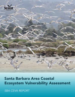
This assessment was a multidisciplinary research project that investigated future changes to southern Santa Barbara County climate, beaches, watersheds, wetland habitats, and beach ecosystems. The target audience is local land use planners and decision makers, and the main objective is to provide information that assists the cities of Santa Barbara, Carpinteria, and Goleta, the County of Santa Barbara, and UC Santa Barbara in climate adaptation planning with a clear focus on coastal ecosystems.
Sea level rise was a major topic of the annual meeting of the National Academy of Engineering held on October 9–10, 2016, and the second day featured a forum on sea level rise adaptation. This summary of the forum, which also incorporates material from Robert J. Nicholls’ plenary presentation, outlines a rich and challenging set of problems for engineers, scientists, and those who work with them.
The Nags Head Comprehensive Plan is an official policy document adopted by the Town of Nags Head to strategically plan for and enhance the quality of life and physical character of the community. The plan, while not regulatory in nature, builds upon adopted plans and policies to provide a foundation for decision making, future regulations, and project development. Further, the plan was created utilizing community input to illustrate a vision for the future of Nags Head and define steps to secure that future.
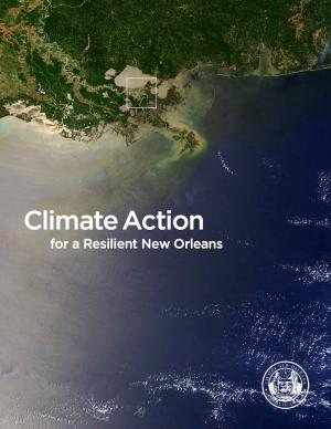
From Mayor Mitchell J. Landrieu's Introduction: As we marked the 10th anniversary of Hurricane Katrina in 2015, we launched the world’s first comprehensive city resilience strategy, Resilient New Orleans, combining local expertise with global best practices to confront our most urgent threats, adapt our city to our changing natural environment, invest in equity, create flexible and reliable systems, and prepare for future shocks.
It is not enough to plan for how we will adapt to climate change. We must end our contribution to it. As the world committed to action in Paris in 2015, so too did we. I signed the Global Covenant of Mayors on Climate & Energy, adding New Orleans to the team of more than 7,400 cities in 119 countries worldwide committed to taking climate action.
In the aftermath of Tropical Storms Irene and Sandy, the population centers of Greater New Haven and Bridgeport recognized significant exposure and vulnerability to their infrastructure, environment, and socioeconomic assets from extreme weather events and a changing climate. To counteract immediate and longer-term risks and broaden dialogue on community resilience building, the Southern Connecticut Regional Framework for Coastal Resilience project was launched. The overarching goal of this project was prioritizing actions and strengthening partnerships by providing proactive risk assessment, community engagement, conceptual design of on-the-ground projects, and this Final Report. The principal purpose of the project was to advance a Regional Resilience Framework—built on projects and partnerships—needed to help improve resilience for over 591,000 residents that represent over 30 percent of Connecticut’s coast. A core goal of this project was to strengthen the resilience of existing and future ecosystems, including a diverse suite of services and co-benefits, alongside existing and future development activities within a population center critical to the state of Connecticut’s future.
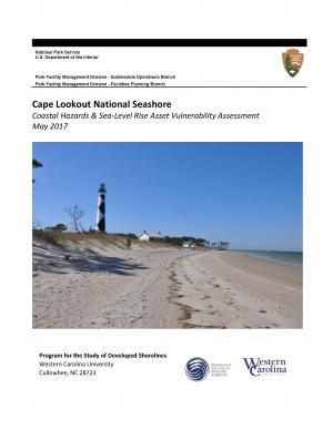
The protocol developed and used in this report is unique in that it is an asset-level assessment of the vulnerability of infrastructure to multiple coastal hazards and climate change factors (e.g., erosion, flooding, storm surge, sea-level rise, and historical flooding) over a 35-year planning horizon (2050). The protocol was applied to all buildings and roads in Cape Lookout National Seashore; the results are summarized in the report.

