Access a range of climate-related reports issued by government agencies and scientific organizations. Browse the reports listed below, or filter by scope, content, or focus in the boxes above. To expand your results, click the Clear Filters link.
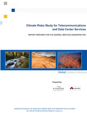
This study investigates how climate change will impact the telecommunications and data center services sector. The report looks not only at the headline-grabbing impacts of extreme weather events, such as those incurred by Hurricane Sandy, but also the risks brought on by slow-onset, gradual changes to the base climate.
This plan—an update to the 2009 California Climate Adaptation Strategy—augments previously identified strategies in light of advances in climate science and risk management options.
This report documents the effort to develop an understanding of possible impacts of climate change and potential future responses by the Towns of Acushnet and Fairhaven and the City of New Bedford, Massachusetts. It focuses specific attention on sea level rise, precipitation, and frequency or intensity of storms that may affect public infrastructure related to water quality and habitat protection.
This plan summarizes the U.S. General Service Administration's approach, accomplishments, plans, actions, and coordination activities to evaluate the agency’s climate change risks and vulnerabilities to manage both the short and long-term effects of climate change on the agency’s mission and operations.
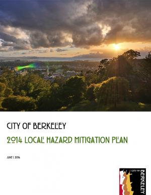
This plan evaluates the risks that different hazards pose to Berkeley and engages the community in dialogue to identify the most important steps that the city and its partners should pursue to reduce these risks. The plan updates the city's plan initially adopted in 2004. To develop the 2004 Disaster Mitigation Plan, the city conducted detailed research on four major natural and two major “man-made” hazards present in Berkeley: earthquake, wildland-urban interface fire, landslide, flood, hazardous materials release, and terrorism. Since that time, new maps and data depicting the extent and possible impacts from tsunami and climate change have become available. In 2011, the city added these hazards to the list and they are incorporated into this plan..
The National Climate Assessment assesses the science of climate change and its impacts across the United States, now and throughout this century. It documents climate change-related impacts and responses for various sectors and regions, with the goal of better informing public and private decision making at all levels.
The assessment draws from a large body of scientific peer-reviewed research, technical input reports, and other publicly available sources; all sources meet the standards of the Information Quality Act. The report was extensively reviewed by the public and experts, including a panel of the National Academy of Sciences, the 13 federal agencies of the U.S. Global Change Research Program, and the Federal Committee on Environment, Natural Resources, and Sustainability.
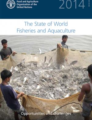
This publication, known by the acronym SOFIA, is released every two years to provide policymakers and civil society with a global view of fisheries and aquaculture and associated policy issues. The 2014 report includes a special study of initial assessments of vulnerabilities to climate change in fisheries and aquaculture. The full archive is available online.
The Intergovernmental Panel on Climate Change (IPCC) Working Group II's contribution to the Fifth Assessment Report (AR5) relates to climate impacts, adaptation, and vulnerability. A Summary for Policymakers and the underlying scientific and technical assessment are also available.
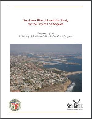
In anticipation of rising sea levels, a team worked to to gauge the impact of rising tides on local communities and infrastructure. This report describes the process and outcomes of efforts to protect at-risk assets through proactive planning and early identification of adaptation measures.
These guidelines—which include climate change and sea level rise considerations—were developed to provide a comprehensive framework for site assessment and alternatives analysis to determine the need for shore protection and identify the technique that best suits the conditions at a given site. There are many guidelines and manuals for the design of "protection" techniques for the more typical open coast, but prior to the Marine Shoreline Design Guidelines (MSDG) there was almost no guidance that reflected the variety of conditions found in Puget Sound. For this reason, the MSDG were created to inform responsible management of Puget Sound shores for the benefit of landowners and shared natural resources.
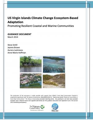
As with the rest of the world and the Caribbean region in particular, the coastal and marine communities of the US Virgin Islands (USVI) are susceptible to the effects of climate change. Hazards include increasingly hazardous coastal conditions and loss of life-sustaining marine, coastal, and island resources. Climate change is anticipated to add to the stresses of the coastal environment by altering temperature and precipitation patterns, increasing the likelihood of extreme precipitation events, and accelerating rates of sea level rise.
Responding and adapting to such changes requires an understanding of the risks; weighing options for adapting to changing conditions; and instituting a suite of strategies to implement, measure, and fund response actions having the most benefits to the ecosystems and communities that depend on those services. With support from National Oceanic and Atmospheric Administration’s (NOAA) Coral Reef Conservation Program, The Nature Conservancy’s (TNC) Caribbean Program directed a project with the objective of developing decision-support tools and conservation strategies that will advance the implementation of ecosystem-based adaptation (EBA) to climate change within the USVI.
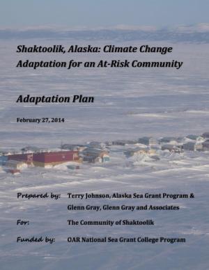
This report describes a community-driven project built on efforts by Shaktoolik and other at-risk, mainly Alaska Native villages on the Bering Sea coast to adapt to potentially devastating effects of climate change. The project involved a multi-party approach to assist the community of Shaktoolik to make a decision whether to relocate or stay at the current location. The result is a well-defined process that may be replicated by other at-risk communities in the region. The final report documents lessons learned, adaptation methods for Shaktoolik, potential funding sources, and a step-by-step action plan to implement the community's decision.
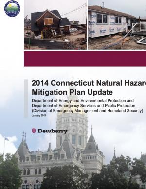
This update serves as guidance for hazard mitigation for the State of Connecticut. Its vision is supported by three central goals, each with an objective, a set of strategies, and associated actions for Connecticut state government, stakeholders, and organizations that will reduce or prevent injury from natural hazards to people, property, infrastructure, and critical state facilities.
This report, the first of its kind for the City of Grand Rapids, outlines the condition of the city's climate resiliency and offers recommendations for how it can both impact and adapt to climate change. The report's goal is to both spur a larger community conversation around processes that will enable Grand Rapids to become a more climate-resilient city and to spur many specific short- and near-term projects, policies, programs, and plans to mitigate the effects of climate change. The report documents projected local climate changes, their potential negative impact to low-income families, and outlines small near-term solutions that the city can make to curb or adapt to climate change. Recommendations include investing in green space and improving the city's tree canopy, improving the city's energy autonomy, and implementing green street infrastructure materials and maintenance techniques.
In 2013, the Baltimore City Department of Planning and Office of Sustainability created the Disaster Preparedness and Planning Project (DP3) as an effort to address existing hazards while simultaneously preparing for predicted hazards due to climate change. This project develops an integrated All Hazards Mitigation Plan, floodplain mapping, and Climate Adaptation Plan program that links research, outreach, and actions to assure implementation of a comprehensive and new risk-preparedness system for addressing existing and future impacts. Integrating hazard mitigation planning, which focuses on past events, with climate adaptation planning, which focuses on what will likely happen in the future, offers a positive, win-win solution for Baltimore City.
The Dane County Climate Change Action Council was formed in March 2013 with a mission to ensure that Dane County government was better prepared for weather extremes brought on by global climate change. The Council facilitated an internal review of county preparations and potential modifications to the operations and capital investments of the county, resulting in this report identifying Dane County’s potential vulnerabilities to weather extremes associated with global climate change and strategies to adapt to a changing climate. The report is the first step in the county’s effort to improve the resiliency of its climate-sensitive resources in the face of climate change; future steps will include cross-departmental collaborations to implement the adaptation strategies outlined in the report.
This report provides a risk-based approach to achieve resilient water security in a changing climate, documents key trends, and highlights best practice from the Organization for Economic Cooperation and Development (OECD) Survey of Policies on Water and Climate Change Adaptation. The report examines options to improve the flexibility of water governance, policy, and financing approaches.
This guidance report helps local health departments leverage existing resources on climate change and public health indicators to make plans and decisions at the local level.
The Sacramento-San Joaquin River Delta is the grand confluence of California’s waters, the place where the state’s largest rivers merge in a web of channels—and in a maze of controversy. In 2009, seeking an end to decades of conflict over water, the California Legislature established the Delta Stewardship Council with a mandate to resolve long-standing issues. The first step toward that resolution is the Delta Plan—a comprehensive management plan for California’s Sacramento-San Joaquin Delta, developed to guide state and local agencies to help achieve the co-equal goals of providing a more reliable water supply for California and protecting, restoring, and enhancing the delta's ecosystem.
Coastal areas are especially vulnerable to hazards, now and in the future, posed by waves and surges associated with sea level change and coastal storms. Coastal risk reduction can be achieved through a variety of approaches, including natural or nature-based features (e.g., wetlands and dunes), nonstructural interventions (e.g., policies, building codes, and emergency response such as early warning and evacuation plans), and structural interventions (e.g., seawalls and breakwaters). This report discusses the U.S. Army Corps of Engineers' capabilities to help reduce risks to coastal areas and improve resilience to coastal hazards through an integrated planning approach.
The City of Marquette is the largest city in Michigan's Upper Peninsula and one of the most economically diverse in the state. The city is especially vulnerable to environmental, economic, and social impacts of climate change, largely because it borders Lake Superior. A team of Michigan State University Extension specialists and educators received funding from the Great Lakes Integrated Sciences and Assessments Center (GLISA) to collaborate with GLISA researchers, relevant decision makers, and stakeholders in Marquette to increase community resilience through incorporating climate variability and change adaption strategies into local land use master plans and policies. Key stakeholders in the agriculture, forestry, natural resources, health, planning, and tourism fields participated in the development of climate change concerns and strategies. Overwhelmingly, residents and local leaders wanted to protect the natural environment that makes Marquette such a desirable place to live. This report details the process and results of this community-driven process, and also contains specific, detailed GIS maps of the region that reflect the climate vulnerabilities and concerns of the residents and leaders in the Marquette region.
NOTE: This report inspired the creation of another report: "Climate and Health Adaptation Planning Guide for Michigan Communities"
The United States' 28 National Estuarine Research Reserves (NERR) are experiencing negative effects of human and climate-related stressors, according to this report. This is the first national-scale climate sensitivity analysis of estuaries to help coastal managers protect the health of estuaries.
This report examines current and potential future impacts of climate trends on the U.S. energy sector.
PlaNYC is a long-term sustainability plan based on the latest climate science. This report includes ideas on how to rebuild the communities in New York City affected by Hurricane Sandy in 2012 and how to increase resilience and infrastructure of buildings city-wide in order to protect against future extreme events.
A contribution to the 2013 National Climate Assessment, this report is a summary and synthesis of the past, present, and projected future of the Southwest region’s climate. It emphasizes new information and understandings since publication of the previous national assessment in 2009.
The Resilience Measurement Index (RMI) was formulated to capture the fundamental aspects of resilience for critical infrastructure with respect to all hazards. The RMI methodology supports decision making related to risk management, disaster response, and maintenance of business continuity. It complements other indices that have been developed―the Protective Measures Index and the Consequences Measurement Index―and thus, in combination with other tools, allows critical infrastructure to be compared in terms of resilience, vulnerability, consequences, and ultimately risk.
This report assesses the state of climate knowledge, impacts, and adaptive capacity of Hawai‘i and the U.S.-Affiliated Pacific Islands (USAPI). Federal, state, and local government agencies, non-government organizations, businesses, and community groups worked together to produce the report. Its aim is to inform people about climate and help them prioritize their activities in the face of a changing climate.
This brochure shares some of the lessons learned from climate-ready estuary projects in New England from 2008 to 2012.
This guide is targeted towards program managers who work in climate change and health adaptation, and provides them with practical information and concrete guidance to mainstream gender throughout all four phases of the project cycle: identification, formulation and design, implementation, and monitoring and evaluation.
The Oregon Department of Transportation (ODOT) has developed this adaptation strategy, which is inclusive of an impact assessment for its infrastructure and operations. The purpose of the strategy is to provide a preliminary assessment of the climate change impacts to ODOT’s assets and systems operations, underline the need for a vulnerability and risk assessment, and identify current areas of adaptive capacity and potential long- and short-term actions to be taken by ODOT.
Oxfam America, in their work to shed light on the vulnerability of the geography and people of the U.S. Southeast, commissioned two reports from the Hazards and Vulnerability Research Institute at the University of South Carolina. The first one covers the entire 13-state region, while the second one contains much more detail about Louisiana and Mississippi. This document provides a brief overview of the findings, the concepts, and the methodology. The aim of these materials is to be useful tools to people in coastal communities, and to decision makers shaping policies in the region.
This Technical Input to the Third National Climate Assessment examines vulnerabilities of infrastructures and urban systems to extreme weather and other events associated with climate change.
The Washington State Department of Transportation prepared this report in fulfillment of a grant from the Federal Highway Administration to test its conceptual climate risk assessment model developed for transportation infrastructure. WSDOT applied the model using scenario planning in a series of statewide workshops, using local experts, to create a qualitative assessment of climate vulnerability on its assets in each region and mode across Washington.
Extreme weather and climate events, interacting with exposed and vulnerable human and natural systems, can lead to disasters. This Special Report explores the challenge of understanding and managing the risks of climate extremes to advance climate change adaptation. Some types of extreme weather and climate events have increased in frequency or magnitude, but populations and assets at risk have also increased, with consequences for disaster risk. Opportunities for managing risks of weather- and climate-related disasters exist or can be developed at any scale, local to international.
This report was prepared for the New York State Department of Transportation to help them identify the vulnerabilities of the state’s transportation system, as well as opportunities to adapt the system and mainstream adaptation into the transportation decision-making process.
The report provides a comprehensive overview of observed and predicted changes to Massachusetts’ climate and the anticipated impacts. It also describes potential adaptation strategies the state may take to prepare for climate change.

