Access a range of climate-related reports issued by government agencies and scientific organizations. Browse the reports listed below, or filter by scope, content, or focus in the boxes above. To expand your results, click the Clear Filters link.
The Northern Rockies Adaptation Partnership identified climate change issues relevant to resource management in the Northern Rockies region and developed solutions intended to minimize negative effects of climate change and facilitate transition of diverse ecosystems to a warmer climate. Their vulnerability assessment emphasizes water, fisheries, wildlife, forest and rangeland vegetation and disturbance, recreation, cultural heritage, and ecosystem services, which are regarded as key resource areas for local ecosystems and communities. Resource managers used the assessment to develop a detailed list of ways to address climate change vulnerabilities through management actions. The large number of adaptation strategies and tactics, many of which are a component of current management practice, provide a pathway for slowing the rate of deleterious change in resource conditions.
The Northern Rockies Adaptation Partnership identified climate change issues relevant to resource management in the Northern Rockies region and developed solutions intended to minimize negative effects of climate change and facilitate transition of diverse ecosystems to a warmer climate. Their vulnerability assessment emphasizes water, fisheries, wildlife, forest and rangeland vegetation and disturbance, recreation, cultural heritage, and ecosystem services, which are regarded as key resource areas for local ecosystems and communities. Resource managers used the assessment to develop a detailed list of ways to address climate change vulnerabilities through management actions. The large number of adaptation strategies and tactics, many of which are a component of current management practice, provide a pathway for slowing the rate of deleterious change in resource conditions.
This guide contains five modules that provide best practices on conducting vulnerability assessments, collaboration among stakeholders, communicating drought preparedness and response strategies, and where to find (and how to use) data on drought. The guide also includes a list of valuable resources for public health professionals. The authors of the guide also developed and included two attractive, user-friendly handouts that can be easily customized and reproduced for community outreach.
The goal of this concerted effort is to help Thurston County (Washington) and the broader South Puget Sound region prepare for and adjust to climate change. The Thurston Regional Planning Council crafted this document with a $250,000 National Estuary Program grant from the U.S. Environmental Protection Agency and significant in-kind support from the community. Partners included representatives from tribes, municipalities, universities, nonprofits, businesses, and other entities within the project area: three geographically diverse watersheds (Nisqually, Deschutes, and Kennedy-Goldsborough) within Thurston County that drain into Puget Sound. The watersheds encompass beaches, rivers, lakes, wetlands, highlands, forests, farms, ranches, cities, towns, and tribal reservations. It is the Council's hope that other communities throughout the Puget Sound region, state, and nation will replicate this project’s science-based assessments, innovative public-engagement efforts (including development of a resilience game), collaborative planning processes, economic analyses, and comprehensive actions.
During late 2016, the National Integrated Drought Information System, the National Drought Mitigation Center, the Midwestern Regional Climate Center, and other regional partners convened four stakeholder meetings in the Midwest Drought Early Warning System. Each of these meetings included a historical drought overview and climate outlook for the region, discussion of critical drought-related needs and challenges, exploration of available tools, local drought planning and management approaches, and strategy development to improve drought early warning and resiliency in the Midwest.
This BAMS special report presents assessments of how human-caused climate change may have affected the strength and likelihood of individual extreme events. This sixth edition of explaining extreme events of the previous year (2016) from a climate perspective is the first of these reports to find that some extreme events were not possible in a pre-industrial climate.
As a key part of the Fourth National Climate Assessment (NCA4), the U.S. Global Change Research Program (USGCRP) oversaw the production of this stand-alone report of the state of science relating to climate change and its physical impacts. The Climate Science Special Report (CSSR) is designed to be an authoritative assessment of the science of climate change, with a focus on the United States, to serve as the foundation for efforts to assess climate-related risks and inform decision making about responses.
As Volume 1 of NCA4, CSSR serves several purposes, including providing (1) an updated and detailed analysis of the findings of how climate change is affecting weather and climate across the United States; (2) an executive summary and 15 chapters that provide the basis for the discussion of climate science found in the second volume of NCA4; and (3) foundational information and projections for climate change, including extremes, to improve “end-to-end” consistency in sectoral, regional, and resilience analyses within the second volume. CSSR integrates and evaluates the findings on climate science and discusses the uncertainties associated with these findings. It analyzes current trends in climate change, both human-induced and natural, and projects major trends to the end of this century. As an assessment and analysis of the science, CSSR provides important input to the development of other parts of NCA4, and their primary focus on the human welfare, societal, economic and environmental elements of climate change. Much of the underlying report is written at a level more appropriate for a scientific audience, though the Executive Summary is intended to be accessible to a broader audience.
The Montana Climate Assessment (MCA) synthesizes, evaluates, and shares credible and relevant scientific information about climate change in Montana with the citizens of the state. The motivation for the MCA arose from citizens and organizations in Montana who have expressed interest in receiving timely and pertinent information about climate change, including information about historical variability, past trends, and projections of future impacts as they relate to topics of economic concern. This first assessment reports on climate trends and their consequences for three of Montana’s vital sectors: water, forests, and agriculture.
With support from the Minnesota Pollution Control Agency, the Region Nine Development Commission created this plan to assess South Central Minnesota’s vulnerability to climate change and create strategies for the region to adapt to climate change. Region Nine, working in tandem with a Climate Change Adaptation Task Force, identified eight top priority sectors to prioritize the planning process: agriculture, water, human health, energy, transportation, forests, ecosystems, business, and economy. The result of the planning process was real, actionable strategies that can be used as a guide to initiate discussions and begin a planning process in Region Nine communities.
This Technical Report presents results from a large set of sectoral impact models that quantify and monetize climate change impacts in the U.S., with a primary focus on the contiguous U.S., under moderate and severe future climates. The report summarizes and communicates the results of the second phase of quantitative sectoral impacts analysis under the Climate Change Impacts and Risk Analysis (CIRA) project. The effort is intended to inform the fourth National Climate Assessment (NCA4) of the U.S. Global Change Research Program (USGCRP). The goal of this work is to estimate climate change impacts and economic damages to multiple U.S. sectors (e.g., human health, infrastructure, and water resources) under different scenarios. Though this report does not make policy recommendations, it is designed to inform strategies to enhance resiliency and protect human health, investments, and livelihoods.
Green infrastructure can help to maximize the environmental, economic, and social benefits of parks. This guide from EPA encourages partnerships between park agencies and stormwater agencies to promote the use of green infrastructure on park lands to improve park lands and access to parks, better manage stormwater, increase community resiliency to shifting weather patterns, and provide funding to implement and maintain park enhancements that benefit the community. Using a stepwise approach for building relationships with potential partners, the guide includes information on how to identify and engage partners, build relationships, involve the community, leverage funding opportunities, and identify green infrastructure opportunities. It includes recommendations on the types of projects that are most likely to attract positive attention and funding and that provide a wide range of benefits. Included case studies from across the country illustrate approaches presented in the guide.
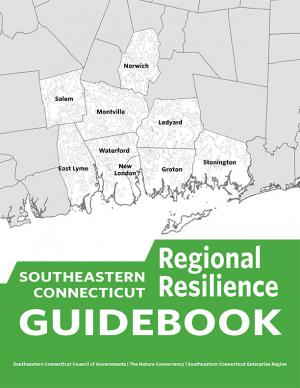
This guidebook results from the culmination of a year of dialogue among diverse stakeholders in southeastern Connecticut who defined challenges and solutions from extreme weather, climate change, and shifting social and economic conditions. Participants included representatives from nine municipalities, public and private utilities, public health departments, chambers of commerce, major employers, conservation organizations, academic institutions, community non-profits, and state agencies, among others. The dialogue captured six themed planning sectors (water, food, ecosystem services, transportation, energy, and regional economy) in a process that used surface and integrated solutions to address singular and multiple challenges across planning sectors. The guidebook provides a quick reference resource to help shape and inform actions that will advance a regional resilience framework for southeastern Connecticut; an accompanying Summary of Findings captures the project's final outcomes and conclusions, as well as providing a comprehensive account of the objectives, process, and details.
This user-friendly summary is based on the 2015 report “City of Long Beach Climate Resiliency Assessment Report" and “Appendices” prepared by the Aquarium of the Pacific at the request of Mayor Robert Garcia. The report includes clear infographics that describe current and projected conditions in the city. It also describe what the city is currently doing and what else the city and its residents can do.
This report documents that the average temperature in 2015 was over one degree higher than pre-industrial times and that the period 2011–2015 was the warmest five-year period on record, consistent with established warming trends. The report further documents that in 2015 another milestone was reached, with globally averaged CO2 levels of 400 parts per million (ppm). The year 2016 is on track to be even warmer and will be the first year in which CO2 at the Mauna Loa Observatory remains above 400 ppm all year, and for many generations to come.
The probability of extreme climate events since 2011, especially those involving extreme high temperatures, has been substantially increased by climate change, often by a factor of 10 or more. The single most significant event in humanitarian terms, with over 250,000 lives lost, was the 2011–2012 famine in the Horn of Africa, where drought was a major factor.
This report makes a case for the One Water approach, highlighting successful strategies and real-world examples of One Water management in practice. The roadmap highlights approaches that water utilities, businesses, agricultural groups, and municipalities, are implementing to build a secure water future for all. The roadmap is organized around six arenas for action: Reliable and Resilient Utilities, Thriving Cities, Competitive Business and Industry, Sustainable Agricultural Systems, Social and Economic Inclusion, and Healthy Waterways.
This report features observed trend data on 37 climate indicators, including U.S and global temperatures, ocean acidity, sea level, river flooding, droughts, and wildfires. It documents rising temperatures, shifting patterns of snow and rainfall, and increasing numbers of extreme climate events, such as heavy rainstorms and record high temperatures. Many of these observed changes are linked to the rising levels of carbon dioxide and other greenhouse gases in our atmosphere, caused by human activities.
This document provides final guidance for federal agencies on how to consider the impacts of their actions on global climate change in their National Environmental Policy Act (NEPA) reviews, providing a framework for agencies to consider both the effects of a proposed action on climate change, as indicated by its estimated greenhouse gas emissions, and the effects of climate change on a proposed action. The memorandum applies to all types of proposed federal agency actions that are subject to NEPA analysis and guides agencies on how to address the greenhouse gas emissions from federal actions and the effects of climate change on their proposed actions within the existing NEPA regulatory framework.
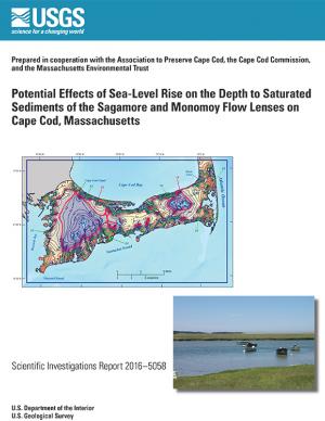
In 2014, the U.S. Geological Survey, in cooperation with the Association to Preserve Cape Cod, the Cape Cod Commission, and the Massachusetts Environmental Trust, began an evaluation of the potential effects of sea-level rise on water table altitudes and depths to water on central and western Cape Cod, Massachusetts. Researchers found that the potential does exist for groundwater inundation in some areas, but the effects of sea-level rise on depths to water and infrastructure likely will not be substantial on a regional level.
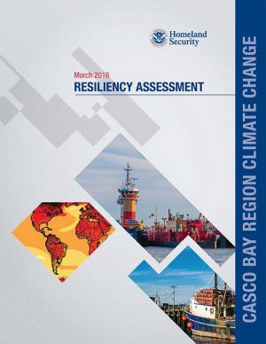
The State of Maine is experiencing shifts in atmospheric and oceanographic conditions that put it at the precipice of abrupt climate change. This report—part of the Department of Homeland Security's Regional Resiliency Assessment Program (RRAP)—focuses on the local and regional consequences of climate disruptions and their impacts on critical infrastructure in the Casco Bay region, the most developed and populous region in Maine. The report identifies vulnerabilities that may potentially affect the region’s ability to maintain its critical infrastructure systems and recover from the impacts of climate change.
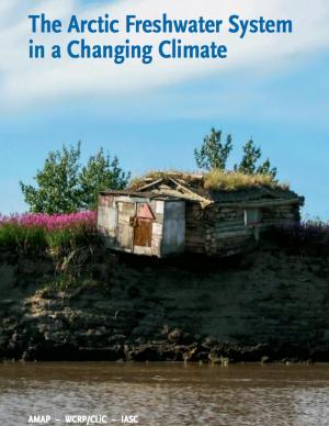
The Arctic is changing at a startling pace. Understanding the role of freshwater in these changes—both how Arctic freshwater systems are affected by climate change, and how changes to the Arctic freshwater system will affect other environmentally relevant processes—is critical to understanding how these changes will affect the lives of people living in the Arctic and beyond. This report is intended to inform the non-expert reader about these changes to the freshwater systems in the Arctic, and their implications.
The SECURE Water Report identifies climate change as a growing risk to Western water management and cites warmer temperatures, changes to precipitation, snowpack and the timing and quality of streamflow runoff across major river basins as threats to water sustainability. Water supply, quality and operations; hydropower; groundwater resources; flood control; recreation; and fish, wildlife and other ecological resources in the Western states remain at risk.
President Obama issued this Memorandum and Action Plan on building long-term drought resilience under his Climate Action Plan. The document elucidates the role of the National Drought Resilience Partnership, a team of federal agencies, in helping communities manage the impact of drought by linking information—such as forecasts and early warnings—with drought preparedness strategies in critical sectors like agriculture, municipal water systems, tourism, and transportation.
This fact sheet presents recent climate change investigations of the U.S. Geological Survey in New England using selected recent publications that highlight the broad spectrum of expertise and commitment to understanding the relations of climate change and water resources in the region.
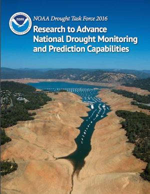
Drought threatens our country’s natural resources, economy, and overall health. Increasingly, NOAA is charged with providing and improving information that helps stakeholders at all levels manage water resources in a more resilient and climate-smart manner. Working with input from farmers, ranchers, natural resource managers, and other drought-impacted industries and populations, NOAA research has worked to improve drought monitoring and prediction for better planning and mitigation of impacts.
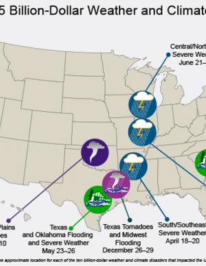
The National Centers for Environmental Information (NCEI) is the nation's scorekeeper in terms of addressing severe weather and climate events in their historical perspective. As part of its responsibility of monitoring and assessing the climate, NCEI tracks and evaluates climate events in the U.S. and globally that have great economic and societal impacts. Found on these webpages are information on the weather and climate events that have had the greatest economic impact from 1980 to 2015. The U.S. has sustained 188 weather and climate disasters since 1980 where overall damages/costs reached or exceeded $1 billion (including CPI adjustment to 2015). The total cost of these 188 events exceeds $1 trillion.
In January 2015, Long Beach Mayor Robert Garcia asked the Aquarium of the Pacific to take a lead in assessing the primary threats that climate change poses to Long Beach, to identify the most vulnerable neighborhoods and segments of the population, and to identify and provide a preliminary assessment of options to reduce those vulnerabilities. Over the course of 2015, the Aquarium hosted and participated in meetings and workshops with academic and government scientists, business and government leaders, local stakeholders, and Long Beach residents to discuss key issues facing our community as the result of climate change. This report, completed in December 2015, represents the culmination of these efforts. The report offers detailed assessments of the five main threats of climate change to Long Beach: drought, extreme heat, sea level rise and coastal flooding, deteriorating air quality, and public health and social vulnerability. It also provides an overview of what is currently being done to mitigate and adapt to these threats, and other options to consider. Finally, this report presents a series of steps and actions that city leaders and community stakeholders can use as a template for making Long Beach a model of a climate resilient city.
King County, Washington's Strategic Climate Action Plan sets forth strategies for reducing greenhouse gas emissions and preparing for climate change impacts.
This guide offers a collection of 19 practical strategies for building owners to make their properties more resilient against the effects of extreme weather events. It draws on advice from over 50 experts in the field of resilience as well as the Federal Emergency Management Agency (FEMA) and the National Flood Insurance Program (NFIP). In addition, the manual offers guidance on determining a property’s vulnerability to various hazards, finding which strategies are relevant to a particular building, and getting started with a resilience plan.
Three years after Superstorm Sandy devastated parts of New York City, the housing stock in many urban coastal areas remains vulnerable to flooding. Much of the housing stock in these high-risk areas is out of compliance with federal flood-resistant design and construction standards.The report illustrates the significant design and financial hurdles of retrofitting multifamily housing common to many urban, coastal areas, describes existing policies and design approaches and their shortfalls, and provides recommendations for state and local practitioners to improve resilience of multi-family housing in their communities.
The Hawai‘i Fresh Water Initiative was launched in 2013 to bring multiple, diverse parties together to develop a forward-thinking and consensus-based strategy to increase water security for the Hawaiian Islands. This Blueprint is the result of the work of the Hawai‘i Fresh Water Council, and provides Hawai‘i policy and decision makers with a set of solutions that have broad, multisector support in the fresh water community that should be adopted over the next three years to put Hawai‘i on a path toward water security. The ultimate goal of the initiative is to create 100 million gallons per day in additional, reliable fresh water capacity for the islands by 2030. The report outlines three aggressive water strategy areas with individual targets.
Many climate-related hydrologic variables in New England have changed in the past century, and many are expected to change during the next century. It is important to understand and monitor these changes because they can affect human water supply, hydroelectric power generation, transportation infrastructure, and stream and riparian ecology. This report describes a framework for hydrologic monitoring in New England by means of a climate-response network.
The State of New Hampshire has initiated a coordinated effort to proactively prepare for the effects of climate change on the natural and human resources of New Hampshire. An important aspect of this effort is to develop a vulnerability assessment of hydrologic response to climate change. The U.S. Geological Survey, in cooperation with the New Hampshire Department of Health and Human Services, is developing tools to predict how projected changes in temperature and precipitation will affect change in the hydrology of watersheds in the State. This study is a test case to assemble the information and create the tools to assess the hydrologic vulnerabilities in four specific watersheds.
Successfully negotiating climate change challenges will require integrating a sound scientific basis for climate preparedness into local planning, resource management, infrastructure, and public health, as well as introducing new strategies to reduce greenhouse gas emissions or increase carbon sequestration into nearly every sector of California’s economy. This Research Plan presents a strategy for developing the requisite knowledge through a targeted body of policy-relevant, California-specific research over three to five years (from early 2014), and determines California’s most critical climate-related research gaps.
This report builds on Maine’s earlier report from 2009—it is not intended as a comprehensive revision of all aspects of the original report. This update focuses on highlights of the understanding in 2015 of past, present, and future trends in key indicators of a changing climate specific to Maine, and recent examples of how Maine people are experiencing these changes.
The Resilient Strategies Guide for Water Utilities provides options for drinking water, wastewater, and stormwater utilities to assist them in developing plans that contain strategies that address their specific needs and priorities.
The Guide outlines the resilience planning process and helps you to identify potential strategies and promote a better understanding of resilience strategies. At the end of the Guide, you can download a report containing all of your selections and submitted information.
Western Water Assessment, in collaboration with the University of Colorado Boulder and Colorado State University, conducted a broad study of climate vulnerability for the state of Colorado. Drawing from existing data and peer-reviewed research, the study summarizes the key challenges facing seven sectors: ecosystems, water, agriculture, energy, transportation, outdoor recreation and tourism, and public health.

