Access a range of climate-related reports issued by government agencies and scientific organizations. Browse the reports listed below, or filter by scope, content, or focus in the boxes above. To expand your results, click the Clear Filters link.
The Working Group II contribution to the IPCC Sixth Assessment Report assesses the impacts of climate change, looking at ecosystems, biodiversity, and human communities at global and regional levels. It also reviews vulnerabilities and the capacities and limits of the natural world and human societies to adapt to climate change.
The Sea Level Rise Technical Report provides the most up-to-date sea level rise projections available for all U.S. states and territories; decision-makers will look to it for information.
This multi-agency effort, representing the first update since 2017, offers projections out to the year 2150 and information to help communities assess potential changes in average tide heights and height-specific threshold frequencies as they strive to adapt to sea level rise.
The State Climate Summaries provided here were initially produced to meet the demand for state-level climate information in the wake of the Third U.S. National Climate Assessment. This 2022 version provides new information and extends the historical climate record to 2020 for each state. The summaries cover assessment topics directly related to NOAA’s mission, specifically historical climate variations and trends, future climate model projections of climate conditions during the 21st century, and past and future conditions of sea level and coastal flooding. Additional background information and links are given below.
The Vermont Climate Action Plan aims to dramatically reduce greenhouse gas emissions, help protect Vermont communities and landscapes from the greatest risks of climate change, and create new clean energy industry and jobs. The Climate Action Plan includes strategies to:
- Reduce greenhouse gas emissions from the transportation, building, regulated utility, industrial, commercial, and agricultural sectors;
- Encourage smart growth and related strategies;
- Achieve long-term sequestration and storage of carbon and promote best management practices to achieve climate mitigation, adaption, and resilience on natural working lands;
- Achieve net zero emissions by 2050 across all sectors;
- Reduce energy burdens for rural and marginalized communities;
- Limit the use of chemicals, substances, or products that contribute to climate change; and
- Build and encourage climate adaptation and resilience of Vermont communities and natural systems.
The Climate Action Plan serves as a guide for the Vermont Legislature in setting policy that supports climate change solutions for Vermonters and Vermont's landscape.
A range of resources documenting report preparation are available in the Climate Action Plan Appendices.
Over the course of January to March 2021, Climate XChange and Fairmount-Indigo CDC Collaborative engaged in conversations with frontline community leaders across Massachusetts. These discussions sought to understand the challenges they see in their communities, comprehend their long-term vision for solutions, gather their priorities for how investments should be spent, and identify ways to make the benefits of investments accessible to all. The researchers talked with individuals from organizations working in communities of color and low-income communities, labor unions, women-led organizations, local colleges, and organizations representing communities affected by sea level rise. This report presents key recommendations that represent the qualities and values that every investment package moving forward should exhibit.
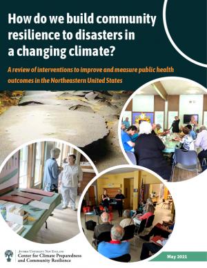
This review examines the peer-reviewed literature on community resilience interventions and metrics that may apply to the Northeastern region of the United States. The overarching goal is to inform local public health practitioners and planners about the availability of evidence-based strategies to strengthen and measure community resilience to climate change-related disasters. It discusses five selected strategies, their applicability at a local public health level, and the metrics used to measure the extent to which community resilience had been strengthened.
In 2020, New York City's Mayor’s Office of Resiliency initiated an engagement process, called the Climate Knowledge Exchange, to align research with climate resiliency and adaptation needs. This report is the first in an annual series that will maintain a public agenda for climate research in NYC. The report communicates NYC’s research needs to external partners, including academic scientists, federal researchers, philanthropic foundations, and community organizations. This in turn will catalyze new and creative partnerships to develop credible and actionable research products that address NYC’s most pressing climate challenges. The report includes the engagement methodology and survey text used with various agencies.
This report's subtitle is Managing the Uncertainty of Future Sea Level Change and Extreme Water Levels for Department of Defence Coastal Sites Worldwide.
From the Executive Summary: Global change, including climate change, poses unique challenges to the Department of Defense (DoD). In particular, coastal military sites, and their associated natural and built infrastructure, operations, and readiness capabilities, are vulnerable to the impacts of rising global sea level and local extreme water level (EWL) events. This report and its accompanying scenario database provide regionalized sea level and EWL scenarios for three future time horizons (2035, 2065, and 2100) for 1,774 DoD sites worldwide. The global nature of DoD’s presence required a broad and comprehensive approach that to this point has been lacking in similar efforts.
As sea levels rise along the Northeastern U.S., coastal forest ecosystems are being impacted. To better enable climate-smart decision-making, the U.S. Department of Agriculture Northeast Climate Hub engaged researchers at Rutgers University to conduct a synthesis of the current state of knowledge concerning how Northeastern U.S. coastal forests, specifically those in mid-Atlantic and southern New England states (VA, MD, DE, NJ, NY, CT, and MA), are responding to impacts from climate change. Drawing upon the scientific literature, expert interviews, and a January 2020 convening of scientists and land managers at the U.S. National Agricultural Library, Beltsville, Maryland, this synthesis identifies key knowledge gaps as well as potential management approaches.
Each region of the United States experiences climate change and its impacts on health differently, due to the regions’ location-specific climate exposures and unique societal and demographic characteristics. This document describes the various health impacts climate change will have on different regions of the United States as outlined in the Fourth National Climate Assessment (NCA4), actions taken by the CDC Climate and Health Program’s health department partners to prepare for and respond to climate change in their communities, and relevant tools and resources.
Climate migration—the preemptive movement of people and property away from areas experiencing severe impacts—is one way to improve climate resilience. This report reviews federal support for climate migration, examining the use of climate migration as a resilience strategy, federal support for climate migration, key challenges to climate migration, and how the federal government can address them. A literature review and interviews with climate resilience experts was conducted, with 46 stakeholders selected and interviewed in four communities that have considered relocation: Newtok, Alaska; Santa Rosa, California; Isle de Jean Charles, Louisiana; and Smith Island, Maryland.
This report provides national, regional, and local information to support effective decision making by U.S. agricultural producers, resource managers, and other agricultural system stakeholders. A set of 20 indicators identifies high-priority agricultural and climate data products while providing the basis for tracking climate change as it plays out across American working lands, toward devising adaptive operational responses.
The report was written as input to the sustained National Climate Assessment process to provide a discrete set of variables that describe linkages between climate trends and variability and U.S. agriculture in recent decades. An additional objective is that the indicators themselves (along with the frameworks for constructing location- and operation-specifc indicators) provide an information resource that can help information service programs, such as USDA’s Climate Hubs, evaluate operational risks posed by climate change in specifc production systems across the country.
Planning for climate change resiliency is an increasingly pressing requirement for communities throughout the world and the Delaware Valley Regional Planning Commission (DVRPC) region. In order to help local officials, non-profits, and communities with this process, numerous planning tools have been developed by a wide range of public and private agencies. Accordingly, the purpose of this paper is to explain, organize, and prioritize the tools that currently exist in order to select ones that are broadly accessible to a wide range of organizations, applicable across a range of sectors, and not overly redundant. During this selection process, a list of over 60 tools was winnowed down to a final toolkit of 18 that are particularly useful at any stage in the resiliency planning process and can be used for communities throughout the DVRPC region.
While all people living in the United States are affected by climate change, some communities and some populations are more vulnerable to changing climate conditions than others. This final report from a NOAA-funded project in New Jersey highlights current evidence regarding impacts of changing climate-related coastal hazards on socially vulnerable populations, identify opportunities to address needs of socially vulnerable populations as part of coastal community climate resilience planning, and outlines possible options for coastal management policy that may enhance efforts to address needs of socially vulnerable populations as part of coastal community resilience efforts.
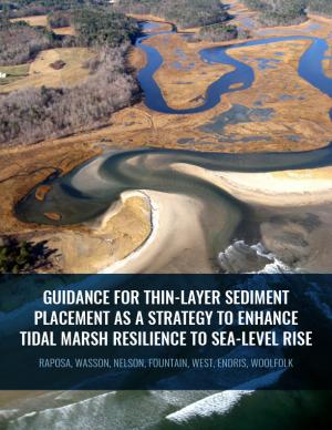
Thin-layer placement (TLP), an emergent adaptation strategy that mimics natural sediment deposition processes, is one of the only viable options to protect tidal marshes from sea level rise in their current footprint. To improve the success of thin-layer placement projects, a collaborative research team at Narragansett Bay and Elkhorn Slough led coordinated restoration experiments at eight National Estuarine Research Reserves on the U.S. East and West coasts to test TLP across diverse marsh plant communities, and produced guidance and recommendations for TLP use. This guidance document is intended to help restoration practitioners, property owners, coastal managers, and funders better understand this strategy for tidal marsh restoration and resilience in the face of sea level rise.
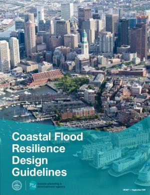
The Design Guidelines serve as a reference for residents, business owners, and developers to translate flood resiliency strategies into best practices. They include a resilience toolkit to address building form, building envelope, and site access; description and supporting information on technical and cost considerations, insurance factors, and sustainable design co-benefits; guidance on urban design, accessibility, and public realm matters related to changes in elevation between a site and surrounding infrastructure; measures to manage additional climate hazards; and case studies that apply resilience strategies from the toolkit to representative building types in the future flood zone. The Guidelines will also be used to administer a future Coastal Flood Resilience Zoning Overlay District.
This guide is designed to help transportation practitioners understand how and where nature-based and hybrid solutions can be used to improve the resilience of coastal roads and bridges. It summarizes the potential flood-reduction benefits and co-benefits of these strategies, then follows the steps in the project delivery process, providing guidance on considering nature-based solutions in the planning process, conducting site assessments, key engineering and ecological design considerations, permitting approaches, construction considerations, and monitoring and maintenance strategies. The guide also includes appendices with site characterization tools, decision support for selecting nature-based solutions, suggested performance metrics, and links to additional tools and resources.
Regional adaptation fora (RAFs) are regional climate change adaptation conferences associated with the National Adaptation Forum. There are six RAFs: the California Adaptation Forum, the Carolinas Climate Resilience Conference, the Great Lakes Adaptation Forum, Local Solutions: Eastern Climate Preparedness Conference, the Southeast Florida Climate Change Compact Summit, and the Southwest Adaptation Forum. This report presents analysis and information drawn from the 2018 RAFs to gain insight about the state of the field, assess opportunities for the field to leverage the RAFs to accelerate dissemination and uptake of promoting promising adaptation practices across regions, and determine how the American Society of Adaptation Professionals can best support the RAFs going forward. The top finding is that RAFs are moving the needle for adaptation professionals and the field. The report serves as a testament to the need for, and value of, regional adaptation fora and encourages increased investment in these events and greater coordination between them.
Flooding is the natural hazard with the greatest economic and social impact in the United States, and these impacts are becoming more severe over time. This report contributes to existing knowledge on urban flooding by examining real-world examples in specific metropolitan areas: Baltimore, Houston, Chicago, and Phoenix. The report identifies commonalities and variances among the case study metropolitan areas in terms of causes, adverse impacts, unexpected problems in recovery, or effective mitigation strategies, as well as key themes of urban flooding. It also relates, as appropriate, causes and actions of urban flooding to existing federal resources or policies.
Georgetown Climate Center (GCC) prepared this report to help the Eastern Shore Climate Adaptation Partnership (ESCAP) identify strategies for adapting to increasing sea level rise and flood risk in the Eastern Shore region of Maryland. ESCAP worked with the Eastern Shore Regional GIS cooperative to assess sea level rise vulnerabilities in the six counties and two municipalities that participate in ESCAP. GCC and the University of Maryland Environmental Finance Center helped to identify potential legal and policy options for enhancing flood resilience in Eastern Shore communities. This report summarizes how more rural jurisdictions, like those on the Eastern Shore, can enhance flood resilience by updating local land use ordinances and floodplain regulations and by pursuing other non-regulatory options, including acquiring flood-prone properties, preserving open space in the floodplain, and coordinating regionally on public outreach and education programs.
The EWN Atlas is a collection of 56 projects illustrating a diverse portfolio of contexts, motivations, and successful outcomes, presented and considered from an Engineering With Nature® perspective to reveal the usefulness of nature-based approaches and the range of benefits that can be achieved. Engineering With Nature is an initiative of the U.S. Army Corps of Engineers enabling more sustainable delivery of economic, social, and environmental benefits associated with water resources infrastructure. EWN intentionally aligns natural and engineering processes to efficiently and sustainably deliver economic, environmental, and social benefits through collaborative processes.
The Global Change Research Act of 1990 mandates that the U.S. Global Change Research Program deliver a report to Congress and the President no less than every four years that “1) integrates, evaluates, and interprets the findings of the Program…; 2) analyzes the effects of global change on the natural environment, agriculture, energy production and use, land and water resources, transportation, human health and welfare, human social systems, and biological diversity; and 3) analyzes current trends in global change, both human-induced and natural, and projects major trends for the subsequent 25 to 100 years.” The Fourth National Climate Assessment (NCA4) fulfills that mandate in two volumes. This report, Volume II, draws on the foundational science described in Volume I, the Climate Science Special Report. Volume II focuses on the human welfare, societal, and environmental elements of climate change and variability for 10 regions and 18 national topics, with particular attention paid to observed and projected risks, impacts, consideration of risk reduction, and implications under different mitigation pathways. Where possible, NCA4 Volume II provides examples of actions underway in communities across the United States to reduce the risks associated with climate change, increase resilience, and improve livelihoods. This assessment was written to help inform decision makers, utility and natural resource managers, public health officials, emergency planners, and other stakeholders by providing a thorough examination of the effects of climate change on the United States.
This analysis examines what's at risk for U.S. coastal real estate from sea level rise. Millions of Americans living in coastal communities will face more frequent and disruptive high-tide flooding; as this flooding increases, it will reach a threshold where normal routines become impossible and coastal residents, communities, and businesses are forced to make difficult, often costly choices. For this analysis, that threshold is defined as flooding that occurs 26 times per year (on average, once every other week) or more, a level of disruption referred to as chronic inundation. The results identify the number of residential and commercial properties at risk of chronic inundation—and the total current property value, estimated population, and property tax base affected—for the entire coastline of the lower 48 states.
Delaware is especially vulnerable to the effects of sea level rise (SLR) due to its flat topography, low mean elevation, and significant community development and infrastructure investments along the coast. Rates of relative SLR measured at tide gauges in and around Delaware are approximately twice the rate of global mean SLR. This report provides critical information on future sea level rise for Delaware's decision makers: it can help readers gain a comprehensive understanding of risk and the likelihood of worsening coastal flooding. In addition to the report, the Delaware Geological Survey worked with others to release an updated series of coastal inundation maps that depict the extent of potential inundation from current average high tide (MHHW level) to seven feet above in one-foot increments. These maps can be used as a planning tool for understanding potential future effects of sea level rise or storm surge.
The city of Cambridge, Massachusetts, is developing a Climate Change Preparedness and Resilience Plan as a practical guide to implement specific strategies in response to climate change threats (heat, flooding from precipitation, flooding from sea level rise and storm surge). The Alewife Preparedness Plan—the first neighborhood plan to be developed—will test how the proposed strategies might create a new framework for resiliency in Alewife. It comprises two parts: a Report and a Handbook. The Report provides the context, framework, and strategies to create a prepared and resilient Alewife neighborhood; the Handbook, a companion document, is a practical compendium of specific preparedness and resiliency strategies and best practices.
In the aftermath of Tropical Storms Irene and Sandy, the population centers of Greater New Haven and Bridgeport recognized significant exposure and vulnerability to their infrastructure, environment, and socioeconomic assets from extreme weather events and a changing climate. To counteract immediate and longer-term risks and broaden dialogue on community resilience building, the Southern Connecticut Regional Framework for Coastal Resilience project was launched. The overarching goal of this project was prioritizing actions and strengthening partnerships by providing proactive risk assessment, community engagement, conceptual design of on-the-ground projects, and this Final Report. The principal purpose of the project was to advance a Regional Resilience Framework—built on projects and partnerships—needed to help improve resilience for over 591,000 residents that represent over 30 percent of Connecticut’s coast. A core goal of this project was to strengthen the resilience of existing and future ecosystems, including a diverse suite of services and co-benefits, alongside existing and future development activities within a population center critical to the state of Connecticut’s future.
This Technical Report presents results from a large set of sectoral impact models that quantify and monetize climate change impacts in the U.S., with a primary focus on the contiguous U.S., under moderate and severe future climates. The report summarizes and communicates the results of the second phase of quantitative sectoral impacts analysis under the Climate Change Impacts and Risk Analysis (CIRA) project. The effort is intended to inform the fourth National Climate Assessment (NCA4) of the U.S. Global Change Research Program (USGCRP). The goal of this work is to estimate climate change impacts and economic damages to multiple U.S. sectors (e.g., human health, infrastructure, and water resources) under different scenarios. Though this report does not make policy recommendations, it is designed to inform strategies to enhance resiliency and protect human health, investments, and livelihoods.
Green infrastructure can help to maximize the environmental, economic, and social benefits of parks. This guide from EPA encourages partnerships between park agencies and stormwater agencies to promote the use of green infrastructure on park lands to improve park lands and access to parks, better manage stormwater, increase community resiliency to shifting weather patterns, and provide funding to implement and maintain park enhancements that benefit the community. Using a stepwise approach for building relationships with potential partners, the guide includes information on how to identify and engage partners, build relationships, involve the community, leverage funding opportunities, and identify green infrastructure opportunities. It includes recommendations on the types of projects that are most likely to attract positive attention and funding and that provide a wide range of benefits. Included case studies from across the country illustrate approaches presented in the guide.
This guidebook results from the culmination of a year of dialogue among diverse stakeholders in southeastern Connecticut who defined challenges and solutions from extreme weather, climate change, and shifting social and economic conditions. Participants included representatives from nine municipalities, public and private utilities, public health departments, chambers of commerce, major employers, conservation organizations, academic institutions, community non-profits, and state agencies, among others. The dialogue captured six themed planning sectors (water, food, ecosystem services, transportation, energy, and regional economy) in a process that used surface and integrated solutions to address singular and multiple challenges across planning sectors. The guidebook provides a quick reference resource to help shape and inform actions that will advance a regional resilience framework for southeastern Connecticut; an accompanying Summary of Findings captures the project's final outcomes and conclusions, as well as providing a comprehensive account of the objectives, process, and details.
New U.S. regional sea level scenarios developed by NOAA and its partners will give coastal communities better, more localized data to help them plan for and adapt to the risk of rising sea levels to their economies and infrastructure.
The National Health Security Strategy of the United States calls on people and their communities to prepare for the threats to health that come with disasters and emergencies, to be ready to protect themselves, and to remain resilient in the face of such threats. The strategy defines resilience as “the sustained ability of communities to withstand, adapt to, and recover from adversity.” How can communities best incorporate resilience into their approaches and practices, especially in light of the potential consequences of climate change? This resource—prepared especially for community-based groups—provides information from the fields of psychology and other social sciences to help communities better understand and prepare for the adverse effects of climate change
This report sets out the broad scope of cultural resources in relation to climate change and identifies major directions of action in cultural resources and climate change for the National Park Service (NPS). These directions in turn will help shape and support collaboration with cultural resource and climate change partners both nationally and internationally. The strategy connects cultural resources to the four areas of NPS climate change response identified in the agency's Climate Change Response Strategy released in 2010: science, adaptation, mitigation, and communication. Approaches and methods from other NPS guidance documents, tools and supporting information, and many park- and partner-based case studies are incorporated throughout.
Climate Ready Boston is an ongoing initiative to help the people and city of Boston to plan for the future impacts of climate change and develop resilient solutions. Boston Mayor Martin J. Walsh describes the challenge and the city's commitment in the report's introduction: "Climate change poses a greater threat to some Bostonians. The very young and very old, people who do not speak English, and those with low incomes or medical illnesses or disabilities are all at elevated risk. By ensuring that our solutions are built together with those communities and in response to their needs, climate action will help us build a more equitable city. Furthermore, because climate change knows no borders, we will work with neighboring municipalities to address the regional impacts we face together." The Climate Ready Boston website offers proposed solutions and information specific to a range of locales. It also offers a presentation and report on Climate Change and Sea Level Rise Projections for Boston.
The Northeast Regional Action Plan was developed to increase the production, delivery, and use of climate-related information to fulfill the NOAA Fisheries mission in the region, and identifies priority needs and specific actions to implement the NOAA Fisheries Climate Science Strategy in the Northeast over the next three to five years. The U.S. Northeast Shelf Large Marine Ecosystem supports a number of economically important fisheries and a wide variety of other important marine and coastal species, from river herring to marine mammals and sea turtles. The region has experienced rising ocean temperatures over the past several decades, along with shifts in the distribution of many fish stocks poleward or deeper. Other expected climate-related changes include sea level rise, decreasing pH (acidification), and changing circulation patterns that could impact marine resources, their habitats, and the people, businesses, and communities that depend on them.
This report examines efforts to develop and implement climate-adaptation projects in 17 cities across the United States. It also presents interviews and insights from Thought Leaders in the field of climate adaptation.
The study analyzed efforts underway, motivations for action, and how communities went from planning to implementation. The report provides insights into the practice of climate change adaptation, including suggestions for supporting community-based champions who are working to reduce their communities’ vulnerability to climate change impacts.
Climate Ready DC is the District’s strategy to make the city more resilient to future climate change. It is based on the best available climate science and was developed through consultation with leading experts within and outside of the District government.


