Access a range of climate-related reports issued by government agencies and scientific organizations. Browse the reports listed below, or filter by scope, content, or focus in the boxes above. To expand your results, click the Clear Filters link.
The State Climate Summaries provided here were initially produced to meet the demand for state-level climate information in the wake of the Third U.S. National Climate Assessment. This 2022 version provides new information and extends the historical climate record to 2020 for each state. The summaries cover assessment topics directly related to NOAA’s mission, specifically historical climate variations and trends, future climate model projections of climate conditions during the 21st century, and past and future conditions of sea level and coastal flooding. Additional background information and links are given below.
As sea levels rise along the Northeastern U.S., coastal forest ecosystems are being impacted. To better enable climate-smart decision-making, the U.S. Department of Agriculture Northeast Climate Hub engaged researchers at Rutgers University to conduct a synthesis of the current state of knowledge concerning how Northeastern U.S. coastal forests, specifically those in mid-Atlantic and southern New England states (VA, MD, DE, NJ, NY, CT, and MA), are responding to impacts from climate change. Drawing upon the scientific literature, expert interviews, and a January 2020 convening of scientists and land managers at the U.S. National Agricultural Library, Beltsville, Maryland, this synthesis identifies key knowledge gaps as well as potential management approaches.
This guide is designed to help transportation practitioners understand how and where nature-based and hybrid solutions can be used to improve the resilience of coastal roads and bridges. It summarizes the potential flood-reduction benefits and co-benefits of these strategies, then follows the steps in the project delivery process, providing guidance on considering nature-based solutions in the planning process, conducting site assessments, key engineering and ecological design considerations, permitting approaches, construction considerations, and monitoring and maintenance strategies. The guide also includes appendices with site characterization tools, decision support for selecting nature-based solutions, suggested performance metrics, and links to additional tools and resources.
The Northeast Regional Action Plan was developed to increase the production, delivery, and use of climate-related information to fulfill the NOAA Fisheries mission in the region, and identifies priority needs and specific actions to implement the NOAA Fisheries Climate Science Strategy in the Northeast over the next three to five years. The U.S. Northeast Shelf Large Marine Ecosystem supports a number of economically important fisheries and a wide variety of other important marine and coastal species, from river herring to marine mammals and sea turtles. The region has experienced rising ocean temperatures over the past several decades, along with shifts in the distribution of many fish stocks poleward or deeper. Other expected climate-related changes include sea level rise, decreasing pH (acidification), and changing circulation patterns that could impact marine resources, their habitats, and the people, businesses, and communities that depend on them.
This fact sheet presents recent climate change investigations of the U.S. Geological Survey in New England using selected recent publications that highlight the broad spectrum of expertise and commitment to understanding the relations of climate change and water resources in the region.
The State of Maine is experiencing shifts in atmospheric and oceanographic conditions that put it at the precipice of abrupt climate change. This report—part of the Department of Homeland Security's Regional Resiliency Assessment Program (RRAP)—focuses on the local and regional consequences of climate disruptions and their impacts on critical infrastructure in the Casco Bay region, the most developed and populous region in Maine. The report identifies vulnerabilities that may potentially affect the region’s ability to maintain its critical infrastructure systems and recover from the impacts of climate change.
Many climate-related hydrologic variables in New England have changed in the past century, and many are expected to change during the next century. It is important to understand and monitor these changes because they can affect human water supply, hydroelectric power generation, transportation infrastructure, and stream and riparian ecology. This report describes a framework for hydrologic monitoring in New England by means of a climate-response network.
This report—the first phase of the Department of the Interior (DOI) assessment effort for Hurricane Sandy projects—was developed for DOI by a metrics expert group of physical and ecological scientists and socioeconomic experts who recommended performance metrics for measuring changes in resilience resulting from the DOI-sponsored projects. It identifies natural and artificial coastal features most affected by Hurricane Sandy along the Northeast coast—such as marshes, beaches, and estuaries—and recommended metrics that would indicate resilience change in those features.
This report builds on Maine’s earlier report from 2009—it is not intended as a comprehensive revision of all aspects of the original report. This update focuses on highlights of the understanding in 2015 of past, present, and future trends in key indicators of a changing climate specific to Maine, and recent examples of how Maine people are experiencing these changes.
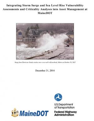
The Maine Department of Transportation study identified transportation assets that are vulnerable to flooding from sea level rise and storm surge in six coastal towns. The team developed depth-damage functions and adaptation design options at three of the sites, and evaluated the costs and benefits of the alternative design structures.
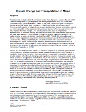
This document meets two distinct, but related, needs. First, it prepares Maine’s Department of Transportation (MaineDOT) to respond to the challenges presented in Maine's LD 460, Resolve to Evaluate Climate Change Adaptation Options for the State. Second, this document positions MaineDOT to receive support for its proactive approach from funding and policy agencies such as the Federal Highway Administration because it constitutes a commitment to action.
Enacted in 2003, Maine's Public Law 237 required the state's Department of Environmental Protection to develop and submit this Climate Action Plan. The CAP includes plans to reduce greenhouse gas emissions to 1990 levels by 2010 and to 10 percent below 1990 levels in 2020.

