Access a range of climate-related reports issued by government agencies and scientific organizations. Browse the reports listed below, or filter by scope, content, or focus in the boxes above. To expand your results, click the Clear Filters link.
The State Climate Summaries provided here were initially produced to meet the demand for state-level climate information in the wake of the Third U.S. National Climate Assessment. This 2022 version provides new information and extends the historical climate record to 2020 for each state. The summaries cover assessment topics directly related to NOAA’s mission, specifically historical climate variations and trends, future climate model projections of climate conditions during the 21st century, and past and future conditions of sea level and coastal flooding. Additional background information and links are given below.
This Guide is written for practitioners already using or wanting to use future climate information in their work, but who are not familiar with the underlying assumptions and choices surrounding climate data. Here, we introduce the climate model scenarios that are used to “drive” climate models forward in time. These scenarios are a combination of socioeconomic and climate forcing pathways. We summarize differences between these scenarios for the Great Lakes region to show users how their choice of model scenario affects future temperature and precipitation projections.
Created especially for decision makers and adaptation planners in the Great Lakes region, this report offers planners guidance in developing adaptation plans while navigating local politics and specialized data. Content is accessible for users of all skill levels, with a focus on beginner. The report is divided into six main sections: Climate Change in the Great Lakes Region, Decision Making Under Uncertainty, Climate Information in the Local Planning Process, Data Analysis Guide for Assessing Climate Vulnerability, Building Climate Knowledge and Capacity, and Making the Case.
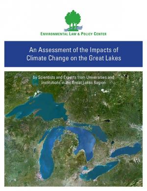
Climate change is causing significant and far-reaching impacts on the Great Lakes and the Great Lakes region. This report, from 18 leading scientists and experts from Midwest and Canadian universities and research institutions, draws on the array of existing research to assess how the shifting global climate impacts the unique Great Lakes region.
The EWN Atlas is a collection of 56 projects illustrating a diverse portfolio of contexts, motivations, and successful outcomes, presented and considered from an Engineering With Nature® perspective to reveal the usefulness of nature-based approaches and the range of benefits that can be achieved. Engineering With Nature is an initiative of the U.S. Army Corps of Engineers enabling more sustainable delivery of economic, social, and environmental benefits associated with water resources infrastructure. EWN intentionally aligns natural and engineering processes to efficiently and sustainably deliver economic, environmental, and social benefits through collaborative processes.
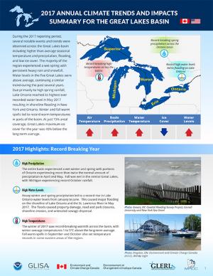
Coordinated by a partnership between climate services organizations in the U.S. and Canada, this product provides a synthesis report summarizing the previous years’ climate trends, events, new research, assessments, and related activities in the Great Lakes region. The 2017 report provides an overview of the climate trends and impacts in the basin for the year, including information on the past year’s climate trends, a summary of some of the major climatic events, and a summary of relevant new climate research and activities. It was developed as a longer term trend analysis and compilation of the existing Great Lakes Region Quarterly Climate Impacts and Outlook and is intended for use by managers and practitioners at federal, state, provincial, regional, and local scales, as well as for stakeholders and the general public. The report is also available for download from binational.net.
During late 2016, the National Integrated Drought Information System, the National Drought Mitigation Center, the Midwestern Regional Climate Center, and other regional partners convened four stakeholder meetings in the Midwest Drought Early Warning System. Each of these meetings included a historical drought overview and climate outlook for the region, discussion of critical drought-related needs and challenges, exploration of available tools, local drought planning and management approaches, and strategy development to improve drought early warning and resiliency in the Midwest.
This plan sets forth the 2017 federal policy platform of the Mississippi River Cities and Towns Initiative, an association of 75 U.S. mayors along the Mississippi River. The document sets forth the mayors’ recommendation of federal programs to support and strengthen the built and natural infrastructure of the Mississippi River corridor, proposing specific funding levels and support of several federal programs. Suggestions for finance mechanisms to restore Mississippi River infrastructure are also included.
This report synthesizes available science on the observed and projected impacts of climate change in the Great Lakes Basin and documents the climate change assessment methods applied in the region. It was initiated in support of commitments under Annex 9-Climate Change Impacts of the Great Lakes Water Quality Agreement to take into account the climate change impacts on the chemical, physical, and biological integrity of the waters of the Great Lakes and communicate and coordinate binationally regarding ongoing developments of domestic science. The report draws upon the range of research conducted by various levels of government, academia, and other organizations and the growing body of knowledge in areas of ecological research and climate change and provides researchers, managers, and decision makers with a time-stamped, thorough, and methodical examination of that climate change science.
Intense rainstorms, floods, and heat waves will become more common in the Great Lakes region due to climate change in the coming decades. While ice-cover declines will lengthen the commercial navigation season on the lakes, warmer lake temperatures will increase risks from invasive species, and could threaten water quality. Material in this report is largely a synthesis of the information contained in the National Climate Assessment’s chapters on the Midwest (Chapter 18) and Northeast (Chapter 16). Donald Scavia, GLISA's co-director, was one of the convening authors of the NCA's Midwest regional chapter; GLISA also served as a hub for the compilation of technical inputs for the Midwest chapter.
This report was designed to Identify how beachgoers perceive the risk of dangerous currents and waves in the Great Lakes; evaluate existing messages and delivery mechanisms (such as National Weather Service Surf Zone Forecasts); translate complex beach conditions into understandable, actionable messages for specific beachgoer audiences; and identify effective delivery mechanisms for specific audiences.
The Dane County Climate Change Action Council was formed in March 2013 with a mission to ensure that Dane County government was better prepared for weather extremes brought on by global climate change. The Council facilitated an internal review of county preparations and potential modifications to the operations and capital investments of the county, resulting in this report identifying Dane County’s potential vulnerabilities to weather extremes associated with global climate change and strategies to adapt to a changing climate. The report is the first step in the county’s effort to improve the resiliency of its climate-sensitive resources in the face of climate change; future steps will include cross-departmental collaborations to implement the adaptation strategies outlined in the report.
The Milwaukee Metropolitan Sewerage District created a systematic plan to implement widespread green infrastructure. As a regional agency, the District is uniquely positioned to lead green infrastructure planning for the Milwaukee region and has funding to undertake the work. This effort will help the District make logical green infrastructure funding decisions, will help municipalities and non-governmental organizations prioritize their actions, and will help inform municipalities and private funders where their green infrastructure money can do the greatest good. Technical analyses for the region’s impervious surfaces, costs/benefits, and recommendations were all completed; the report comprises the final Regional Green Infrastructure Plan. The plan was approved by the MMSD Commission on July 22, 2013.
The Global Warming Task Force was created by Wisconsin Governor Jim Doyle in April 2007. The Task Force created this report, which contains its policy recommendations to reduce greenhouse gas emissions in Wisconsin, as well as its short- and long-term goals for reducing greenhouse gas emissions in the state.
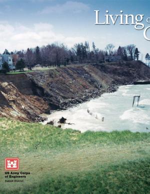
This booklet describes how natural processes affect the coast, including changes in lake levels, storms and storm surges, waves and wave climate, transport of sediment, ice on the shore, shoreline erosion, lakebed erosion, and movement of water on the land. It also describes how to protect coastal investments by adapting to natural processes, restoring a natural shoreline, moderating coastal erosion, armoring the shore, stabilizing bluffs and banks, controlling surface water and groundwater, building environmentally friendly shore protection structures, and working with engineers and contractors. The final section covers risk management and the economics of protecting a coastal investment, including shoreline property features and value, government regulations to protect a coastal investment, costs of shore protection, and accounting for climate change. There is also a list of resources for more information and a glossary of coastal engineering terms.

