Access a range of climate-related reports issued by government agencies and scientific organizations. Browse the reports listed below, or filter by scope, content, or focus in the boxes above. To expand your results, click the Clear Filters link.
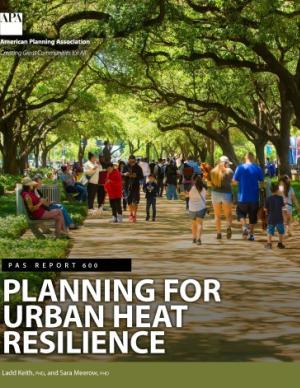
Heat is the number one weather-related killer in the United States. As average global temperatures continue to rise, the threats of both extreme heat events and chronic heat are projected to increase.
Heat disproportionately affects marginalized residents and those who face systematic inequities such as workplace safety, housing quality, energy affordability, transportation reliability, and healthcare access. But planning can shape heat risk. Planners will be key practitioners in helping their communities achieve greater heat resiliency by proactively managing and mitigating heat across the many systems and sectors it affects.
PAS Report 600 provides holistic guidance to help practitioners increase urban heat resilience equitably in the communities they serve. It provides an in-depth overview of the contributors to urban heat and equity implications, and it lays out an urban heat resilience framework and collection of strategies to help planners mitigate and manage heat across a variety of plans, policies, and actions.
The Fiscal Year 2022 edition of the U.S. Global Change Research Program (USGCRP’) annual report to Congress, Our Changing Planet, presents recent Program accomplishments that illustrate how USGCRP is meeting its mandate under the GCRA and achieving the goals outlined in the Program’s 2012–2021 Strategic Plan and its 2017 update. Highlighted activities represent interagency collaborations undertaken in calendar year 2020 that rely on coordinated investments of two or more member agencies and contribute to implementing USGCRP’s strategic goals.
The Vermont Climate Action Plan aims to dramatically reduce greenhouse gas emissions, help protect Vermont communities and landscapes from the greatest risks of climate change, and create new clean energy industry and jobs. The Climate Action Plan includes strategies to:
- Reduce greenhouse gas emissions from the transportation, building, regulated utility, industrial, commercial, and agricultural sectors;
- Encourage smart growth and related strategies;
- Achieve long-term sequestration and storage of carbon and promote best management practices to achieve climate mitigation, adaption, and resilience on natural working lands;
- Achieve net zero emissions by 2050 across all sectors;
- Reduce energy burdens for rural and marginalized communities;
- Limit the use of chemicals, substances, or products that contribute to climate change; and
- Build and encourage climate adaptation and resilience of Vermont communities and natural systems.
The Climate Action Plan serves as a guide for the Vermont Legislature in setting policy that supports climate change solutions for Vermonters and Vermont's landscape.
A range of resources documenting report preparation are available in the Climate Action Plan Appendices.
For the six states of the U.S. Southwest (Arizona, California, Colorado, Nevada, New Mexico, and Utah)i , January 2020 through August 2021 have been exceptional in the instrumental climate record since 1895, with the lowest total precipitation and the third-highest daily average temperatures recorded, which together imposed an unyielding, unprecedented, and costly drought. This exceptional drought punctuates a two-decade period of persistently warm and dry conditions throughout the region.
This Guide is written for practitioners already using or wanting to use future climate information in their work, but who are not familiar with the underlying assumptions and choices surrounding climate data. Here, we introduce the climate model scenarios that are used to “drive” climate models forward in time. These scenarios are a combination of socioeconomic and climate forcing pathways. We summarize differences between these scenarios for the Great Lakes region to show users how their choice of model scenario affects future temperature and precipitation projections.
This report aims to build the capacity of organizations to serve as catalysts in supporting members of their communities stepping into leadership roles, as well as engaging them meaningfully in defining the scope of local climate change risks and impacts and formulating and implementing equitable solutions alongside key partners. This guide was developed using qualitative data collected through a series of interviews with experts from around the country who are designing, managing, and implementing community-based leadership development programs. Although not all of these programs directly address climate change and environmental justice, this collection of diverse programming illustrates the broad ways in which communities address leadership development and grassroots engagement in local decision making. This tool provides a comprehensive picture of training and capacity-building theory and practice, and showcases programs that are diverse in content, audience, geography, outcome, and practice.
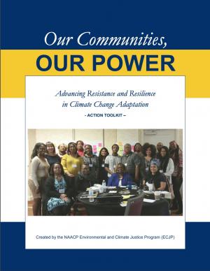
This report provides step-by-step guidance and lessons learned on how to effectively engage with community members to understand climate impacts and to develop more equitable climate resilience strategies. Community-based organizations have repeatedly emphasized that to equitably and successfully carry out climate resilience solutions, it’s imperative to directly engage with community members to deeply understand how these threats directly impact them. Likewise, to formulate solutions that are equitable and truly work—and to get utilities and city officials to prioritize equitable investments in under-invested areas—organizations must directly engage with members of the community when identifying solutions. The toolkit provides real-world case studies, a project planning and facilitation guide, and extensive lists of references and resources.
Safe and secure water supplies are a continuing fundamental pursuit for life in the West. This 2021 Report provides an assessment of climate change impacts to water uses in the West and adds a new set of West-wide information based in paleohydrology. This report describes our collaborative actions taken to increase the reliability of water and power deliveries since 2016, including: science and research, planning, infrastructure sustainability, efficient hydropower production, and on-the-ground actions to meet needs for irrigation, municipalities, power, Tribes, and the environment.
This report highlights the equity implications of sea level rise in the first nationwide assessment of risk to the country’s affordable housing supply. As climate change causes sea levels to rise, the number of affordable housing units at risk of coastal flooding is projected to more than triple to nearly 25,000 nationwide over the next 30 years.
This guide is intended to help communities in Michigan and across the Great Lakes Region develop a climate and health adaptation plan or to integrate climate and health concepts into existing initiatives. A climate and health adaptation plan is defined here as a strategy document that fosters collaboration across disciplines and interest groups to instigate a series of activities toward the common objectives of understanding and then preventing or reducing the anticipated health impacts of climate change in the area.
Each region of the United States experiences climate change and its impacts on health differently, due to the regions’ location-specific climate exposures and unique societal and demographic characteristics. This document describes the various health impacts climate change will have on different regions of the United States as outlined in the Fourth National Climate Assessment (NCA4), actions taken by the CDC Climate and Health Program’s health department partners to prepare for and respond to climate change in their communities, and relevant tools and resources.
Planning for climate change resiliency is an increasingly pressing requirement for communities throughout the world and the Delaware Valley Regional Planning Commission (DVRPC) region. In order to help local officials, non-profits, and communities with this process, numerous planning tools have been developed by a wide range of public and private agencies. Accordingly, the purpose of this paper is to explain, organize, and prioritize the tools that currently exist in order to select ones that are broadly accessible to a wide range of organizations, applicable across a range of sectors, and not overly redundant. During this selection process, a list of over 60 tools was winnowed down to a final toolkit of 18 that are particularly useful at any stage in the resiliency planning process and can be used for communities throughout the DVRPC region.
This report and the accompanying community spotlights provide an overview of climate change science, reasons why action is needed, how science supports decision making and planning, ways to adapt to climate change and limit the severity of its effects, and how such efforts can help build resiliency. The report illustrates the ways in which science can help individuals, communities, businesses, and government agencies make informed decisions. By working together to identify solutions and bring about positive change, we can reduce the risks faced by current and future generations.
This Summary for Policymakers summarizes the findings of the AMAP Assessment 2018: Arctic Ocean Acidification report released in October 2018. It offers a review of the latest science relating to regional ocean acidification, the biological responses to it, an overview of case studies and their associated findings, and recommendations for the Arctic Council.
The Central Council of the Tlingit and Haida Indian Tribes of Alaska (Tlingit & Haida) is a federally recognized Indian Tribe that serves 20 villages and communities stretching over 43,000 square miles within the Alaska Panhandle. The Tlingit and Haida membership is among the largest, most isolated, and most geographically dispersed of Native or Tribal populations nationwide. The region encompasses a 525-mile strip of coastline and interior waterways, bordered by Canada on the north, south, and east, with the Gulf of Alaska on the west.
The Central Council recognizes that wild salmon, berries, clams, herring, halibut, yellow cedar and other species important for subsistence, cash and culture are at risk. In response, they have released a 53-page climate change adaptation plan. The document is a roadmap for prioritizing, monitoring, and responding to threats stemming from warming air and ocean temperatures, caused by increasing levels of greenhouse gases trapped in the atmosphere.
The Beloved Community is a vision for our future where all people share equally in the wealth and bounty of the earth, where we protect its abundance, diversity, and beauty for future generations. In this vision of liberation, racism, exploitation, and domination are replaced by democracy, cooperation, interdependence, and love. To get there, we pursue transformative, systems-change solutions. What do we mean by this? The root causes of the problems our communities face—like climate change, racism, and economic inequality—are all deeply connected. Since the problems are connected, so are the solutions. The purpose of this toolkit is to put us on the path toward achieving this vision. Through the context of building equity and resilience into climate adaptation planning, we introduce strategies to transform our communities and, by extension, society. Our ultimate goal is to create lasting and systemic change. At the same time, we recognize the urgency of the issues our communities face and the need to take action now. That is why we pursue change at every scale—from policy changes to community-based projects—to institute the transformative change we need to uphold our vision of the beloved community.
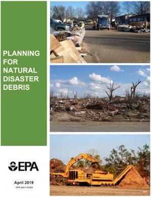
The guidance provided by this report is designed to help all communities create disaster debris management plans. It assists communities in planning for natural disaster debris before disasters—such as hurricanes, earthquakes, tornadoes, volcanoes, floods, wildfires, and winter storms—occur by providing useful, relevant information intended to increase community preparedness and resiliency. The report includes recommended components of a debris management plan, suggested management options for various natural disaster debris streams, a collection of case studies that highlights how several communities prepared for and managed debris generated by recent natural disasters, resources to consult in planning for natural disasters, and the EPA’s recommended pre-incident planning process to help prepare communities for effective disaster debris management.
The frequency and severity of disasters over the last few decades have presented unprecedented challenges for communities across the United States. This report summarizes the existing portfolio of relevant or related resilience measurement efforts and notes gaps and challenges associated with them. It describes how some communities build and measure resilience, and offers four key actions that communities could take to build and measure their resilience to address gaps identified in current community resilience measurement efforts. The report also provides recommendations to the Gulf Research Program to build and measure resilience in the Gulf of Mexico region.
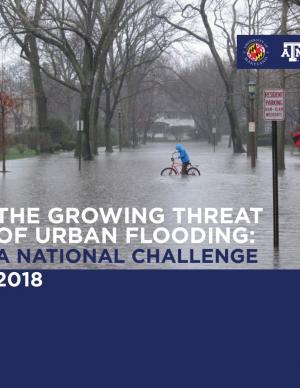
Flooding is the natural hazard with the greatest economic and social impact in the United States, and these impacts are becoming more severe over time. This report contributes to existing knowledge on urban flooding by examining real-world examples in specific metropolitan areas: Baltimore, Houston, Chicago, and Phoenix. The report identifies commonalities and variances among the case study metropolitan areas in terms of causes, adverse impacts, unexpected problems in recovery, or effective mitigation strategies, as well as key themes of urban flooding. It also relates, as appropriate, causes and actions of urban flooding to existing federal resources or policies.
Georgetown Climate Center (GCC) prepared this report to help the Eastern Shore Climate Adaptation Partnership (ESCAP) identify strategies for adapting to increasing sea level rise and flood risk in the Eastern Shore region of Maryland. ESCAP worked with the Eastern Shore Regional GIS cooperative to assess sea level rise vulnerabilities in the six counties and two municipalities that participate in ESCAP. GCC and the University of Maryland Environmental Finance Center helped to identify potential legal and policy options for enhancing flood resilience in Eastern Shore communities. This report summarizes how more rural jurisdictions, like those on the Eastern Shore, can enhance flood resilience by updating local land use ordinances and floodplain regulations and by pursuing other non-regulatory options, including acquiring flood-prone properties, preserving open space in the floodplain, and coordinating regionally on public outreach and education programs.
This report offers the first national assessment of the scope and consequences of urban flooding in the United States. Researchers analyzed available data concerning urban flooding, surveyed municipal flood and stormwater managers, and met with professionals whose disciplines intersect with urban flooding at the local, state, and national level. The research team's findings affirm that urban flooding is a national and significant source of economic loss, social disruption, and housing inequality. This report presents the full results of the study, addresses governance issues that affect urban flood risk reduction, examines critical challenges, and offers recommendations for actions.
From Mayor Mitchell J. Landrieu's Introduction: As we marked the 10th anniversary of Hurricane Katrina in 2015, we launched the world’s first comprehensive city resilience strategy, Resilient New Orleans, combining local expertise with global best practices to confront our most urgent threats, adapt our city to our changing natural environment, invest in equity, create flexible and reliable systems, and prepare for future shocks.
It is not enough to plan for how we will adapt to climate change. We must end our contribution to it. As the world committed to action in Paris in 2015, so too did we. I signed the Global Covenant of Mayors on Climate & Energy, adding New Orleans to the team of more than 7,400 cities in 119 countries worldwide committed to taking climate action.
In the aftermath of Tropical Storms Irene and Sandy, the population centers of Greater New Haven and Bridgeport recognized significant exposure and vulnerability to their infrastructure, environment, and socioeconomic assets from extreme weather events and a changing climate. To counteract immediate and longer-term risks and broaden dialogue on community resilience building, the Southern Connecticut Regional Framework for Coastal Resilience project was launched. The overarching goal of this project was prioritizing actions and strengthening partnerships by providing proactive risk assessment, community engagement, conceptual design of on-the-ground projects, and this Final Report. The principal purpose of the project was to advance a Regional Resilience Framework—built on projects and partnerships—needed to help improve resilience for over 591,000 residents that represent over 30 percent of Connecticut’s coast. A core goal of this project was to strengthen the resilience of existing and future ecosystems, including a diverse suite of services and co-benefits, alongside existing and future development activities within a population center critical to the state of Connecticut’s future.
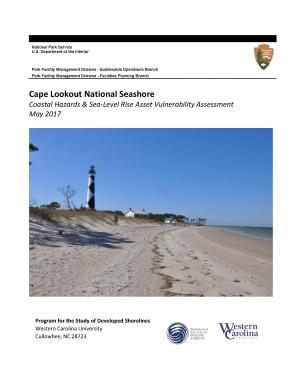
The protocol developed and used in this report is unique in that it is an asset-level assessment of the vulnerability of infrastructure to multiple coastal hazards and climate change factors (e.g., erosion, flooding, storm surge, sea-level rise, and historical flooding) over a 35-year planning horizon (2050). The protocol was applied to all buildings and roads in Cape Lookout National Seashore; the results are summarized in the report.
The Tampa Bay region is known as one of the most vulnerable in the world to wind damage, coastal flooding from storm surge, and rising sea levels. The City of St. Petersburg—with over 60 miles of coastal frontage—has already felt the impacts of storms. The adverse effects from these types of environmental events often impact low-income communities the hardest, as they have the most difficulty bouncing back from stresses and shocks. The City of St. Petersburg is committed to ensuring that investments in making the city resilient are equitable and create a range of opportunities that everyone can benefit from. The Urban Land Institute of Tampa Bay convened top experts in climate resilience from New Orleans, Miami, Boston, and the Tampa Bay region to provide technical assistance to the city on creating an equitable culture of resilience. A grant from the ULI Foundation and Kresge Foundation funded this effort.
This report is part of a series of six case studies that explore lessons that are being learned by climate collaboratives from around the United States that are bringing together local governments and other stakeholders at the regional level to both reduce carbon pollution (mitigation) and prepare for the impacts of climate change (adaptation). Each case study explores the history and development structure and decision-making methods, funding sources, roles, and initiatives of each of these climate collaboratives. A synthesis report also explores lessons that can be learned by comparing the efforts of each collaborative on climate policy in their regions. These case studies were supported by a grant from the Kresge Foundation. In developing these case studies, the Georgetown Climate Center collaborated with the Alliance of Regional Collaboratives for Climate Adaptation (ARCCA).
This report summarizes findings from a workshop held in El Paso, Texas, on July 13, 2016. The El Paso-Juárez-Las Cruces region is home to approximately 2.4 million people, most of whom are living in or near the urban centers of Ciudad Juárez (Chihuahua), El Paso, and Las Cruces (New Mexico). These cities share characteristics, such as a high proportion of residents of Hispanic origin, median income below the U.S. national average, and a range of climate-related environmental issues that include drought, flooding, air pollution, dust storms, and frequent occurrences of extremely high temperatures during the late spring and early summer. With hotter temperatures and more frequent and persistent heat waves projected for the El Paso-Juárez-Las Cruces region, it is critical to develop more robust systems of institutions, social learning, and partnerships to understand risks and strengthen public health resilience.
Climate Ready DC is the District’s strategy to make the city more resilient to future climate change. It is based on the best available climate science and was developed through consultation with leading experts within and outside of the District government.
In 2014, the U.S. Geological Survey, in cooperation with the Association to Preserve Cape Cod, the Cape Cod Commission, and the Massachusetts Environmental Trust, began an evaluation of the potential effects of sea-level rise on water table altitudes and depths to water on central and western Cape Cod, Massachusetts. Researchers found that the potential does exist for groundwater inundation in some areas, but the effects of sea-level rise on depths to water and infrastructure likely will not be substantial on a regional level.
The State of Maine is experiencing shifts in atmospheric and oceanographic conditions that put it at the precipice of abrupt climate change. This report—part of the Department of Homeland Security's Regional Resiliency Assessment Program (RRAP)—focuses on the local and regional consequences of climate disruptions and their impacts on critical infrastructure in the Casco Bay region, the most developed and populous region in Maine. The report identifies vulnerabilities that may potentially affect the region’s ability to maintain its critical infrastructure systems and recover from the impacts of climate change.
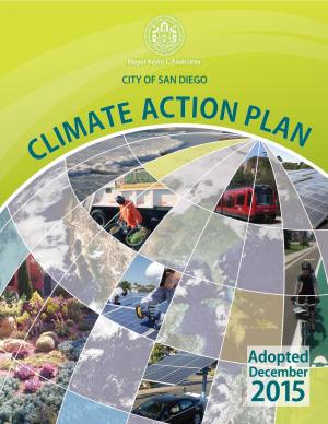
With the goal of creating a cleaner San Diego for future generations, the City of San Diego’s Climate Action Plan calls for eliminating half of all greenhouse gas emissions in the City and aims for all electricity used in the city to be from renewable sources by 2035. The Climate Action Plan is a package of policies that will benefit San Diego’s environment and economy. It will help create new jobs in the renewable energy industry, improve public health and air quality, conserve water, more efficiently use existing resources, increase clean energy production, improve quality of life, and save taxpayer money. The plan identifies steps the City of San Diego can take to achieve the 2035 targets, including creating a renewable energy program, implementing a zero waste plan, and changing policy to have a majority of the City’s fleet be electric vehicles. The Climate Action Plan helps achieve the greenhouse gas reduction targets set forth by the State of California. The City’s first Climate Action Plan was approved in 2005 and a commitment to update the plan was included in the City’s 2008 General Plan update.
King County, Washington's Strategic Climate Action Plan sets forth strategies for reducing greenhouse gas emissions and preparing for climate change impacts.
This guide provides a framework for the selection of appropriate storm damage risk reduction treatments for low-volume roads. There are important tasks and processes that are necessary to make informed treatment selections that this guide does not cover in detail, but should be included in comprehensive road management programs. These tasks include road condition inventories, hazard assessments, and strategic plans for treating high-hazard sites. Specific “stormproofing” measures discussed in this guide include timely road maintenance, many key road drainage measures, culvert diversion prevention, pulling back marginal fill slopes, use of biotechnical and vegetative slope stabilization and erosion control, gully prevention, bridge maintenance, and many other measures.
The New River Valley Livability Energy Report uses nine principles to describe a sustainable, affordable, and reliable regional energy plan for the New River Valley in Virginia. Each principle is accompanied by practical strategies communities can use to promote sustainability. The report could serve as a model for other regional energy plans.
This report—the first phase of the Department of the Interior (DOI) assessment effort for Hurricane Sandy projects—was developed for DOI by a metrics expert group of physical and ecological scientists and socioeconomic experts who recommended performance metrics for measuring changes in resilience resulting from the DOI-sponsored projects. It identifies natural and artificial coastal features most affected by Hurricane Sandy along the Northeast coast—such as marshes, beaches, and estuaries—and recommended metrics that would indicate resilience change in those features.
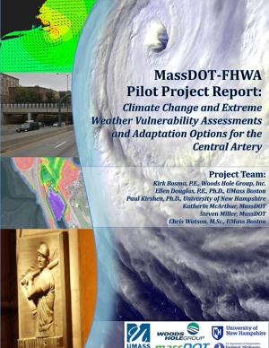
The two main objectives of this pilot project were to (1) assess the vulnerability of Boston's Central Artery/Tunnel System to sea level rise and extreme storm events, and (2) investigate and present adaptation options to reduce identified vulnerabilities.

