Access a range of climate-related reports issued by government agencies and scientific organizations. Browse the reports listed below, or filter by scope, content, or focus in the boxes above. To expand your results, click the Clear Filters link.
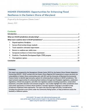
Georgetown Climate Center (GCC) prepared this report to help the Eastern Shore Climate Adaptation Partnership (ESCAP) identify strategies for adapting to increasing sea level rise and flood risk in the Eastern Shore region of Maryland. ESCAP worked with the Eastern Shore Regional GIS cooperative to assess sea level rise vulnerabilities in the six counties and two municipalities that participate in ESCAP. GCC and the University of Maryland Environmental Finance Center helped to identify potential legal and policy options for enhancing flood resilience in Eastern Shore communities. This report summarizes how more rural jurisdictions, like those on the Eastern Shore, can enhance flood resilience by updating local land use ordinances and floodplain regulations and by pursuing other non-regulatory options, including acquiring flood-prone properties, preserving open space in the floodplain, and coordinating regionally on public outreach and education programs.
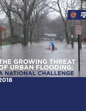
This report offers the first national assessment of the scope and consequences of urban flooding in the United States. Researchers analyzed available data concerning urban flooding, surveyed municipal flood and stormwater managers, and met with professionals whose disciplines intersect with urban flooding at the local, state, and national level. The research team's findings affirm that urban flooding is a national and significant source of economic loss, social disruption, and housing inequality. This report presents the full results of the study, addresses governance issues that affect urban flood risk reduction, examines critical challenges, and offers recommendations for actions.
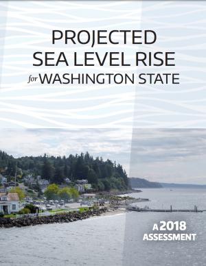
This report provides an updated set of sea level rise projections that incorporate the latest science and community-scale projections. The new projections can be applied to risk management and planning processes, and are recommend for communities performing coastal impacts assessments within the state of Washington.
An interactive map based on the report shows relative sea level rise (RSLR) projections for 171 sites along Washington’s coast. The projections for each site are provided as a downloadable excel spreadsheet which contains three worksheets: (1) an overview, (2) RSLR projections for a low greenhouse gas scenario (RCP 4.5), and (3) RSLR projections for a high greenhouse gas scenario (RCP 8.5).
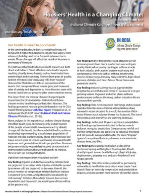
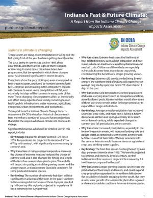
In the coming decades, Indiana’s changing climate will bring with it higher temperatures, longer heat waves, more extremely hot days, and more frequent extreme storm events. Those changes will affect the health of Hoosiers in every part of the state. This report describes historical and future climate-related health impacts that affect Indian residents; the findings presented here are primarily based on the Indiana Climate change Impacts Assessment Health Working Group technical report and the report Indiana’s Past and Future Climate.
Indiana’s climate is changing. Temperatures are rising, more precipitation is falling, and the last spring frost of the year has been getting steadily earlier. This report describes historical climate trends from more than a century of data and future projections that detail the ways in which our climate will continue to change.
During late 2016, the National Integrated Drought Information System, the National Drought Mitigation Center, the Midwestern Regional Climate Center, and other regional partners convened four stakeholder meetings in the Midwest Drought Early Warning System. Each of these meetings included a historical drought overview and climate outlook for the region, discussion of critical drought-related needs and challenges, exploration of available tools, local drought planning and management approaches, and strategy development to improve drought early warning and resiliency in the Midwest.
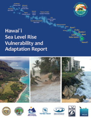
This report provides the first state-wide assessment for Hawai'i documenting vulnerability to sea level rise. The report includes recommendations to reduce exposure and sensitivity to sea level rise and to increase capacity to adapt. It also provides recommendations based on emerging practices framed through extensive stakeholder consultations. It is considered a "living" report, and will be updated as further information is gathered. The framework of the report is intended to be used when facing other climate change threats affecting Hawai'i.
Delaware is especially vulnerable to the effects of sea level rise (SLR) due to its flat topography, low mean elevation, and significant community development and infrastructure investments along the coast. Rates of relative SLR measured at tide gauges in and around Delaware are approximately twice the rate of global mean SLR. This report provides critical information on future sea level rise for Delaware's decision makers: it can help readers gain a comprehensive understanding of risk and the likelihood of worsening coastal flooding. In addition to the report, the Delaware Geological Survey worked with others to release an updated series of coastal inundation maps that depict the extent of potential inundation from current average high tide (MHHW level) to seven feet above in one-foot increments. These maps can be used as a planning tool for understanding potential future effects of sea level rise or storm surge.
This assessment of seven priority hazards was undertaken by the Florida BRACE (Building Resilience Against Climate Effects) program. Existing climate scenarios project heat, drought, and sea level rise vulnerability to the year 2100 with a high, medium, and low range of outcomes for these three hazards. Hurricane winds, storm surge, flooding, and wildland fire are more difficult to project into the future due to a significantly smaller geographic impact; for these four hazards, probability indexes were used in conjunction with historical patterns to explain possible changes to Florida’s long-term weather. Social and medical vulnerability indices were also employed to quantify social and medical vulnerability to these priority hazards.
The Montana Climate Assessment (MCA) synthesizes, evaluates, and shares credible and relevant scientific information about climate change in Montana with the citizens of the state. The motivation for the MCA arose from citizens and organizations in Montana who have expressed interest in receiving timely and pertinent information about climate change, including information about historical variability, past trends, and projections of future impacts as they relate to topics of economic concern. This first assessment reports on climate trends and their consequences for three of Montana’s vital sectors: water, forests, and agriculture.
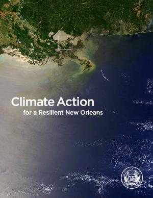
From Mayor Mitchell J. Landrieu's Introduction: As we marked the 10th anniversary of Hurricane Katrina in 2015, we launched the world’s first comprehensive city resilience strategy, Resilient New Orleans, combining local expertise with global best practices to confront our most urgent threats, adapt our city to our changing natural environment, invest in equity, create flexible and reliable systems, and prepare for future shocks.
It is not enough to plan for how we will adapt to climate change. We must end our contribution to it. As the world committed to action in Paris in 2015, so too did we. I signed the Global Covenant of Mayors on Climate & Energy, adding New Orleans to the team of more than 7,400 cities in 119 countries worldwide committed to taking climate action.
In the aftermath of Tropical Storms Irene and Sandy, the population centers of Greater New Haven and Bridgeport recognized significant exposure and vulnerability to their infrastructure, environment, and socioeconomic assets from extreme weather events and a changing climate. To counteract immediate and longer-term risks and broaden dialogue on community resilience building, the Southern Connecticut Regional Framework for Coastal Resilience project was launched. The overarching goal of this project was prioritizing actions and strengthening partnerships by providing proactive risk assessment, community engagement, conceptual design of on-the-ground projects, and this Final Report. The principal purpose of the project was to advance a Regional Resilience Framework—built on projects and partnerships—needed to help improve resilience for over 591,000 residents that represent over 30 percent of Connecticut’s coast. A core goal of this project was to strengthen the resilience of existing and future ecosystems, including a diverse suite of services and co-benefits, alongside existing and future development activities within a population center critical to the state of Connecticut’s future.
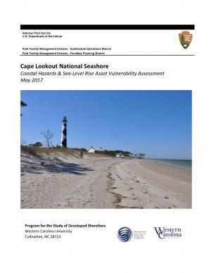
The protocol developed and used in this report is unique in that it is an asset-level assessment of the vulnerability of infrastructure to multiple coastal hazards and climate change factors (e.g., erosion, flooding, storm surge, sea-level rise, and historical flooding) over a 35-year planning horizon (2050). The protocol was applied to all buildings and roads in Cape Lookout National Seashore; the results are summarized in the report.
The Tampa Bay region is known as one of the most vulnerable in the world to wind damage, coastal flooding from storm surge, and rising sea levels. The City of St. Petersburg—with over 60 miles of coastal frontage—has already felt the impacts of storms. The adverse effects from these types of environmental events often impact low-income communities the hardest, as they have the most difficulty bouncing back from stresses and shocks. The City of St. Petersburg is committed to ensuring that investments in making the city resilient are equitable and create a range of opportunities that everyone can benefit from. The Urban Land Institute of Tampa Bay convened top experts in climate resilience from New Orleans, Miami, Boston, and the Tampa Bay region to provide technical assistance to the city on creating an equitable culture of resilience. A grant from the ULI Foundation and Kresge Foundation funded this effort.
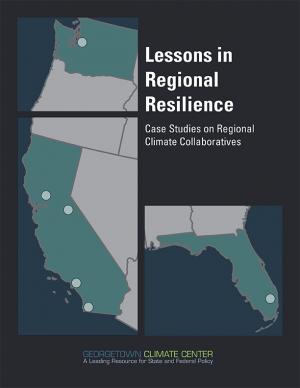
This report is part of a series of six case studies that explore lessons that are being learned by climate collaboratives from around the United States that are bringing together local governments and other stakeholders at the regional level to both reduce carbon pollution (mitigation) and prepare for the impacts of climate change (adaptation). Each case study explores the history and development structure and decision-making methods, funding sources, roles, and initiatives of each of these climate collaboratives. A synthesis report also explores lessons that can be learned by comparing the efforts of each collaborative on climate policy in their regions. These case studies were supported by a grant from the Kresge Foundation. In developing these case studies, the Georgetown Climate Center collaborated with the Alliance of Regional Collaboratives for Climate Adaptation (ARCCA).
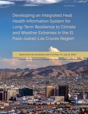
This report summarizes findings from a workshop held in El Paso, Texas, on July 13, 2016. The El Paso-Juárez-Las Cruces region is home to approximately 2.4 million people, most of whom are living in or near the urban centers of Ciudad Juárez (Chihuahua), El Paso, and Las Cruces (New Mexico). These cities share characteristics, such as a high proportion of residents of Hispanic origin, median income below the U.S. national average, and a range of climate-related environmental issues that include drought, flooding, air pollution, dust storms, and frequent occurrences of extremely high temperatures during the late spring and early summer. With hotter temperatures and more frequent and persistent heat waves projected for the El Paso-Juárez-Las Cruces region, it is critical to develop more robust systems of institutions, social learning, and partnerships to understand risks and strengthen public health resilience.
Climate Ready DC is the District’s strategy to make the city more resilient to future climate change. It is based on the best available climate science and was developed through consultation with leading experts within and outside of the District government.
This two-part report is the result of workshops convened in 2015 and 2016. The Part 2 reports documents the second workshop, which brought federal and state coastal managers together with statutory authorities for review and permitting of marine aquaculture in federal waters off the coast of southern California with scientists and other stakeholders.
This two-part report is the result of workshops convened in 2015 and 2016. The Part 1 report documents participants' efforts to develop frames of reference and rationale for creation of an offshore finfish aquaculture industry in southern California.
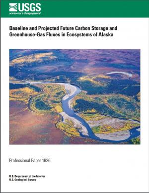
The cold temperatures of Alaska have led to the storage of vast quantities of soil and vegetation carbon, yet high-latitude ecosystems are potentially more vulnerable to higher temperature changes than ecosystems in the temperate zone. In particular, these increases in temperature may expose the substantial stores of carbon in the region to loss from more wildfire and permafrost thaw, which could turn the ecosystems of Alaska into a net carbon source. The assessment of Alaska ecosystem carbon stocks and fluxes, as well as methane fluxes, as reported here was conducted to better understand the baseline and projected carbon distributions and potential responses to a rapidly changing environment.
Climate change impacts ecosystems in many ways, from effects on species to phenology to wildfire dynamics. Assessing the potential vulnerability of ecosystems to future changes in climate is an important first step in prioritizing and planning for conservation. Although assessments of climate change vulnerability commonly are done for species, fewer have been done for ecosystems. To aid regional conservation planning efforts, this report assesses climate change vulnerability for ecosystems in the Southeastern United States and Caribbean.
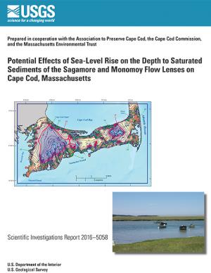
In 2014, the U.S. Geological Survey, in cooperation with the Association to Preserve Cape Cod, the Cape Cod Commission, and the Massachusetts Environmental Trust, began an evaluation of the potential effects of sea-level rise on water table altitudes and depths to water on central and western Cape Cod, Massachusetts. Researchers found that the potential does exist for groundwater inundation in some areas, but the effects of sea-level rise on depths to water and infrastructure likely will not be substantial on a regional level.
This fact sheet presents recent climate change investigations of the U.S. Geological Survey in New England using selected recent publications that highlight the broad spectrum of expertise and commitment to understanding the relations of climate change and water resources in the region.
The State of Maine is experiencing shifts in atmospheric and oceanographic conditions that put it at the precipice of abrupt climate change. This report—part of the Department of Homeland Security's Regional Resiliency Assessment Program (RRAP)—focuses on the local and regional consequences of climate disruptions and their impacts on critical infrastructure in the Casco Bay region, the most developed and populous region in Maine. The report identifies vulnerabilities that may potentially affect the region’s ability to maintain its critical infrastructure systems and recover from the impacts of climate change.
On Earth Day 2015, Connecticut Governor Malloy issued Executive Order 46 creating the Governor’s Council on Climate Change, also known as the GC3. The Council is to examine the effectiveness of existing policies and regulations designed to reduce greenhouse gas emissions and identify new strategies to meet the state’s greenhouse gas emissions reduction target of 80 percent below 2001 levels by 2050. It will do so, in part, by developing interim state-wide greenhouse gas reduction targets for years between 2020 and 2050 and by identifying short- and long-term statewide strategies to achieve the necessary reductions.
The Global Warming Solutions Act of 2008 required the Massachusetts Secretary of Energy and Environmental Affairs to set a limit on greenhouse gas emissions that would lead to a 10–20 percent reduction in emissions by 2020, and an 80 percent reduction by 2050. This update to Massachusetts' 2010 Climate Action Plan includes recommendations on how to achieve this goal.
This technical report focuses on sharing the collective efforts of the Inuit Circumpolar Council-Alaska, 146 Inuit contributing authors, a 12-member Food Security Advisory Committee, and many other Inuit who provided input and guidance to the process. The report aspires to strengthen the evidence base of (1) what Inuit food security is, (2) what the drivers of food (in)security are, and (3) identify information needed to conduct an assessment through the development of a conceptual framework. The assessment tool is designed to build the baseline of information needed to understand the Arctic environment and allow a pathway for assessments (food security, ecosystem, political, cultural, etc.) to link eco- and socio- components of sciences and indigenous knowledge.
With the goal of creating a cleaner San Diego for future generations, the City of San Diego’s Climate Action Plan calls for eliminating half of all greenhouse gas emissions in the City and aims for all electricity used in the city to be from renewable sources by 2035. The Climate Action Plan is a package of policies that will benefit San Diego’s environment and economy. It will help create new jobs in the renewable energy industry, improve public health and air quality, conserve water, more efficiently use existing resources, increase clean energy production, improve quality of life, and save taxpayer money. The plan identifies steps the City of San Diego can take to achieve the 2035 targets, including creating a renewable energy program, implementing a zero waste plan, and changing policy to have a majority of the City’s fleet be electric vehicles. The Climate Action Plan helps achieve the greenhouse gas reduction targets set forth by the State of California. The City’s first Climate Action Plan was approved in 2005 and a commitment to update the plan was included in the City’s 2008 General Plan update.
This report documents recommendations made by the Virginia Climate Commission and describes how they were acted upon. Highlights include appointment of a Chief Resilience Officer and development of a protocol for sea level rise projections. The report also makes 113 recommendations to help Virginia adapt to the consequences of climate change, and to reduce Virginia’s contributions to the problem.
King County, Washington's Strategic Climate Action Plan sets forth strategies for reducing greenhouse gas emissions and preparing for climate change impacts.
This guide provides a framework for the selection of appropriate storm damage risk reduction treatments for low-volume roads. There are important tasks and processes that are necessary to make informed treatment selections that this guide does not cover in detail, but should be included in comprehensive road management programs. These tasks include road condition inventories, hazard assessments, and strategic plans for treating high-hazard sites. Specific “stormproofing” measures discussed in this guide include timely road maintenance, many key road drainage measures, culvert diversion prevention, pulling back marginal fill slopes, use of biotechnical and vegetative slope stabilization and erosion control, gully prevention, bridge maintenance, and many other measures.
This report updates the information contained within Maryland's 2012 Greenhouse Gas Reduction Act (GGRA) Plan. This document summarizes the state’s progress toward achieving the 2020 emissions reduction goal established by the GGRA and shows that Maryland is on target to not only meet, but to exceed, its emission reduction goal.
The purpose of this document is to promote state policy recommendations and actions that aim to help improve Colorado’s ability to adapt to future climate change impacts and increase Colorado’s state agencies' levels of preparedness, while simultaneously identifying opportunities to mitigate greenhouse gas emissions at the agency level.
The Hawai‘i Fresh Water Initiative was launched in 2013 to bring multiple, diverse parties together to develop a forward-thinking and consensus-based strategy to increase water security for the Hawaiian Islands. This Blueprint is the result of the work of the Hawai‘i Fresh Water Council, and provides Hawai‘i policy and decision makers with a set of solutions that have broad, multisector support in the fresh water community that should be adopted over the next three years to put Hawai‘i on a path toward water security. The ultimate goal of the initiative is to create 100 million gallons per day in additional, reliable fresh water capacity for the islands by 2030. The report outlines three aggressive water strategy areas with individual targets.
This report discusses impacts of Hurricane/Post Tropical Cyclone Sandy on fishing and fishing-related businesses in New York and New Jersey one year after landfall. It describes major factors leading to different levels of impact on different sectors, and some reasons behind these different impact levels. Further examined are types of impediments to recovery, aids to recovery, and community impacts. It concludes with (1) two factors that can potentially improve response to, and lessen impacts of, future natural disasters, and (2) lessons learned by the researchers.
The New River Valley Livability Energy Report uses nine principles to describe a sustainable, affordable, and reliable regional energy plan for the New River Valley in Virginia. Each principle is accompanied by practical strategies communities can use to promote sustainability. The report could serve as a model for other regional energy plans.

