Access a range of climate-related reports issued by government agencies and scientific organizations. Browse the reports listed below, or filter by scope, content, or focus in the boxes above. To expand your results, click the Clear Filters link.
Heat is the number one weather-related killer in the United States. As average global temperatures continue to rise, the threats of both extreme heat events and chronic heat are projected to increase.
Heat disproportionately affects marginalized residents and those who face systematic inequities such as workplace safety, housing quality, energy affordability, transportation reliability, and healthcare access. But planning can shape heat risk. Planners will be key practitioners in helping their communities achieve greater heat resiliency by proactively managing and mitigating heat across the many systems and sectors it affects.
PAS Report 600 provides holistic guidance to help practitioners increase urban heat resilience equitably in the communities they serve. It provides an in-depth overview of the contributors to urban heat and equity implications, and it lays out an urban heat resilience framework and collection of strategies to help planners mitigate and manage heat across a variety of plans, policies, and actions.
The Vermont Climate Action Plan aims to dramatically reduce greenhouse gas emissions, help protect Vermont communities and landscapes from the greatest risks of climate change, and create new clean energy industry and jobs. The Climate Action Plan includes strategies to:
- Reduce greenhouse gas emissions from the transportation, building, regulated utility, industrial, commercial, and agricultural sectors;
- Encourage smart growth and related strategies;
- Achieve long-term sequestration and storage of carbon and promote best management practices to achieve climate mitigation, adaption, and resilience on natural working lands;
- Achieve net zero emissions by 2050 across all sectors;
- Reduce energy burdens for rural and marginalized communities;
- Limit the use of chemicals, substances, or products that contribute to climate change; and
- Build and encourage climate adaptation and resilience of Vermont communities and natural systems.
The Climate Action Plan serves as a guide for the Vermont Legislature in setting policy that supports climate change solutions for Vermonters and Vermont's landscape.
A range of resources documenting report preparation are available in the Climate Action Plan Appendices.
For the six states of the U.S. Southwest (Arizona, California, Colorado, Nevada, New Mexico, and Utah)i , January 2020 through August 2021 have been exceptional in the instrumental climate record since 1895, with the lowest total precipitation and the third-highest daily average temperatures recorded, which together imposed an unyielding, unprecedented, and costly drought. This exceptional drought punctuates a two-decade period of persistently warm and dry conditions throughout the region.
Climate change is expected to disrupt many aspects of life in American Sāmoa. Those who are already vulnerable—including children, the elderly, low-income families, and individuals with disabilities—are at greater risk from extreme weather and climate events. This report provides guidance for decision makers seeking to better understand the implications of climate variability and change for American Sāmoa and its communities and identifies the additional information and research needed to support responses that enhance resilience and help American Sāmoa to withstand the changes to come. This is one of a series of PIRCA reports aimed at assessing the state of knowledge about climate change indicators, impacts, and adaptive capacity of the U.S.-Affiliated Pacific Islands and the Hawaiian archipelago. Authors from the University of Hawai‘i and the East-West Center—along with 25 technical contributors from local governments, NGOs, researchers, and community groups—collaboratively developed the American Sāmoa report.
In 2020, New York City's Mayor’s Office of Resiliency initiated an engagement process, called the Climate Knowledge Exchange, to align research with climate resiliency and adaptation needs. This report is the first in an annual series that will maintain a public agenda for climate research in NYC. The report communicates NYC’s research needs to external partners, including academic scientists, federal researchers, philanthropic foundations, and community organizations. This in turn will catalyze new and creative partnerships to develop credible and actionable research products that address NYC’s most pressing climate challenges. The report includes the engagement methodology and survey text used with various agencies.
To plan for future sea level rise, Miami-Dade County relies on the 2019 Unified Sea Level Rise Projection for Southeast Florida developed by the Southeast Florida Regional Climate Change Compact. These projections are revised every five years to ensure they reflect the best available science. Based on these consensus projections, they expect sea levels to be approximately two feet higher 40 years from 2019 levels and continue rising beyond that.
This report's subtitle is Managing the Uncertainty of Future Sea Level Change and Extreme Water Levels for Department of Defence Coastal Sites Worldwide.
From the Executive Summary: Global change, including climate change, poses unique challenges to the Department of Defense (DoD). In particular, coastal military sites, and their associated natural and built infrastructure, operations, and readiness capabilities, are vulnerable to the impacts of rising global sea level and local extreme water level (EWL) events. This report and its accompanying scenario database provide regionalized sea level and EWL scenarios for three future time horizons (2035, 2065, and 2100) for 1,774 DoD sites worldwide. The global nature of DoD’s presence required a broad and comprehensive approach that to this point has been lacking in similar efforts.
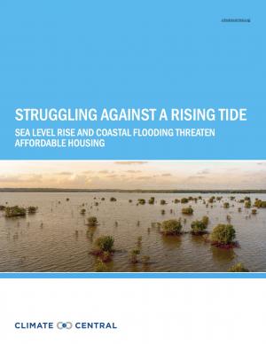
This report highlights the equity implications of sea level rise in the first nationwide assessment of risk to the country’s affordable housing supply. As climate change causes sea levels to rise, the number of affordable housing units at risk of coastal flooding is projected to more than triple to nearly 25,000 nationwide over the next 30 years.
This guide is intended to help communities in Michigan and across the Great Lakes Region develop a climate and health adaptation plan or to integrate climate and health concepts into existing initiatives. A climate and health adaptation plan is defined here as a strategy document that fosters collaboration across disciplines and interest groups to instigate a series of activities toward the common objectives of understanding and then preventing or reducing the anticipated health impacts of climate change in the area.
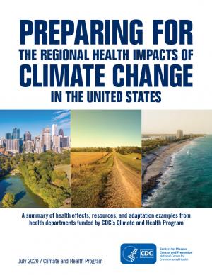
Each region of the United States experiences climate change and its impacts on health differently, due to the regions’ location-specific climate exposures and unique societal and demographic characteristics. This document describes the various health impacts climate change will have on different regions of the United States as outlined in the Fourth National Climate Assessment (NCA4), actions taken by the CDC Climate and Health Program’s health department partners to prepare for and respond to climate change in their communities, and relevant tools and resources.
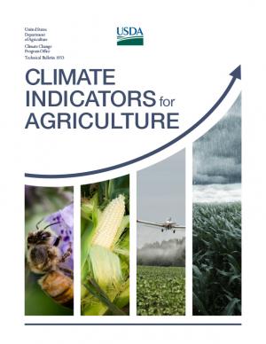
This report provides national, regional, and local information to support effective decision making by U.S. agricultural producers, resource managers, and other agricultural system stakeholders. A set of 20 indicators identifies high-priority agricultural and climate data products while providing the basis for tracking climate change as it plays out across American working lands, toward devising adaptive operational responses.
The report was written as input to the sustained National Climate Assessment process to provide a discrete set of variables that describe linkages between climate trends and variability and U.S. agriculture in recent decades. An additional objective is that the indicators themselves (along with the frameworks for constructing location- and operation-specifc indicators) provide an information resource that can help information service programs, such as USDA’s Climate Hubs, evaluate operational risks posed by climate change in specifc production systems across the country.
Heatwaves are deadly and their impacts are on the rise globally due to climate change. People living in urban areas are amongst the hardest hit when a heatwave occurs because these are hotter than the surrounding countryside. It is crucial that cities incorporate heat-reduction tactics such as green spaces into their plans for growth or retrofit them in built areas; this emergency can only be avoided if city institutions, community groups, and planners contribute to reducing heat risk now and in the future. This guide is intended to help city staff take the first steps to understanding the heat risks they face, develop an early warning system, work with partners to consolidate heat action plans, and adapt urban planning practices.
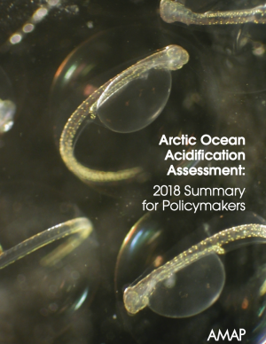
This Summary for Policymakers summarizes the findings of the AMAP Assessment 2018: Arctic Ocean Acidification report released in October 2018. It offers a review of the latest science relating to regional ocean acidification, the biological responses to it, an overview of case studies and their associated findings, and recommendations for the Arctic Council.
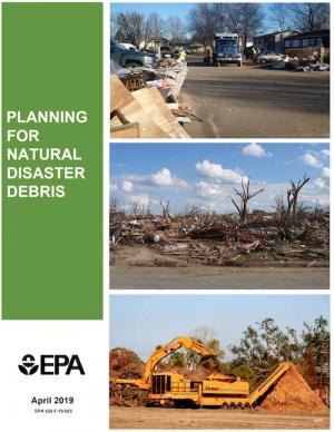
The guidance provided by this report is designed to help all communities create disaster debris management plans. It assists communities in planning for natural disaster debris before disasters—such as hurricanes, earthquakes, tornadoes, volcanoes, floods, wildfires, and winter storms—occur by providing useful, relevant information intended to increase community preparedness and resiliency. The report includes recommended components of a debris management plan, suggested management options for various natural disaster debris streams, a collection of case studies that highlights how several communities prepared for and managed debris generated by recent natural disasters, resources to consult in planning for natural disasters, and the EPA’s recommended pre-incident planning process to help prepare communities for effective disaster debris management.
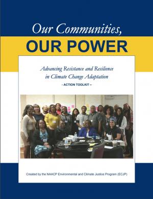
The Beloved Community is a vision for our future where all people share equally in the wealth and bounty of the earth, where we protect its abundance, diversity, and beauty for future generations. In this vision of liberation, racism, exploitation, and domination are replaced by democracy, cooperation, interdependence, and love. To get there, we pursue transformative, systems-change solutions. What do we mean by this? The root causes of the problems our communities face—like climate change, racism, and economic inequality—are all deeply connected. Since the problems are connected, so are the solutions. The purpose of this toolkit is to put us on the path toward achieving this vision. Through the context of building equity and resilience into climate adaptation planning, we introduce strategies to transform our communities and, by extension, society. Our ultimate goal is to create lasting and systemic change. At the same time, we recognize the urgency of the issues our communities face and the need to take action now. That is why we pursue change at every scale—from policy changes to community-based projects—to institute the transformative change we need to uphold our vision of the beloved community.
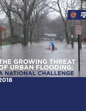
This report offers the first national assessment of the scope and consequences of urban flooding in the United States. Researchers analyzed available data concerning urban flooding, surveyed municipal flood and stormwater managers, and met with professionals whose disciplines intersect with urban flooding at the local, state, and national level. The research team's findings affirm that urban flooding is a national and significant source of economic loss, social disruption, and housing inequality. This report presents the full results of the study, addresses governance issues that affect urban flood risk reduction, examines critical challenges, and offers recommendations for actions.
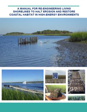
Shorelines with high boat wake and wave energy face especially rapid erosion and habitat loss. A new living shoreline design from researchers at the University of Florida and the Guana Tolomato Matanzas Reserve that uses gabion-breaks has proven successful in high-energy environments. The gabion-break design uses two lines of defense to reduce erosion along the marsh edge—porous wooden breakwalls placed in front of structures that will foster oyster growth. This manual for restoration practitioners describes a collaborative research project that tested gabion-breaks along the Atlantic Intracoastal Waterway in northeast Florida. It discusses the project’s results and details the steps to use gabion-breaks, including planning, design, maintenance, monitoring, and costs.
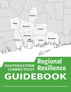
This guidebook results from the culmination of a year of dialogue among diverse stakeholders in southeastern Connecticut who defined challenges and solutions from extreme weather, climate change, and shifting social and economic conditions. Participants included representatives from nine municipalities, public and private utilities, public health departments, chambers of commerce, major employers, conservation organizations, academic institutions, community non-profits, and state agencies, among others. The dialogue captured six themed planning sectors (water, food, ecosystem services, transportation, energy, and regional economy) in a process that used surface and integrated solutions to address singular and multiple challenges across planning sectors. The guidebook provides a quick reference resource to help shape and inform actions that will advance a regional resilience framework for southeastern Connecticut; an accompanying Summary of Findings captures the project's final outcomes and conclusions, as well as providing a comprehensive account of the objectives, process, and details.
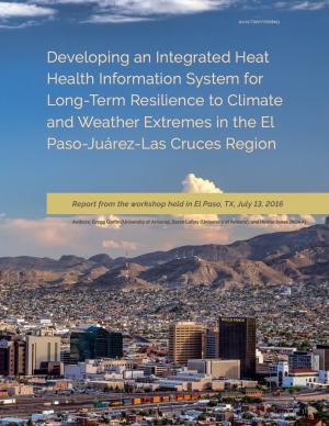
This report summarizes findings from a workshop held in El Paso, Texas, on July 13, 2016. The El Paso-Juárez-Las Cruces region is home to approximately 2.4 million people, most of whom are living in or near the urban centers of Ciudad Juárez (Chihuahua), El Paso, and Las Cruces (New Mexico). These cities share characteristics, such as a high proportion of residents of Hispanic origin, median income below the U.S. national average, and a range of climate-related environmental issues that include drought, flooding, air pollution, dust storms, and frequent occurrences of extremely high temperatures during the late spring and early summer. With hotter temperatures and more frequent and persistent heat waves projected for the El Paso-Juárez-Las Cruces region, it is critical to develop more robust systems of institutions, social learning, and partnerships to understand risks and strengthen public health resilience.
With insight from 26 campus and stakeholder advisors, the support of the USDA Agricultural Marketing Service’s Transportation Division, and input from regional food supply chain businesses throughout the region, this 68-page report details the process used to assess the Chicago region food system and findings through the three-year participatory research effort. It includes eleven sections with 17 figures to illustrate key concepts, along with extensive supporting materials. The report presents three innovations with proofs of concept that could be applied widely in the region and beyond to improve food distribution, both in rural and urban regions.
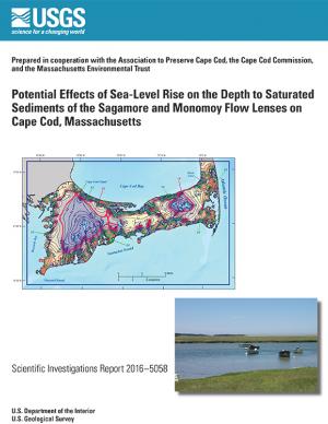
In 2014, the U.S. Geological Survey, in cooperation with the Association to Preserve Cape Cod, the Cape Cod Commission, and the Massachusetts Environmental Trust, began an evaluation of the potential effects of sea-level rise on water table altitudes and depths to water on central and western Cape Cod, Massachusetts. Researchers found that the potential does exist for groundwater inundation in some areas, but the effects of sea-level rise on depths to water and infrastructure likely will not be substantial on a regional level.
The State of Maine is experiencing shifts in atmospheric and oceanographic conditions that put it at the precipice of abrupt climate change. This report—part of the Department of Homeland Security's Regional Resiliency Assessment Program (RRAP)—focuses on the local and regional consequences of climate disruptions and their impacts on critical infrastructure in the Casco Bay region, the most developed and populous region in Maine. The report identifies vulnerabilities that may potentially affect the region’s ability to maintain its critical infrastructure systems and recover from the impacts of climate change.
Flooding and sea level rise are challenges the City of Charleston has taken seriously for centuries. However, this City that we love is experiencing the effects more frequently than ever. In the 1970s Charleston experienced an average of 2 days of tidal flooding per year and it is projected that the City could experience 180 days of tidal flooding in 2045. Identifying initiatives that will improve our ability to withstand these effects is timely. This
Sea Level Rise Strategy Plan is that comprehensive inventory of initiatives.
In 1993, Portland was the first U.S. city to create a local action plan for cutting carbon. Portland’s Climate Action Plan is a strategy to put Portland and Multnomah County on a path to achieve a 40 percent reduction in carbon emissions by 2030 and an 80 percent reduction by 2050 (compared to 1990 levels). The 2015 Climate Action Plan builds on the accomplishments to date with ambitious new policies, fresh research on consumption choices, and engagement with community leaders serving low-income households and communities of color to advance equity through the City and County’s climate action efforts.
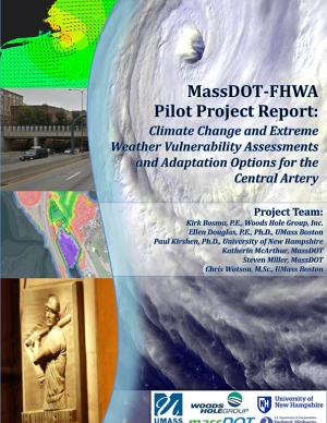
The two main objectives of this pilot project were to (1) assess the vulnerability of Boston's Central Artery/Tunnel System to sea level rise and extreme storm events, and (2) investigate and present adaptation options to reduce identified vulnerabilities.
This report—the first phase of the Department of the Interior (DOI) assessment effort for Hurricane Sandy projects—was developed for DOI by a metrics expert group of physical and ecological scientists and socioeconomic experts who recommended performance metrics for measuring changes in resilience resulting from the DOI-sponsored projects. It identifies natural and artificial coastal features most affected by Hurricane Sandy along the Northeast coast—such as marshes, beaches, and estuaries—and recommended metrics that would indicate resilience change in those features.
The State of New Hampshire has initiated a coordinated effort to proactively prepare for the effects of climate change on the natural and human resources of New Hampshire. An important aspect of this effort is to develop a vulnerability assessment of hydrologic response to climate change. The U.S. Geological Survey, in cooperation with the New Hampshire Department of Health and Human Services, is developing tools to predict how projected changes in temperature and precipitation will affect change in the hydrology of watersheds in the State. This study is a test case to assemble the information and create the tools to assess the hydrologic vulnerabilities in four specific watersheds.
The Resilient Strategies Guide for Water Utilities provides options for drinking water, wastewater, and stormwater utilities to assist them in developing plans that contain strategies that address their specific needs and priorities.
The Guide outlines the resilience planning process and helps you to identify potential strategies and promote a better understanding of resilience strategies. At the end of the Guide, you can download a report containing all of your selections and submitted information.
Find out how hometowns across the United States are building their resilience to climate change. Two women who studied climate change science and policy in graduate school took a three-month road trip to find out what climate change adaptation looks like in the United States. They visited more than 30 communities preparing for climate change and documented what they learned in blogs and through media reports. This report describes six big lessons from the ongoing adaptation work they saw across the country.
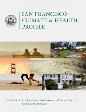
This report links climate change projections with their associated health outcomes, and identifies populations and locations most vulnerable to these health outcomes in San Francisco. The goal of the Climate and Health Profile is to support local public health climate adaptation efforts, and advance urban health and environmental justice in the climate and health field.
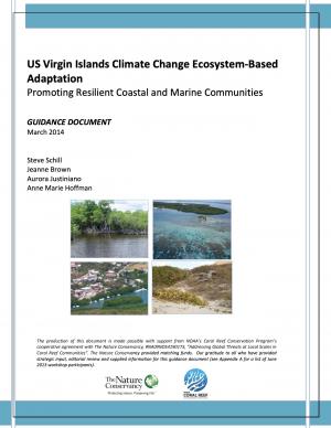
As with the rest of the world and the Caribbean region in particular, the coastal and marine communities of the US Virgin Islands (USVI) are susceptible to the effects of climate change. Hazards include increasingly hazardous coastal conditions and loss of life-sustaining marine, coastal, and island resources. Climate change is anticipated to add to the stresses of the coastal environment by altering temperature and precipitation patterns, increasing the likelihood of extreme precipitation events, and accelerating rates of sea level rise.
Responding and adapting to such changes requires an understanding of the risks; weighing options for adapting to changing conditions; and instituting a suite of strategies to implement, measure, and fund response actions having the most benefits to the ecosystems and communities that depend on those services. With support from National Oceanic and Atmospheric Administration’s (NOAA) Coral Reef Conservation Program, The Nature Conservancy’s (TNC) Caribbean Program directed a project with the objective of developing decision-support tools and conservation strategies that will advance the implementation of ecosystem-based adaptation (EBA) to climate change within the USVI.
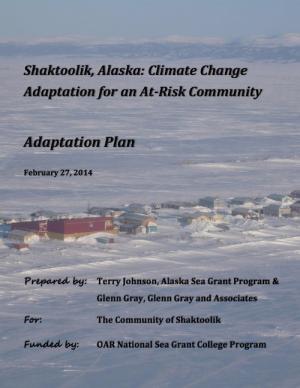
This report describes a community-driven project built on efforts by Shaktoolik and other at-risk, mainly Alaska Native villages on the Bering Sea coast to adapt to potentially devastating effects of climate change. The project involved a multi-party approach to assist the community of Shaktoolik to make a decision whether to relocate or stay at the current location. The result is a well-defined process that may be replicated by other at-risk communities in the region. The final report documents lessons learned, adaptation methods for Shaktoolik, potential funding sources, and a step-by-step action plan to implement the community's decision.
This report, the first of its kind for the City of Grand Rapids, outlines the condition of the city's climate resiliency and offers recommendations for how it can both impact and adapt to climate change. The report's goal is to both spur a larger community conversation around processes that will enable Grand Rapids to become a more climate-resilient city and to spur many specific short- and near-term projects, policies, programs, and plans to mitigate the effects of climate change. The report documents projected local climate changes, their potential negative impact to low-income families, and outlines small near-term solutions that the city can make to curb or adapt to climate change. Recommendations include investing in green space and improving the city's tree canopy, improving the city's energy autonomy, and implementing green street infrastructure materials and maintenance techniques.
The Dane County Climate Change Action Council was formed in March 2013 with a mission to ensure that Dane County government was better prepared for weather extremes brought on by global climate change. The Council facilitated an internal review of county preparations and potential modifications to the operations and capital investments of the county, resulting in this report identifying Dane County’s potential vulnerabilities to weather extremes associated with global climate change and strategies to adapt to a changing climate. The report is the first step in the county’s effort to improve the resiliency of its climate-sensitive resources in the face of climate change; future steps will include cross-departmental collaborations to implement the adaptation strategies outlined in the report.
The City of Marquette is the largest city in Michigan's Upper Peninsula and one of the most economically diverse in the state. The city is especially vulnerable to environmental, economic, and social impacts of climate change, largely because it borders Lake Superior. A team of Michigan State University Extension specialists and educators received funding from the Great Lakes Integrated Sciences and Assessments Center (GLISA) to collaborate with GLISA researchers, relevant decision makers, and stakeholders in Marquette to increase community resilience through incorporating climate variability and change adaption strategies into local land use master plans and policies. Key stakeholders in the agriculture, forestry, natural resources, health, planning, and tourism fields participated in the development of climate change concerns and strategies. Overwhelmingly, residents and local leaders wanted to protect the natural environment that makes Marquette such a desirable place to live. This report details the process and results of this community-driven process, and also contains specific, detailed GIS maps of the region that reflect the climate vulnerabilities and concerns of the residents and leaders in the Marquette region.
NOTE: This report inspired the creation of another report: "Climate and Health Adaptation Planning Guide for Michigan Communities"
The Sacramento-San Joaquin River Delta is the grand confluence of California’s waters, the place where the state’s largest rivers merge in a web of channels—and in a maze of controversy. In 2009, seeking an end to decades of conflict over water, the California Legislature established the Delta Stewardship Council with a mandate to resolve long-standing issues. The first step toward that resolution is the Delta Plan—a comprehensive management plan for California’s Sacramento-San Joaquin Delta, developed to guide state and local agencies to help achieve the co-equal goals of providing a more reliable water supply for California and protecting, restoring, and enhancing the delta's ecosystem.

