Access a range of climate-related reports issued by government agencies and scientific organizations. Browse the reports listed below, or filter by scope, content, or focus in the boxes above. To expand your results, click the Clear Filters link.
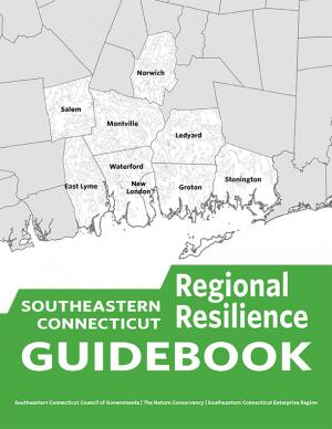
This guidebook results from the culmination of a year of dialogue among diverse stakeholders in southeastern Connecticut who defined challenges and solutions from extreme weather, climate change, and shifting social and economic conditions. Participants included representatives from nine municipalities, public and private utilities, public health departments, chambers of commerce, major employers, conservation organizations, academic institutions, community non-profits, and state agencies, among others. The dialogue captured six themed planning sectors (water, food, ecosystem services, transportation, energy, and regional economy) in a process that used surface and integrated solutions to address singular and multiple challenges across planning sectors. The guidebook provides a quick reference resource to help shape and inform actions that will advance a regional resilience framework for southeastern Connecticut; an accompanying Summary of Findings captures the project's final outcomes and conclusions, as well as providing a comprehensive account of the objectives, process, and details.
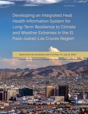
This report summarizes findings from a workshop held in El Paso, Texas, on July 13, 2016. The El Paso-Juárez-Las Cruces region is home to approximately 2.4 million people, most of whom are living in or near the urban centers of Ciudad Juárez (Chihuahua), El Paso, and Las Cruces (New Mexico). These cities share characteristics, such as a high proportion of residents of Hispanic origin, median income below the U.S. national average, and a range of climate-related environmental issues that include drought, flooding, air pollution, dust storms, and frequent occurrences of extremely high temperatures during the late spring and early summer. With hotter temperatures and more frequent and persistent heat waves projected for the El Paso-Juárez-Las Cruces region, it is critical to develop more robust systems of institutions, social learning, and partnerships to understand risks and strengthen public health resilience.
New U.S. regional sea level scenarios developed by NOAA and its partners will give coastal communities better, more localized data to help them plan for and adapt to the risk of rising sea levels to their economies and infrastructure.
This report documents that the average temperature in 2015 was over one degree higher than pre-industrial times and that the period 2011–2015 was the warmest five-year period on record, consistent with established warming trends. The report further documents that in 2015 another milestone was reached, with globally averaged CO2 levels of 400 parts per million (ppm). The year 2016 is on track to be even warmer and will be the first year in which CO2 at the Mauna Loa Observatory remains above 400 ppm all year, and for many generations to come.
The probability of extreme climate events since 2011, especially those involving extreme high temperatures, has been substantially increased by climate change, often by a factor of 10 or more. The single most significant event in humanitarian terms, with over 250,000 lives lost, was the 2011–2012 famine in the Horn of Africa, where drought was a major factor.
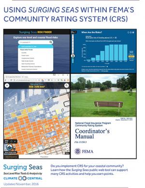
This guide describes how Climate Central's Surging Seas web tool can be used to support activities that receive points within the Federal Emergency Management Agency's (FEMA) Community Rating System (CRS) program. It is informed by conversations with local CRS coordinators and implementers, and with FEMA CRS representatives. The guide provides step-by-step instructions on how to access and obtain information and downloads from the Surging Seas tool that could be utilized within specific CRS activities in FEMA’s Coordinator’s Manual (FIA-15/2013).
The Office of Management and Budget (OMB), in collaboration with the Council of Economic Advisers (CEA), has attempted to quantify the fiscal risks posed by climate change for the Federal Government. To date, this effort has yielded two primary conclusions: first, that our current understanding of the fiscal risks of climate change is nascent, limited in scope, and subject to significant uncertainty; and second, that the evidence available thus far indicates the fiscal risks to the Federal Government could be very significant over the course of this century without ambitious action to reduce greenhouse gas emissions (GHGs) and adapt our communities to a changing climate.
This report outlines the contours of fiscal risk through five program-specific assessments: crop insurance, health care, wildfire suppression, hurricane-related disaster relief, and Federal facility flood risk. These programs were assessed because they are directly influenced by climate change, they have strong links to the Federal Budget, and quantitative scientific and economic models regarding the likely magnitude of impacts were available. This report also considers potential impacts to Federal revenues.
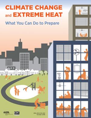
Climate change affects human health by making extreme heat more common, more severe, and last longer. That is expected to continue into the future. This handbook explains the connection between climate change and extreme heat events, and outlines actions citizens can take to protect their health during extreme heat. This resource builds on the 2006 Excessive Heat Events Guidebook from the Environmental Protection Agency (EPA), and includes up-to-date climate information from recent climate assessment reports, such as the 2014 Third National Climate Assessment, the 2016 Impacts of Climate Change on Human Health in the United States, and EPA’s 2016 Climate Change Indicators in the United States.
With insight from 26 campus and stakeholder advisors, the support of the USDA Agricultural Marketing Service’s Transportation Division, and input from regional food supply chain businesses throughout the region, this 68-page report details the process used to assess the Chicago region food system and findings through the three-year participatory research effort. It includes eleven sections with 17 figures to illustrate key concepts, along with extensive supporting materials. The report presents three innovations with proofs of concept that could be applied widely in the region and beyond to improve food distribution, both in rural and urban regions.
This Web toolkit raises airport operator awareness about vulnerabilities caused by significant weather events. The toolkit helps airports develop more robust contingency and recovery plans, in addition to their airport emergency plans. The toolkit focuses on events that are “rare but plausible”; that is, events that may have happened in the distant past, or in adjacent geographic areas, but are not common event types at the airport itself, and therefore may not be in the forefront of the airport managers’ minds.
As climate changes and ocean temperatures rise, the abundance, distribution, and life cycles of fish in federally managed ocean fisheries may change too. Federal agencies managing ocean fisheries have limited information to determine exactly how climate change might harm specific fish populations, and may not always understand the potential effects. To better manage climate-related risks, the report recommends (1) the development of guidance on how to incorporate climate information into the fisheries management process, and (2) finalizing Regional Action Plans for implementing the NOAA Fisheries Climate Science Strategy that incorporate performance measures for tracking achievement of the Strategy’s Objectives.
This guide provides basic assistance to electric utilities and other stakeholders in assessing vulnerabilities to climate change and extreme weather and in identifying an appropriate portfolio of resilience solutions. The guide is also part of a broader DOE effort to inform preparedness, resilience planning, and response initiatives.
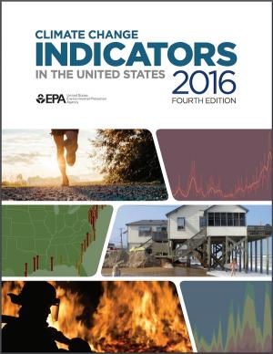
This report features observed trend data on 37 climate indicators, including U.S and global temperatures, ocean acidity, sea level, river flooding, droughts, and wildfires. It documents rising temperatures, shifting patterns of snow and rainfall, and increasing numbers of extreme climate events, such as heavy rainstorms and record high temperatures. Many of these observed changes are linked to the rising levels of carbon dioxide and other greenhouse gases in our atmosphere, caused by human activities.
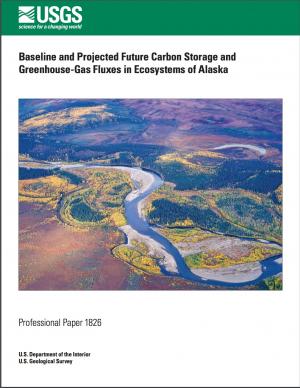
The cold temperatures of Alaska have led to the storage of vast quantities of soil and vegetation carbon, yet high-latitude ecosystems are potentially more vulnerable to higher temperature changes than ecosystems in the temperate zone. In particular, these increases in temperature may expose the substantial stores of carbon in the region to loss from more wildfire and permafrost thaw, which could turn the ecosystems of Alaska into a net carbon source. The assessment of Alaska ecosystem carbon stocks and fluxes, as well as methane fluxes, as reported here was conducted to better understand the baseline and projected carbon distributions and potential responses to a rapidly changing environment.
This document provides final guidance for federal agencies on how to consider the impacts of their actions on global climate change in their National Environmental Policy Act (NEPA) reviews, providing a framework for agencies to consider both the effects of a proposed action on climate change, as indicated by its estimated greenhouse gas emissions, and the effects of climate change on a proposed action. The memorandum applies to all types of proposed federal agency actions that are subject to NEPA analysis and guides agencies on how to address the greenhouse gas emissions from federal actions and the effects of climate change on their proposed actions within the existing NEPA regulatory framework.
An analysis of 45 years of U.S. Forest Service records from the western U.S. show that the number of large fires on Forest Service land is increasing dramatically. The area burned by these fires is also growing at an alarming rate.
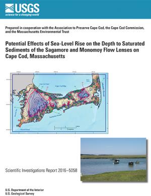
In 2014, the U.S. Geological Survey, in cooperation with the Association to Preserve Cape Cod, the Cape Cod Commission, and the Massachusetts Environmental Trust, began an evaluation of the potential effects of sea-level rise on water table altitudes and depths to water on central and western Cape Cod, Massachusetts. Researchers found that the potential does exist for groundwater inundation in some areas, but the effects of sea-level rise on depths to water and infrastructure likely will not be substantial on a regional level.
This assessment strengthens and expands our understanding of climate-related health impacts by providing a more definitive description of climate-related health burdens in the United States. It builds on the 2014 National Climate Assessment and reviews and synthesizes key contributions to the published literature. The findings represent an improvement in scientific confidence in the link between climate change and a broad range of threats to public health, while recognizing populations of concern and identifying emerging issues. The overall findings underscore the significance of the growing risk climate change poses to human health in the United States.
A multi-agency team of researchers developed this Department of Defense report to provide regionalized sea level and extreme water level scenarios for the years 2035, 2065, and 2011 for 1,774 military sites worldwide. The information included in the report is meant to assist decision makers and others in making robust choices to manage their risk of future sea level and extreme water levels.
The U.S. Environmental Protection Agency produced this publication with assistance from federal, state, local, and academic partners. It is designed to help community officials, emergency managers, meteorologists, and others plan for and respond to excessive heat events. The guidebook highlights best practices that have been employed to save lives during excessive heat events in different urban areas. Originally published in June 2006, its Appendix A—a list of federal resources—was updated in March 2016.
This fact sheet presents recent climate change investigations of the U.S. Geological Survey in New England using selected recent publications that highlight the broad spectrum of expertise and commitment to understanding the relations of climate change and water resources in the region.
The State of Maine is experiencing shifts in atmospheric and oceanographic conditions that put it at the precipice of abrupt climate change. This report—part of the Department of Homeland Security's Regional Resiliency Assessment Program (RRAP)—focuses on the local and regional consequences of climate disruptions and their impacts on critical infrastructure in the Casco Bay region, the most developed and populous region in Maine. The report identifies vulnerabilities that may potentially affect the region’s ability to maintain its critical infrastructure systems and recover from the impacts of climate change.
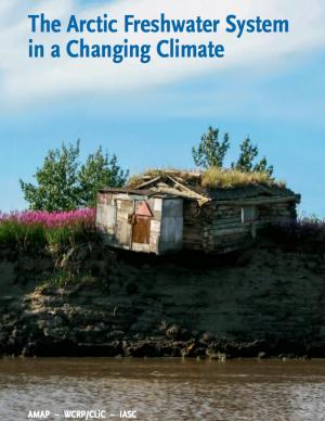
The Arctic is changing at a startling pace. Understanding the role of freshwater in these changes—both how Arctic freshwater systems are affected by climate change, and how changes to the Arctic freshwater system will affect other environmentally relevant processes—is critical to understanding how these changes will affect the lives of people living in the Arctic and beyond. This report is intended to inform the non-expert reader about these changes to the freshwater systems in the Arctic, and their implications.
As climate has warmed over recent years, a new pattern of more frequent and more intense weather events has unfolded across the globe. Climate models simulate such changes in extreme events, and some of the reasons for the changes are well understood. Warming increases the likelihood of extremely hot days and nights, favors increased atmospheric moisture that may result in more frequent heavy rainfall and snowfall, and leads to evaporation that can exacerbate droughts.
Event attribution can answer questions about how much climate change influenced the probability or intensity of a specific type of weather event. As event attribution capabilities improve, they could help inform choices about assessing and managing risk, and in guiding climate adaptation strategies. This report examines the current state of science of extreme weather attribution, and identifies ways to move the science forward to improve attribution capabilities.
The SECURE Water Report identifies climate change as a growing risk to Western water management and cites warmer temperatures, changes to precipitation, snowpack and the timing and quality of streamflow runoff across major river basins as threats to water sustainability. Water supply, quality and operations; hydropower; groundwater resources; flood control; recreation; and fish, wildlife and other ecological resources in the Western states remain at risk.
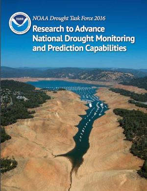
Drought threatens our country’s natural resources, economy, and overall health. Increasingly, NOAA is charged with providing and improving information that helps stakeholders at all levels manage water resources in a more resilient and climate-smart manner. Working with input from farmers, ranchers, natural resource managers, and other drought-impacted industries and populations, NOAA research has worked to improve drought monitoring and prediction for better planning and mitigation of impacts.
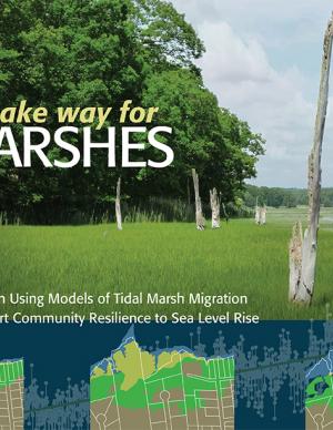
Rapidly rising seas threaten to drown tidal marshes and diminish the benefits provided to people and wildlife by these valuable coastal ecosystems. Increasingly, government agencies and non-government organizations are harnessing the power of computer-based models of marsh ecosystems to inform management and policy strategies to sustain tidal marshes. This report covers the entire modeling lifecycle, from developing a modeling approach and working with data to communicating modeling results. While some of the information pertains specifically to the northeastern United States, the report is also intended as a useful resource for modeling of marsh migration in other regions. The report is available online, with a printer-friendly version also available for download.
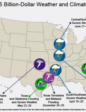
The National Centers for Environmental Information (NCEI) is the nation's scorekeeper in terms of addressing severe weather and climate events in their historical perspective. As part of its responsibility of monitoring and assessing the climate, NCEI tracks and evaluates climate events in the U.S. and globally that have great economic and societal impacts. Found on these webpages are information on the weather and climate events that have had the greatest economic impact from 1980 to 2015. The U.S. has sustained 188 weather and climate disasters since 1980 where overall damages/costs reached or exceeded $1 billion (including CPI adjustment to 2015). The total cost of these 188 events exceeds $1 trillion.
This technical report focuses on sharing the collective efforts of the Inuit Circumpolar Council-Alaska, 146 Inuit contributing authors, a 12-member Food Security Advisory Committee, and many other Inuit who provided input and guidance to the process. The report aspires to strengthen the evidence base of (1) what Inuit food security is, (2) what the drivers of food (in)security are, and (3) identify information needed to conduct an assessment through the development of a conceptual framework. The assessment tool is designed to build the baseline of information needed to understand the Arctic environment and allow a pathway for assessments (food security, ecosystem, political, cultural, etc.) to link eco- and socio- components of sciences and indigenous knowledge.
This peer-reviewed scientific assessment identifies climate change effects on global food security. Climate change is likely to diminish continued progress on global food security through production disruptions that lead to local availability limitations and price increases, interrupted transport conduits, and diminished food safety, among other causes. The assessment is a contribution to the U.S. National Climate Assessment, is called for under the President’s Climate Action Plan, and was led by the U.S. Department of Agriculture.
Flooding and sea level rise are challenges the City of Charleston has taken seriously for centuries. However, this City that we love is experiencing the effects more frequently than ever. In the 1970s Charleston experienced an average of 2 days of tidal flooding per year and it is projected that the City could experience 180 days of tidal flooding in 2045. Identifying initiatives that will improve our ability to withstand these effects is timely. This
Sea Level Rise Strategy Plan is that comprehensive inventory of initiatives.
The 2015 World Economic Forum rated food crises, extreme weather, and failure of infrastructure as top global risks in 2015. Around the world, regions are contending with extreme weather, including drought, flooding, and changes in growing seasons. These extremes affect crops and pests, and may disrupt agriculture and its supply chains, especially in the second half of this century. This paper presents an example of how transportation of agricultural products in the Upper Mississippi River Valley region of the United States may be impacted by, and respond to, a changing climate.
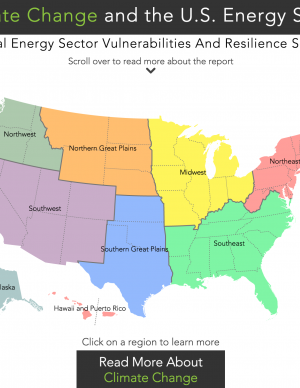
An interactive map provides access to one-page documents of climate and energy information customized for nine regions of the United States. Each document summarizes climate impacts for the region; provides a table of Quick Facts on energy supply and demand, electrical power, and critical infrastructure in the region; and enumerates examples of important energy sector vulnerabilities and climate resilience solutions.
This report synthesizes available science on the observed and projected impacts of climate change in the Great Lakes Basin and documents the climate change assessment methods applied in the region. It was initiated in support of commitments under Annex 9-Climate Change Impacts of the Great Lakes Water Quality Agreement to take into account the climate change impacts on the chemical, physical, and biological integrity of the waters of the Great Lakes and communicate and coordinate binationally regarding ongoing developments of domestic science. The report draws upon the range of research conducted by various levels of government, academia, and other organizations and the growing body of knowledge in areas of ecological research and climate change and provides researchers, managers, and decision makers with a time-stamped, thorough, and methodical examination of that climate change science.
The Hawai‘i Fresh Water Initiative was launched in 2013 to bring multiple, diverse parties together to develop a forward-thinking and consensus-based strategy to increase water security for the Hawaiian Islands. This Blueprint is the result of the work of the Hawai‘i Fresh Water Council, and provides Hawai‘i policy and decision makers with a set of solutions that have broad, multisector support in the fresh water community that should be adopted over the next three years to put Hawai‘i on a path toward water security. The ultimate goal of the initiative is to create 100 million gallons per day in additional, reliable fresh water capacity for the islands by 2030. The report outlines three aggressive water strategy areas with individual targets.
This document identifies seven key steps to increase production, delivery, and use of climate-related information to support the management of fish stocks, fisheries, and protected species. The steps focus on how a changing climate affects living marine resources, ecosystems, and the communities that depend on them, and how to respond to those changes. The strategy identifies key risks in the U.S. from climate change, including millions of U.S. jobs, ocean fisheries worth billions, protected marine species, habitats that provide valuable services, and the health and enjoyment of our oceans and coasts from recreation and tourism.
This handbook (USGS Professional Paper 1815) was designed as a guide to the science and simulation models for understanding the dynamics and impacts of sea level rise on coastal ecosystems. Coastal land managers, engineers, and scientists can benefit from this synthesis of tools and models that have been developed for projecting causes and consequences of sea level change on the landscape and seascape.

