A balancing act
Increasingly accessible resources in the Arctic region have caught the imagination of potential developers. For instance, exploration geologists believe the North Slope of Alaska and the seas around it hold some of the largest remaining deposits of oil, gas, and coal in the United States. Additionally, the region provides habitat for a diverse array of fish, wildlife, and plant resources. A range of individuals and companies are eager to build businesses based on the region’s rich resources.
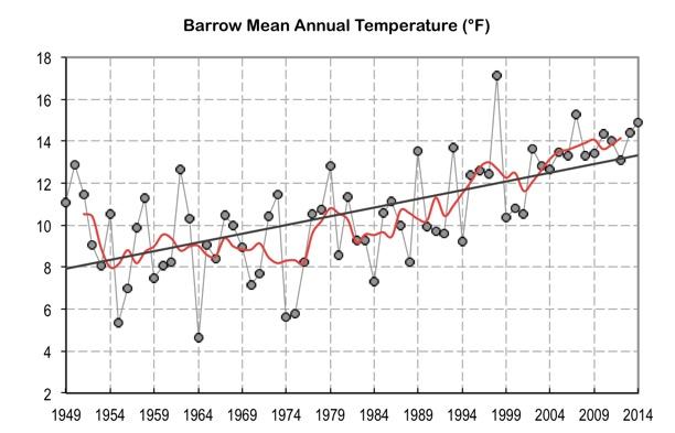
The region has also caught the attention of environmental stewards and groups that monitor climate conditions and impacts. As temperatures rise, melting permafrost endangers infrastructure and modifies landscapes, reduced sea ice necessitates new approaches for subsistence hunters, and increased coastal erosion reduces the expanse of safe, solid land along coasts.
To balance conflicting goals of resource development and climate resilience, decision makers need solid scientific information and an informed vision of potential future conditions in the region.
Imagining possible futures
In order to understand the potential costs and benefits of developing Arctic resources in a safe and sustainable manner—and to help ensure that residents and ecosystems in the region can adapt as conditions change—federal, state, local, and Native entities in Alaska formed the North Slope Science Initiative (NSSI). The group is authorized to serve as an inter-governmental forum for science collaboration through the Energy Policy Act of 2005.
To produce science-based guidance for development or energy resources in the region, NSSI took up the idea of developing detailed scenarios—plausible stories about how the future might unfold—to describe how resource development could occur and what monitoring efforts would be useful to help protect people and the environment as conditions change.
To get started, the NSSI scenarios project team gathered information and worked with key stakeholders to consider what development activities might occur on the North Slope and in the Beaufort and Chukchi seas. Stakeholders included individuals from North Slope communities, representatives of energy and resource extraction and processing industries, tribal members, academic partners, non-governmental organizations, and members of the North Slope Science Initiative. Together, experts and stakeholders considered uncertainties that might affect resource development in the context of a changing climate through the year 2040.
How much development?
Working through the complex and sometimes conflicting goals of stakeholders, the North Slope Science Initiative used a three-stage process to identify and explore possible outcomes of resource development.
In the first stage, collaborators and expert consultants compiled background documents to stimulate discussion and understanding of key drivers of change in the region. Experts and stakeholders used these documents in a workshop setting to explore a range of development scenarios. Participants worked in small groups to discuss uncertainties and relationships among the drivers of change, and rank the importance of various drivers. Workshop outcomes included several scenario narratives plus supporting maps for three potential futures.
NSSI grouped workshop outcomes into three scenarios based on the level of development they described. In the high development scenario, resource development occurs both onshore and offshore. In the medium development scenario, most development activity occurs onshore. In the low development scenario, resource extraction activities decrease onshore and no activity occurs offshore.
Implications of development
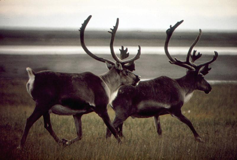
At a second workshop, stakeholders considered the implications of each of the three scenarios. How would each potential future impact people and systems across the region? Participants produced 15 scenario implication maps with corresponding narratives. For example, for the high development scenario, participants recognized that new roads and infrastructure could impact activities such as caribou hunting, and they sketched a map of the area they thought might be impacted.
The NSSI scenarios project team is now analyzing narratives from the workshop and linking them with available data. For the example above, NSSI staff will locate scientific data to document the actual range of caribou and the areas where subsistence hunting occurs, and integrate spatially accurate information representing these activities into their maps. End users will be able to use the scenario maps to make informed estimates of the costs and benefits of development.
The final phase of the project will assess current environmental monitoring activities in the North Slope region to determine if they are sufficient to detect and monitor changes that could occur as a result of development. By the end of the project, NSSI will have a solid list of the scientific information stakeholders need to support decisions related to development of energy resources.
The stepwise process of imagining plausible futures, listing foreseeable implications, and considering the potential affects of climate on systems such as transportation, infrastructure, ecosystems, and communities can help the region choose its future. Outcomes of the project will provide companies, organizations, and agencies with a science-informed look at the primary factors that might affect development of natural resources in the North Slope region. Additionally, U.S. Arctic managers can access information from the project to help them make informed decisions about what research and monitoring will be necessary to keep residents and ecosystems safe as development occurs.


