Landslide Monitoring
Find stations and view data from this pilot project to develop a national landslide inventory database.
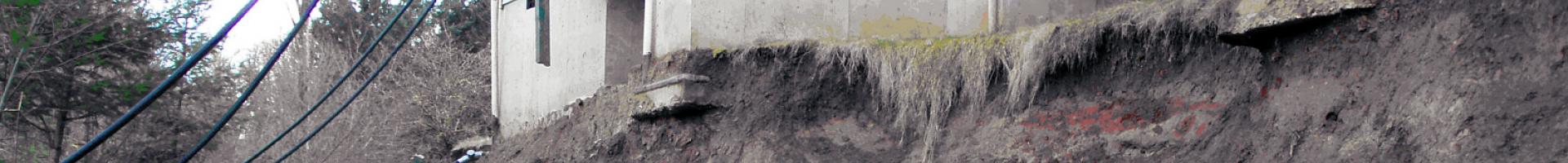
Scientists in the U.S. Geological Survey's Landslide Hazards Program monitor selected landslides and hillsides in order to learn more about the physical processes that trigger landslides. Continuous, real-time monitoring occurs at some sites and periodic monitoring occurs at others; the most recent measurements are provided online for a few of the monitoring sites. Graphs showing the most recent data are updated regularly, with update cycles ranging from 15 minutes to 24 hours. Updates may be interrupted occasionally by instrument, computer, or network malfunctions.
Information is currently available for monitoring stations located in California, Colorado, North Carolina, Oregon, Puerto Rico, and Washington.