Image
Hazard
Landslides
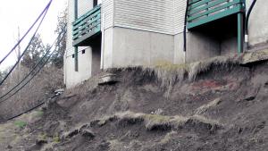
Relatively rapid downhill movement of a mass of soil, rock, and other debris.
Relevant Options
Maintain a jurisdiction-wide repository for landslide data, including the locations and dates of slides and observations about factors that may have contributed to their occurrence.
Complete an inventory of locations where critical facilities, other buildings and infrastructure are at high risk for erosion or landslides.
Manage risk or remove existing buildings and infrastructure from high-risk erosion and landslide hazard areas. For example, where prevention measures are not feasible, consider an acquisition, relocation
Develop a notification system for natural hazards that is responsive to community needs.
Encourage nonprofits to hold land conservation easements. Encourage them to use those easements in ways that help manage climate change impacts.
Consult local experts such as public works and planning departments or state geological staff to identify areas of your community at high risk for erosion or landslides.
Collaborate with your health department and Area Agency on Aging to identify individuals vulnerable to the effects of erosion or landslides. Determine
Inform property owners and residents located in areas at high risk of erosion and landslide about their risks.
Update local government maintenance protocols to prepare for climate vulnerabilities.
Increase awareness of erosion and landslide hazards. Consult with emergency management professionals to create a community warning or public notification system.
Develop and promote an educational campaign to build a shared understanding of the value of urban forests and encourage planting appropriate species, watering and care.
Locate utilities and critical facilities outside of areas susceptible to erosion or landslides to decrease the risk of service disruption.
Ensure there are alternate routes identified for emergency service vehicles during floods and landslides.
Harden and stabilize roads against landslides with retaining walls and vegetation.
Conduct an audit of landslide and flood-prone areas. Identify the likelihood and consequences of climate related impacts to these properties. Prioritize
Collaborate with state resource management agencies and partner institutions to map landslide risk along transmission line rights-of-way and critical access roads. Include research on the effects of heavier
Incorporate information on bridge and road vulnerability to erosion, flooding and landslides into capital improvement planning processes.
Develop or update the jurisdiction's landslide study to reflect current and projected climate conditions.
Ensure backup power is available at facilities that serve vulnerable populations.
Implement monitoring mechanisms or procedures (e.g., visual inspection, electronic monitoring systems) in landslide hazard areas.
Related Case Studies & Action Plans
Image
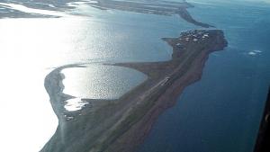
This photo has been released into the public domain because it contains materials that originally came from the U.S. Army Corps of Engineers. No endorsement by licensor implied.
Image
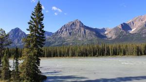
Photo attributed to Royalbroil. Incorporated here under the Creative Commons Attribution 3.0 Unported license. No endorsement by licensor implied.
