Image
Tool
ForWarn Forest Change Assessment Viewer
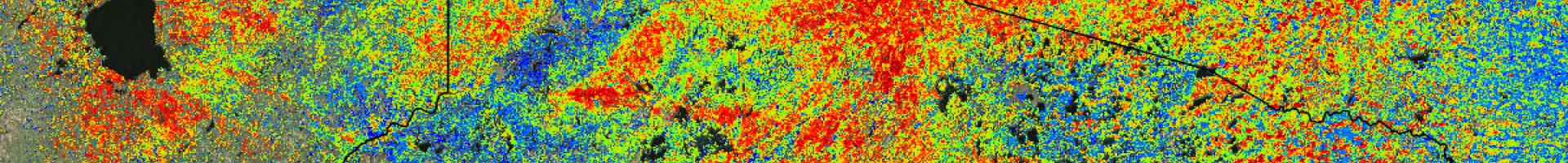
Forest managers and landowners can monitor forest health across the contiguous United States using satellite images taken every eight days. ForWarn's images and tools help them attribute abnormalities to insects, disease, wildfire, storms, human development, or unusual weather. Archived data provide the ability to detect disturbances across all lands since 2000.
The Assessment Viewer displays phenological data products to better understand landscape conditions and to warn of potential forest disturbances. It also includes an archive of frequently updated ForWarn national disturbance maps and other related data.