A beach in trouble
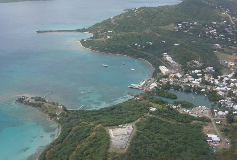
The community of Culebra, on a small island east of Puerto Rico's main island, could tell that Playa Tamarindo was in trouble. The coral habitats located within an easy swim of their popular beach were showing signs of stress. Looking for the cause, community members recognized erosion from an unpaved parking lot and road had increased the volume of land-based sediments that drifted into nearshore marine communities.
The coral communities are a crucial part of both the marine ecosystem and Culebra’s tourism economy. Snorkeling, diving, and kayaking to experience intact, healthy coral communities—and maybe spot one of three species of sea turtles—make Tamarindo Beach the second-most visited beach on Culebra. And this island resource was suffering.
Individual coral animals—called polyps—tolerate a relatively narrow range of environmental conditions. In order to thrive, they require clear, tropical waters, free of pollutants and sun-blocking sediments.
When Culebranses took notice of the post-rainstorm runoff carrying pollutants such as sediment, they recognized the processes as a factor in the observed coral bleaching, excessive algal growth, and coral death. To save the corals of their beloved beach, they took action.
Plan the work...
Residents participated in community meetings to make a plan. They agreed that the primary issues at Tamarindo Beach involved runoff from the dirt parking area and the partially paved access road to the beach. A second factor involved motor vehicles driving (illegally) on the beach and dunes, damaging the capacity of any remaining vegetation to hold sediment in place. They set project goals to reduce these sources of sediment and ameliorate conditions for the nearshore ecosystems. The plan included actions for beach stabilization, reforestation of permanent vegetation, and the delineation of pedestrian and vehicular traffic to and from the beach. With a clear vision of their project, they got to work.
...and work the plan
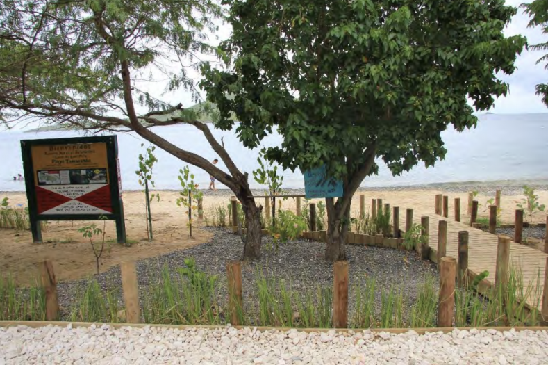
To slow the flow of rainwater, the community leveled and stabilized the 10-12 car parking area, covered it with a layer of stone, and surrounded it with a wooden fence. To keep motor vehicles in the parking area and off the beach, fence posts were cemented in place along the edge. To further stem the flow of runoff, members of the community planted 600 grasses around the perimeter of the parking lot. They selected grass plants known for their stabilizing root systems and sediment-trapping capacity. Finally, an area near the parking lot where water accumulated after rain was broken up with swales, giving rainwater that pooled in the area a chance to infiltrate into the ground. With the parking lot secure, the team turned their attention to revegetating the area between the parking lot and the beach.
The group implemented measures to slow the flow of runoff to the beach. One tactic involved creating two small infiltration galleries to treat water coming from the parking lot. The next involved replanting areas that were denuded due to uncontrolled vehicle access to the beach.
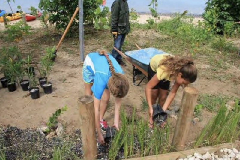
Volunteers planted 325 trees and shrubs donated by the Department of Natural Resources of Puerto Rico (DNER), including sea grape, portia tree and cooperwood, and cocoplum. To guide pedestrians to the beach and away from the new plantings, three access points were clearly marked, two with small boardwalks to keep visitors off of the developing vegetation. Community members fill a 400-gallon cistern each week to ensure adequate water for the new plants.
The access road is part of the second phase of the project, and the Municipality of Culebra is finalizing details to complete the paving of the road.
Many hands make light work
The Tamarindo Beach restoration project is a remarkable example of a community collaboration. The Caribbean nonprofit CORALations helped to select the site, supported with data collected by the Society of Marine Environment and its student chapter that demonstrated the adverse effects of marine sedimentation on coral habitats off Playa Tamarindo over the years. The project was wrapped into the Watershed Management Plan for Culebra, which involved the Puerto Rico DNER and the Forest Service Bureau. Funding came from the Coral Reef Conservation Program of the National Oceanic and Atmospheric Administration, with project design and implementation provided by the nonprofit organizations Protectores de Cuencas, Inc. and Ridge to Reefs, Inc. Local organizations, including students from Culebra's Eco School and Abbie's School, round out the list of partners. It goes without saying that this project could not have taken place without the active participation of the community of Culebra.
And the results, please...
Project managers used an open-source digital tool called OpenNSPECT, from NOAA's Office for Coastal Management, to determine the impact of their work. Using baseline water quality data, managers can evaluate the success of the restoration project. Initial reviews of the data indicate overall sediment levels in Tamarindo’s marine habitats have decreased.
The successful watershed restoration project at Playa Tamarindo is one of many habitat conservation projects on Culebra Island that opened doors to collaboration among federal, territorial, academic, and nonprofit partners, ensuring the health of island ecosystems into the future.


