A region at risk
Land around the San Francisco Bay hosts a diverse mix of neighborhoods, waterfronts, industrial districts, airports, recreation areas, and habitat for fish and wildlife. Networks of freeways, railroads, power lines, and other infrastructure crisscross the land and extend into and across the water. Recognizing that rising sea level puts everything around the Bay at risk, people are working together to prepare for changes along their shoreline.
In 2010, individuals and groups in the region initiated a partnership to promote preparedness for sea level rise and storm events while protecting ecosystems and infrastructure. To get things started, the San Francisco Bay Conservation and Development Commission (BCDC) and partners initiated the Adapting to Rising Tides (ART) project along the eastern shore of the Bay in Alameda County.
Visualizing vulnerabilities
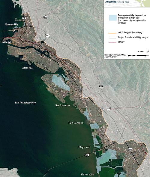
One effort of the ART project was to produce a map of the Bay Area showing areas of potential inundation for different amounts of sea level rise. The group accessed high-resolution topographic data available through federal and state agencies, and combined them with contours representing various elevations for sea level. They also used socioeconomic and demographic data to depict the social vulnerability of communities across the region. Using the map, stakeholders with a range of concerns could visualize their vulnerabilities and recognize the value of working with others toward mutually beneficial outcomes.
Building capacity to engage stakeholders in the planning process
To build the project's effectiveness, leaders of the ART project and staff from city and county agencies participated in NOAA’s Roadmap for Adapting to Coastal Risk training. The team used resources available through the Digital Coast to deepen their understanding of the components of vulnerability to sea level rise, come up with adaptation options for responding to specific risks, and build the capacity of stakeholder groups to engage in adaptation planning.
Expanding engagement
Based on their initial success, the partnership expanded the ART project to bring the information, tools, resources, and lessons learned to the broader San Francisco Bay area. Communities involved in local planning efforts or adaptation projects can access a portfolio of tools and resources, or participate in staff engagement opportunities focused on planning at a number of regional, asset-specific, and neighborhood scales. Based in part on the engagement opportunities offered through this regional partnership, municipal leaders and residents around the Bay are using the Sea Level Rise Viewer to visualize and document vulnerability and build climate reslilience.


