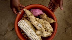
Home
Main navigation
  • Case Studies
    Mega Menu Icon
    Image
    case study icon
    Browse Case Studies
    • Filtered by hazard
      • Drought
      • Extreme Heat
      • Coastal Flooding
      • Flooding
      • Wildfire
    • Filtered by asset
      • Agriculture
      • Community Services
      • Critical Facilities
      • Economy
      • Energy
      • People
      • Property
      • Natural Areas
      • Transportation
      • Water Infrastructure
  • Tools
    Mega Menu Icon
    Image
    data and tools icon
    Browse Tools
    • Filtered by hazard
      • Drought
      • Extreme Heat
      • Coastal Flooding
      • Flooding
      • Wildfire
    • Filtered by asset
      • Agriculture
      • Community Services
      • Critical Facilities
      • Economy
      • Energy
      • People
      • Property
      • Natural Areas
      • Transportation
      • Water Infrastructure
  • Funding
    Mega Menu Icon
    Image
    funding icon
    Browse Funding & Capacity
    • Funding & Building Capacity
    • Search for Funding Opportunities
    • Grant Development Resources
  • Steps to Resilience
    • Overview
    • Get Started
    • Understand Exposure
    • Assess Vulnerability & Risk
    • Investigate Options
    • Prioritize & Plan
    • Take Action
  • Toolkit Contents
    Mega Menu Icon
    Image
    popular resources icon
    Browse Popular Resources
    • Announcements
    • About this Toolkit
    • Steps to Resilience
    • Glossary
    • Contact
    • Case Studies
    • Tools
    • Help Desk
    • Trainings
    • Options Database
    • New to the Toolkit?
    • Topics & Sectors
    • Regions
    • Hazards
    • Assets

Breadcrumb

  1. Home
  2. Tool
Tool

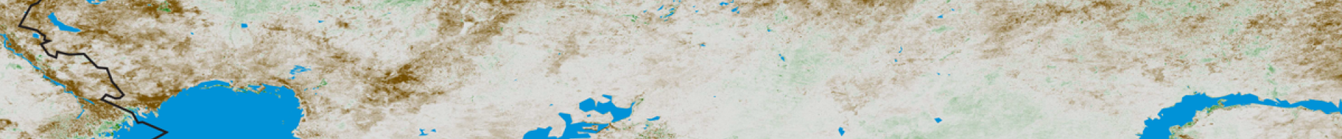
Famine Early Warning System Network (FEWS NET)

Description

This portal provides access to geospatial data, satellite image products, and derived data products in support of drought monitoring efforts that could give early warning about potential famines throughout the world. 

Details

Hazards
Drought
Extreme Heat
Flooding – General
High Winds
Assets
Agriculture and Food Supply
Economy
People
Sources
United States Geological Survey (USGS)
Take me to the tool

Steps Addressed

Get Started
Understand Exposure
Assess Vulnerability & Risk
Investigate Options
Prioritize & Plan
Take Action

Related Case Studies & Action Plans

Using Climate Data, Satellite Imagery, and Local Knowledge to Prevent Famine
Browse Case Studies
Browse All Tools
Climate.gov
  • Home
  • News & Features
  • Teaching Climate
  • Maps & Data
  • FAQs
  • Contact
Main Menu
  • About
  • FAQ
  • Contact
  • Acknowledgments
  • Sitemap
Latest
  • Funding Opportunities
  • Glossary
  • Announcements
Partners
  • climate.data.gov
  • climate.gov
  • USA.gov
  • NEMAC
Toolkit
  • Case Studies
  • Tools
  • Funding
  • Steps to Resilience
  • Popular Resources

Climate Resilience Toolkit home link

Required Footer Links
  • NOAA Privacy
  • Accessibility
  • FOIA
  • Information Quality
  • No-FEAR Act
  • Ready.gov
  • USA.gov