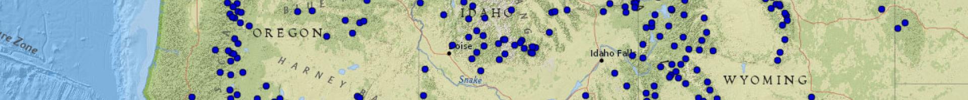
Snow Telemetry (SNOTEL) Data Viewer
Resource managers and flood forecasters access SNOTEL (snow telemetry) data to monitor temperature, precipitation, and the amount of water stored as snowpack at remote mountain sites across the West.
SNOTEL sites are automated weather stations installed in remote, mountainous areas where it’s difficult for people to travel. Pressure-sensitive “pillows” at the sites weigh the amount of snow that sits on them through the winter. Hourly measurements provide resources managers with a continuous estimate of the amount of water contained in snowpack. Temperature and precipitation data recorded at SNOTEL sites also help resource managers understand local conditions at the remote sites. This information is valuable for estimating the rate of snowmelt.
For each station, the SNOTEL Data Viewer provides one-click access to station information, tables showing 30 days of daily data or 7 days of hourly data, water year year-to-date charts showing accumulated precipitation, and other custom reports.
