Coastal Impacts
The Southeast's productive coastal zone
The coastal zone of the United States Southeast region encompasses a rich and diverse landscape of people, habitats, species, and ecosystems. The coastal plain and low-lying inland region support a rapidly growing population, tourism economy, critical infrastructure, and important cultural resources and assets.
Industries related to the coast such as fishing, shipping, and tourism are economic drivers in the Southeast, which accounts for more than 20 percent of the nation's gross domestic product. Despite its diverse livelihoods and robust economy, the combined effects of accelerating sea level rise, increases in the amount of rain that falls in heavy downpours, and continuing coastal development are increasing flood risks and threatening personal safety, vital ecosystems, and coastal economies.
Rising seas mean more coastal flooding
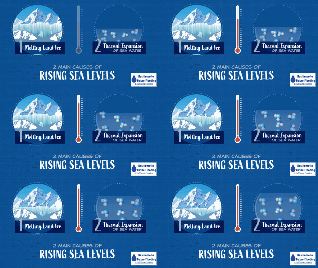
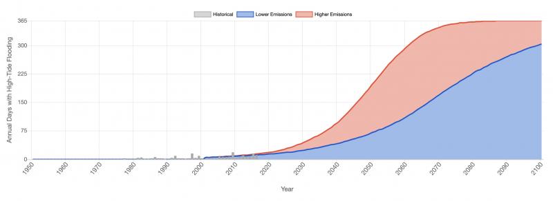
Averaged over the whole planet, warming temperatures from the emissions of heat-trapping gases are causing land and glacial ice to melt and ocean water to expand as it warms. Together, these processes are raising average global sea level. As warming continues, the rate of global sea level rise is accelerating. Estimates for the amount of global sea level rise expected in the coming decades vary depending on local geography. Though timing differs, all scenarios in the Southeast United States point to increases in the depth and frequency of coastal flooding. By 2050, many Southeast cities are projected to experience more than 30 days of high tide flooding per year, even with reductions in fossil fuel emissions.
Along some Southeast coasts, global sea level rise is paired with regional or local sinking land due to natural forces and/or extraction of water, oil, and gas. Alterations in ocean circulation, caused by changes in wind, currents, and climate patterns, are also a factor in relative sea level rise. As a result, local rates of sea level rise in the Southeast are even higher than the global average. Some tide gauges in low-lying areas of the Southeast already show 1 to 3 feet of local relative sea level rise over the past 100 years. This trend is anticipated to continue throughout this century.
In addition, as documented by a recent scientific review, the intensity of tropical storms is likely increasing due to warmer ocean temperatures, increasing the odds of extreme coastal flood events. In summary, rising seas are causing more coastal flooding; normal high tides are increasingly reaching critical levels; higher storm surges are inundating areas further inland; and saltwater intrusion is increasingly affecting ecosystems and infrastructure.
High tides
The highest tides of the year occur when the Moon’s regular orbit brings it close to Earth while the Moon is in its new or full phase. This natural condition, unrelated to climate, is called perigee (peri = near and gee = Earth). Perigean tides, also called “king tides,” usually occur over several days in the spring and fall each year. In many cities, these conditions result in recurrent flooding along coastlines. Additionally, even without perigee, high tides, sometimes heightened by weather, are more frequently generating flooding impacts.
Without significant adaptation measures, many coastal locations in the Southeast are projected to experience daily high-tide flooding by the end of the century. Numerous historic buildings, forts, and prehistoric archaeological sites exist across the coastal Southeast, and more than 13,000 of these locations are at risk of flooding and inundation.
Impacts of high tides
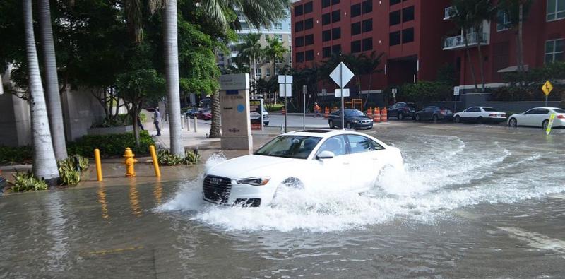
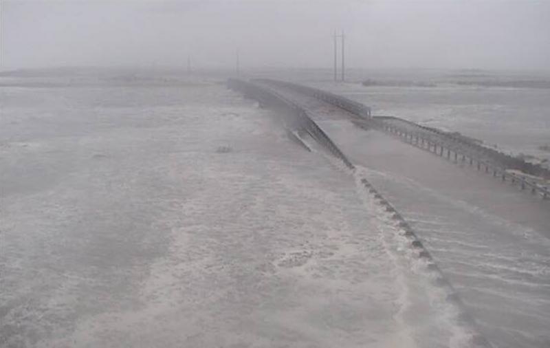
Much of the Southeast region’s coast is bordered by large expanses of salt marsh and barrier islands. Long causeways with intermittent bridges connect the mainland to these popular tourism destinations. Most of the bridges were built decades ago at only a few feet above the highest water levels of the year. Sea level rise has put these transportation connection points at risk: high-tide coastal flooding has started to inundate these and other low-lying roads, restricting access during certain times of the day and stranding people on the islands.
High-tide floods have several impacts on infrastructure, including increasingly frequent road closures, excess water in stormwater management systems, and deterioration of roads, rails, and other infrastructure from exposure to saltwater. NOAA’s National Weather Service issues coastal flood advisories and warnings when water levels at tide gauges are expected to rise above identified flooding levels.
The rise in sea levels also causes saltwater intrusion, affecting surface and groundwater supplies, habitats and agricultural lands, and water management infrastructure. Already, communities in the Southeast's coastal areas—from Baton Rouge, Louisiana, to South Carolina's Low Country—are dealing with saltwater intrusion in aquifers and septic systems, threatening potable water supplies and wastewater management.
In several low-lying coastal cities in the Southeast, the annual number of high-tide coastal flooding events has increased 500 to 1,000 percent since the 1960s. High-tide flooding is now accelerating at 75 percent of locations along the East and Gulf Coasts. Nineteen locations, primarily in these regions, broke or tied their flood records. NOAA's National Ocean Service offers more fast facts about high-tide flooding. Each year, NOAA documents changes in high-tide flooding patterns from the previous year at 98 NOAA tide gauges along the U.S. coast and provides a flooding outlook for these locations for the coming year, as well as projections for the next several decades. NOAA's Tides & Currents site offers the most recent annual outlook.
High-tide flood monitoring as a climate change indicator is based on National Ocean Service statistically derived thresholds (PDF) that differ from the National Weather Service warning thresholds mentioned above. Nationally, high-tide flooding is occurring twice as frequently now as 20 years ago. It is anticipated that some coastal areas will see high-tide flooding up to 75 days a year by 2050. Observed increases in the frequency of high-tide flooding is directly tied to relative sea level rise, and these events put businesses, neighborhoods, infrastructure, transportation, and ecosystems in the Southeast at risk of economic damage. Further, even when higher tides do not directly cause floods, they can cause other sources of water, such as rainfall or rivers, to flood communities by preventing adequate drainage capacity.
Tropical storms and surge
Tropical storms form when surface sea temperatures are warm and able to heat the air above. Typically, the conditions for tropical storm formation are favorable in the summer months in the northern hemisphere. As seawater temperatures rise as a result of global warming, conditions for the formation of tropical storms are becoming more favorable for longer periods of time, thus extending hurricane season. Additionally, warmer sea surface temperatures lead to stronger, more powerful tropical storms and storm surge.
As sea levels and temperatures rise, tropical storms can become more powerful and make landfall further inland. Destructive winds and storm surge are increasingly threatening coastal infrastructure, economies, and people. Without significant adaptation measures, many more coastal locations in the Southeast are projected to experience increased duration of flooding and wind damage from tropical storms by the end of the century.
Heavy rainfall events
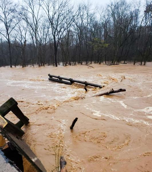
The frequency and intensity of single-day heavy rainfall events has increased steadily in the Southeast, and projections indicate the trend will continue in the future. Heavy rainfall events are characterized by precipitation above normal for their location. Heavy rainfall events threaten natural resources, industry, the local economy, and people by putting them at higher risk of flooding. Across the Southeast since 2014, there have been numerous examples of intense rainfall events with devastating impacts on inland and low-lying communities. Of these events, four major inland flood events occurred in just three years (2014–2016) in the Southeast, causing billions of dollars in economic damages and loss of life.
Events of such magnitudes are projected to become more likely in the future due to a changing climate, putting more people in peril from future floods. Unfortunately, the majority of existing regulatory flood maps do not account for future flood risk due to the increasing frequency of more intense precipitation events, sea level rise, or for new development that reduces a floodplain's ability to absorb and channel stormwater.
The growing number of extreme rainfall events stresses stormwater management and transportation systems that were not designed to withstand such events. The combined effects of rising numbers of high-tide flooding events, exacerbated storm surge, and extreme rainfall events, along with deteriorating stormwater infrastructure, are increasing the frequency and magnitude of coastal and lowland flood events and significant economic damage from flooding.
Impacts on stormwater management
Some of the oldest coastal cities in the Southeast were built just above sea level, and they rely on gravity-driven drainage systems to manage their stormwater. As sea levels have risen, these stormwater systems no longer drain into the tidal estuaries. Higher mean sea level causes stormwater outfalls to be partially or fully occluded, which reduces the rate at which stormwater can be drained away. Additionally, seawater in the stormwater pipes prevents rainwater from draining, so it backs up into the streets—resulting in increased flooding from storms that previously would have drained away.
Cities such as Charleston, New Orleans, and Miami have already begun to improve their stormwater infrastructure and explore nature-based infrastructure design options to reduce present and future flood risk. By reducing the amount of water that reaches the stormwater system, nature-based infrastructure (e.g., increasing the extent of pervious surfaces, adding water retention wetlands, etc.) can keep current stormwater infrastructure (such as pumps and backflow preventers) functioning.
Impacts on transportation and supply chains
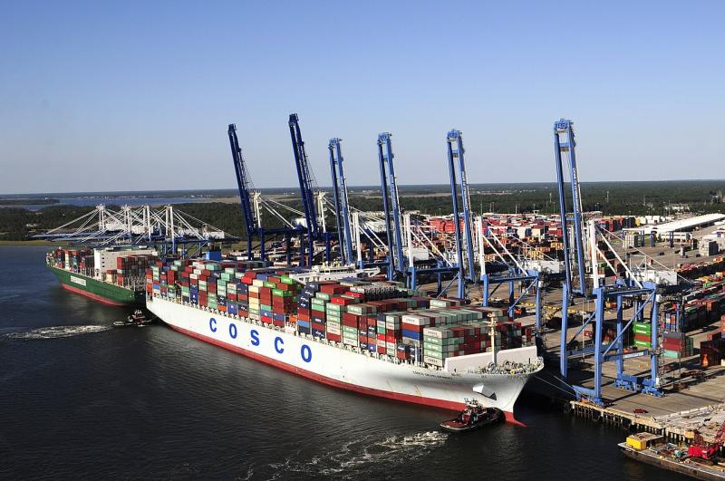
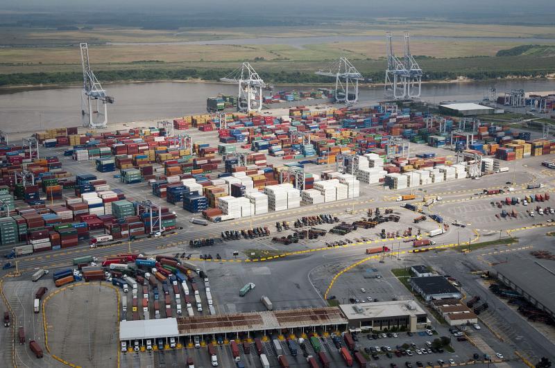
Flooding from extreme rainfall events and tropical storms can disrupt transportation and supply chains. When future tropical storms or hurricanes arrive in the Southeast, higher sea levels will allow their associated storm surges to travel farther inland than in the past, inundating larger and more densely populated areas and impacting transportation by blocking or flooding roads and rails. Marine transportation can be impacted as well. Large ports, such as Charleston, Savannah, and Jacksonville, and the rails and roads that link to them are particularly vulnerable to coastal flooding and sea level rise.
The Port of Jacksonville distributes raw material for industries, food, clothes, and essential goods to Puerto Rico. Thus, a storm surge in Jacksonville could also have an impact on distribution of goods throughout the U.S. Caribbean region.
For additional information on the impacts of tropical storms, surge, and extreme rainfall events, see the Coasts topic.
Adapting to increased flooding
Coastal adaptation to increased flood risk will require a variety of approaches at various scales.
Convening and collaborating
The recent increases in flood risk have led many cities and counties to take adaptive actions to reduce these effects. For example, four counties in Southeast Florida formed a climate compact to address climate change impacts, including sea level rise and high-tide flooding; their climate action plan was one of the first intergovernmental collaborations to address climate change, adaptation, and mitigation in the country. Since then, a number of large and small cities in the region have begun comprehensive planning, enacted new building codes, and replaced bridges to deal with coastal flooding issues.
Louisiana’s Strategic Adaptation For Safe Environments (LA SAFE)
LA SAFE addresses community resilience holistically—integrating risk planning with planning for stormwater management, housing, transportation, economic development, education, recreation, and culture. The Regional Adaptation Strategy summarizes goals and action items developed through LA SAFE’s planning effort for implementation across a larger geography (currently serving six parishes over a 50-year time frame). In 2017, the group produced Louisiana's Comprehensive Coastal Master Plan for a sustainable coast.
Learn more about LA SAFE »
Elevating and protecting infrastructure
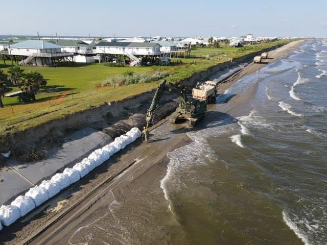
Communities should consider future flood risk when making long-term capital investments in infrastructure. Various tools are available to assess current and future vulnerabilities and risk to help guide decision making. In addition to moving infrastructure out of harm’s way through elevation, nature-based solutions, such as restoration of barrier islands and wetlands, can help mitigate the impacts of storm surge and potential damage to infrastructure.
Policies and incentives
Many communities in the Southeast participate in the Federal Emergency Management Agency (FEMA) Community Rating System (CRS) program, which provides reduced flood insurance premiums to communities that go above and beyond the minimum National Flood Insurance Program regulation standards. Many communities require a safety factor—also known as freeboard, expressed as feet above the base flood elevation—for construction in special flood hazard areas.
Several Southeast communities have earned insurance premium discounts by implementing freeboard and other regulations that exceed the minimum standards. A recent paper by coastal specialists and economists shows a positive correlation between local government participation in the CRS program and residential flood insurance coverage.1 The more residents and businesses carry flood insurance for their properties, the greater the resilience of the community because it buffers mid-term financial impacts from flooding. See also the Building Resilience in Coastal Communities page in our Coasts topic.
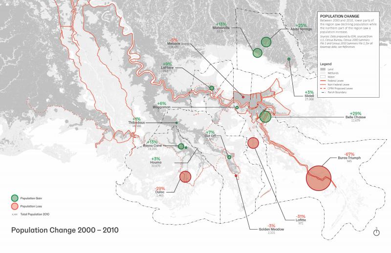
Increases in extreme rainfall events and high tide coastal floods could impact the quality of life of permanent residents as well as tourists who visit the low-lying and coastal regions of the Southeast. Recent social science studies have indicated that people may move away from coastal communities that are vulnerable to the impacts of sea level rise, high-tide flooding, saltwater intrusion, and storm surge, reducing municipalities' tax income. In Louisiana, population shifts have already been occurring due to increased flood risk and land loss.
Even as other communities begin to develop adaptation strategies to address current issues, the adaptation strategies they consider could be designed for longer time horizons and more extreme, worst-case scenarios. These strategies should be implemented using adaptive management best practices, including monitoring.
The preceding text is adapted from Impacts, Risks, and Adaptation in the United States: Fourth National Climate Assessment, Volume II, Chapter 19: Southeast.
Explore more
To learn more about climate impacts on coastal areas, see the Coasts topic.
- 1Frimpong, E., D.R. Petrolia, A. Harri, and J.H. Cartwright, 2020. Flood Insurance and Claims: The Impact of the Community Rating System. Applied Economic Perspectives and Policy 42, 245–262. https://doi.org/10.1093/aepp/ppz013.
