Screen capture from the FIRMS Fire Map

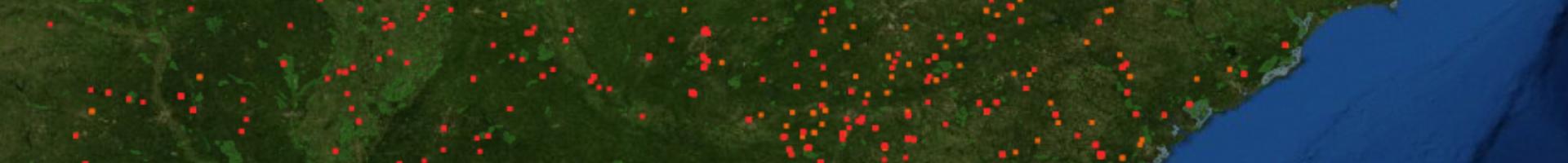
Fire Information for Resource Management System (FIRMS)

View and download satellite data showing near real-time active fire locations worldwide.

This tool distributes near real-time active fire data within three hours of a satellite overpass from NASA's Moderate Resolution Imaging Spectroradiometer (MODIS) and NASA's Visible Infrared Imaging Radiometer Suite (VIIRS) satellites. The active fire/hotspot data can be viewed in the FIRMS Fire Map or in NASA’s Worldview.

Users can also subscribe to receive email alerts notifying them of fires in areas of interest. Alerts can be sent in near real-time or as daily or weekly summaries, and can include CSV and KML attachments. This service is free of charge. Data is downloadable as SHP, KML, TXT, or WMS files.

FIRMS was developed to provide near real-time active fire locations to natural resource managers who faced challenges in obtaining timely satellite-derived fire information. It can also be used by electric utilities and others to assess potential fire impact to infrastructure and assets.

Last modified
10 May 2024 - 12:15pm