Image
Tool
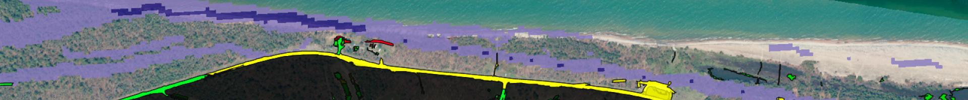
Great Lakes Shoreviewer
The Great Lakes Shoreviewer is a risk assessment and climate adaptation planning tool. It provides oblique-angle color photography plus multiple layers of additional analysis for prioritized sections of Great Lakes coastline in Michigan (Lake Superior, Lake Michigan, and Lake Huron). It also provides potential risk rankings (high, medium, low) for coastal property, buildings, roads, and infrastructure.
The tool provides professional color photography of every inch of coastline (and many islands) in the Upper Peninsula of Michigan. Each coastline photo also has a series of maps showing important natural features for planning and protection efforts.