Hawai'i Coastal Erosion Website
This site provides shoreline change data to assist in coastal zone decision making.
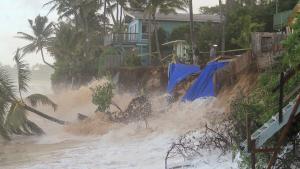
Shorelines are highly variable environments characterized by a number of natural hazards, including tsunami, storm surge, high winds, coastal erosion, sea level rise, and high-wave overtopping. Building on eroding coasts increases vulnerability to all these hazards. When erosion threatens the built environment, a common reaction is to armor the shoreline with a seawall or revetment. However, armoring may impound sand, thereby impacting the sediment budget of a beach and exacerbating the erosion. Shoreline armoring also increases wave turbulence and reflection.
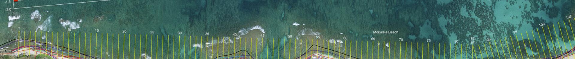
This site provides sets of historical maps and air photos, modern vertical and oblique air photos, and maps depicting rates of shoreline change spaced every 20 meters on the sandy beaches of Maui, Oahu, and Kauai.