Image
Tool
Maryland Coastal Atlas
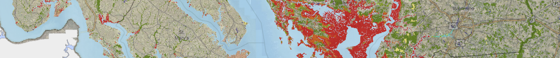
State and local decision makers can access maps depicting sensitive coastal habitats, living resources, and human uses to inform their coastal planning processes. The atlas gives users a way to share spatial information early in the planning process, helping them to identify potential conflicts so that they can then be avoided or addressed.
Spatial data are essential for many planning activities, including siting of renewable energy projects, designing restoration projects, and helping communities identify areas vulnerable to sea level rise, flooding, and erosion.
Details
Assets