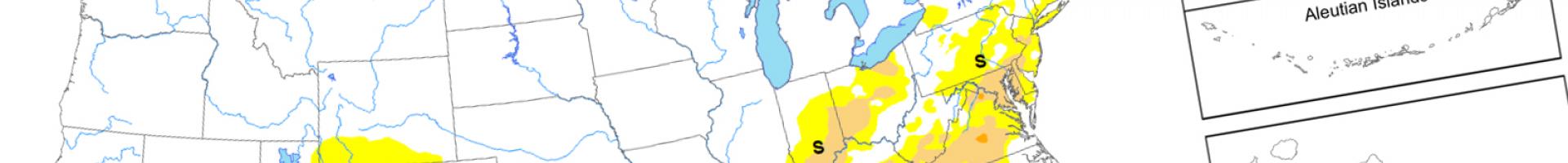
Current Drought - U.S. Drought Monitor
The U.S. Drought Monitor releases a new map every Thursday, highlighting parts of the United States and its territories that are in various stages of drought. The map uses five classifications: abnormally dry (D0), showing areas that may be going into or are coming out of drought, and four levels of drought ranging from moderate (D1), severe (D2), extreme (D3), to exceptional (D4).
The USDA uses the drought monitor to trigger disaster declarations and eligibility for low-interest loans. The Farm Service Agency uses it to help determine eligibility for their Livestock Forage Program, and the Internal Revenue Service uses it for tax deferral on forced livestock sales due to drought. State, local, tribal, and basin-level decision makers use it to trigger drought responses, ideally along with other more local indicators of drought.