Case Studies
Mary Hollinger, NESDIS/NODC biologist, NOAA. NOAA Photo Library: line2637. CC-BY-2.0 (http://creativecommons.org/licenses/by/2.0, via Wikimedia Commons
U.S. Navy, Machinist Mate 3rd Class Juan Pinalez. Public domain, via Wikimedia Commons
Jsayre64, own work. CC-BY-SA-3.0, http://creativecommons.org/licenses/by-sa/3.0, via Wikimedia Commons
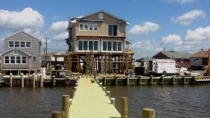
Still image from video "After Sandy: Facing the Future." Video footage: Kurt Mann
thepipe26, own work. CC-BY-2.0, http://creativecommons.org/licenses/by-sa/2.0/legalcode, via Wikimedia Commons
Famartin, own work. CC-BY-SA-3.0, http://creativecommons.org/licenses/by-sa/3.0, via Wikimedia Commons
Flickr user JoshuaDavisPhotography.com, http://www.flickr.com/people/articnomad/. Creative Commons Attribution-Share Alike 2.0 license, http://creativecommons.org/licenses/by-sa/2.0, via Wikimedia Commons
Adam Whelchel, The Nature Conservancy
Photo attributed to Ebyabe. Incorporated here under a Creative Commons Attribution 2.0 Generic License. No endorsement by licensor implied.
Photo attributed to Ken Lund. Incorporated here under the Creative Commons Attribution-Share Alike 2.0 Generic license. No endorsement by licensor implied.
Photo attributed to U.S. Fish and Wildlife Service Headquarters. Incorporated here under the Creative Commons Attribution 2.0 Generic license. No endorsement by licensor implied.
Photo attributed to Diego Delso, delso.photo. Incorporated here under the terms of the license CC BY-SA. No endorsement by licensor implied.
Tom Burke
Photo attributed to Michael Oswald. This work has been released into the public domain by its author. No endorsement by licensor implied.